NASA shots show aftermath of Mexico quake (images)
Radar images released Wednesday show how and where a massive earthquake in April reformed the surrounding landscape.


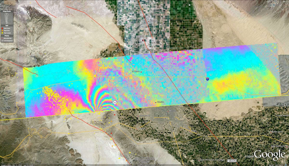
Mexico quake damage
When an earthquake struck northern Baja California this spring, it made its place in history (it was the largest recorded earthquake in the area since 1892) and left its mark on the surrounding landscape.
The April 4 quake, which was centered about 40 miles south of the Mexico-U.S. border, measured a 7.2 magnitude. NASA on Wednesday released a few radar images that show some of the disruption the earthquake caused to the Earth's surface in the region.
Scientists at the space agency's Jet Propulsion Laboratory used a system they call Uninhabited Aerial Vehicle Synthetic Aperture Radar (or UAVSAR, for short) to evaluate surface deformation. The radar flies on an aircraft 41,000 feet above the earth and measures the slight differences in distance between the aircraft and the ground over multiple flights, NASA said. By comparing data from flights in 2009 with that from post-quake flights, the JPL team was able to get an idea of how the landscape changed.
This image shows some of the affected area, with NASA data laid over an image from Google Earth. The red lines show major fault lines, while the red, orange, and yellow dots show the locations of aftershocks. The smooth, contoured streaks of color show gradual changes in the landscape. The more jagged, pixelated sections indicate more sudden changes in those measured distances between land and aircraft (read: places that were ripped apart by the earthquake).
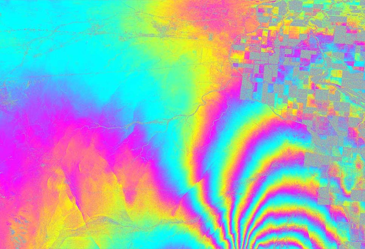
Mexico quake damage up close
This is an enlarged version of the most affected portion of the previous UAVSAR map. The rough edges you see over on the right indicate variations of between 1 centimeter and a few inches. The area shown here covers an area of about 12.5 miles by 12.5 miles.
The goal of all this data collection is to look at how and where the Earth's surface has been disrupted so scientists can predict the way an earthquake might have put strain on nearby faults--and therefore, which fault areas might be more prone to breaking next.
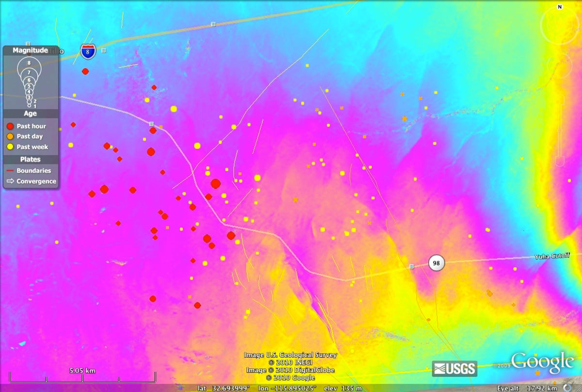
Mexico aftershock
This image shows an area that was struck by an aftershock with magnitude 5.7.
Mexico earthquake map
More Galleries

My Favorite Shots From the Galaxy S24 Ultra's Camera
20 Photos
Honor's Magic V2 Foldable Is Lighter Than Samsung's Galaxy S24 Ultra
10 Photos
The Samsung Galaxy S24 and S24 Plus Looks Sweet in Aluminum
23 Photos
Samsung's Galaxy S24 Ultra Now Has a Titanium Design
23 Photos
I Took 600+ Photos With the iPhone 15 Pro and Pro Max. Look at My Favorites
34 Photos
