A typical Navteq field team drives out in an older-generation Ford Escape equipped with an array of six cameras and military-grade GPS. Here is a look at the technology used to map the streets.
Wayne Cunningham
Wayne Cunningham reviews cars and writes about automotive technology for CNET's Roadshow. Prior to the automotive beat, he covered spyware, Web building technologies, and computer hardware. He began covering technology and the Web in 1994 as an editor of The Net magazine.
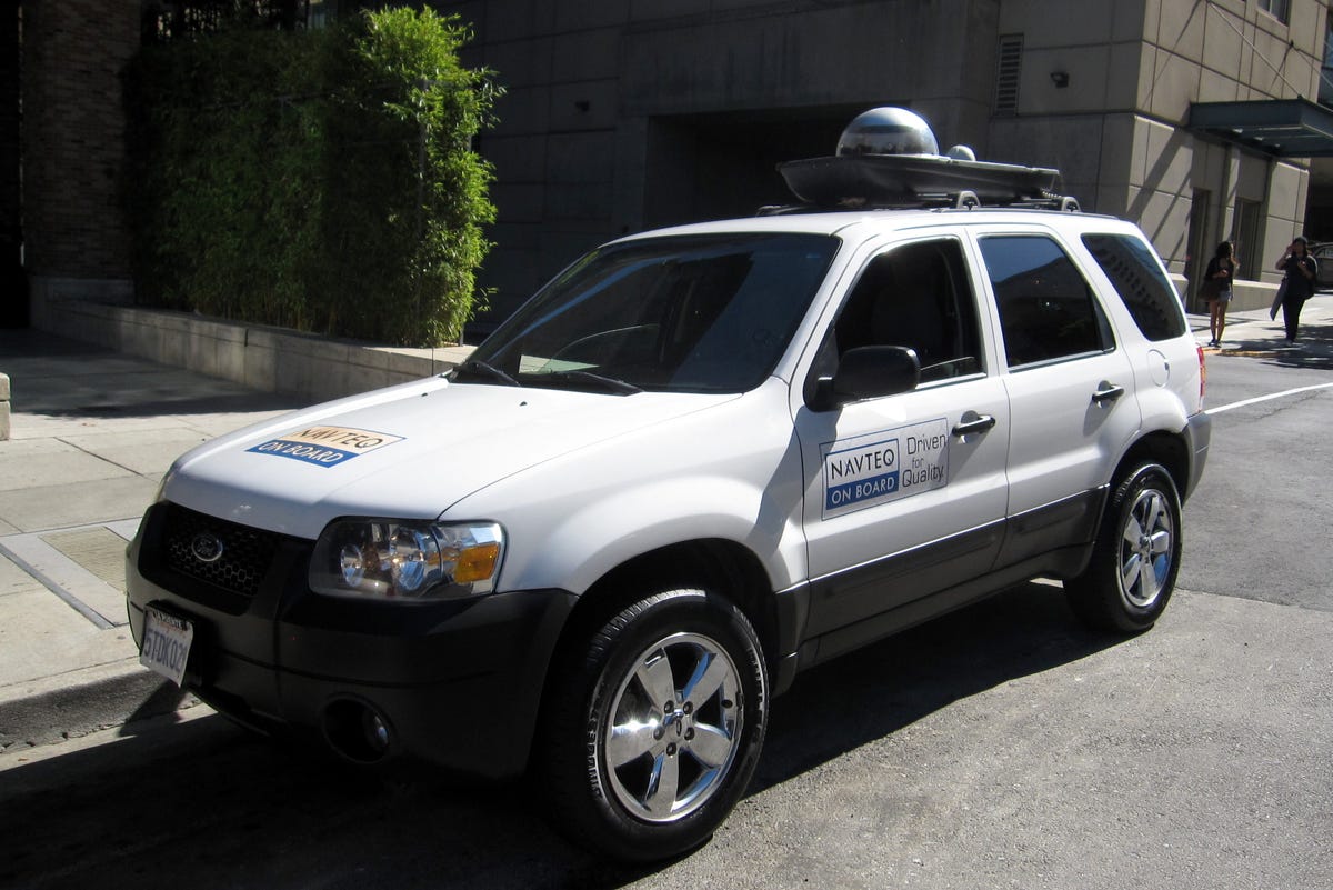
This older-model Ford Escape is a typical car for a Navteq field team. It has been fitted with a professional-grade GPS antenna, cameras, and a computer for storing collected data. Although the majority of roads in the country are mapped, Navteq field teams go out to update for construction changes and new subdivisions, and to add new information to the Navteq database.
2 of 10 Wayne Cunningham/CNET
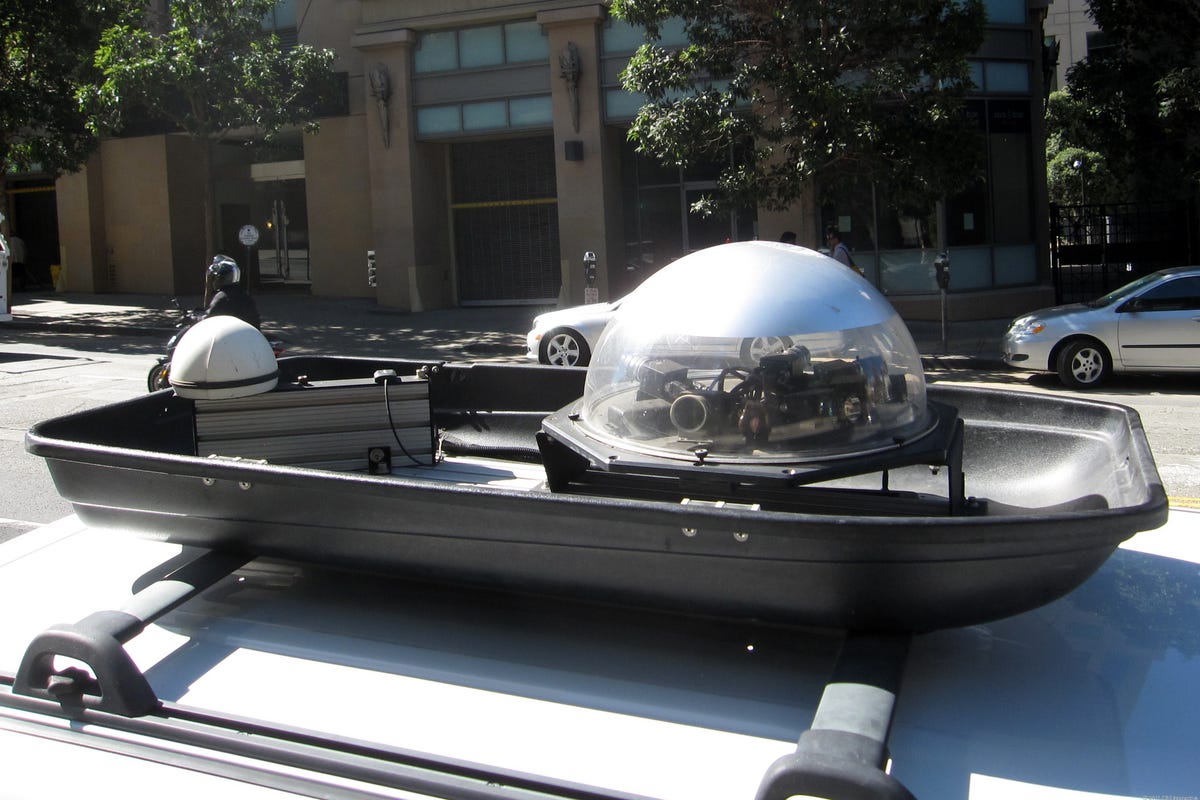
The roof rack on Navteq's Escape is fitted with a camera dome and GPS radar. The rack has a very DIY quality to it: an aerodynamic luggage carrier with the top removed. When Navteq first started sending out its field teams, it merely used a GPS-connected laptop to collect street information.
3 of 10 Wayne Cunningham/CNET
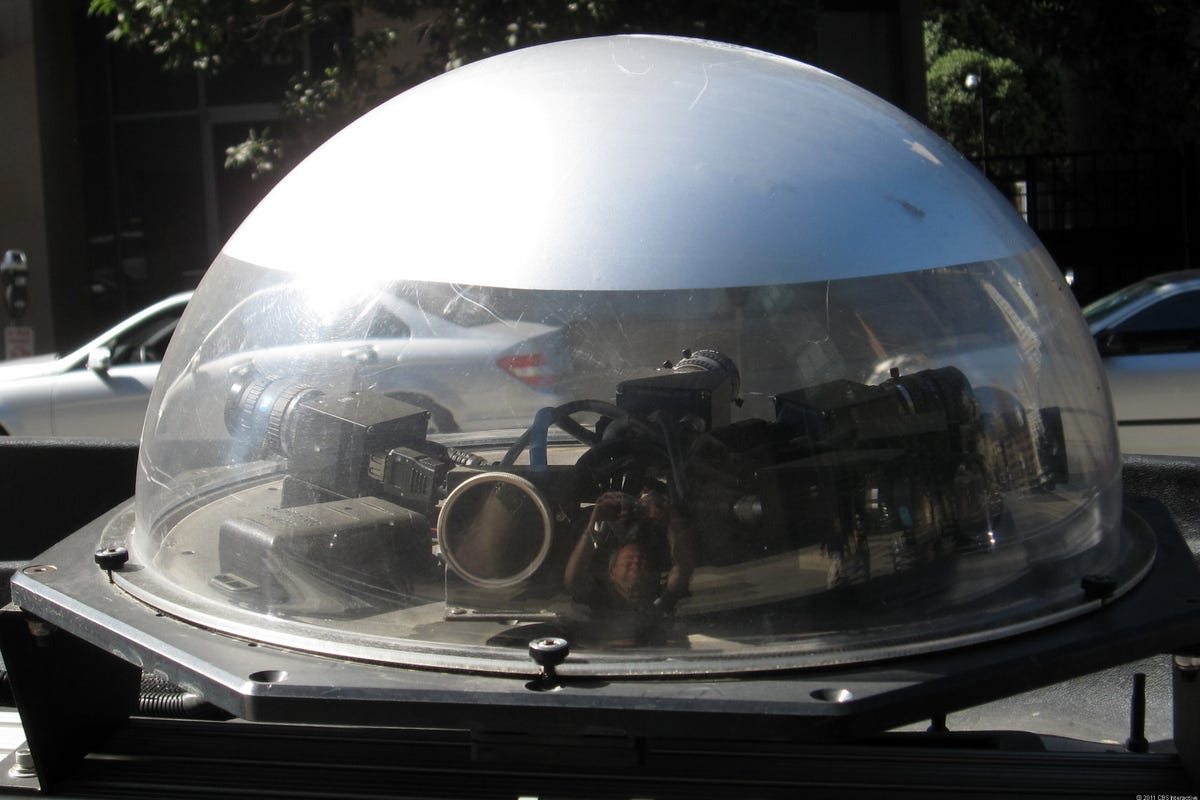
The dome holds six cameras covering nearly 360 degrees. But these cameras are not used to create something like Google Street View. Instead, they give the mappers visual data with which to refine the maps.
4 of 10 Wayne Cunningham/CNET
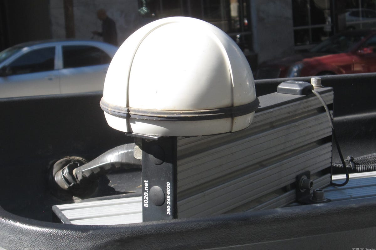
This GPS antenna is a key element of the field team's work. It is a much more accurate piece of equipment than a typical portable navigation device. A Navteq field team member noted that, because this GPS system is military-grade, he was not allowed to take it out of the country.
5 of 10 Wayne Cunningham/CNET
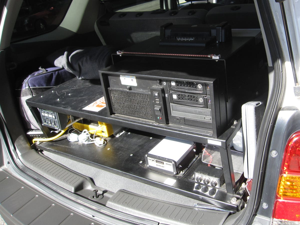
The back of the Escape holds the computing power. The Escape is loaded with a power supply, a computer to store the collected data, and the GPS unit.
6 of 10 Wayne Cunningham/CNET
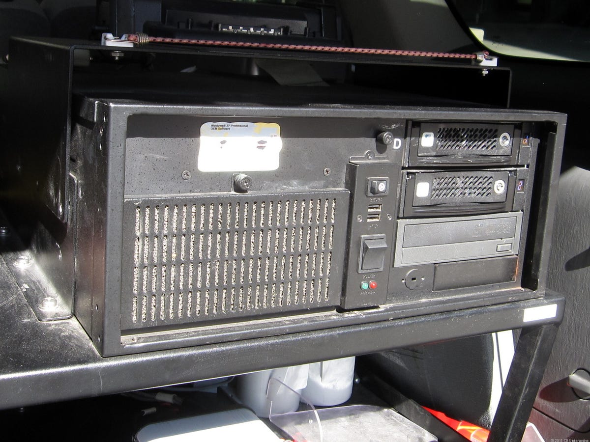
This computer has two removable 500GB hard drives, which store the collected mapping data. Back at the office, the Navteq field team removes the drives and loads the data up to a central server, where it can be further refined.
7 of 10 Wayne Cunningham/CNET
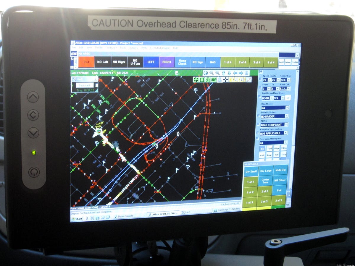
A Navteq field team consists of a driver and a collector. The collector sits in the passenger seat, using the large monitor to update information about each street. Most of the information is updated using a pen tablet, but there is also a game controller hooked up to the system, which makes it easier to control the cameras or make quick adjustments to the maps.
8 of 10 Wayne Cunningham/CNET
This custom interface shows the map, which the collector will update. Although it does show the progress of the mapping vehicle, it does not work as a navigation system. As the car progresses along a street, the collector can enter data such as how many lanes, whether the street is one- or two-way, and whether it is an appropriate route for trucks, pedestrians, and bicycles.
9 of 10 Wayne Cunningham/CNET
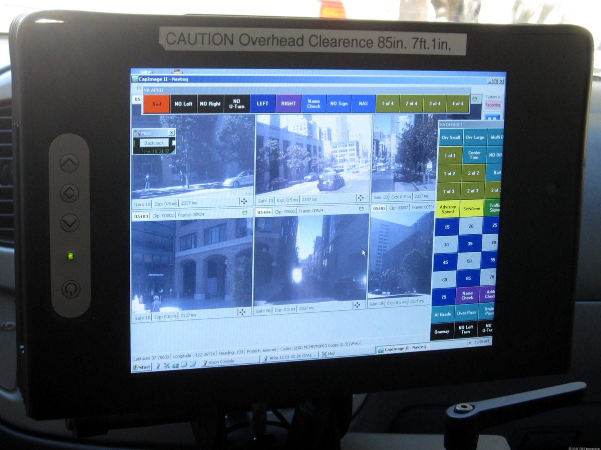
These camera views are recorded primarily so that when a Navteq employee is reviewing the mapping data back in the office he or she can confirm data such as speed limits, whether there is a divider in the road, and the nature of intersections.
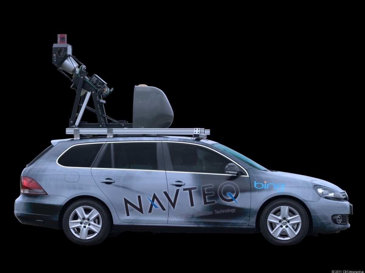
10 of 10 Navteq
Navteq's latest field team vehicles are much more sophisticated than the early ones. They include cameras from Microsoft's Bing search service that record images for Bing's Streetside street-view feature. Along with the cameras, LIDAR equipment uses laser beams to create a 3D map of the environment.