Disasters as seen from space
Satellites can offer some of the most compelling – and useful – imagery after a natural disaster hits.
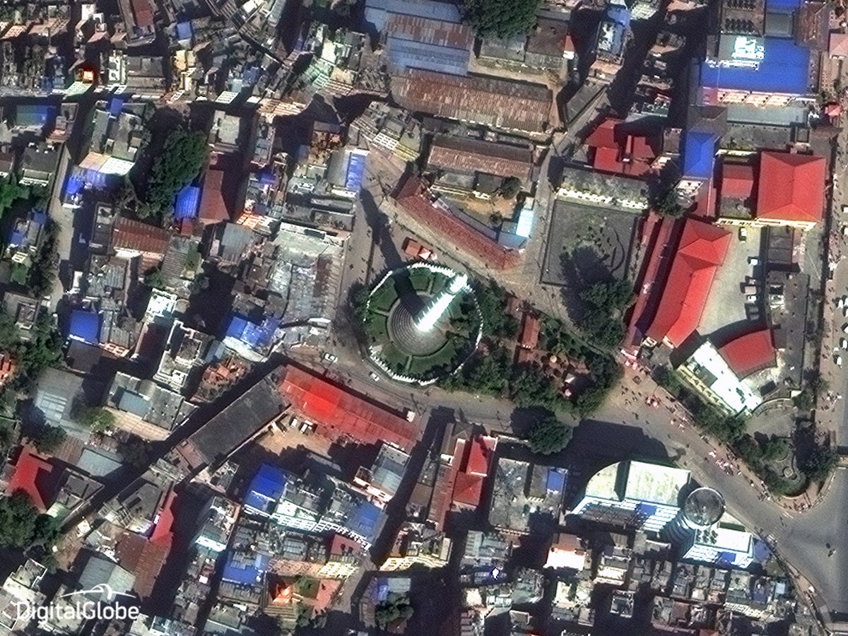
Satellite imagery company DigitalGlobe shared these images, starting with that of the Dharahara Tower in Kathmandu, Nepal. This image was taken in October 2014, before an earthquake destroyed much of the region the following April. The tower is visible in the center.
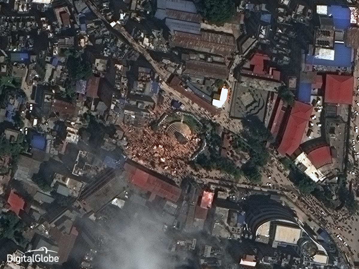
Dharahara Tower, April 2015
After the Nepal earthquake toppled the 183-year-old tower, a DigitalGlobe satellite captured this image.
"A particularly poignant part of this imagery is that you can see so many people outdoors now," says DigitalGlobe's Kevin Bullock. "It's an indication of people being so scared to be in their homes that they would rather be in the streets."

Kathmandu, Nepal, October 2014
A green space dominated this satellite image of Kathmandu, Nepal, in 2014, before the earthquake struck.
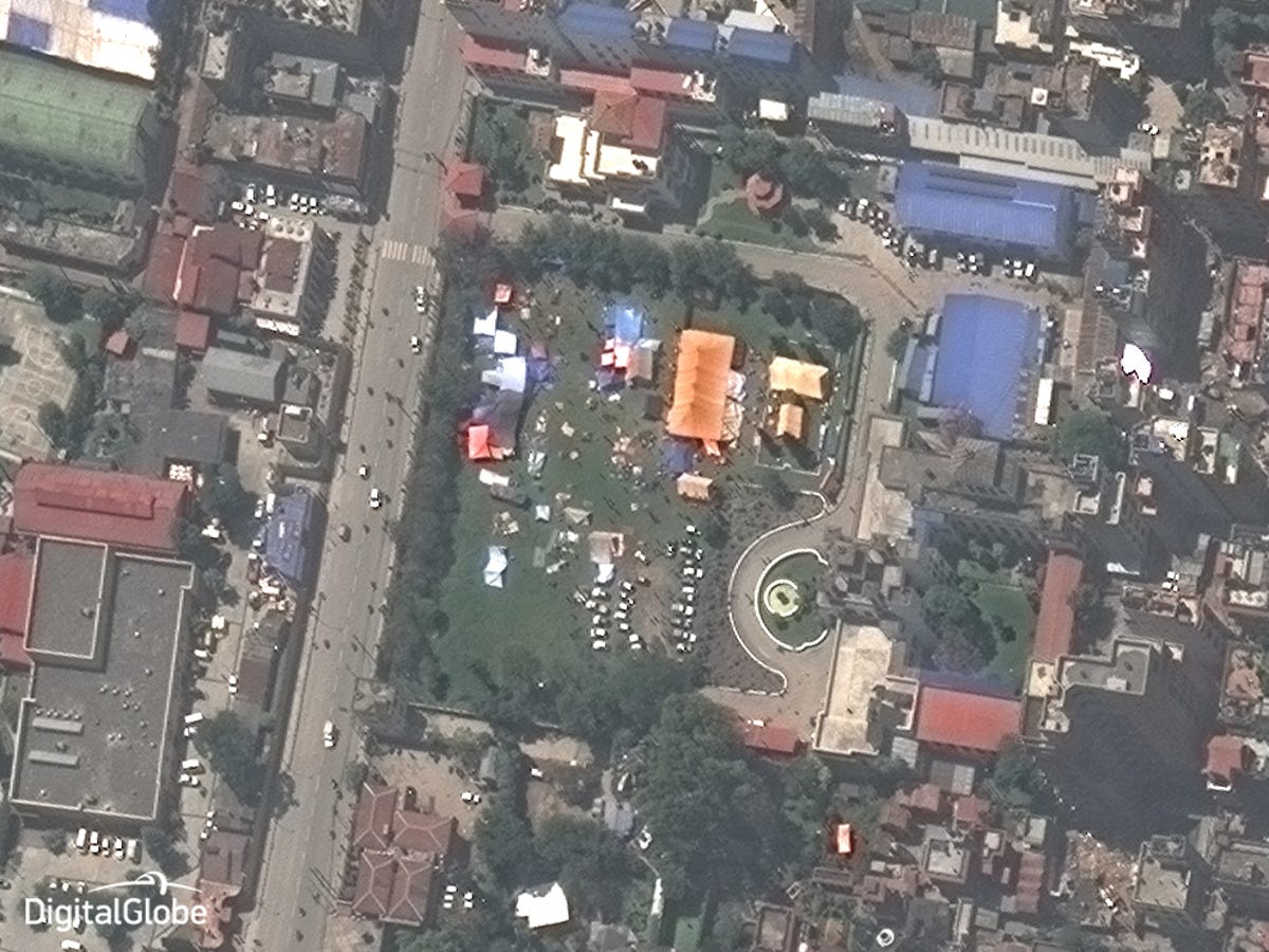
Kathmandu, Nepal, April 2015
After the quake, a refugee tent city popped up. Satellite imagery companies such as DigitalGlobe use these images to estimate how many displaced people may be in a given area, allowing disaster volunteers to better plan their relief efforts.
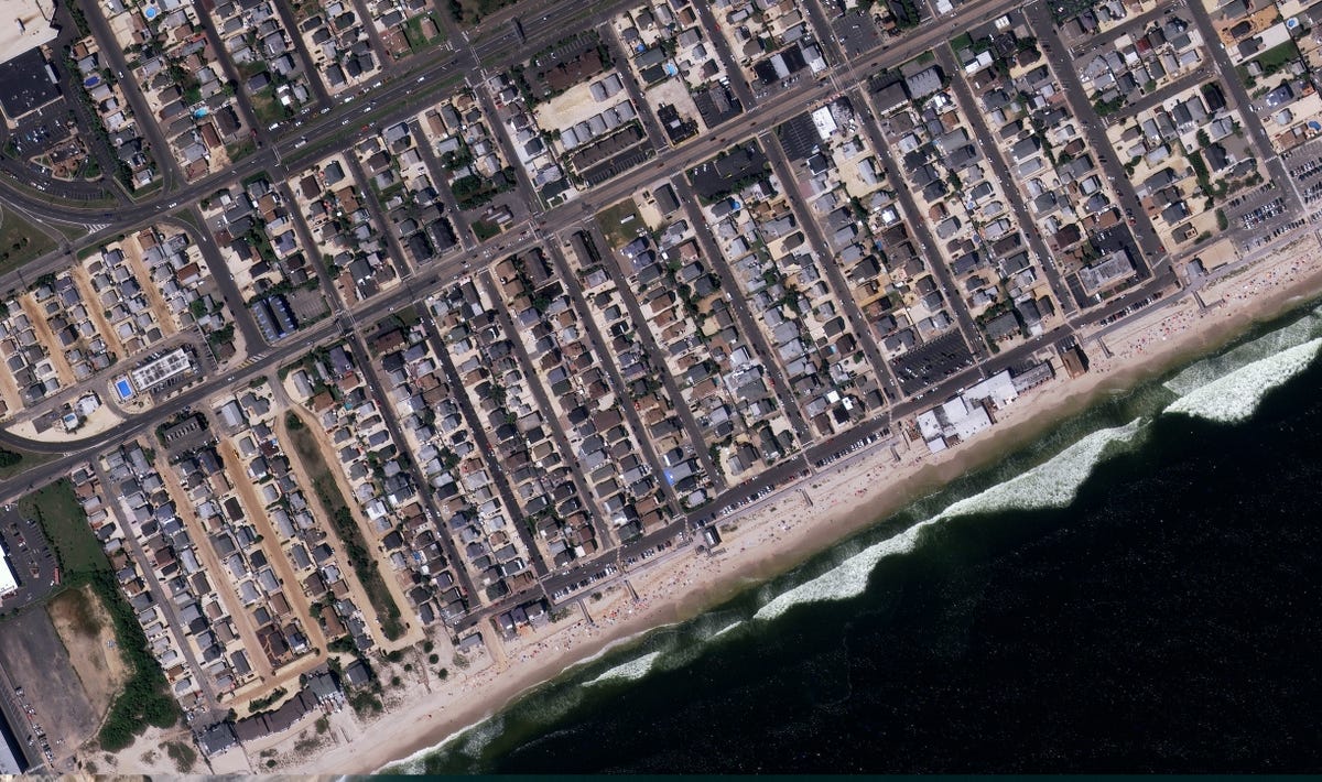
Seaside Heights N.J., September 2011
DigitalGlobe's image collection documents the changing landscape of billions of square kilometers. Example: the devastation that hit Seaside Heights, N.J., in 2012. This image was taken in 2011, before Hurricane Sandy hit.
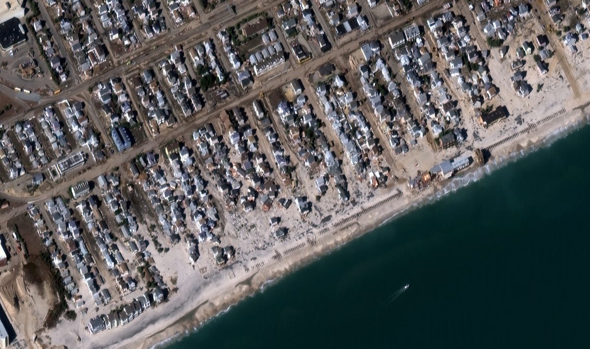
Seaside Heights N.J., November 2012
After Hurricane Sandy hit the Eastern seaboard in 2012, large swaths of the Seaside Heights boardwalk were damaged and much of the borough was flooded.
Many of the houses were sturdily built, meaning that they didn't collapse ... but they did drift, like boats, right off of their foundations.
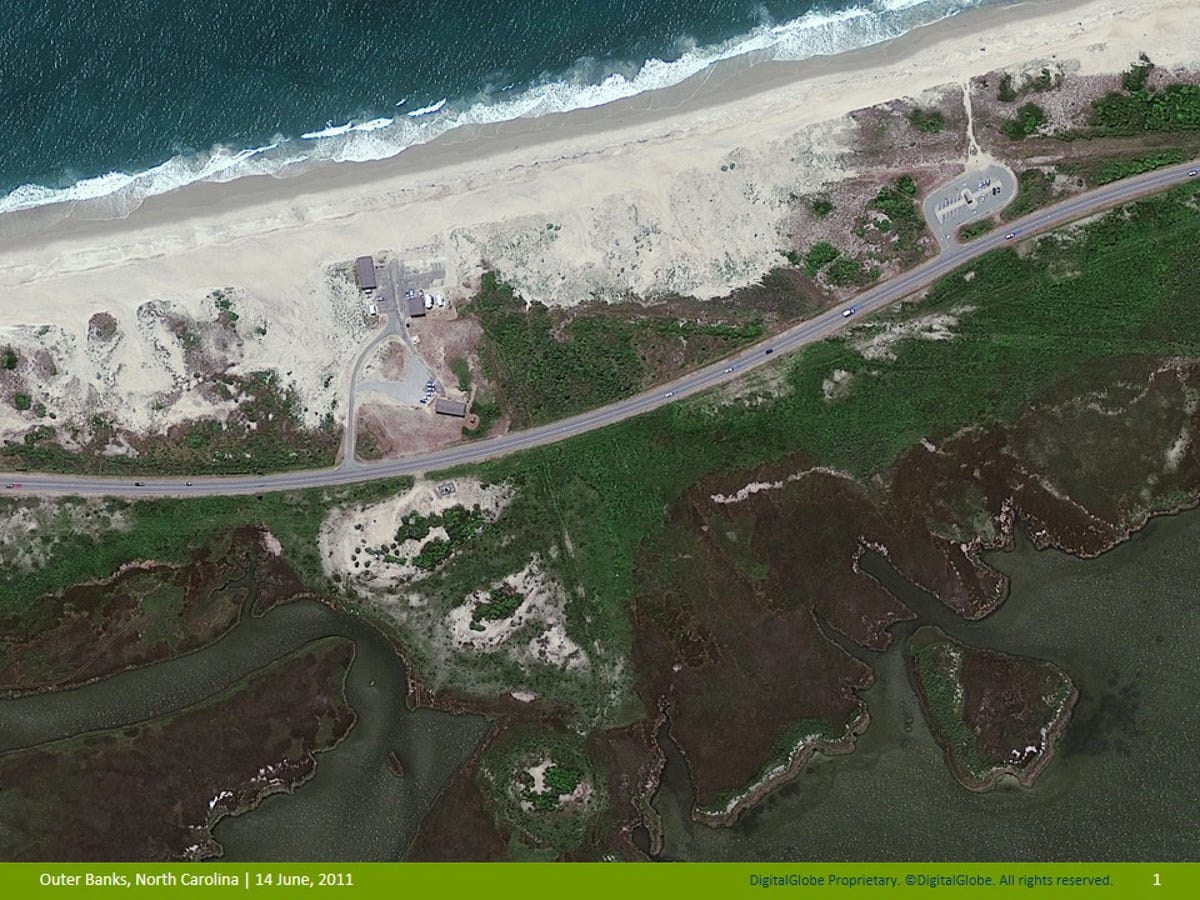
Outer Banks, North Carolina, June 2011
The Outer Banks area of far eastern North Carolina sits between the Atlantic Ocean and a sound. The strip of land between the bodies of water is vulnerable to hurricanes and other severe weather. This is a section of the Outer Banks before a 2011 storm struck.

Outer Banks, North Carolina, September 2011
Hurricane Irene made landfall in late August 2011. This is the resulting damage from waves that reached nine feet. The flooding of Highway 12 is clearly seen in this satellite photo.
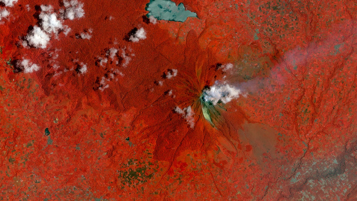
Mt. Sinabung, Indonesia
Satellites can capture various wavelengths of light, including those not visible to humans. The satellite that captured this pre-eruption Mt. Sinabung volcano, in Indonesia, collects images in several spectral bands, including infrared.
The red portions of this image are, in reality, green forest.
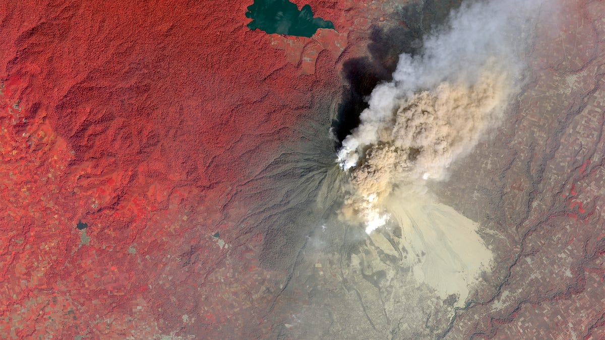
Mt. Sinabung, Indonesia, 2014
This infrared satellite photo clearly shows the area of deforestation after the volcano erupted.

Tuscaloosa, Alabama, April 2006
Alabama saw a tornado rip through Tuscaloosa in 2011. Here's what it looked like before the event.
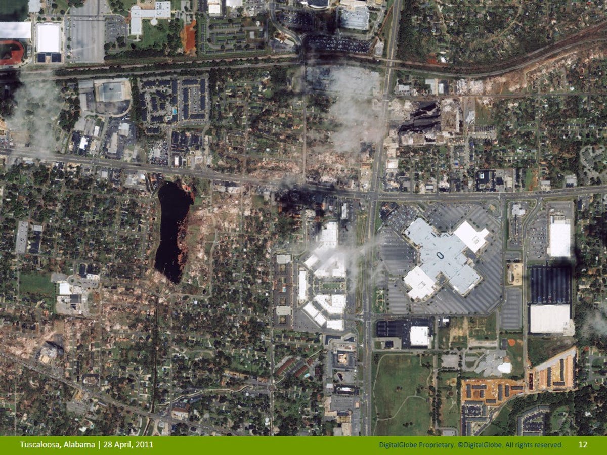
Tuscaloosa, Alabama, April 2011
This DigitalGlobe image shows just how devastating, but compact, a tornado can be. The scar of the tornado is clearly visible, running from southwest to northeast across the image. The tornado, at its largest, was 1.5 miles wide.

Tacloban City, Philippines, February 2012
Typhoon Haiyan was one of the most powerful tropical cyclones ever recorded. It killed more than 6,000 people. Here is how Tacloban City, in the Philippines, looked before the storm.
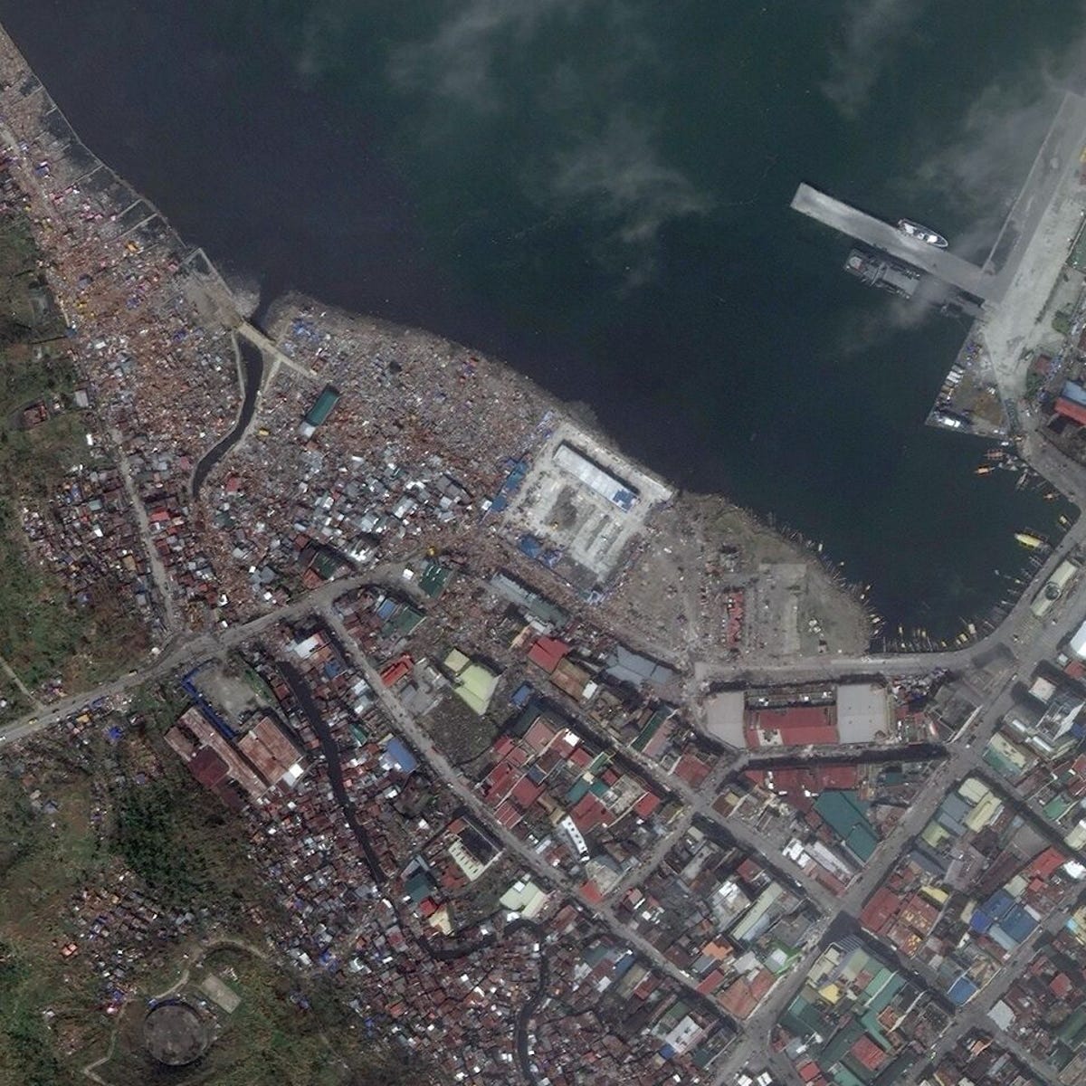
Tacloban City, Philippines, November 2013
The storm wiped out many of the city's waterside structures, including homes. By estimating an average of 3-4 people per hut, satellite imaging companies can help calculate the size and scope of a disaster more quickly than via headcount.
Note that the fishing boats–a main source of income for residents here–are gone.
More Galleries

My Favorite Shots From the Galaxy S24 Ultra's Camera
20 Photos
Honor's Magic V2 Foldable Is Lighter Than Samsung's Galaxy S24 Ultra
10 Photos
The Samsung Galaxy S24 and S24 Plus Looks Sweet in Aluminum
23 Photos
Samsung's Galaxy S24 Ultra Now Has a Titanium Design
23 Photos
I Took 600+ Photos With the iPhone 15 Pro and Pro Max. Look at My Favorites
34 Photos
