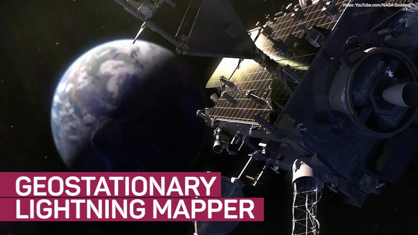
Geostationary Lightning Mapper sends first images back to Earth
Science
[MUSIC]
The first images are in from NASA's new lightening mapper technology and they are pretty incredible.
The geostationary lightning mapper or GLM for short,is a single-channel near-infrared optical transient detector,that can detect the momentary changes in an optical scene indicating the presence of lighting according to the geostationary operational environmental satellite website.
The lightning mapper is on board NOAA's GOES-16 satellite and is providing national weather service forecasters with new important data on lightning strikes on the western hemisphere.
This video footage of a lightning storm was taken over Texas on February 14th 2017.
The green cross is Houston Texas While the green, squiggly lines indicate the coastline of the Gulf of Mexico.
This lightning data can be used by weather forecasters to more quickly warn the public of increased lightning storms moving into an area.
As well as early warnings for flash floods and sever weather, including tornados.
This weather data is very important for warning mariners and aviators of dangerous weather conditions in the area.
You can read more about the geostationary lightning mapper in Amanda Kooser's article at cnet.com.