With Ground Truth, Google marries virtual world with the real
At its Google I/O show, the company details how it gathers and corrects data for its massive global mapping effort. It takes hundreds of people to map a country.


- Shankland covered the tech industry for more than 25 years and was a science writer for five years before that. He has deep expertise in microprocessors, digital photography, computer hardware and software, internet standards, web technology, and more.

SAN FRANCISCO--Google Maps began as roads and satellite photos. Now, through a project called Ground Truth, it's becoming an ever more sophisticated virtual mirror of the real world.
But how? Google engineers described their methods Wednesday at the Google I/O show, describing how they've moved from licensing satellite photos to building 3D version of the world that can be updated in minutes.
The answer might surprise close Google watchers accustomed to the company's heavily automated, algorithmic, computer-centric way of doing things. There's plenty of that, but it also takes lots of elbow grease, said Michael Weiss-Malik, engineering director for Google's Ground Truth and Map Maker, speaking at the Google I/O show Wednesday.
"It takes hundreds of people to map a typical country," Weiss-Malik said. "It's a very large-scale operation."
And it's a crucial one for Google -- especially as mobile devices enable people to navigate all over the globe. Google Maps is an essential service, and Google works to keep it accurate and available. During the last three years, the service has had a 99.995 percent uptime.
Google just has released a massive overhaul of Google Maps that people can sign up for starting on Thursday. Google I/O attendees have access now.
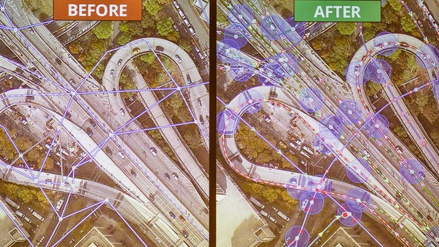
The essence of the Ground Truth project is marrying Google's real-world information with data sets from sources such as cities, census operations, and postal address databases. "You can conflate those two together and correct one with the other," he said.
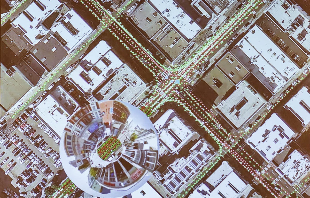
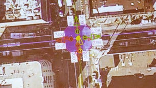
For example, Google might get road information from a government that indicates a particular road is a two-way street. But Google's own traffic data, gathered anonymously from people's Android phone data, might show that it appears to be a one-way street. A Ground Truth operator then can look at Google Street View data, including signs, to see what's actually there, he said.
Google also acts on complaints of problems from Google Maps users. When they tell Google something is wrong, specially trained operators look at the Street View data to check what's there. Under some circumstances, user feedback can trigger a redrive for more up-to-date imagery.

The company does use computers, too, of course. For example, image processing finds street signs, road names, building addresses, and lane markings.
"This is an incredibly efficient mapping machine we've built," he said. Good, thing, too, because it must be updated constantly. "The biggest challenge for any map maker is as soon as you've published it, it's out of date," he said.
Street View cars are a fixture for Google Maps data collection, but Google also gathers data from other sources. The company merges data from multiple aerial photos, for example, to construct 3D models of city buildings. And in 200 countries, it lets anyone add map data through Map Maker.
In India, where Map Maker has been around for years, most of the country has been mapped by the public, Weiss-Malik said.
It's a mammoth effort overall. "Every two weeks, Google publishes as much new imagery as Google had in all of 2006," Weiss-Malik said.