Google Tool Shows Water, Vegetation on Earth's Surface in Near Real Time
Dynamic World is an AI-backed topographical map.


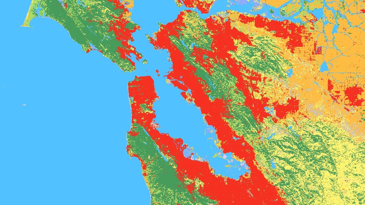
Screenshot of Google Dynamic World over the San Francisco Bay Area.
Google's latest mapping tool takes the power of Google Maps and brings in near real-time data of the world's water, vegetation, snow and human-made development.
Called Dynamic World, the tool can help with understanding the impacts of environmental disturbances, from floods, wildfires, deforestation and urban development, the company said in a blog post Thursday.
"The global land squeeze pressures us to find smarter, efficient, and more sustainable ways to use land," said Craig Hanson, vice president of foods, forests, water and the ocean at the World Resources Institute, in the blog post. "If the world is to produce what is needed from land, protect the nature that remains and restore some of what has been lost, we need trusted, near real-time monitoring of every hectare of the planet."
Google declined to comment on this story.
Current land cover maps can take time to produce and may only be updated monthly or annually, according to Google. Using AI and imagery captured by the Copernicus Sentinel-2 satellite, it can analyze 5,000 images a day showcasing data as recent as two days old. It can also pull data as far back as June 2015. Google says Dynamic World can help researchers create unique and specific maps, such as analyzing crop harvests between particular dates.
The project was made in conjunction with the World Resources Institute and is powered by Google Earth Engine and AI platform. It provides global data at a 10-meter resolution. This means that not only can Dynamic World show concrete in a built-up city, but small parks nestled between buildings. Google says this type of near real-time data can give scientists and policymakers a better understanding of changes in climate and land to "make more accurate predictions and effective plans to protect our planet in the future."