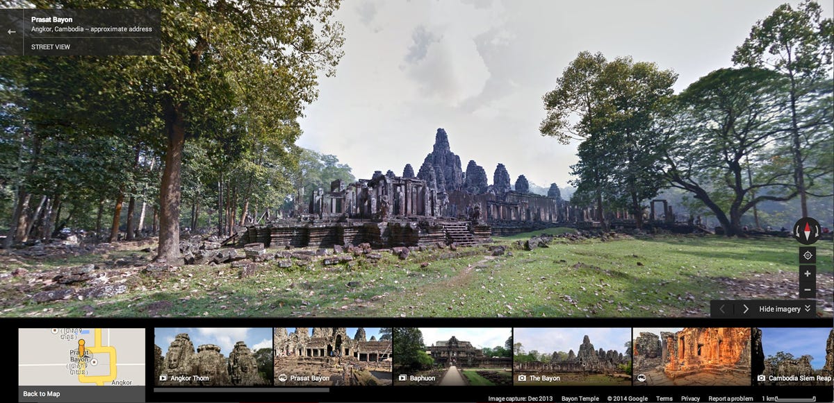
Google Maps traverses Cambodia's centuries-old Angkor temples
The Web giant’s Street View Trekker records more than 90,000 panoramas of 100 ancient temples at this massive archaeological site.


Walking through Cambodia's Angkor temples feels like going back in time. In the vast area, which is impossible to cover in one day, one can see remnants from the Khmer empire dating back thousands of years -- majestic steeples, intricate sculptures, endless winding roads, and ancient vines and trees that have taken over many of the area's structures.
While Cambodia is a difficult place for most people to get to, Google is letting people around the world take in Angkor's jaw-dropping temples from their desktops and mobile devices. The Web giant launched its newest Street View trek on Wednesday -- Temples of Angkor -- which takes armchair travelers in and out of ancient structures hidden in Cambodia's jungle.
"The temples at Angkor each have a unique story -- whether it's the way they were built, the ancient Khmer cities they sit on, or the artwork they contain," Google Maps group product manager Manik Gupta wrote in a blog post. "To give you the most complete picture, our team used all the tools available to us: Street View cars, Trekkers and tripods to carefully photograph the exteriors and interiors of Angkor's temples as they stand today."
For this Street View trek, Google partnered with APSARA Authority and recorded more than 100 temples in Angkor, which included more than 90,000 panoramas of structures' exteriors, interiors, and individual carvings. For example, people can meander through the famous Banteay Srei temple made from pink sandstone or study the detailed relief work on Ramayana's Battle of Lanka.
Angkor is the largest religious monument in the world and is considered one of the most important archaeological sites in South-East Asia. It was built over hundreds of years -- from the 9th century to the 15th -- and spans more than 400 square kilometers of land.
In addition to the Street View Trek, Google has also added nearly 300 art and photography exhibits about Angkor's historical and artistic heritage to its Google Cultural Institute site.
"We hope this new imagery will not only let people experience the scale and beauty of Angkor wherever they are, but also demonstrate how technology can change the way cultural treasures are preserved for generations to come," Gupta wrote.
Over the past few years, Google Maps has morphed from being just a street view program into a mapping tool that goes off the grid to record Earth's many wonders. In the past couple of months, the Web giant created a way for Internet users to explore the Grand Canyon by sailing down the Colorado River, visit the frozen home of polar bears in a remote area of the Canadian tundra, and gaze at 30 of India's national treasures including the Taj Mahal.