Google Earth brings virtual tourism to iPhone
The Internet giant releases an iPhone version of its geographic exploration software. And with multitouch and GPS, the interface is better than a PC's.


- Shankland covered the tech industry for more than 25 years and was a science writer for five years before that. He has deep expertise in microprocessors, digital photography, computer hardware and software, internet standards, web technology, and more.
Correction made on October 27 at 9:40 a.m. PDT: See details below.
SAN FRANCISCO--Google already has customized some of its Web sites for display on the iPhone, but now the company also dived headlong onto Apple's highly regarded mobile phone with a full-fledge application, a handheld version of its Google Earth geographical software (download for Windows and Mac).
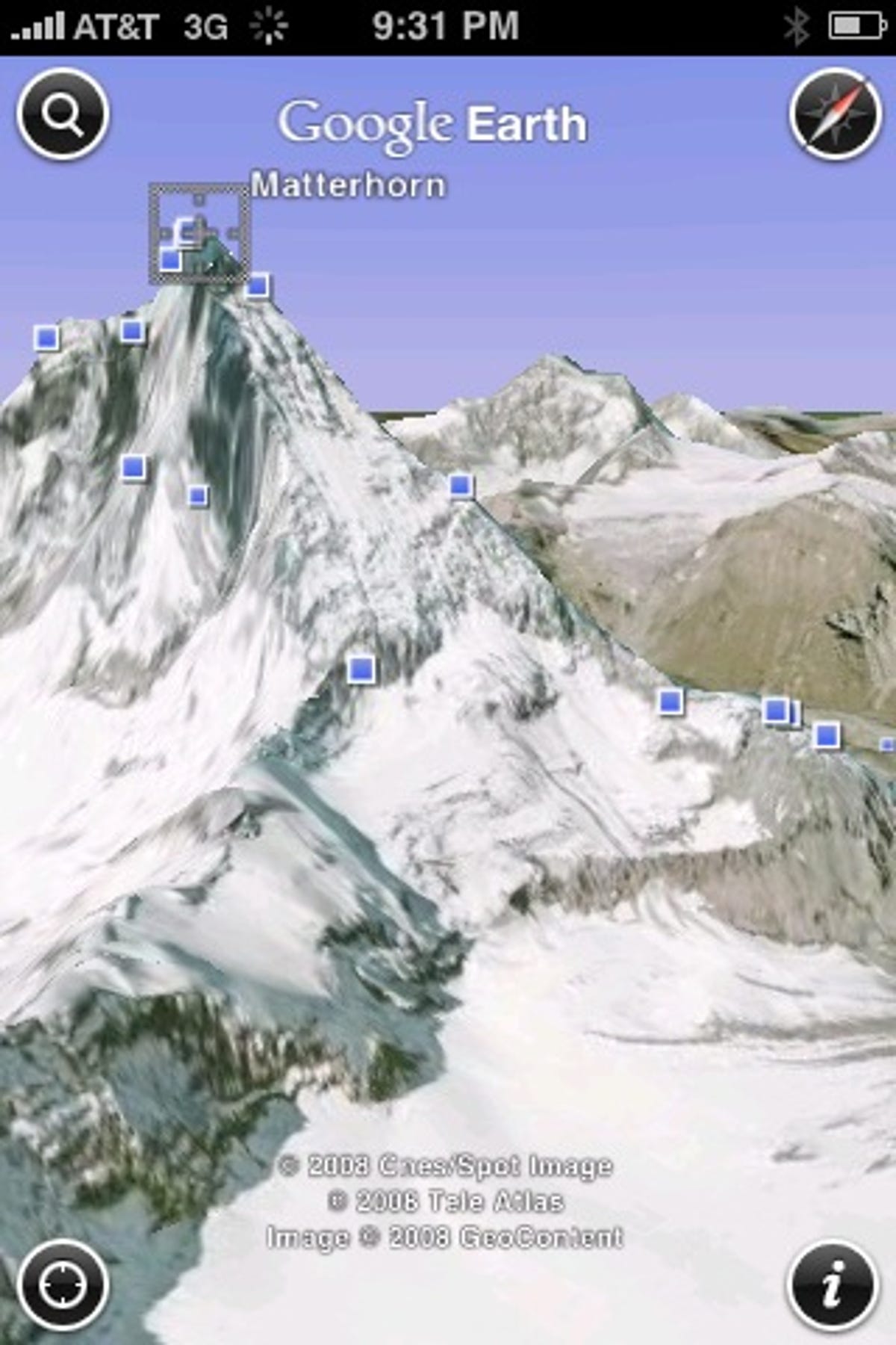
Google Earth lets people virtually fly around a 3D view of the world made from satellite and aerial imagery mapped onto the planet's mountains and valleys. The iPhone version reproduces this core experience, downloading imagery from Google's servers as the perspective shifts and dotting the map with landmarks, photos, and other information.
"The idea of having Earth on a mobile device is something people dreamed of back to the Keyhole days and before," said Peter Birch, Google Earth's product manager, referring to the satellite imagery company Google acquired in 2004. "This is the first opportunity we've had to be able to deliver a great experience."
Keyhole began its first version of what later became Google Earth in 2001, when computer horsepower and network capacity had not risen to their current levels. "A lot of that core engine can run on a device like this," Birch said.
The free software started becoming available through Apple's App store on Sunday (download here). (Update 7:50 p.m. PDT: Apparently Australian App Store users get the first crack at this software, but it should be spreading to other regions "soon," Google said.) It's a free download in 20 countries, running in all 18 languages the iPhone supports.
Surprising performance, good interface
I tried the application late last week and was impressed how well the iPhone version kept up with the performance, features, and usability of Google Earth for Windows, Mac OS X, and Linux--at least, while using a Wi-Fi network connection. For example, your view of the world starts looking straight down, but you can tilt the view so terrain contours are visible, and generating that variable perspective takes some significant processing.
What's most interesting to me, though, is that the iPhone's multitouch screen actually made using the application easier than the PC versions. Dragging a fingertip across the screen slides the view appropriately, of course. Two-finger pinch gestures not only zoom in and out, but also, by adding a little twirling rotary motion, steer the view's orientation in one direction or another.
Another nice feature: When the iPhone is tilted a certain angle out of horizontal, Google Earth reads data from the phone's accelerometer and adjusts your view accordingly, so you can look up into the sky. And it's integrated with the iPhone's ability to locate itself through GPS, Wi-Fi networks, and mobile phone towers.
The only things I didn't figure out on my own within a minute of use is that you can use a two-finger drag to tilt the perspective back--flight-simulator gamers might think of pulling the stick back to lift the nose of a virtual airplane--and that you also can zoom in and out with single-finger and two-finger double-tapping, respectively.
"One of the challenges we face with Google Earth is people aren't used to moving around in 3D, especially if you're moving around with a mouse," Birch said.

It's a very intuitive interface, a notch more so than the mouse controls of the PC version--though I've heard Google Earth is much easier to grasp with a 3D controller such as Logitech's 3DConnexion SpaceNavigator. One intriguing possibility is that Google could bring this interface to multitouch-aware computers such as Apple's newer MacBook models.
"Macs have multitouch on them," Birch said. "That's something we could consider."
Just a curiosity?
So what exactly do you use Google Earth for?
Though you can search for specific addresses, Google Earth in general is more for exploring than for practical tasks such as navigation. There's no turn-by-turn directions and no map view showing street names, as on Google Maps, for example.
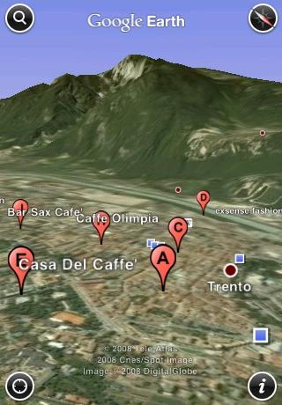
But there is some practical utility. The computer version of Google Earth can show many layers of information, including user-supplied ones on the Internet. The iPhone is more limited for now, with small blue squares indicating where you can see geotagged photos of a particular area that are stored on Google's Panoramio site and "W" icons indicating links to geotagged Wikipedia articles.
Also handy for folks whizzing around foreign cities in buses, taxies, rental cars, or trains, the iPhone app can show your changing location on a map.
Search + mapping = revenue
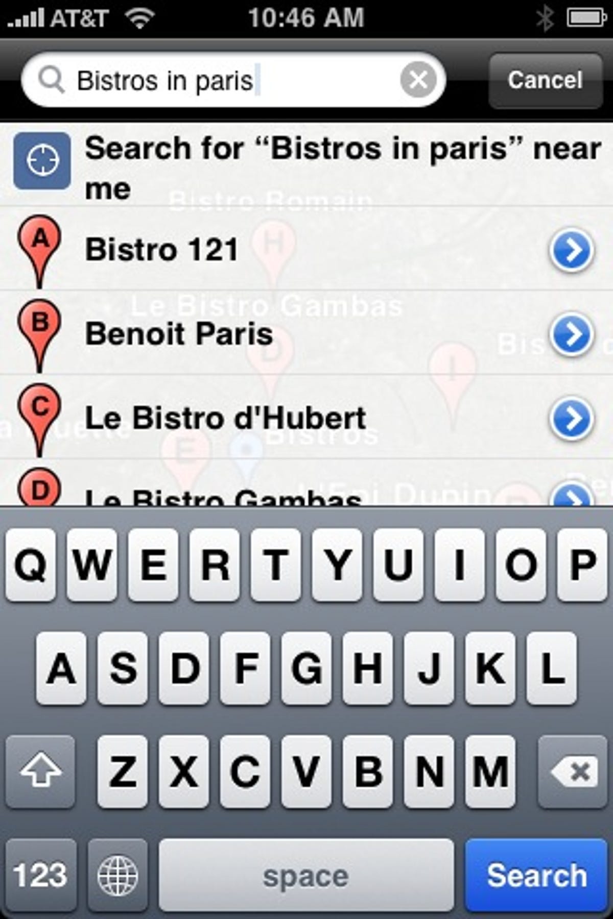
And where would a Google application be without search? The Google Earth iPhone application will show search results such as pizza restaurants as small red pushpins. Touching the pushpin will pop up a window with information such as a business's Web site and phone number.
And happily, like Safari but unlike most iPhone applications, Google Earth can use a horizontally oriented touch-screen keyboard, too.
Google Earth for iPhone has a small Webkit-based browser to show the specific information users click on, and the bare-bones browsing experience includes a link to the more fully featured Safari browser Apple builds into the iPhone. One handy trick: when you click the address of a business, the iPhone will intercept the command and show it on the Google Maps application so you can get directions. Personally, I'd prefer a more direct link to Google Maps, though.
And where would Google search be without Google advertising? There are now ads in Google Maps for desktop computers, and Google Earth for PCs shows "very limited" ads right now, Birch said, but currently there are no ads on the iPhone version of Google Earth, but Birch said Google is "definitely not" ruling it out.

"Within (Google's geographic products group) as a whole, we see advertising as a huge opportunity. Geographic mapping as a business for Google is a great opportunity. We wouln't be in it if we didn't see it as a major bottom-line contributor," Birch said. "We're absolutely looking at and experimenting with ads in Earth as well."
Google Earth is a little different from many Google products, though, because the company also sells premium versions of the software, so Google has alternate revenue sources.
Google Earth for Android?
Birch was cagey about what else will come of the software, but Google's Android operating system for mobile phones appears to be high on the list.
"We're huge fans of the iPhone. It's a fantastic platform and a great opportunity to show Google technology. We're equally excited about Android," Birch said. However, he added, "We have nothing to announce right now."
Adding other features available on the desktop version of Google Earth also is a possibility. There's no support for the 3D buildings Google Earth can show, for example, nor the ability to view KML (Keyhole Markup Language) data such as a guided city tour.
"There are a lot of things on the wish list," Birch said.
Even in its 1.0 incarnation, though, Google Earth for the iPhone should prove entertaining and useful for geography buffs or virtual tourists.
Correction: This story incorrectly described the current iPhone's navigational abilities. The phone can provide step-by-step driving directions.