See the sun rise over the 'bomb cyclone' storm from space
A dangerous winter storm system in the US shows off its scenic side in a dramatic NOAA satellite time lapse.


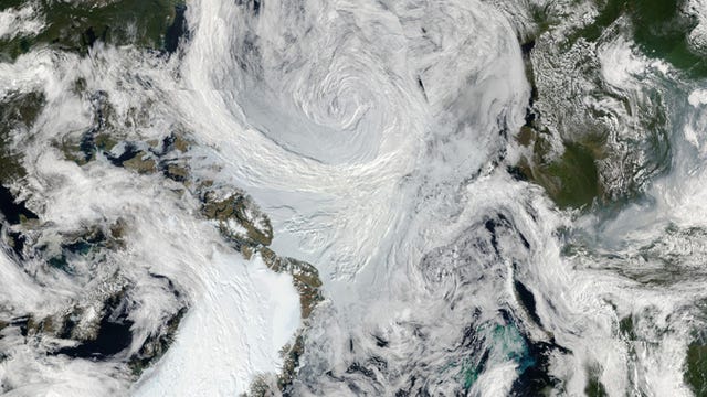
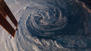
People in the US are seeing white this week as they experience snow flurries and extreme cold from a "bomb cyclone" storm surging across the East Coast. Its appearance from space is quite a bit different. The US National Oceanic and Atmospheric Administration shared a video on Friday showing a surprisingly majestic sunrise satellite view.
The East Coast is waking up to an arctic chill this morning following the bombogenesis #BombCyclone. This type of rapidly intensifying storm with hurricane force winds in this part of the globe during winter is rare @NWS #blizzard2018 More imagery: https://t.co/mbgRYot60A pic.twitter.com/v1y87b83ab
— NOAA Satellites (@NOAASatellites) January 5, 2018
The time-lapse video shows a darkened view of the Earth that brightens as the sun sweeps across it, highlighting the swirling storm patterns. NOAA's Goes-East weather-monitoring satellite provided the imagery.
While the term "bomb cyclone" comes off as very dramatic, NOAA says it's actually less scary than it sounds. It's a catchier version of the weather term "bombogenesis." NOAA's simplified explanation is that bombogenesis happens when a storm intensifies very rapidly over 24 hours.
"More precisely, it's a mid-latitude cyclone that rapidly intensifies, with a central pressure that drops at least 24 millibars over 24 hours (a millibar measures atmospheric pressure)," NOAA notes.
The massive winter storm brought with it lots of snowfall, hurricane-force winds and flooding along the coast. NOAA's satellite will continue to watch over the system from its safe spot in space.