New Audi A8 MMI system to feature Google Maps, Wikipedia
Not content with pwning China or revolutionising smart phones, Google is stepping into the world of automotive tech by bringing Google Earth imagery to the new Audi A8
Our mighty overlords at Google are at it again. Not content with pwning China or pimping smart phones, the search behemoth is about to take a step into the world of automotive technology by bringing Google Earth to the new Audi A8.
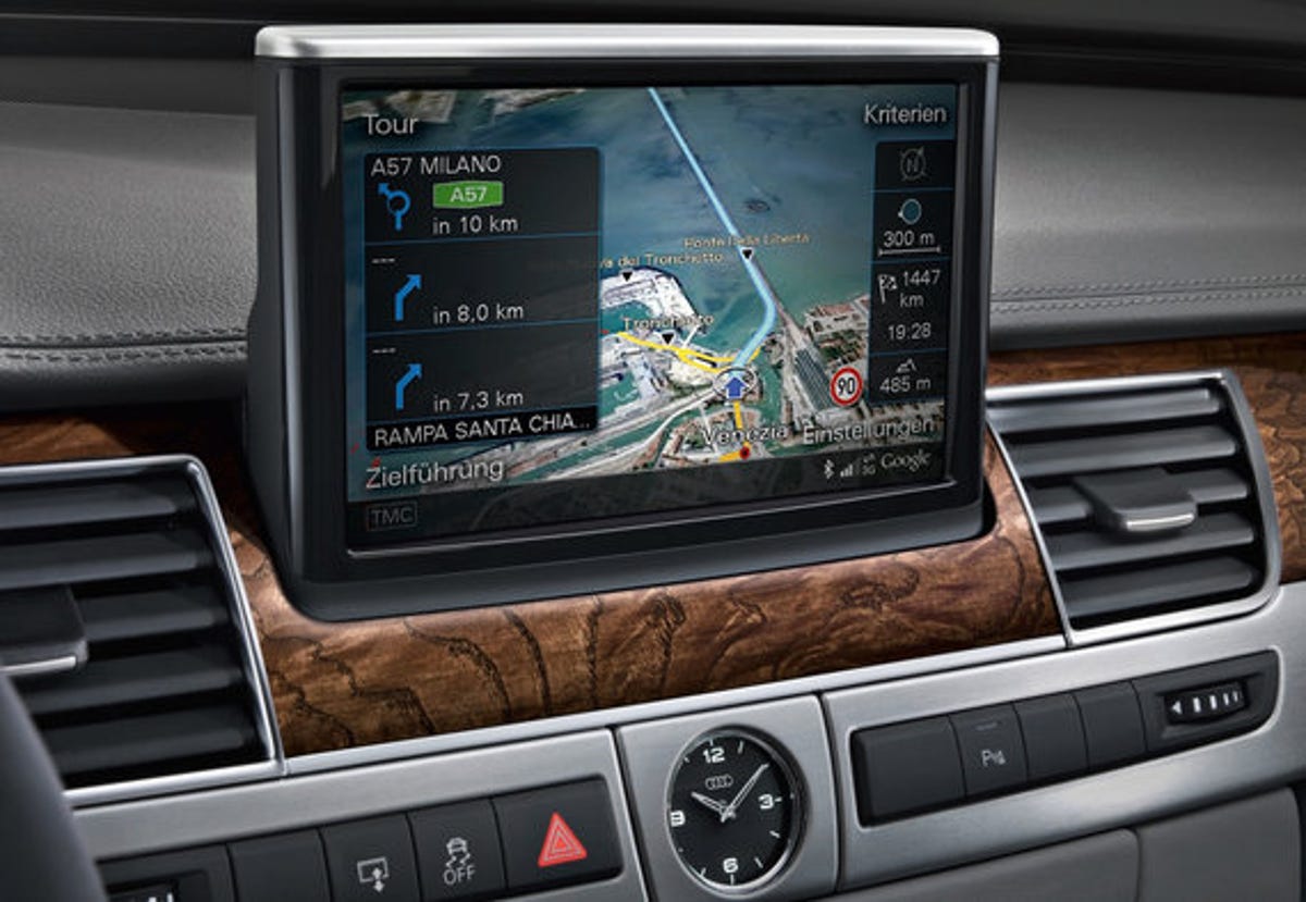
Yup, from May, Audi's MMI (Multi Media Interface) system will mix its existing offline maps with data pulled directly from the Internet. Unlike ordinary GPS maps, it'll show drivers their location in high-resolution Google Earth satellite imagery on the car's 8-inch display, making it even easier to figure out where you are and where you're going. Should you spot an interesting-looking building or point of interest, the system can pull live information from Wikipedia.
"What manner of sorcery is this?" you ask. It's all quite simple, really. Audi's MMI system features an optional integrated GPRS/EDGE modem, into which users can insert a SIM card -- thus enabling Internet connectivity. If you don't fancy the idea of putting your SIM into the car, you can also link the MMI system to your mobile phone via Blueooth and leech off your existing mobile Web package.
As if that weren't impressive enough, the new A8s will feature optional night-vision systems that identify pedestrians in pitch-black conditions and Adaptive Cruise Control with a Stop & Go system that halts the car in slow-moving traffic and gets it going again once drivers in front have pulled away.
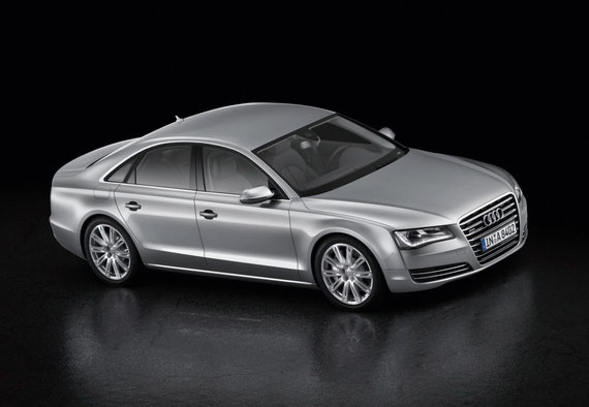
We'll be breaking into an Audi showroom to give the thing a go sometime in the near future, so check back soon for some hands-on loving. In the meantime, click 'Continue' for a pic of the car itself.
More Galleries

My Favorite Shots From the Galaxy S24 Ultra's Camera
20 Photos
Honor's Magic V2 Foldable Is Lighter Than Samsung's Galaxy S24 Ultra
10 Photos
The Samsung Galaxy S24 and S24 Plus Looks Sweet in Aluminum
23 Photos
Samsung's Galaxy S24 Ultra Now Has a Titanium Design
23 Photos
I Took 600+ Photos With the iPhone 15 Pro and Pro Max. Look at My Favorites
34 Photos
