BF Goodrich rolls into GPS navigation with OnTrail app
This off-road navigation app draws on the power of the public with shared trails and a gaming twist.


I am a bit of a map nerd. Latitude and longitude, heading and distance; I love the feeling of a paper map in my hands, rulers ready to chart my next adventure. But sometimes that just isn't practical. Navigating with map and compass takes time, and with GPS so readily available, I'd be a fool to not use it while exploring the great unknown. Enter BF Goodrich's new OnTrail app, a nifty little program that can help you find, record and even gamify your trails.
BFG is known for tires, but the company also has a hand in mapping, having provided the paper maps for off-road chase vehicles in Baja races for years. OnTrail has some routes already added by the good folks at BFG, but much of the content is user-generated. As such, there are some things missing. For example, the Rubicon Trail is here, but the equally cool Mojave Road is not. Further, you'll find some trails have robust descriptions while information on others is pretty scarce.
When I open the app I can see my current location surrounded by icons for nearby trails. On the right side are icons for weather, map layers -- including topographic lines and satellite -- and different tools. At the bottom are icons for my journal, which is where any previous or future trips are stored, gamification (more on that in a minute) and my profile. I can swipe up for nearby recommended trails as well as for missions, which are part of the gamification that, again, I'll get to shortly.
I can search for a trail by vehicle type, be it 4x4, side-by-side or dirt bike. I can also filter by trail skill level, length, seasonal availability and overall rating. Of course, one person's medium difficulty is another person's terrifyingly hard, so take these user-generated ratings with a grain of salt.


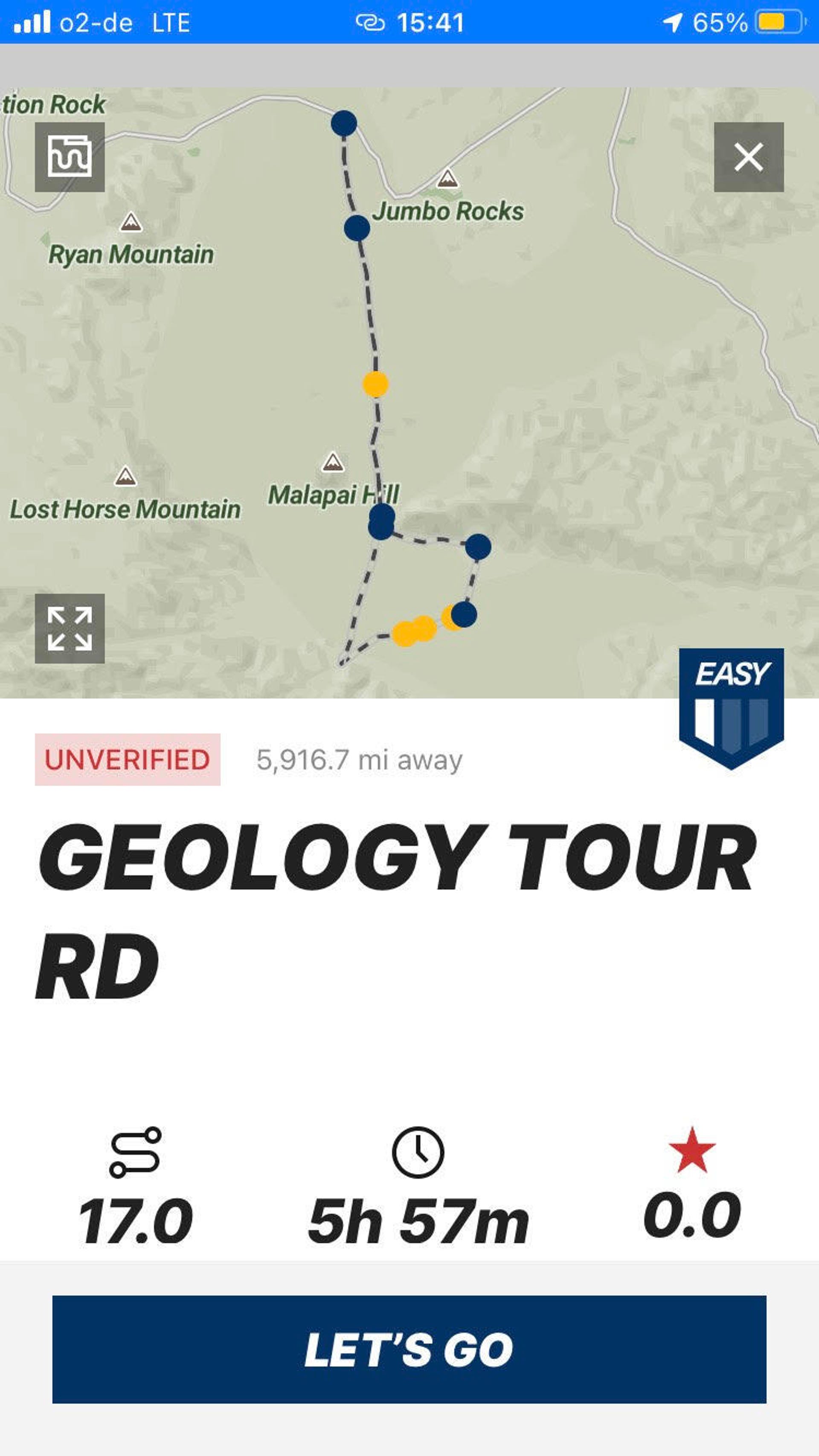
To test the app, I try out an easy trail that starts in Joshua Tree National Park. The first thing I do is download the map so that it works once I get out of cell service. This particular trail was uploaded by BFG staff and has a healthy description that includes the land manager and if there are any facilities along the route. It also gives me written directions to the trailhead, but I can also input the coordinates into Google maps or other on-road nav applications for directions to the start of the route, as well.
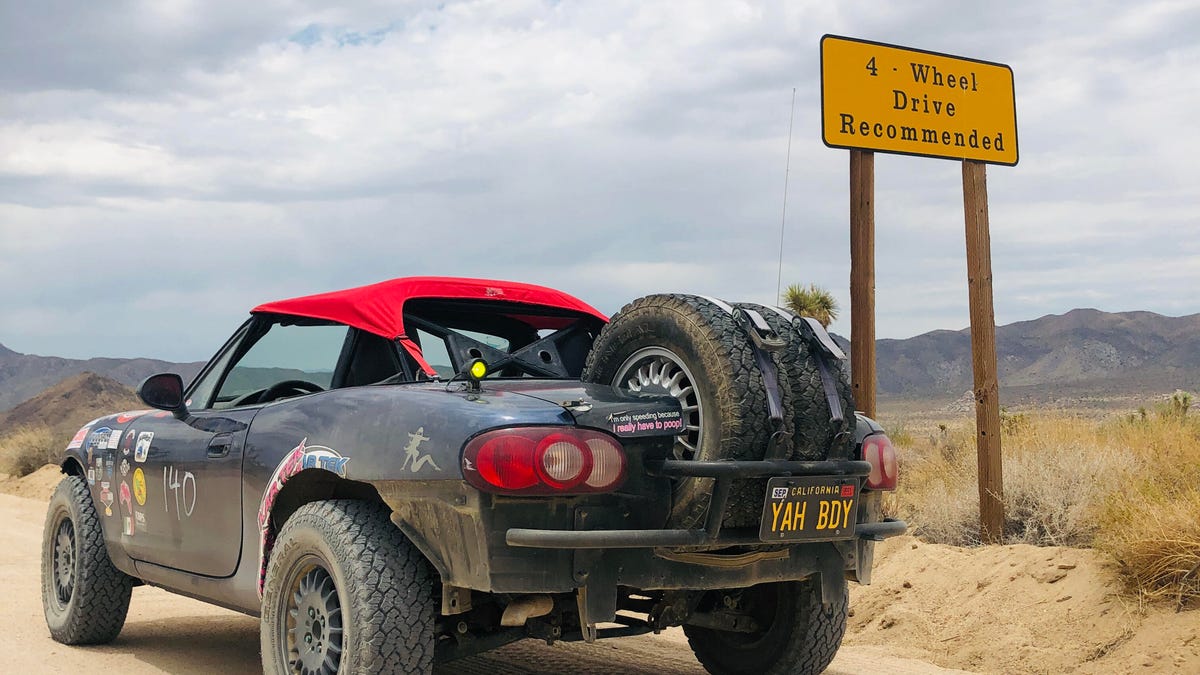
I also choose the satellite map overlay, since it gives me an idea of the surrounding terrain. After a quick calibration the app can also give me the pitch and roll of my vehicle, something that a lot of new rigs already have built into the dash, but Buddy, my little off-road Miata, is lacking.
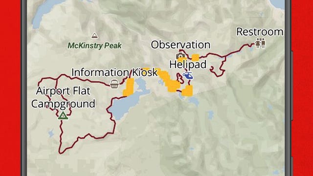
Once I get to the trail the app shows me various waypoints, like hiking trailheads and directions specific to the trail. There are even danger points marked, although Buddy handles it all like a champ. The trail is 17 miles long and the app says the average time spent driving it is 5 hours and 57 minutes, though I'm able to do it much quicker.

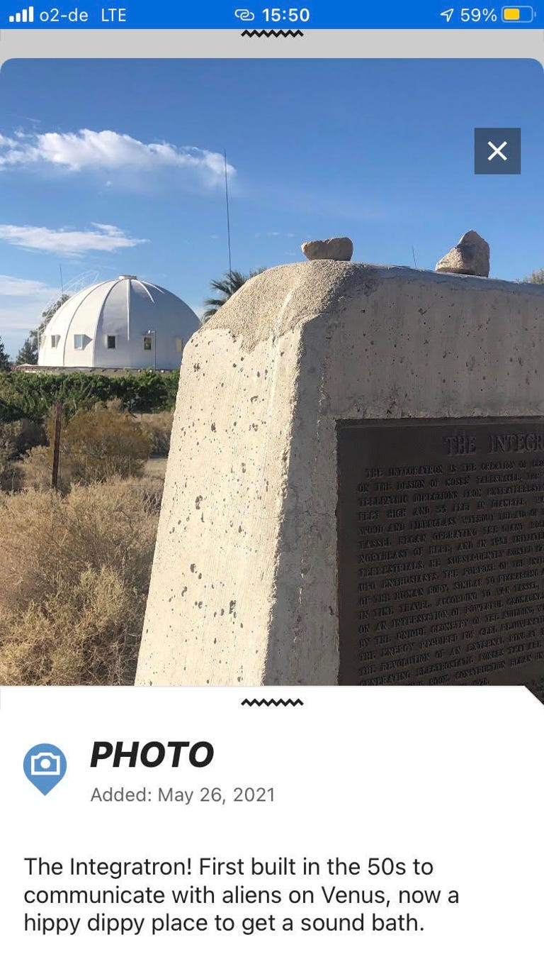
I can also upload my own trails, so the next day I head out to a high-desert landmark: the Integratron. First built with the intention of communicating with aliens on Venus (seriously), the Integratron is now a hippie mecca where you can get a sound bath. I hit the Start icon and take a picture of the Integratron, add a little caption and upload it to the app. Along the way I can easily add photos of Giant Rock, a sign that warns of Marine Corps bombing grounds and of my final destination, a bush in the middle of a lake bed where AT&T cell service works. I add a description of the trail, give it a name -- Integratron Cell Phone Bush/KOH, if you're curious -- and hit publish. It's super easy.
You can also submit a trail that you may have on a GPX file. This is great if you already have a route saved on your computer but want to share it with the world. Of course, maybe you want to keep your trail on the DL. (Hey, we all need our secret places.) The app lets you record a trail and keep it just for you and your buddies.
Now, as for the gamification part. The app has various missions you can complete for experience points, which are used to garner badges and basically show if you're an active user or not, and tread points, which allow you to enter drawings for rewards, like $1,000 worth of BF Goodrich tires. You can earn experience points for going through a quick safety course, recording a trail or uploading a trail from a GPX file. Tread points are awarded for publishing a trail and a few other tasks.
The points all seem a little random; why does recording a trail give you experience points and publishing that same trail give you tread points? I'm also not one to be super into status and badges, but if you're the competitive sort, you may find it fun.
The app has a web portal that I find to be easier to use when searching for a trail, if only for the bigger screen of my computer. I can add a route to my journal on the website and it shows up in my journal in the app. Easy peasy.

In all, the app is pretty easy to use, with one big caveat: It does not play well with older iPhones. Even though I am running iOS 14.4.2, I'm still on a seemingly ancient iPhone 8. I'm not sure how it does with older Android phones, but I'd be sure to have something new-ish before you pull the trigger. BF Goodrich OnTrail is $34.99 a year and is available for iPhone, iPad and Android.
There are plenty of great off-road GPS apps available. Gaia allows you to record tracks and share trails for free, but if you want to download the maps to use offline the cost is $39.99 per year. However, Gaia also features maps for hiking, mountain biking and back country skiing. There are also options on Gaia for Europe and the Baja peninsula. OnTrail, meanwhile, is currently only available for the United States. With BF Goodrich being a huge player in off-road racing in Mexico, it seems only natural for OnTrail to expand into Baja ASAP.
OnX is another popular app with a free version, a medium-priced yearly subscription of $29.99 and a pricey $99.99 yearly subscription that includes private property boundaries and land owner names. You only need to be chased off someone's land once to see the value here.
Still, at the end of the day, the OnTrail app is just another tool and you shouldn't rely solely on technology when you venture out into the wild. Ever have your cell phone overheat? I have. Ever taken your phone out to snap a cool picture and drive off with it on the fender, never to be seen again? Yep, that's happened to me, too. The point is, always carry a backup paper map, a compass and know how to use them.