Traces of a wet past in Martian craters (pictures)
New images sent back from the European Space Agency's Mars Express show channels and erosion in Martian desert craters that hint at a watery past.
James Martin
James Martin is the Managing Editor of Photography at CNET.
His photos capture technology's impact on society - from the widening wealth gap in San Francisco, to the European refugee crisis and Rwanda's efforts to improve health care.
From the technology pioneers of Google and Facebook, photographing Apple's Steve Jobs and Tim Cook, Facebook's Mark Zuckerberg and Google's Sundar Pichai, to the most groundbreaking launches at Apple and NASA, his is a dream job for any documentary photography and journalist with a love for technology.
Exhibited widely, syndicated and reprinted thousands of times over the years, James follows the people and places behind the technology changing our world, bringing their stories and ideas to life.
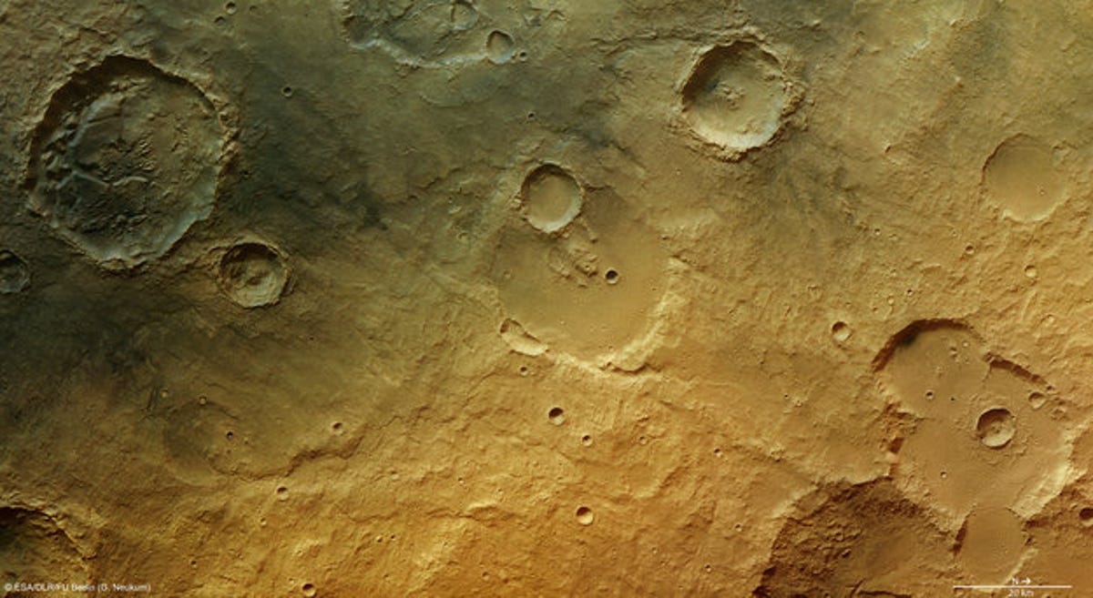
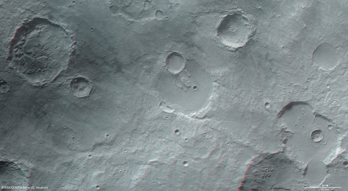
The European Space Agency's Mars Express -- an orbiter studying the interior, subsurface, and surface of the planet Mars -- has recently returned new images that suggest craters found throughout the planet's landscape were once filled with water and sediments, long since drained, and left a barren planetary desert with just hints to its wet past.
The images, taken on January 15, are of a region north of an ancient riverbed called Tagus Valles and east of Tinto Valles and Palos crater.
Yardangs, formations carved from abrasive forces shaping the sediments, tell the ancient story of the deposits left during a flood event believed to have once covered the entire region.
Over time, slow erosion from retreating water has removed some of the sediment, leaving the patterns of stronger blocks behind, seen in the form of channels (lower center), fluidized debris around craters, (bottom right), and blocks of eroded sediments (top left). Additional geologic activity, possibly volcanoes, may have deposited the fine dusting of dark material which can be seen in the top left.
2 of 5 ESA/DLR/FU Berlin (G. Neukum)
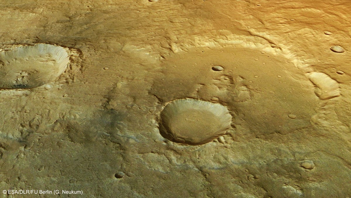
Deformation in a flooded crater
This closer view focuses on the smaller crater in the center which overlies the older, larger crater. To the right, a faint channel can be seen flowing from the crater, perhaps showing that a crater lake once transported water and sediments flowing from the channel.
3 of 5 ESA/DLR/FU Berlin (G. Neukum)
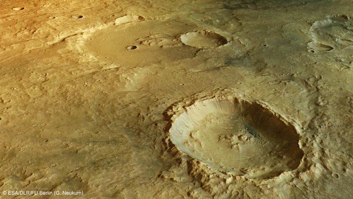
Landslides inside a crater
In the foreground is one of the deepest craters in the region, where numerous landslides, resulting from water weakening the crater walls, had occurred, leaving grooves in the walls and debris piled on the floor below.
4 of 5 ESA/DLR/FU Berlin (G. Neukum)
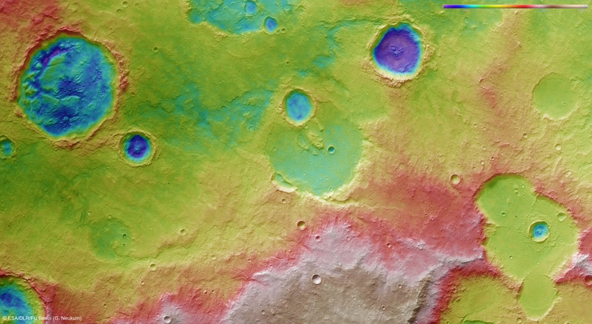
Topography of Tagus Valles
Evidence of this crater’s wet past can be seen in the top right of this image taken by ESA's Mars Express High-Resolution Stereo Camera. A small, winding river channel, in blue, can be seen in this digital terrain model of the region to the north of Mars' Hesperia Planum, including part of the Tagus Valles region, taken on January 15.
5 of 5 ESA/DLR/FU Berlin (G. Neukum)
3D view of Tagus Valles region
Images of the area north of Hesperia Planum and close to the Tagus Valles region were captured on January 15 by the Mars Express using the High-Resolution Stereo Camera (HRSC) to create this 3D image of the surface.