NASA's Earth Day commemoration includes a historic look at our home planet, beginning with images taken in 1947 from a V-2 rocket.
Jon Skillings
Jon Skillings is an editorial director at CNET, where he's worked since 2000. A born browser of dictionaries, he honed his language skills as a US Army linguist (Polish and German) before diving into editing for tech publications -- including at PC Week and the IDG News Service -- back when the web was just getting under way, and even a little before. For CNET, he's written on topics from GPS, AI and 5G to James Bond, aircraft, astronauts, brass instruments and music streaming services.
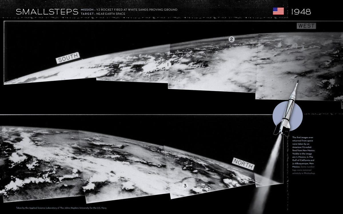
1 of 5 Johns Hopkins Applied Physics Laboratory, via NASA
V-2 view of Earth
In honor of Earth Day, NASA is showing off a number of views of our home in space, including some historic images. The space agency says that the photos here are the first pictures of Earth seen from an altitude of more than 100 miles. (The threshold to outer space is generally considered 60 miles, if I remember correctly from "The Right Stuff.") They were taken on March 7, 1947, from a captured German V-2 rocket in which the warhead had been replaced by a nose cone that contained a camera.
Until that point, NASA says, the highest altitude from which pictures had been taken of Earth was 13.7 miles, from the Explorer II balloon in 1935.
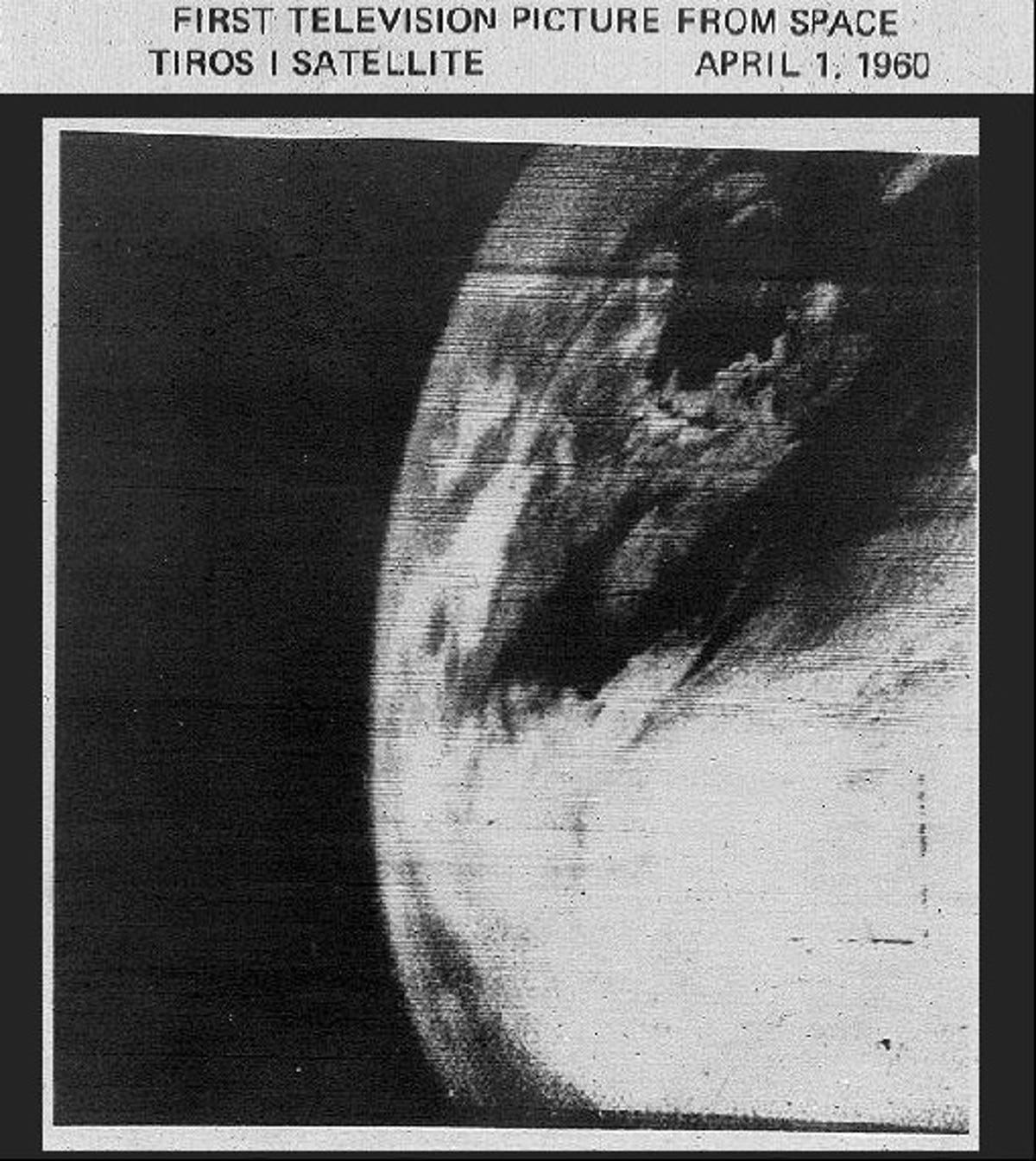
2 of 5 NASA
TIROS-1 satellite view
The clarity isn't great, but this image is momentous nonetheless. NASA says that this view, from the TIROS-1 satellite on April 1, 1960, is the first photo of Earth taken from a weather satellite.
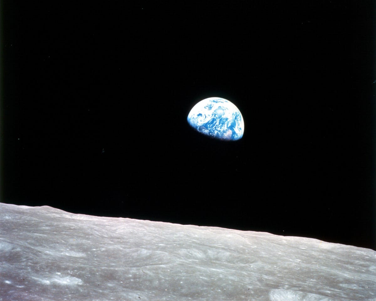
The Apollo 8 mission in December 1968 took humans out of Earth's orbit for the first time. The spacecraft, carrying Frank Borman, Jim Lovell, and William Anders, circled the moon 10 times before returning home. The astronauts brought back images of "Earthrise" that quickly became associated with the burgeoning environmental movement.
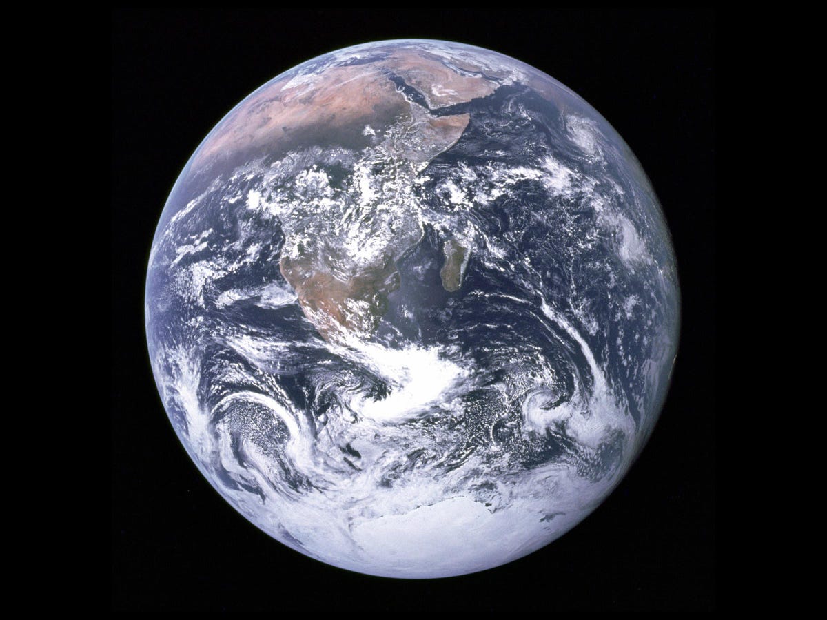
4 of 5 NASA
Earth from Apollo 17
In December 1972, Apollo 17 was the last of the NASA missions to put men--Eugene Cernan and Harrison Schmitt--on the moon. This image from the Apollo 17 voyage shows the whole big blue marble of Earth. (A poster of that image hung on my wall for many years when I was a teen--I believe I got it from my National Geographic subscription.)
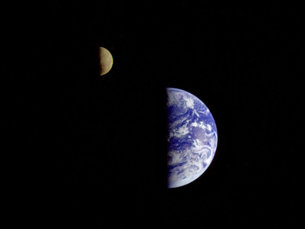
5 of 5 NASA
Earth and moon
It's not clear exactly when this image was taken--it's from the Galileo satellite, which was launched in October 1989, did flybys of Earth and Venus in 1990, and Earth again in 1992, before entering orbit around Jupiter in 1995. (The Galileo mission ended in September 2003, after 35 orbits of Jupiter.) So it's not exactly an early view of Earth from space--but it is a striking one of Earth and moon, from about 3.9 million miles away.
Here's what you see, according to NASA: "Antarctica is visible through clouds (bottom). The Moon's far side is seen; the shadowy indentation in the dawn terminator is the south pole Aitken Basin, one of the largest and oldest lunar impact features."