New imagery collected by the VIIRS sensor aboard the Suomi NPP satellite maps the subtle differences in Earth's greenness, from the lushest vegetation to vast, dry deserts.
James Martin
James Martin is the Managing Editor of Photography at CNET.
His photos capture technology's impact on society - from the widening wealth gap in San Francisco, to the European refugee crisis and Rwanda's efforts to improve health care.
From the technology pioneers of Google and Facebook, photographing Apple's Steve Jobs and Tim Cook, Facebook's Mark Zuckerberg and Google's Sundar Pichai, to the most groundbreaking launches at Apple and NASA, his is a dream job for any documentary photography and journalist with a love for technology.
Exhibited widely, syndicated and reprinted thousands of times over the years, James follows the people and places behind the technology changing our world, bringing their stories and ideas to life.
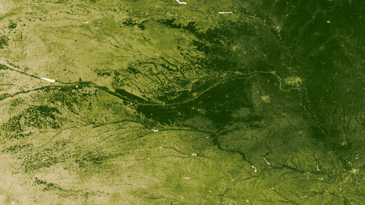
Farmland straddles the Platte River in the state of Nebraska in images from the NASA/NOAA Suomi NPP satellite from July 22-28, 2012. The region produces about 40 percent of the annual corn yield for the U.S., and nutrient input from this region drives aquatic and marine ecosystems from the Mississippi watershed to the Gulf of Mexico.
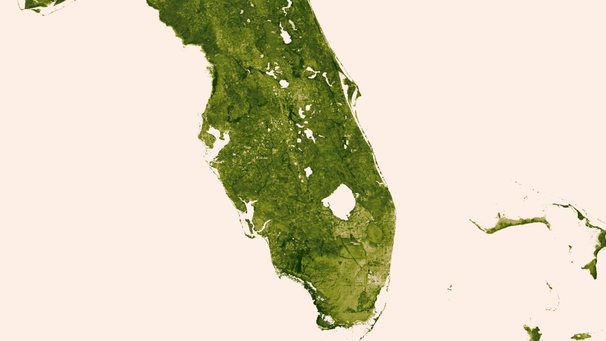
In these images collected by the NASA/NOAA Suomi NPP satellite on March 18-24, 2013, The "river of grass" extending south of Lake Okeechobee shows clear signs of its modified state with dense agriculture, urban sprawl, and water conservation areas delineated by a series of waterways that crisscross Southern Florida.
3 of 12 NASA/NOAA
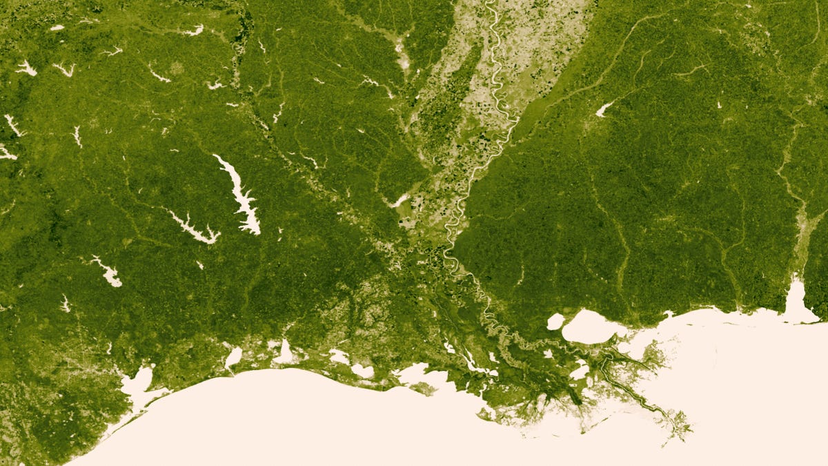
The Mississippi Delta
The Mississippi and its many tributaries empty into the Gulf of Mexico -- and where these two bodies of water meet lies 40 percent of the salt marsh in the contiguous United States.
4 of 12 NASA/NOAA
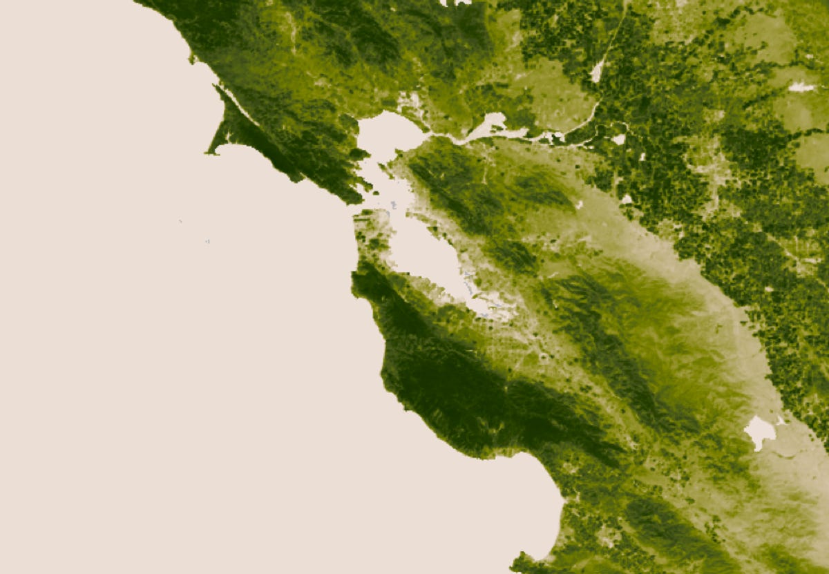
The San Francisco Bay Area
This vegetation map of the San Francisco Bay Area, seen here centered around San Francisco, shows the lush coastal areas of Point Reyes National Seashore to the north and the Santa Cruz Mountains to the south, as the climate transitions to the Central Valley farmlands to the east.
5 of 12 NASA/NOAA
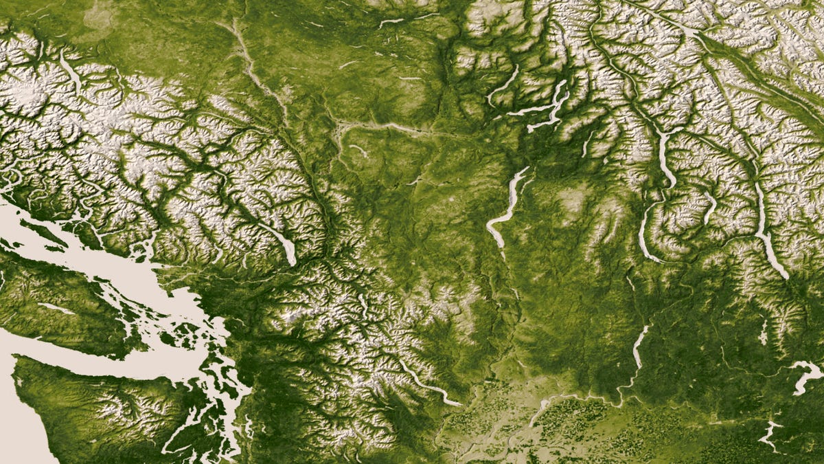
The Rocky, Cascade, and Coast mountain Ranges
The Rocky, Cascade, and Coast mountain Ranges dominate the landscape of the Pacific Northwest. Potatoes and other agriculture can be seen in the bottom center of the image as the Rockies give way to the plains of Idaho.
6 of 12 NASA/NOAA
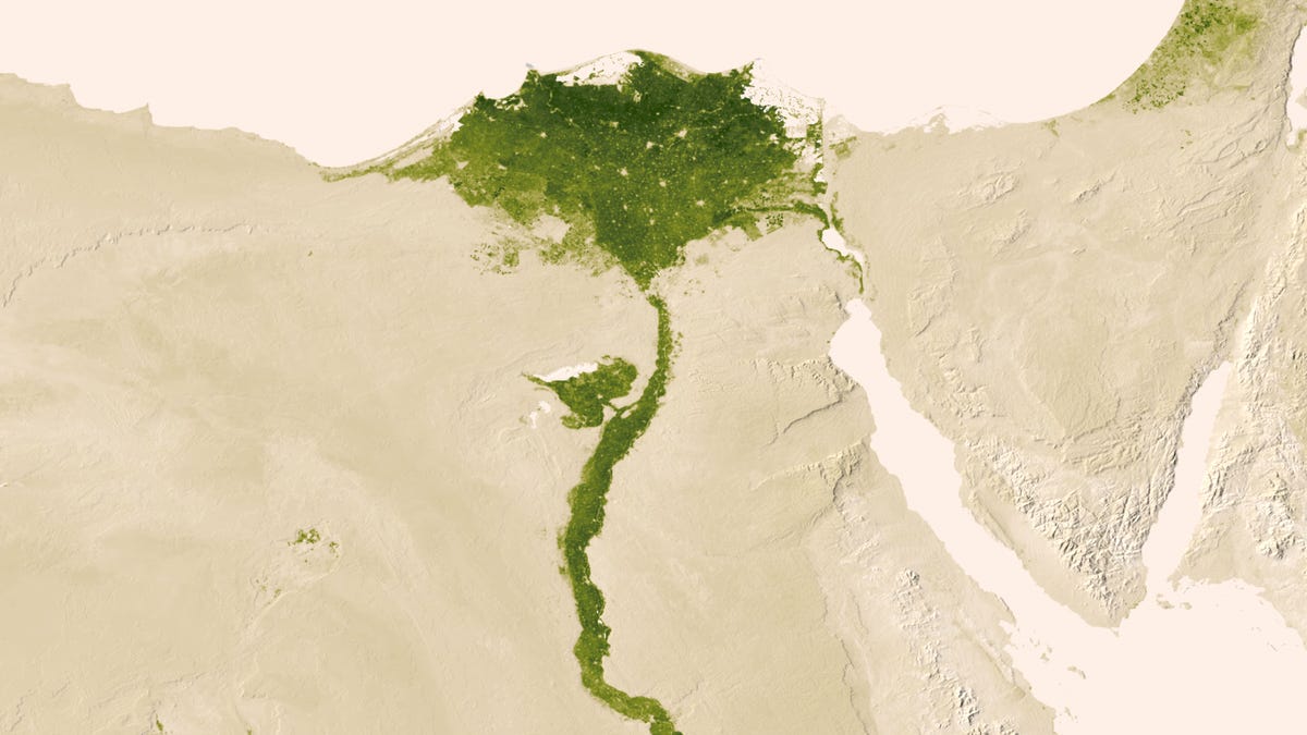
The Nile River
In the dry Egyptian deserts, the Nile River provides life-sustaining water.
7 of 12 NASA/NOAA
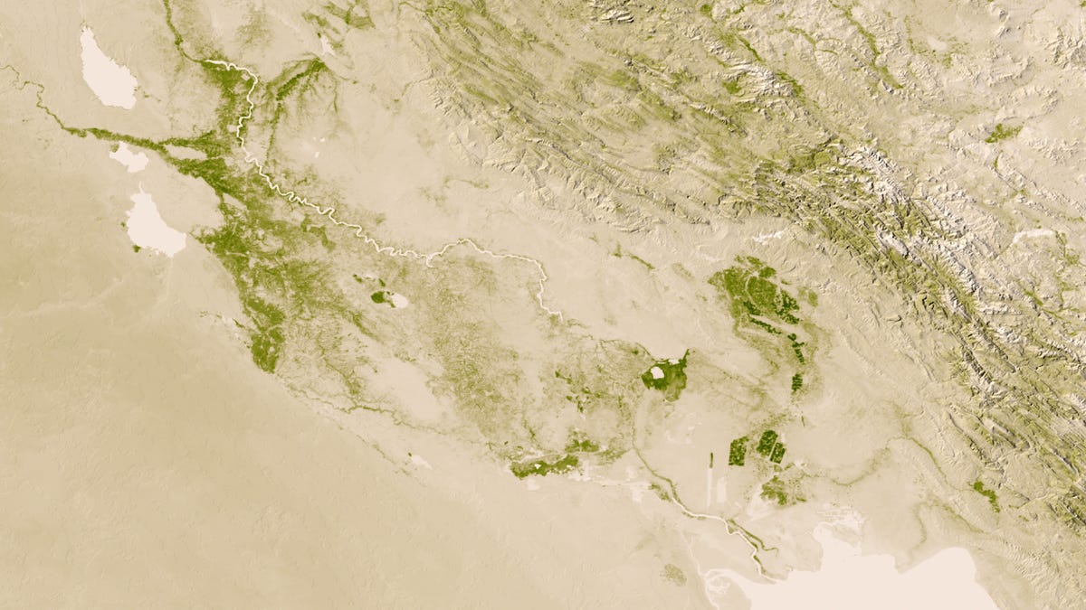
The Tigris and Euphrates
The Tigris, seen toward the north, and the Euphrates River, in the south, create a fertile crescent through the vast dryness of central Iraq.
8 of 12 NASA/NOAA
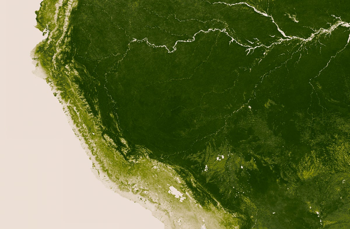
The Amazon jungle
The dense Amazon rainforest in Peru and Bolivia is seen here, representing some of the most lush green jungle regions in the world in imagery taken from the NASA/NOAA Suomi NPP satellite.
9 of 12 NASA/NOAA
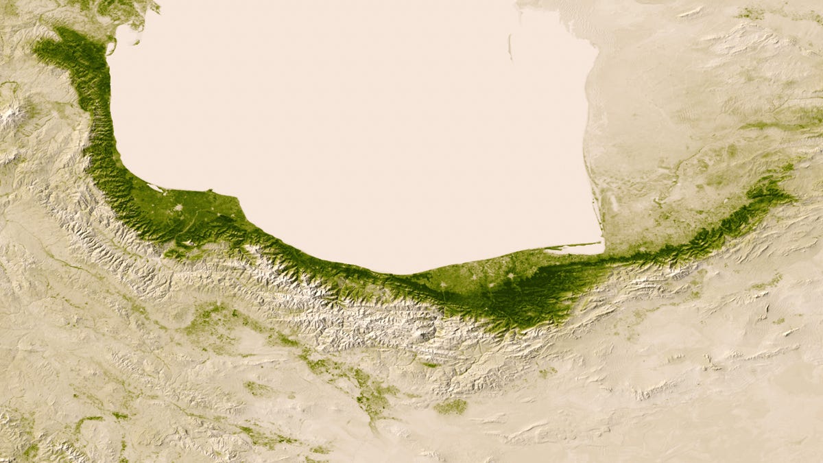
Climate boundaries in Iran
Moisture from the Caspian Sea precipitates on the northern edge of the Elburz Mountains, and on the southern edge, deserts emerge in the rain shadow.
10 of 12 NASA/NOAA
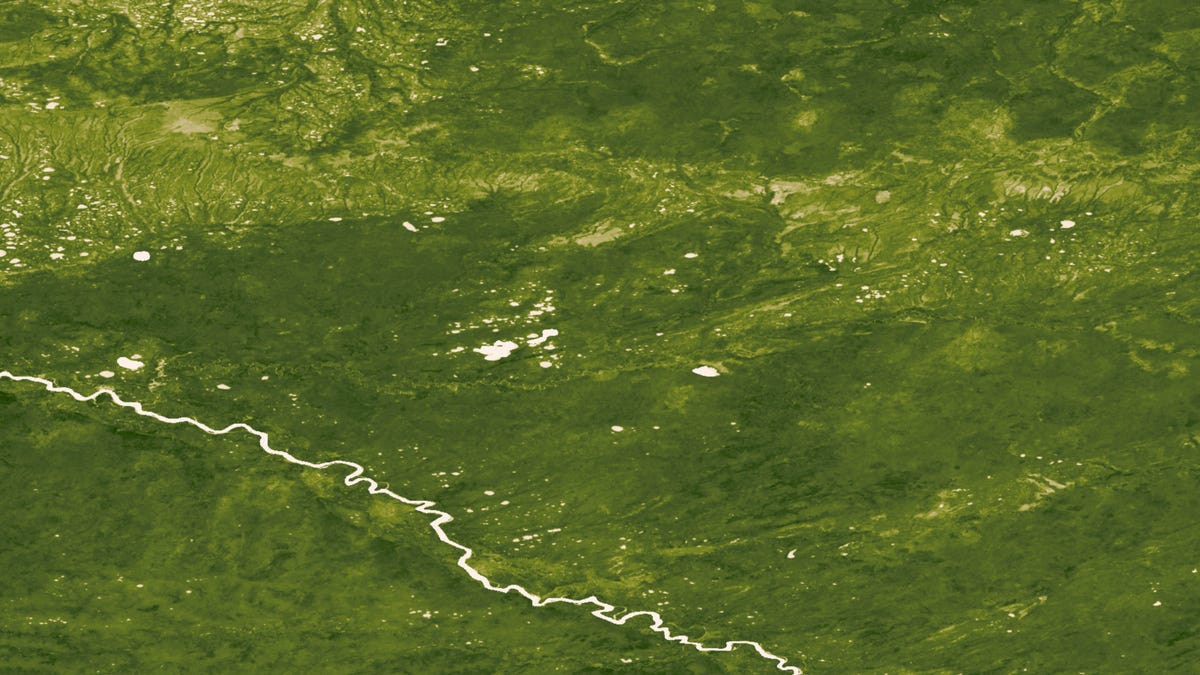
Dense Russian forests
In these images taken from June 18-24, 2012, we can see the dense boreal forest in Central Russia near the town of Langepas prior to a bout of devastating fires that hit the region last year.
11 of 12 NASA/NOAA
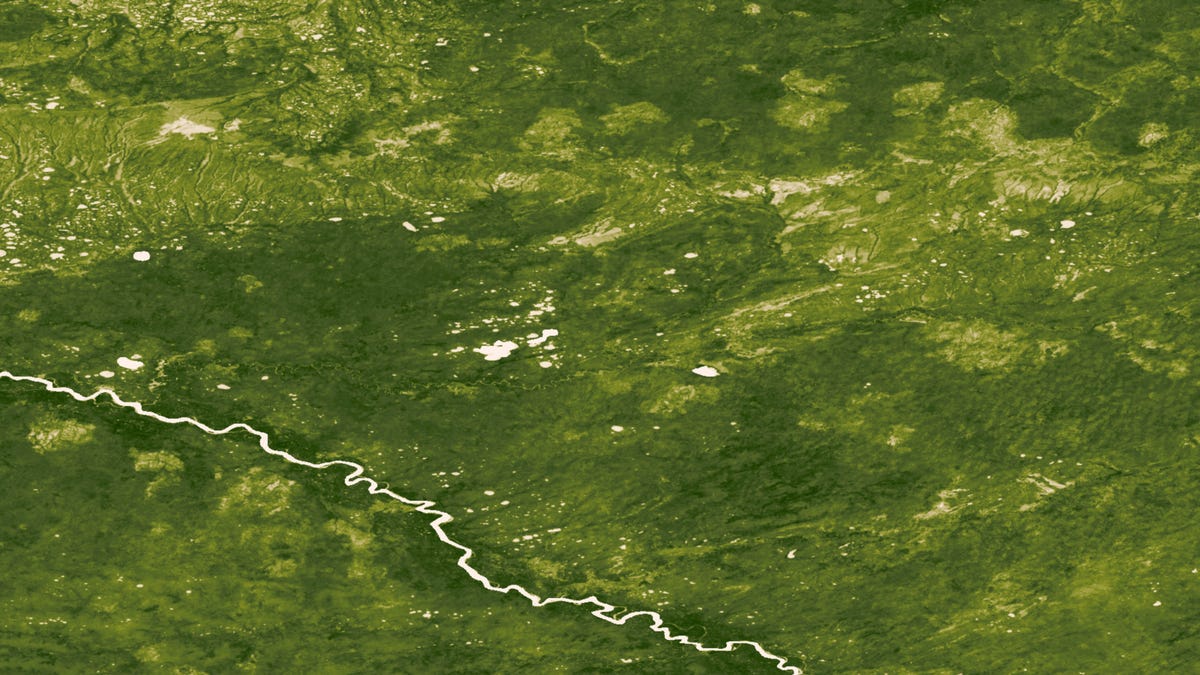
Burn scars in Russia
Though the surrounding area became more green, irregularly shaped areas of lesser vegetation mark the burn scars left by massive wildfires near the Russian town of Langepas, visible in these images taken from July 23-29, 2012.
12 of 12 NASA/NOAA
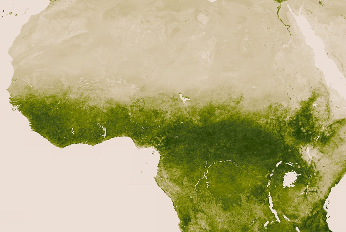
The Congo to the Sahara
In this imagery of Africa taken from the NASA/NOAA Suomi NPP satellite, we can see the stark divisions between the green jungles of the Congo as it transitions into the hot dry Sahara Desert.