Mapbox photography heat map etches out world's most photogenic cities (pictures)
A new interactive map uses 10 years' worth of Flickr geo-location data to visualise the most popular places in the world for photos, creating a heat map based on geotags.


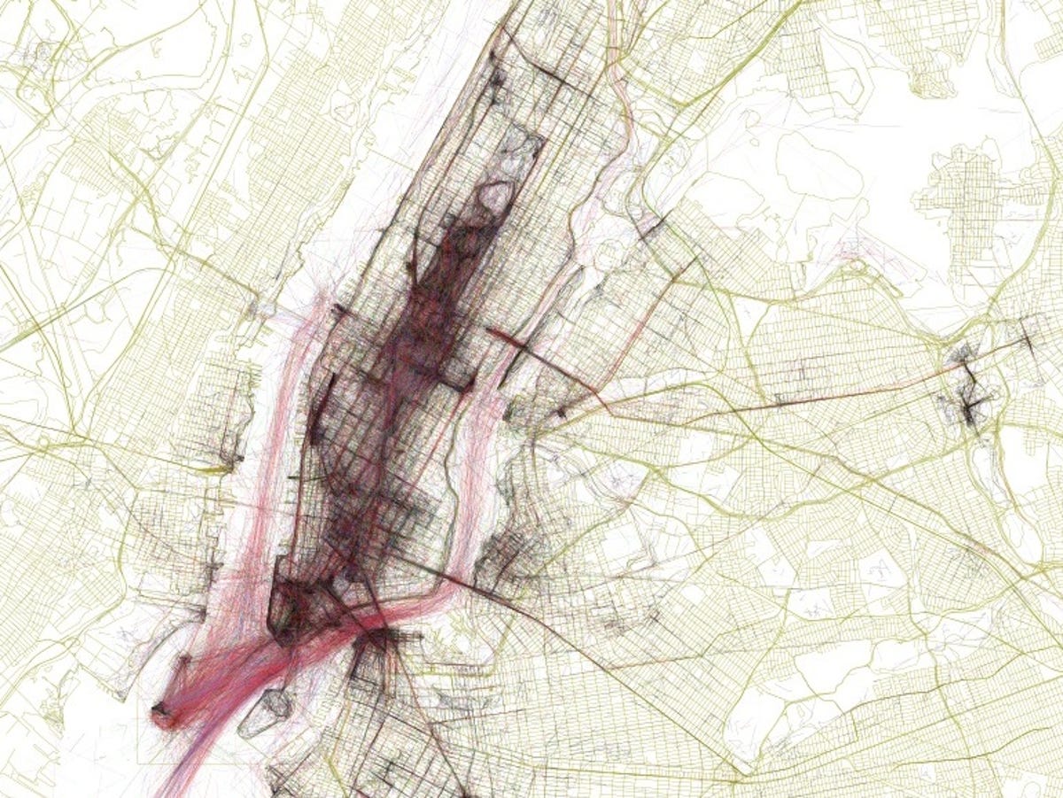
New York City
Mapbox, the San Francisco- and Washington, D.C.- based start-up that is taking on Google with its growing collection of interactive and customisable maps, has now released the Geotaggers' World Atlas -- an interactive map that visualises 10 years' worth of location data from photos uploaded to Flickr.
You can search the full map of the world for your local area but, to get you started, Mapbox has mapped the world's biggest cities to give an idea of the most visited places in the world.
The place with the most active map? New York, New York -- of course.
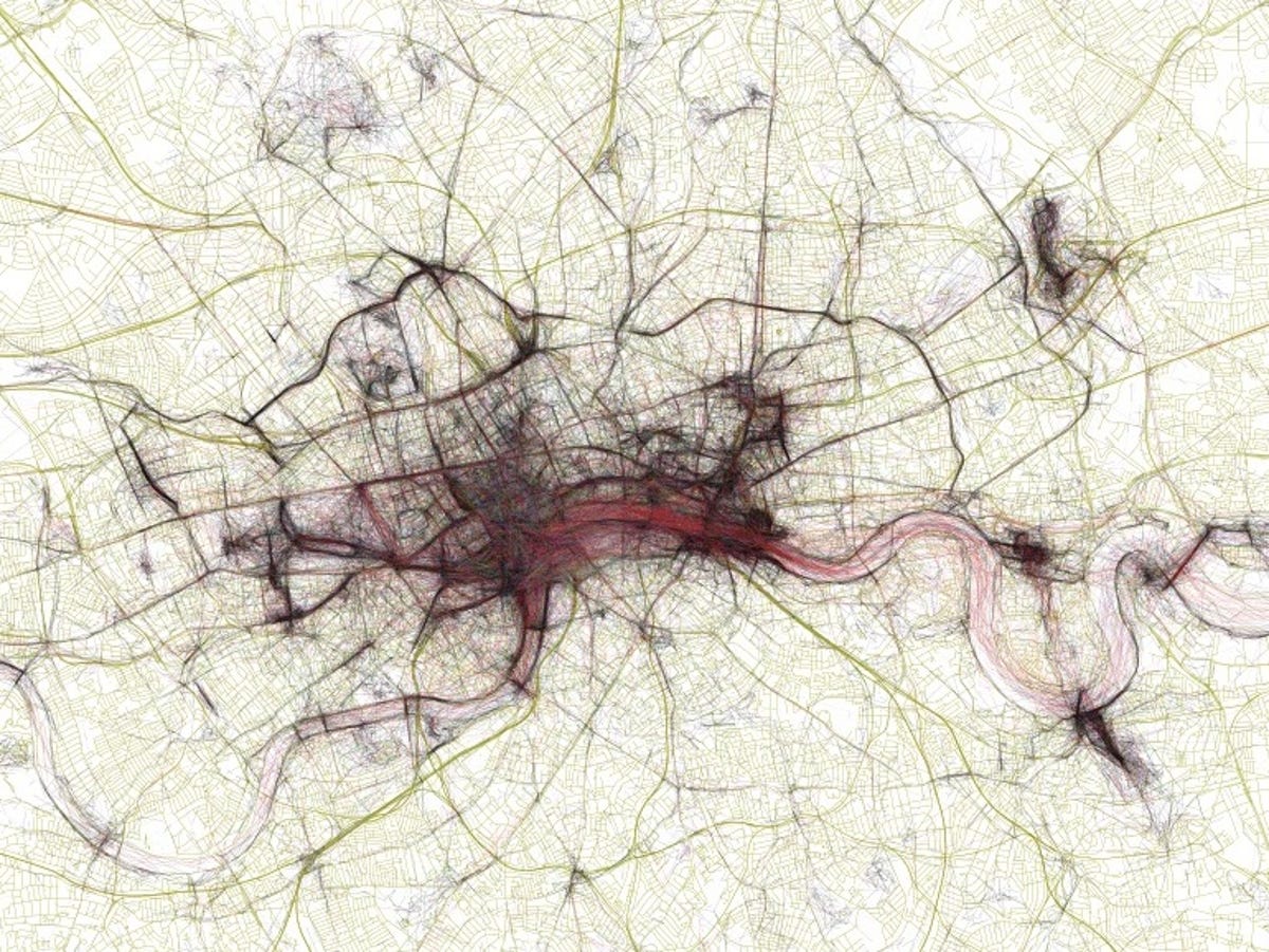
London
Mapbox data artist and software developer Eric Fischer said the project started five years ago when he began retrieving photo locations from Flickr's search API and drawing lines between the places where each photo was taken.
"A cluster of geotagged photos is a good indicator of the interestingness of a place because it signifies that people went there in the first place, saw something worth taking a picture of, and put the extra effort into posting it online for others to appreciate," he said.
"And a sequence of photos along a route is even more significant, because it indicates that someone sustained their interest over distance and time rather than taking one picture and turning back."
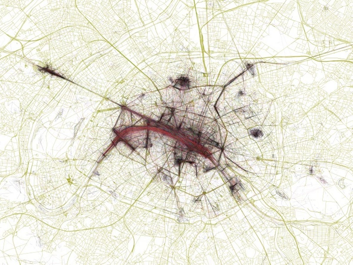
Paris
The map shows areas of dense activity mapped over streets and freeways. In this image of Paris, the tourist hotspots around the Seine are etched over repeatedly, with a long stretch to the left tracking along the Champs-Élysées towards the Arc de Triomphe.
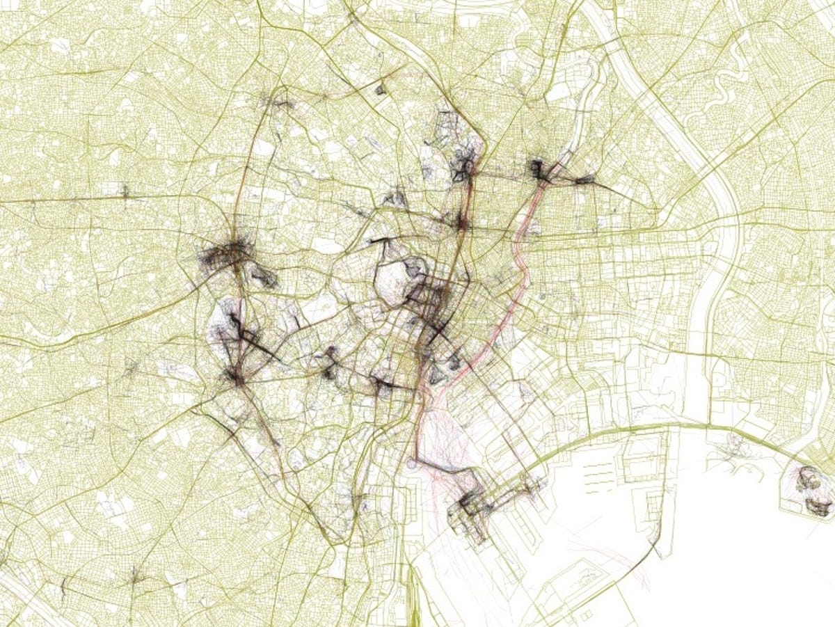
Tokyo
In comparison to New York and Paris, this shot of Tokyo shows how spread out the city is in terms of photo locations. In a blog post explaining the Geotaggers' World Atlas, Fischer kept each major city to a uniform map scale, allowing users to compare the density and size of each city as well as the relative distance between photography hotspots.
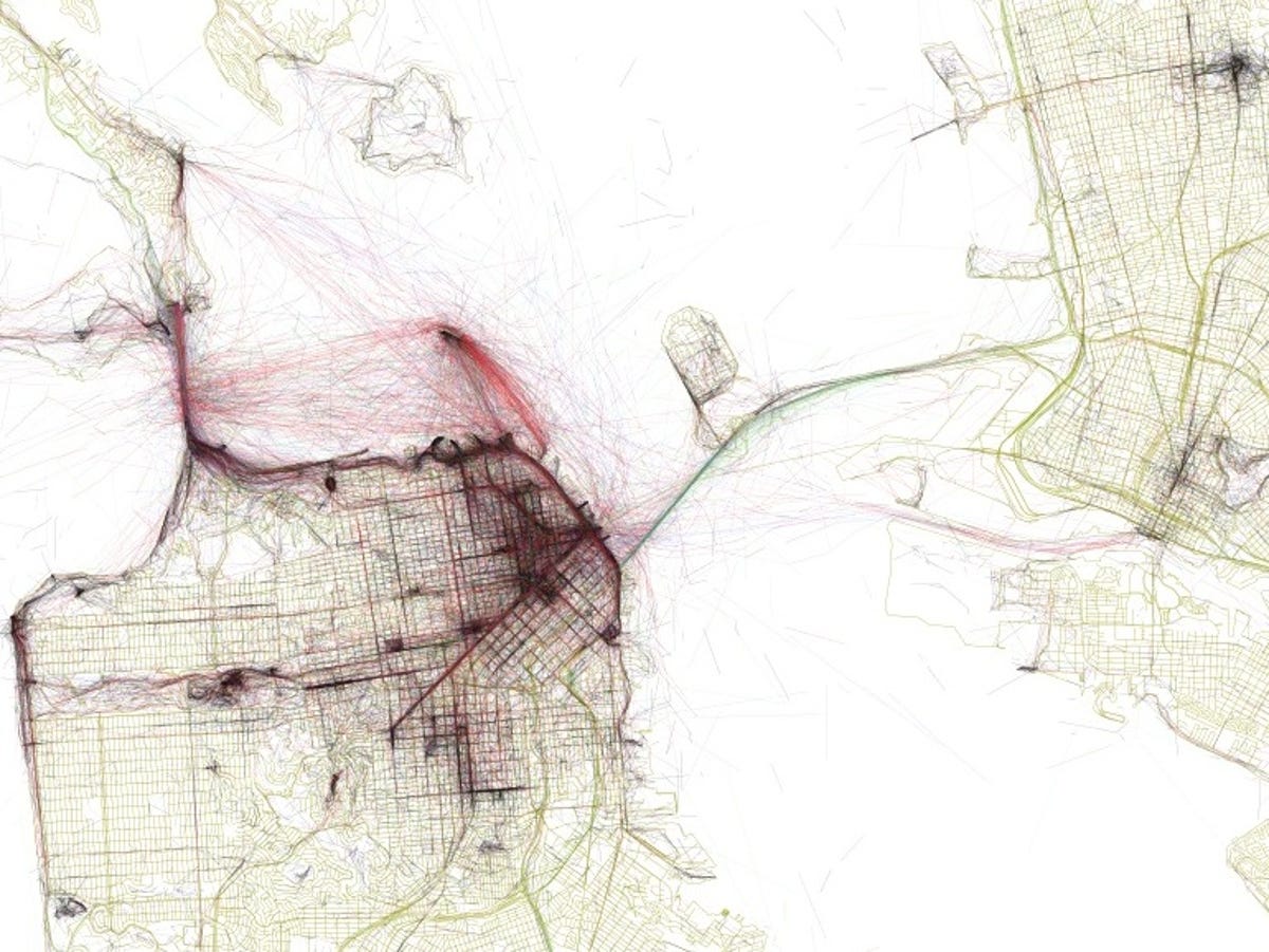
San Francisco
The Geotaggers' World Atlas doesn't just cover land. According to Fischer, the process of mapping was "full of surprises" including those found on the water.
"The red lines on the map (which show where a photographer traveled between photo sites at a speed between 7 and 19 miles per hour, based on the time stamps and locations of the pictures) that I had hoped would identify favorite bike routes turned out instead to reveal scenic ferries," he said.
Case in point: the ferry ride to Alcatraz in San Francisco.

Venice
Similarly, the map of Venice shows a vivid 'S' cutting through the map where the Grand Canal divides the city. The map also shows the smaller waterways which branch off the Canal, though they are less pronounced.
Las Vegas
Travelling across the world to the home of another Venetian, the famous Las Vegas Boulevard shows plenty of traffic shuttling up and down the main strip, with scribbles of activity as photographers duck off the thoroughfare into the major casinos. The dark patch in the centre of this image matches up with the famous Bellagio fountains.

Hong Kong
According to Fischer, Mapbox's latest map-making venture "has been full of surprises, making me aware of streets, neighborhoods, and whole cities I knew nothing about before. The separate paths of thousands of individuals combine to give the appearance of a sketch."
So what might first appear to be a mess of individual lines, could actually be a map of Hong Kong's famous harbour.
More Galleries

My Favorite Shots From the Galaxy S24 Ultra's Camera
20 Photos
Honor's Magic V2 Foldable Is Lighter Than Samsung's Galaxy S24 Ultra
10 Photos
The Samsung Galaxy S24 and S24 Plus Looks Sweet in Aluminum
23 Photos
Samsung's Galaxy S24 Ultra Now Has a Titanium Design
23 Photos
I Took 600+ Photos With the iPhone 15 Pro and Pro Max. Look at My Favorites
34 Photos
