Images: NASA's biggest achievements for Earth
In time for <a href="http://news.cnet.com/8301-11128_3-10223854-54.html">Earth Day</a>, NASA ran an online contest to let Earthlings pick the top 10 accomplishments in the agency's five decades of observing the planet. The winner: GPS.


First place: GPS
In time for Earth Day, NASA ran an online contest to let Earthlings pick the top 10 accomplishments in the agency's five decades of observing the planet.
The candidates were picked from a National Academy of Sciences study in 2008. The winners were announced Tuesday, on the eve of Earth Day.
First place: GPS
According to NASA, the power behind the Global Positioning System is a large body of scientific data about the Earth. "Precise navigation with GPS satellites would be impossible without ultra-precise knowledge of Earth's shape and how it rotates. NASA pioneered much of this work with a global network of laser ranging satellites and super-charged GPS receivers to monitor daily changes in Earth's surface," the agency says.
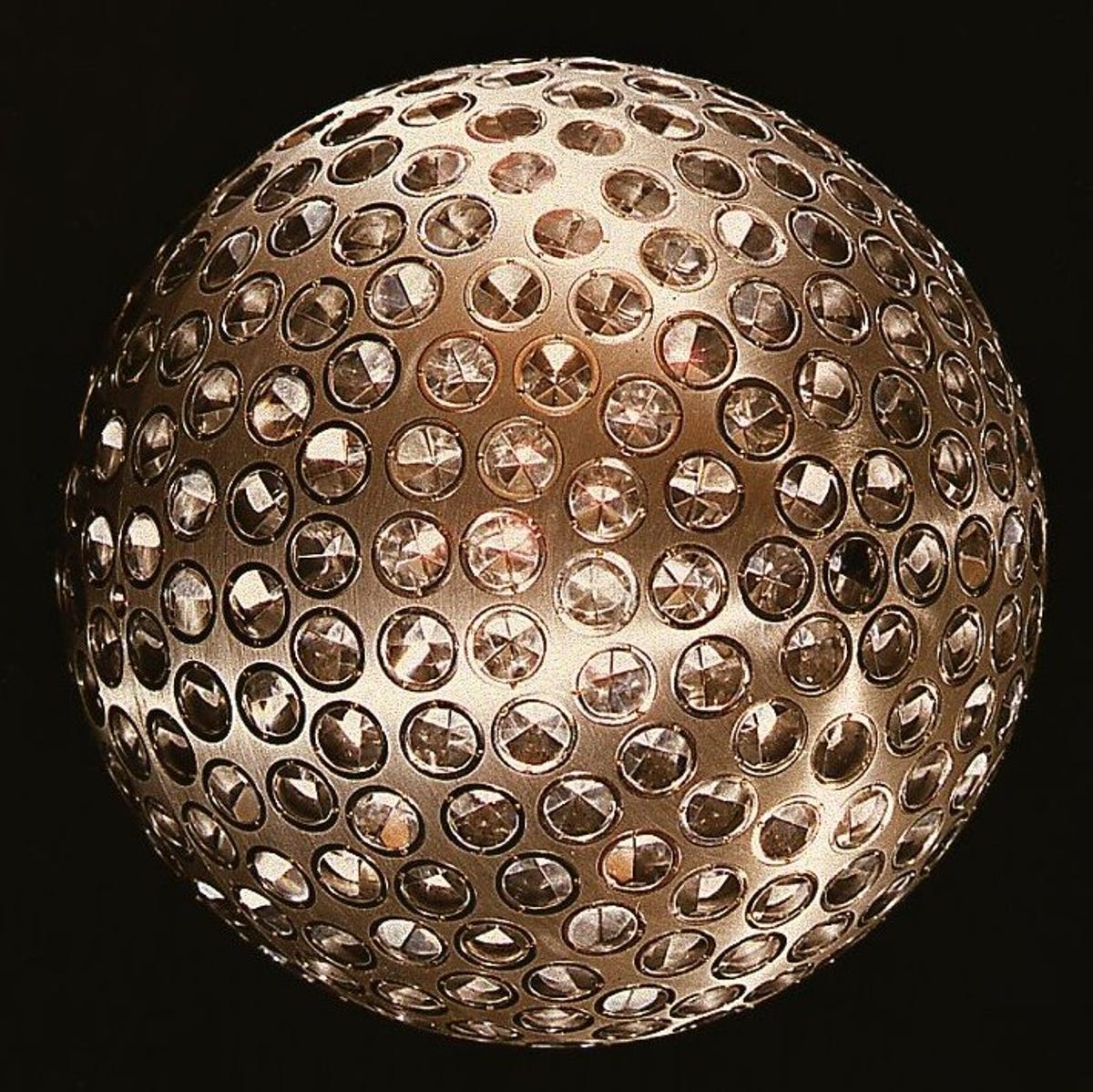
This is NASA's Laser Geodynamics Satellite, Lageos I, launched in 1976.
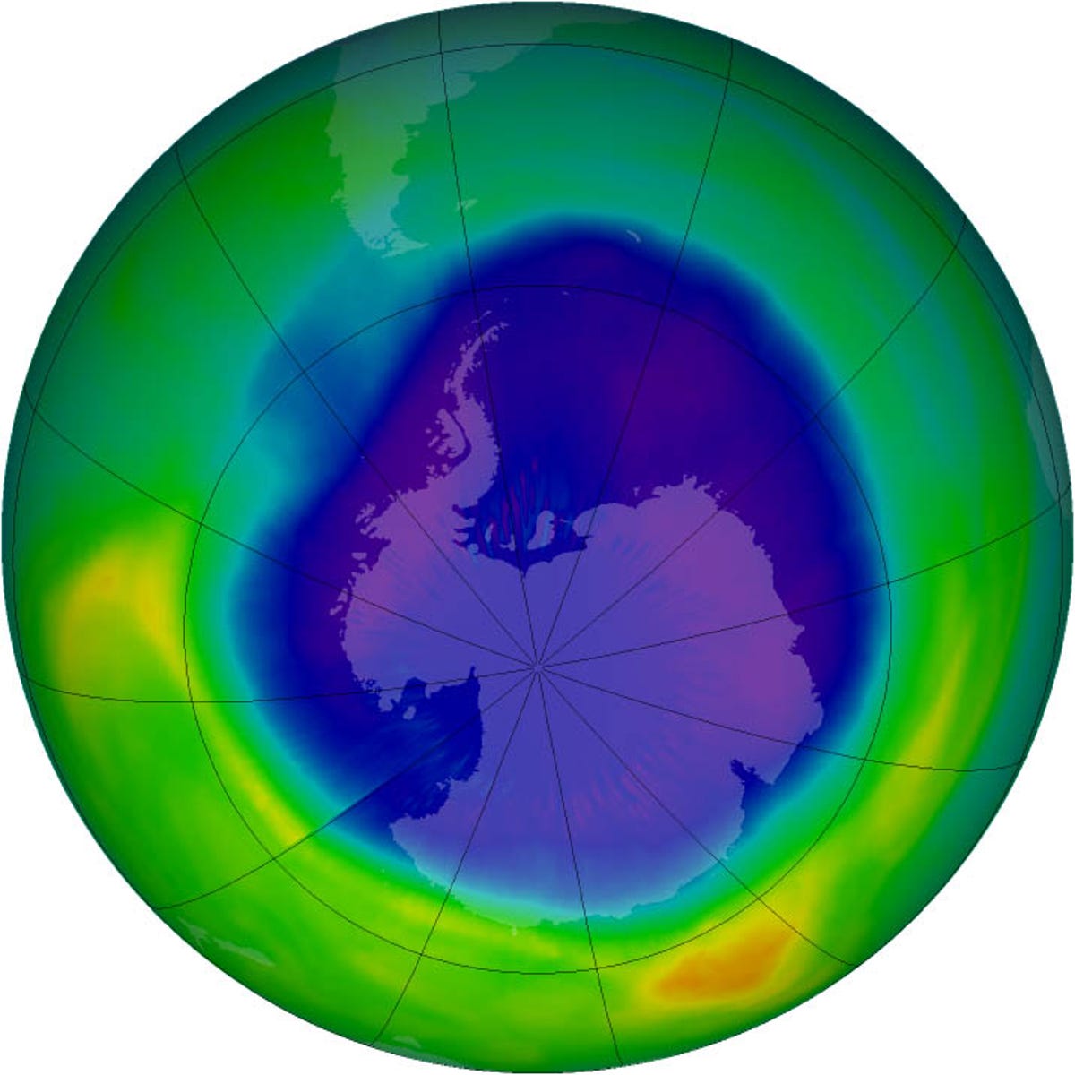
Second place: Diagnosing the ozone layer
Second place: Diagnosing the ozone layer
NASA says its satellites and aircraft have offered important evidence that certain manmade chemicals have been destroying the ozone layer. The information has led countries to ban such chemicals.
"Scientists now so thoroughly understand the ingredients of the chemical brew and the atmospheric conditions producing ozone damage that they can predict when the ozone hole over Antarctica will recover (look for it around 2070)," NASA says.
Here is the ozone hole over Antarctica in 2007.
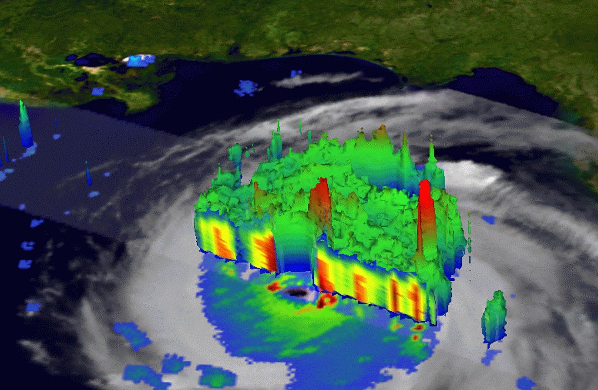
Third place: Predicting the weather
Third place: Predicting the weather
NASA uses its bird's-eye view to watch weather systems develop. According to the space agency, it has been decades since an undetected hurricane or tropical cyclone has struck land. In addition, seven-day weather forecasts have improved greatly over the past 30 years.
This is Hurricane Katrina in 2005.
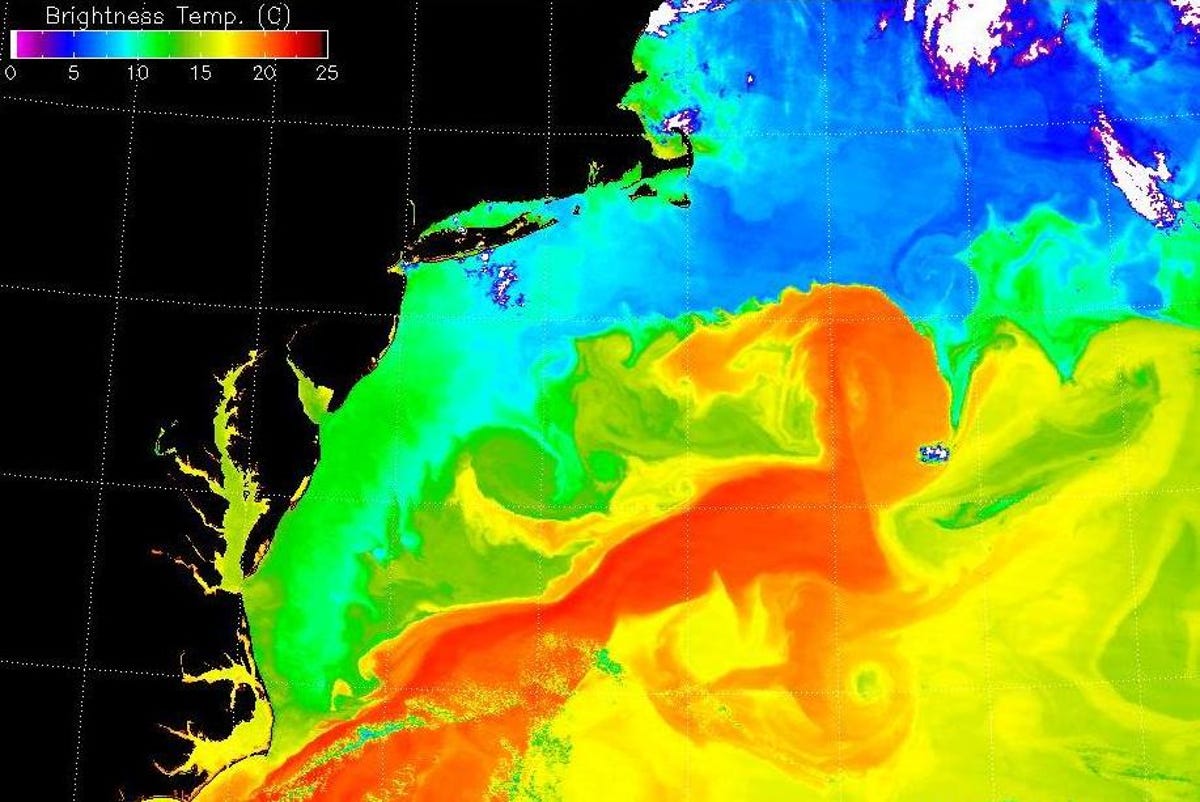
Fourth place: Tracking the seas
Fourth place: Tracking the seas
NASA started tracking the ocean surface temperature in the 1970s. With that data in hand, observers now know that most of the extra heat generated by global warming is absorbed by the seas. "This isn't good news for rising sea levels--water expands when it gets warmer, adding to rising seas around the world," NASA notes.
These are the warm waters of the Gulf Stream in 2001.
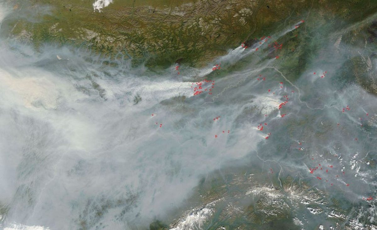
Fifth place: Following air pollution's global reach
Fifth place: Following air pollution's global reach
People once considered air pollution a local problem. But views from space shows the pollution moves across national borders and across oceans.
"In the 1980s the first maps of ozone pollution low in the atmosphere, where it is a health hazard, drew attention to human impacts on the atmosphere such as agricultural fires and land-use changes in the tropics," NASA says.
These are Alaskan wildfires in 2004.
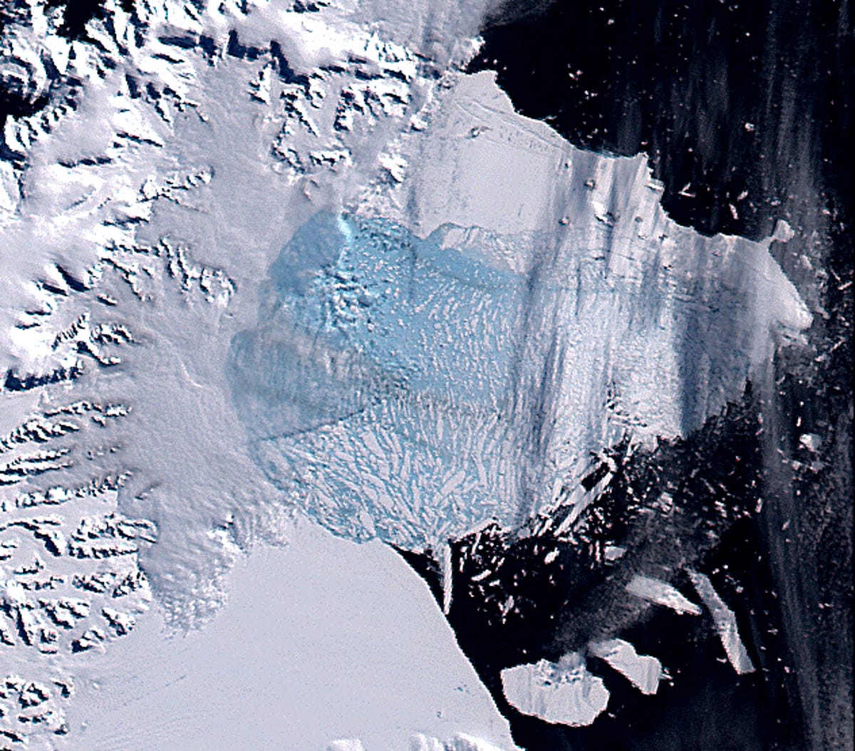
Sixth place: Identifying movement of ice sheets
Sixth place: Identifying movement of ice sheets
Satellites show that the Earth's polar ice sheets are losing "massive amounts" of ice at outlet glaciers and that the "floating ice shelves that buttress these glaciers are prone to failure," the agency says.
According to NASA, "many now see these changes as the 'canary in the coal mine' of what global warming can do to Earth, including the possibility of a rapid rise in sea level."
This is Antarctica's Larsen B Ice Shelf in 2002.
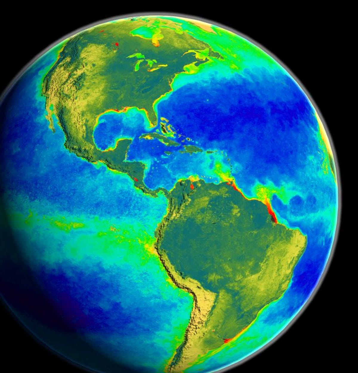
Seventh place: Measuring 'green-ness'
Seventh place: Measuring "green-ness"
Space-based instruments can now measure the "green-ness" of chlorophyll in plants.
"We can track widespread changes in ecosystems, like the increasing growing season in the far north and the rise and fall of ocean algae and fisheries associated with El Nino events," NASA says. "And we can see how big a part ecosystems play in the ongoing cycling of carbon dioxide in and out of the atmosphere."
This image of the Western Hemisphere is from NASA's Sea-viewing Wide Field-of-view Sensor onboard the SeaStar spacecraft.
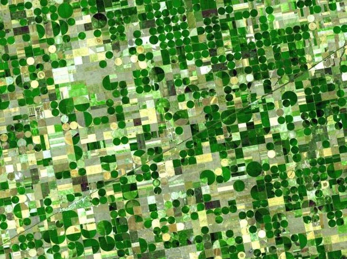
Eighth place: Predicting crop yields
Eighth place: Predicting crop yields
The U.S. Geological Survey and NASA developed a satellite instrument in the 1970s that could map out large-scale agricultural crops. The tool is used to estimate the size of annual yields of wheat, corn, soybeans, and other crops and to help forecast crop shortages and surpluses worldwide.
This image is of crop circles in Kansas in 2001.
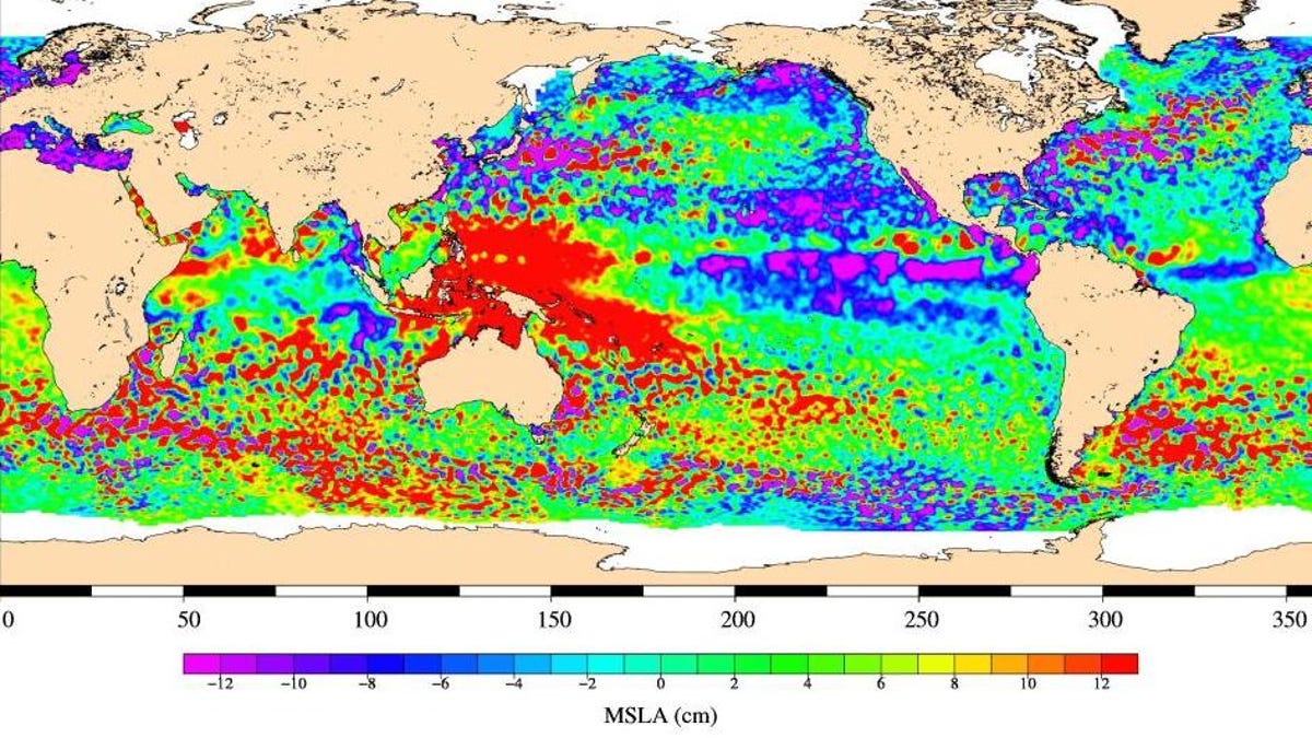
Ninth place: Measuring the waters
Ninth place: Measuring the waters
The height of the sea surface can now be measured from space. Satellites can see a "topsy-turvy water world full of tiny eddies that mix and churn and the grand-daddy of all ocean phenomena: El Nino. This big-time ocean event--lasting more than a year and stretching halfway around the world--changes weather and climate across the globe," NASA says.
The view also shows that sea levels are rising three times faster than a century ago, the agency says.
Here are high and low areas of the world's oceans (red and blue, respectively) in 2009.
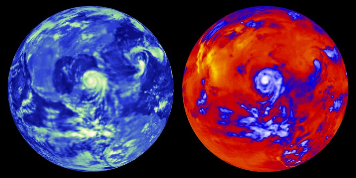
Tenth place: Energy audit for our home planet
Tenth place: Energy audit for our home planet
Earth-orbiting tools can track the flow of energy in and out of the planet.
"We've measured changes in the sun's energy output reaching Earth (pretty small) and the amount of energy redirected away from Earth after a massive volcano erupted into the stratosphere (a lot, but not for long)," NASA says. "With this inventory of the natural factors that heat and cool the planet, we get a better fix on the role humans play in altering climate."
A hurricane system both cools the Earth by reflecting sunlight (at left, the white/green areas) and warms it by trapping heat (at right, the blue/white areas.)
More Galleries

My Favorite Shots From the Galaxy S24 Ultra's Camera
20 Photos
Honor's Magic V2 Foldable Is Lighter Than Samsung's Galaxy S24 Ultra
10 Photos
The Samsung Galaxy S24 and S24 Plus Looks Sweet in Aluminum
23 Photos
Samsung's Galaxy S24 Ultra Now Has a Titanium Design
23 Photos
I Took 600+ Photos With the iPhone 15 Pro and Pro Max. Look at My Favorites
34 Photos
