Hurricane hunters witness Irma's ire from above
Bold airplane crews fly into the eye of Hurricane Irma as NASA satellites watch the monster Category 5 storm from above.


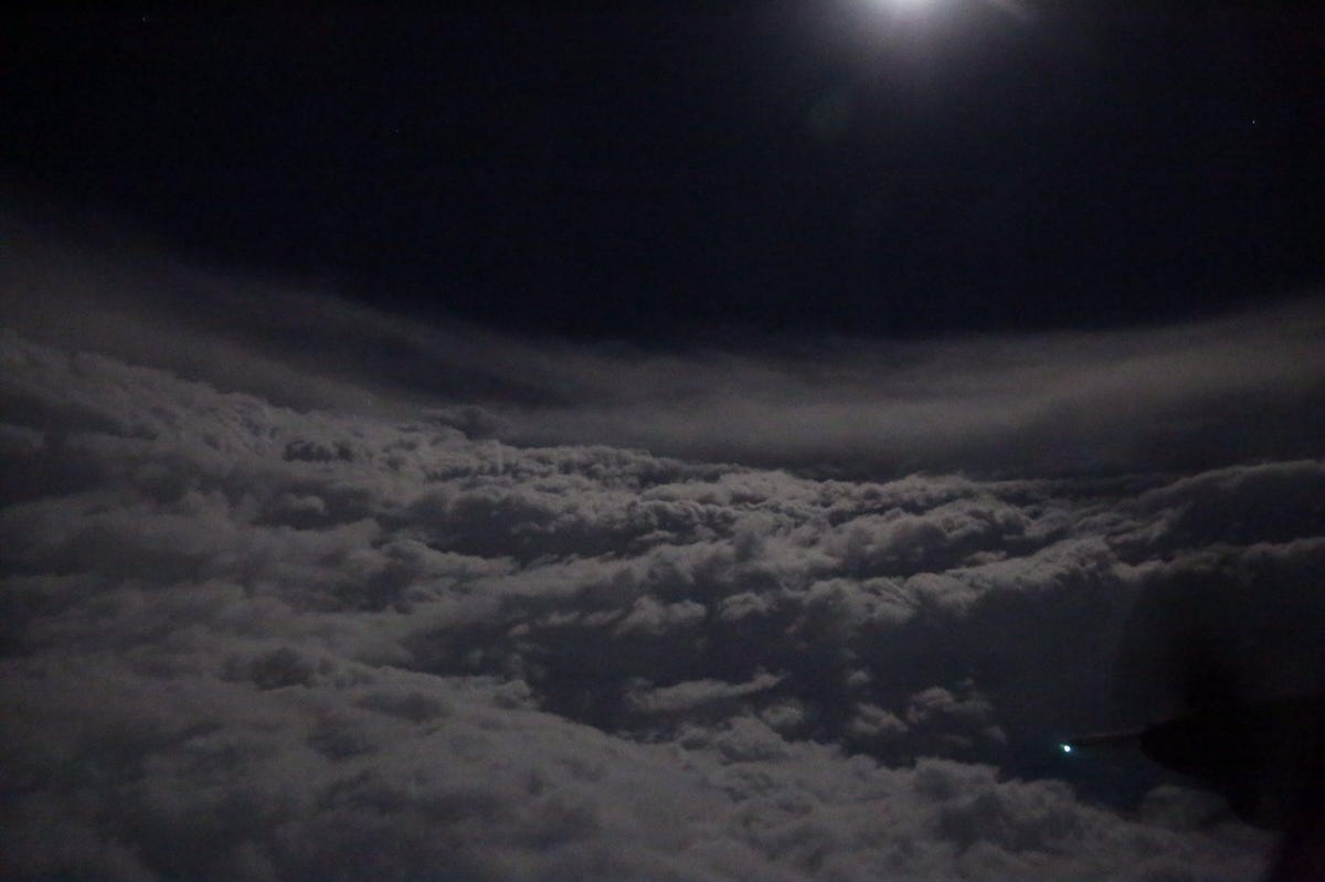
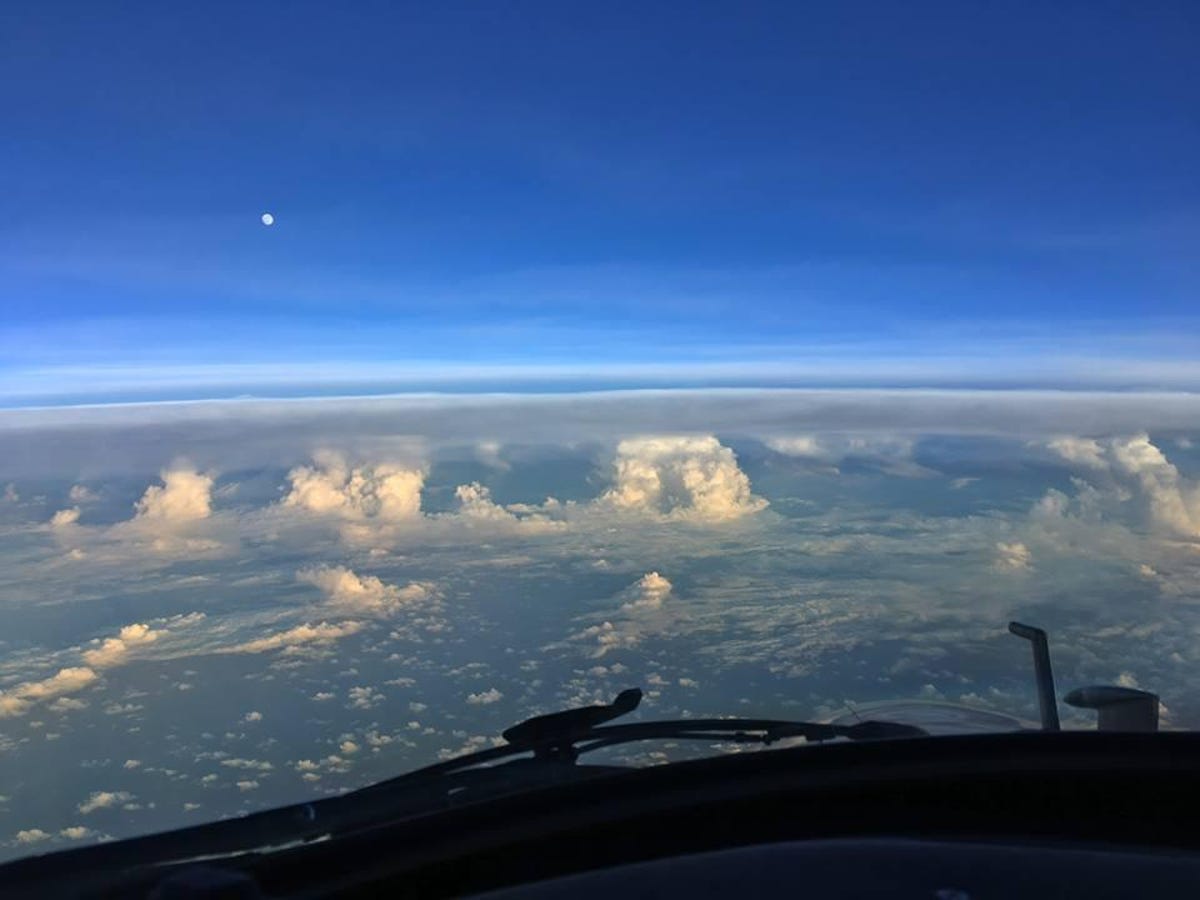
Moonlight inside the hurricane
Hurricane hunters boldly fly above and into storms to gather important weather data. The US Air Force Reserve Hurricane Hunters squadron refers to this as "tropical storm reconnaissance." The crews record wind speeds and monitor the storm's rotation, temperature and pressure. They also capture spectacular hurricane photos.
The Air Force Hurricane Hunters shared this photo on Sept. 6 showing the moon lighting up the inside of Hurricane Irma, a Category 5 monster storm. The team's official name is the 53rd Weather Reconnaissance Squadron.
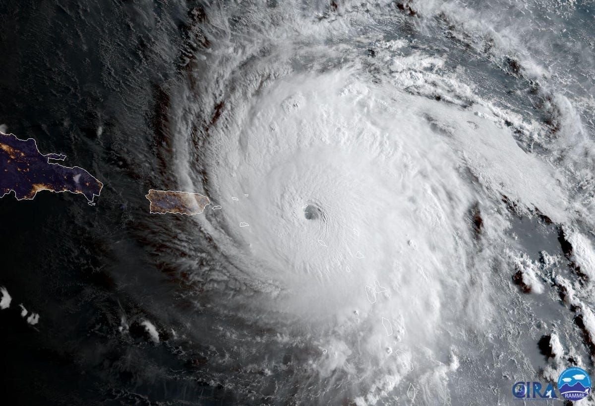
Satellite view
NOAA and NASA's GOES-16 satellite has a prime view of Hurricane Irma as it rampages across the Atlantic Ocean. This image shows the hurricane on Sept. 6 as it nears the Caribbean island of Anguilla.
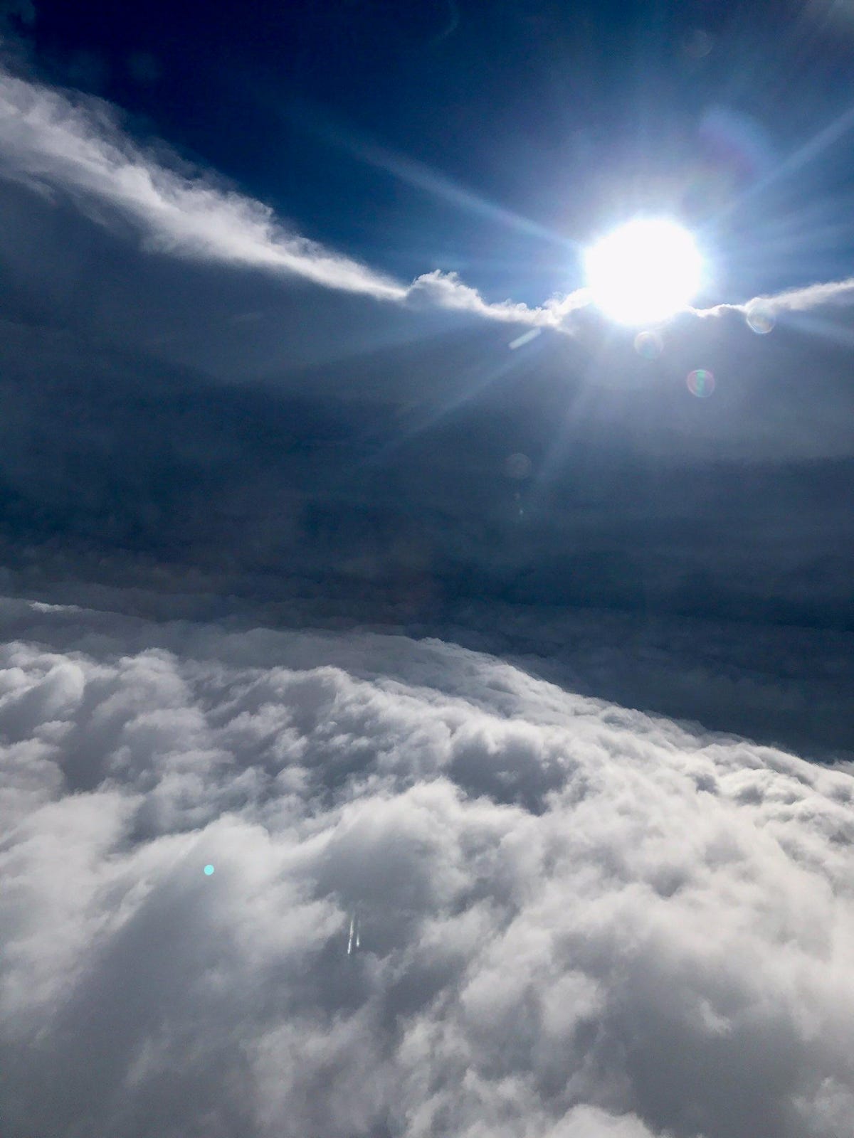
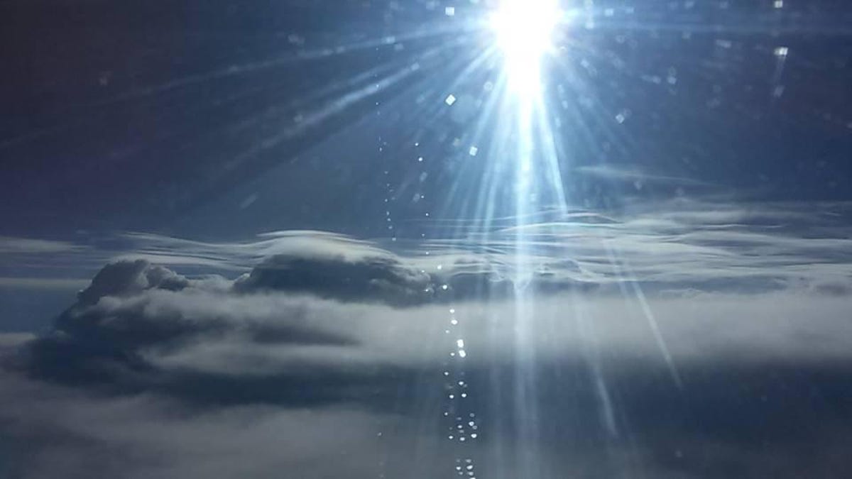
Sun lights up Irma's eye
US Air Force Hurricane Hunters caught a glimpse of the sun sending beams of light over the edge of Hurricane Irma's eye on Sept. 6.
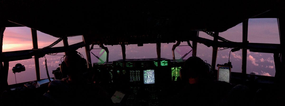
Sunset in a hurricane
This panoramic view shows the sun setting in shades of purple and pink near Hurricane Irma. It's a look out from the flight deck of a WC-130J Super Hercules aircraft used by the US Air Force Reserve's Hurricane Hunters.
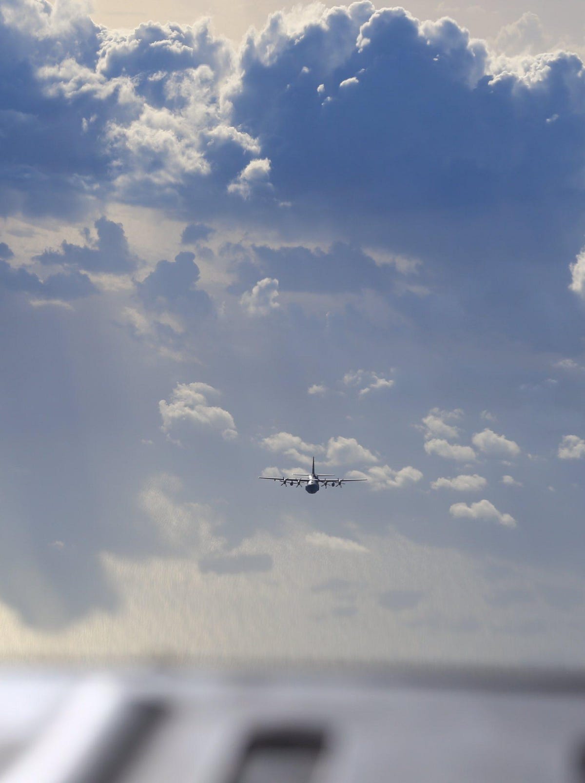
Two planes pass by Irma
Two planes used by the US Air Force Reserve Hurricane Hunters pass each other on Sept. 4. as their missions to study Hurricane Irma briefly overlap.
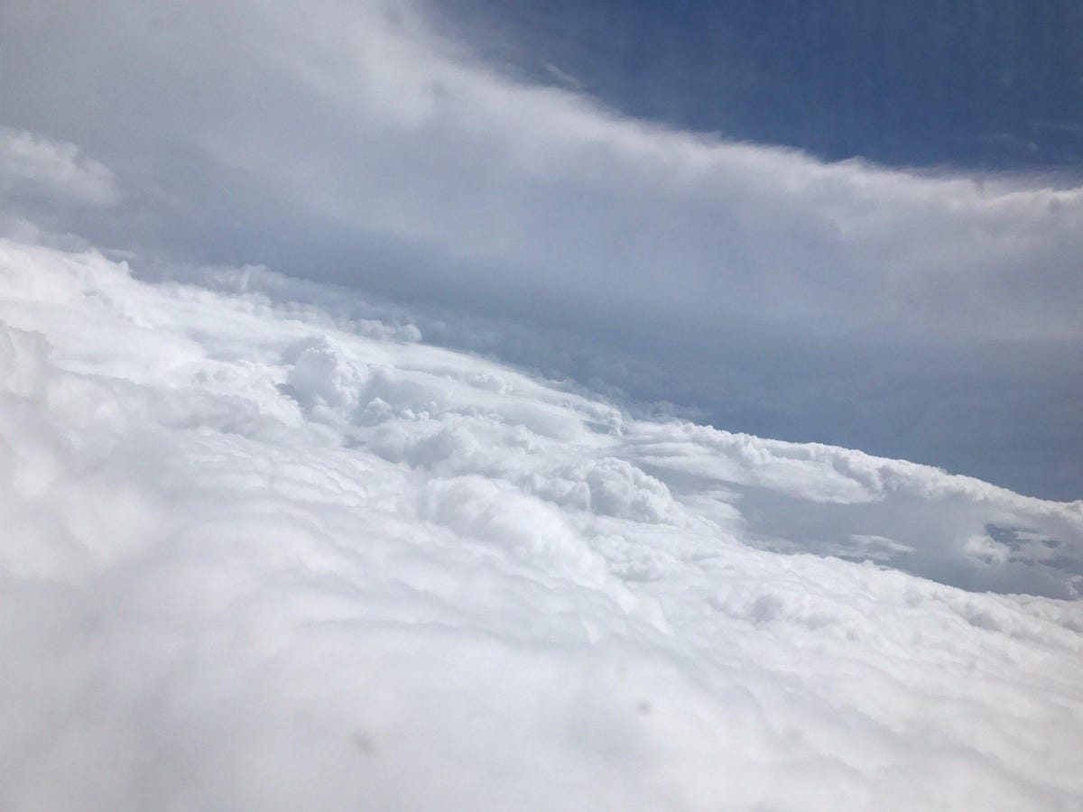
A stadium in Irma's eye
Hurricane researchers refer to the bowl-like formation inside a hurricane's eye as the "stadium effect." This US Air Force Reserve photo from Sept. 5 shows the "stadium" wall and floor created by Hurricane Irma.
Outside Irma
Along with the US Air Force Reserve, the National Oceanic and Atmospheric Administration also fields a team of airborne hurricane hunters.
NOAA Hurricane Hunter Jessica Williams snapped this photo from outside of Hurricane Irma on Sept. 6. Williams is a meteorologist and flight director.
A side view of Irma
Part of NOAA's hurricane-hunting Gulfstream IV jet, nicknamed "Gonzo," is visible in this photo from Sept. 5. The view shows Hurricane Irma's northwest side.
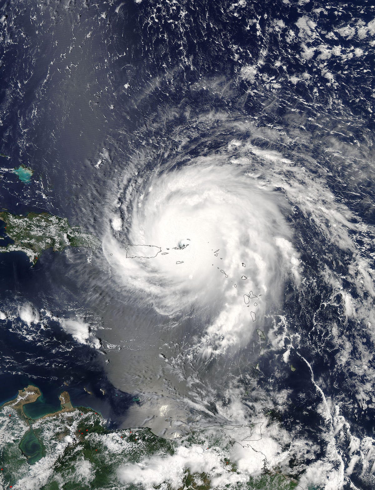
NASA's Aqua satellite looks down
Multiple satellites are keeping an eye on massive Hurricane Irma from above. This color image comes from NASA's Aqua satellite. The space agency released it on Sept. 7. The photo shows the hurricane moving over Puerto Rico.
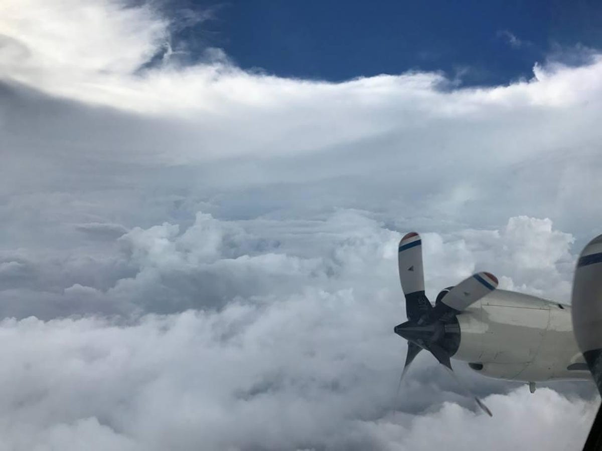
Inside Irma's eye
The "stadium effect" is visible in this NOAA photo from inside Hurricane Irma's eye, taken on Sept. 5. The plane's propellers add an interesting sense of perspective to the view.

Barbuda in the eye of the storm
NASA and NOAA's Suomi NPP satellite sent back this unusual infrared view of Hurricane Irma with the eye of the storm sitting exactly over the island of Barbuda on Sept. 6.
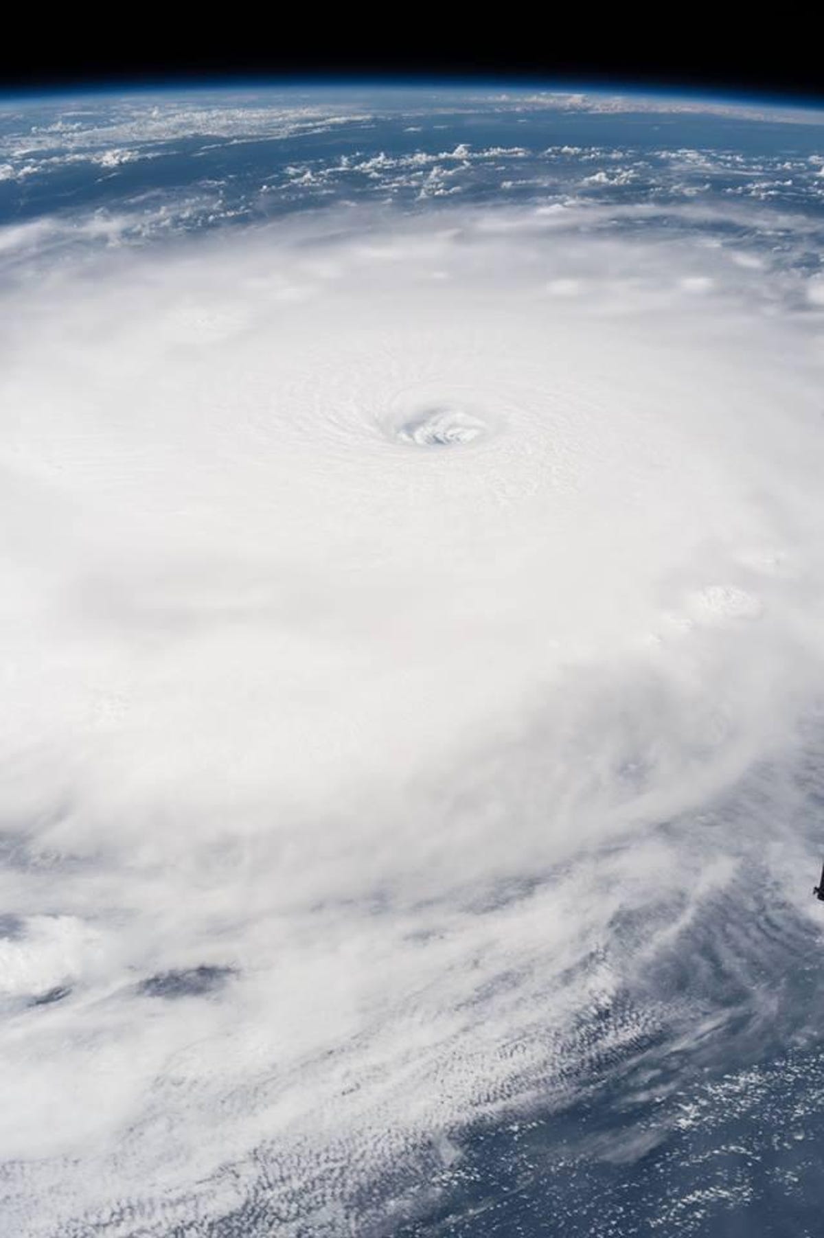
The view from the space station
Astronauts on board the International Space Station got a dramatic look at Hurricane Irma on Sept. 5.
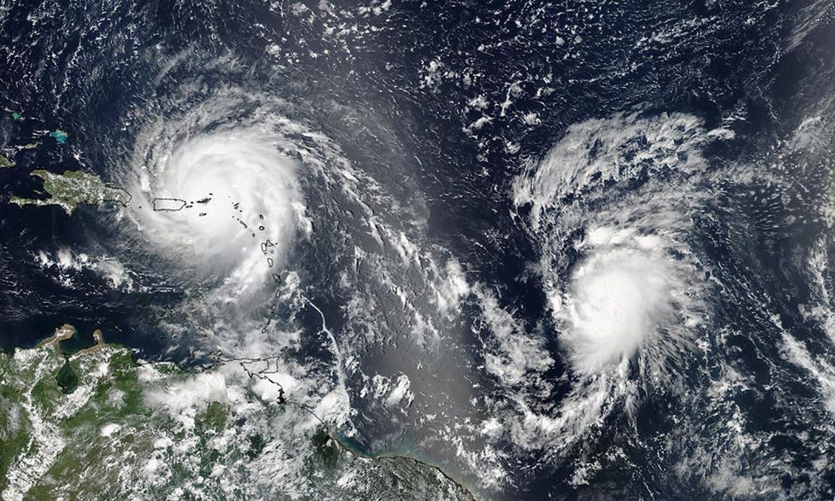
Two hurricanes
Hurricane Irma isn't the only threat in the Atlantic Ocean. Two more hurricanes, Jose and Katia, are active as of Sept. 7. This NASA and NOAA Suomi NPP satellite image shows Irma on the left and Jose on the right on Sept. 6.
More Galleries

My Favorite Shots From the Galaxy S24 Ultra's Camera
20 Photos
Honor's Magic V2 Foldable Is Lighter Than Samsung's Galaxy S24 Ultra
10 Photos
The Samsung Galaxy S24 and S24 Plus Looks Sweet in Aluminum
23 Photos
Samsung's Galaxy S24 Ultra Now Has a Titanium Design
23 Photos
I Took 600+ Photos With the iPhone 15 Pro and Pro Max. Look at My Favorites
34 Photos
