How hacked ocean tech gives Marines real-time weather info (pictures)
Scientists at the Scripps Oceanographic Institute converted existing ocean-buoy technology into a system Marines in Afghanistan use to get accurate weather information. CNET Road Trip 2012 takes a look.


Deployment
LA JOLLA, Calif. -- For U.S. Marines in Afghanistan, deciding when it's safe to conduct aviation missions is partly dependent on knowing real-time weather conditions.
At forward operating bases throughout the country, that job had to be done manually, but reductions in staffing have made it harder to gather the data. Now, though, the Marines can rely on technology developed at the Scripps Oceanographic Institute called Expeditionary Meteorology System (XMET) to get the weather information they need.
CNET reporter Daniel Terdiman stopped by Scripps as part of Road Trip 2012 to learn about the system.
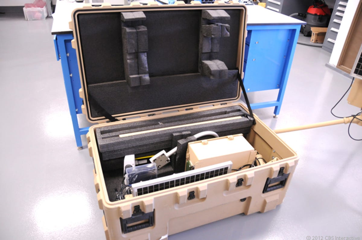
XMET in a box
The XMET system is designed to be highly portable and to be set up by two Marines in five minutes or less.
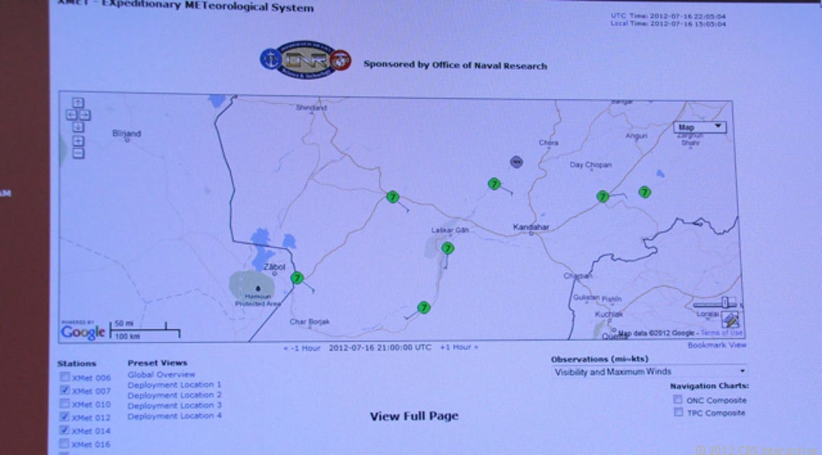
Deployment map
On this Web-based XMET screen, it's possible to see where the technology is deployed around Afghanistan. Each green dot on the map indicates a deployment.
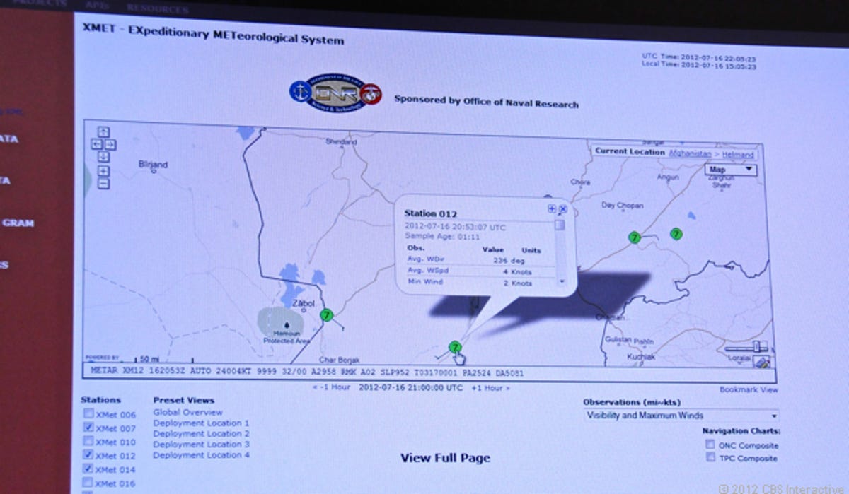
Information screen
In this photograph, it's possible to see the XMET screen, including information about the weather conditions at a specific forward operating base.
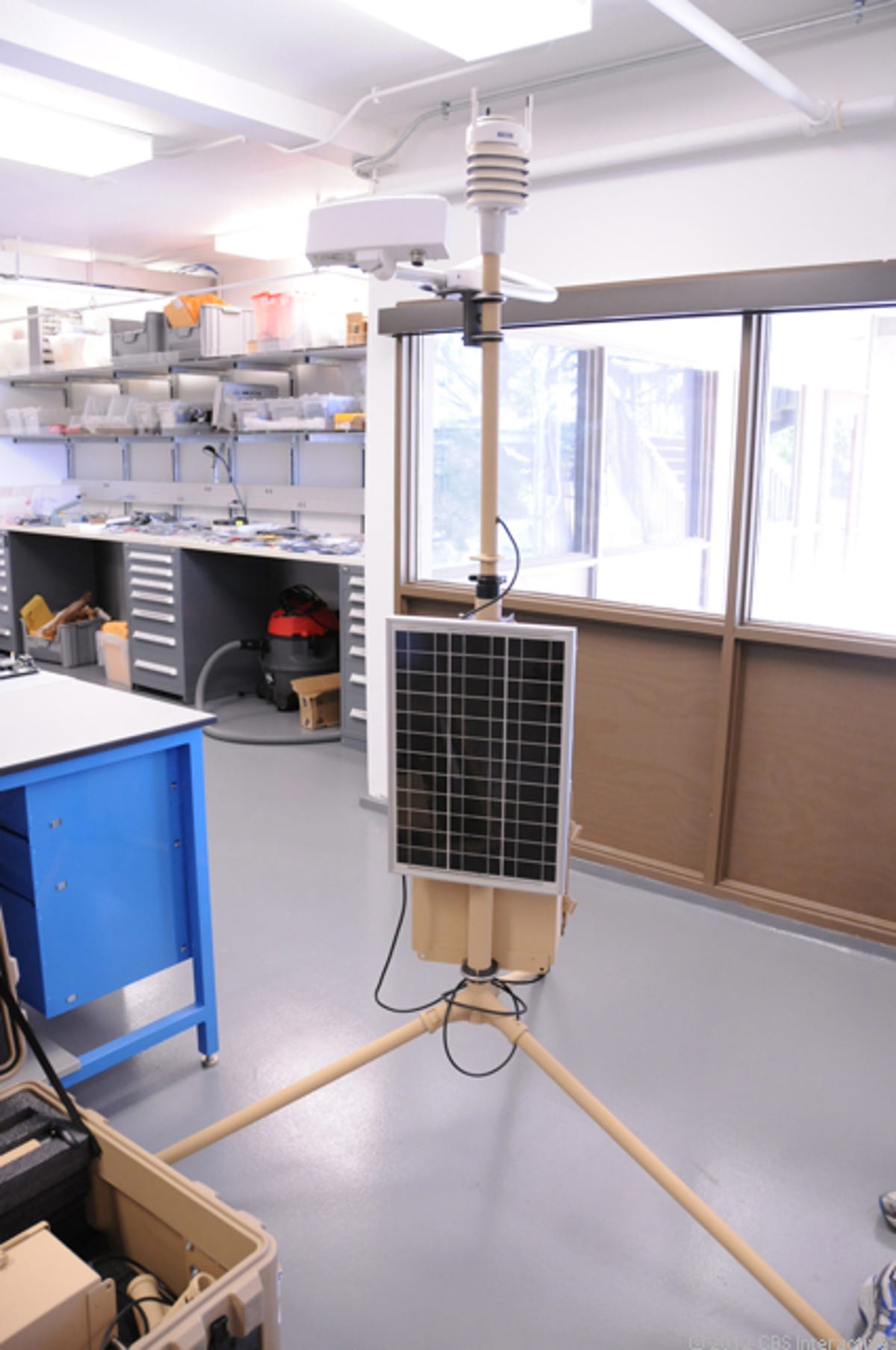
XMET in the lab
Inside the labs at the Scripps Oceanographic Institute, researchers have set up an XMET system to demonstrate its size and portability.
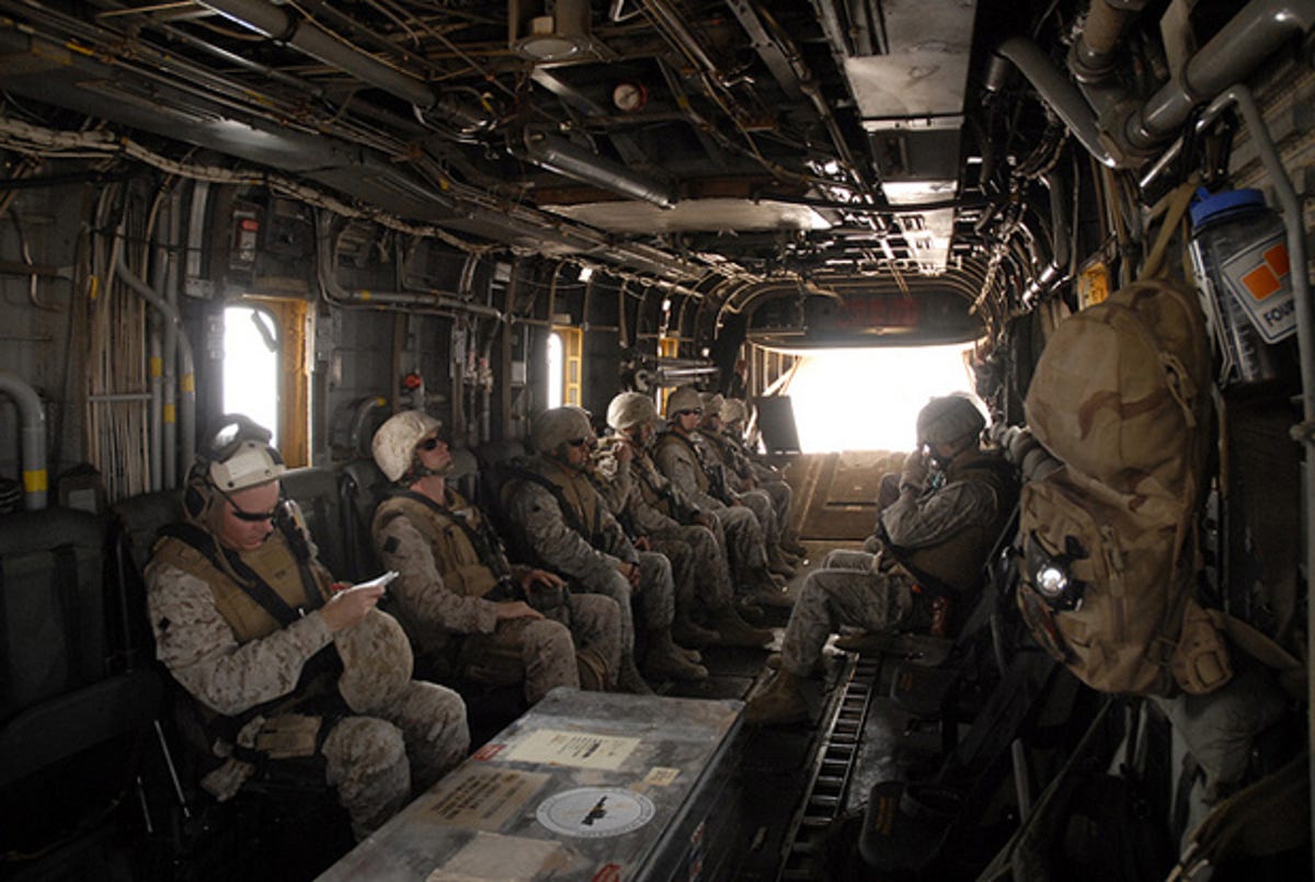
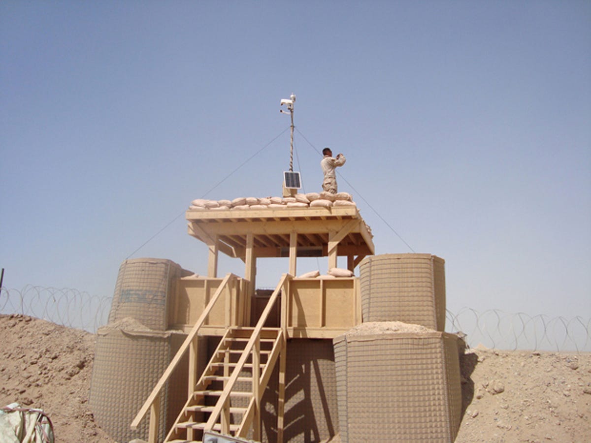
Deploying XMET
In this U.S. Marine photograph, Marines prepare to deploy XMET in Iraq.
More Galleries

My Favorite Shots From the Galaxy S24 Ultra's Camera
20 Photos
Honor's Magic V2 Foldable Is Lighter Than Samsung's Galaxy S24 Ultra
10 Photos
The Samsung Galaxy S24 and S24 Plus Looks Sweet in Aluminum
23 Photos
Samsung's Galaxy S24 Ultra Now Has a Titanium Design
23 Photos
I Took 600+ Photos With the iPhone 15 Pro and Pro Max. Look at My Favorites
34 Photos
