Getting started with Maps in OS X Mavericks (pictures)
OS X's new Maps application integrates with other Apple apps and can even beam trips to your iPhone with one click.


Getting started with Maps in OS X Mavericks
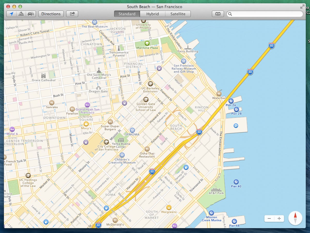
With the debut of OS X 10.9 Mavericks, Apple's Maps app makes the jump from the smartphone to your laptop. Version 1.0 of the Maps application looks almost identical to the iOS 7 app, with a similar color palette and iconography.
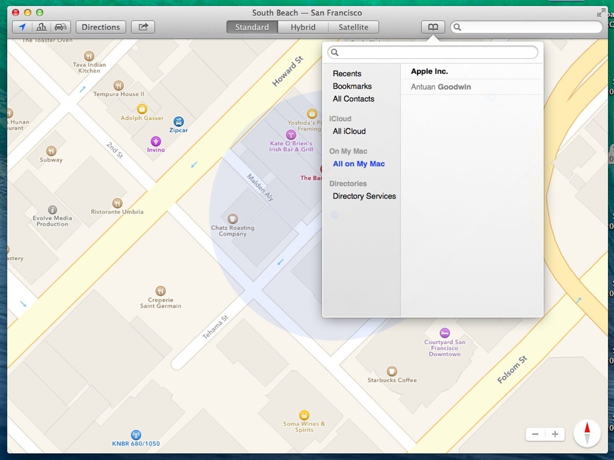
Address book integration
Users who have filled their OS X address book with contacts will find them integrated into the new Maps application via a drop-down menu. Clicking a contact drops a pin on the map.
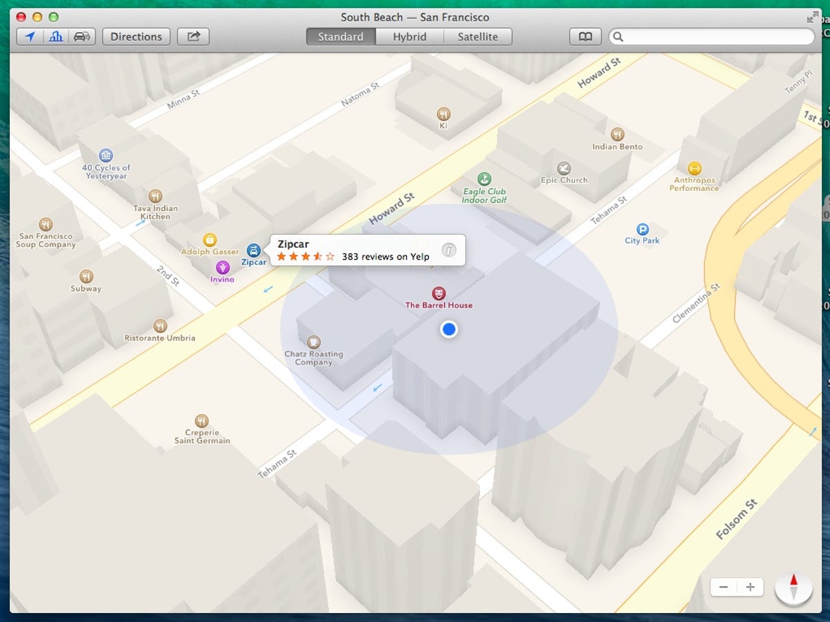
3D fly-over view
Clicking a button in the upper left corner lowers the virtual camera over the map, revealing a 3D view of the buildings in the surrounding area.
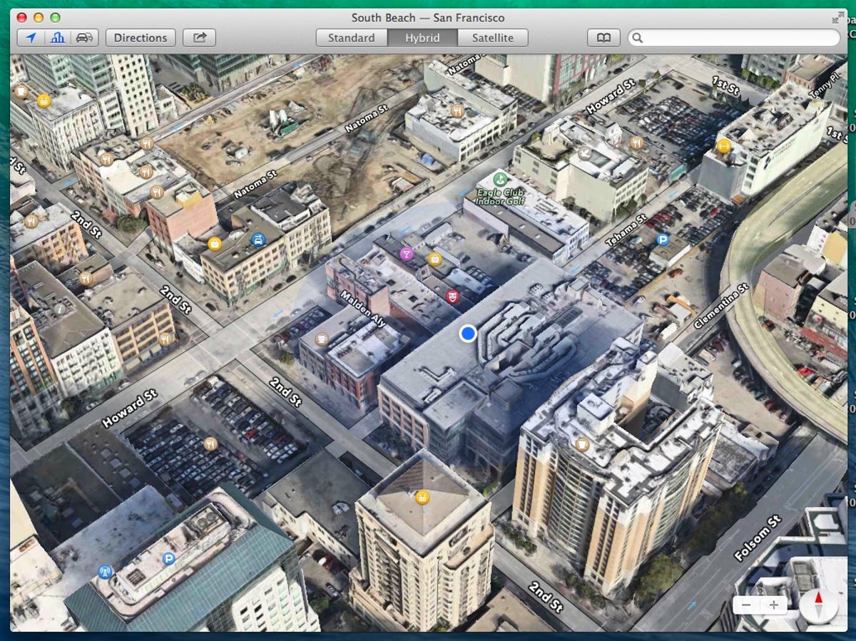
Hybrid view
The streets, business icons, and 3D buildings can be overlaid with satellite imagery by switching to the Hybrid view. A third view called Satellite, removes street data, text, and icons for a clean, virtual view. The map can be zoomed, panned, and rotated with multi-touch inputs.
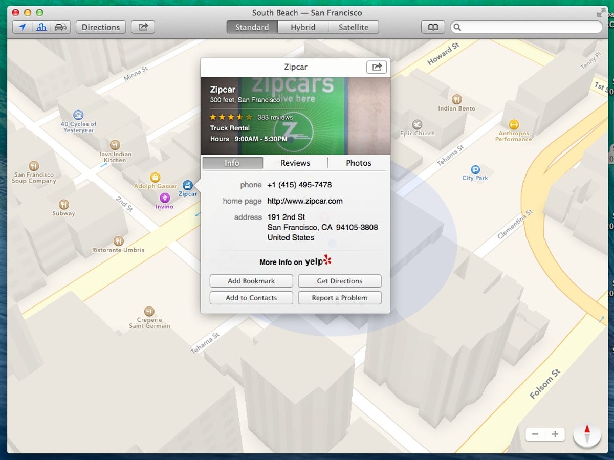
Rich destination data
Clicking any of the icons representing businesses on the map or searching for a destination brings this animated box filled with more information about the business and complete with ratings and reviews from Yelp, photos, and more.
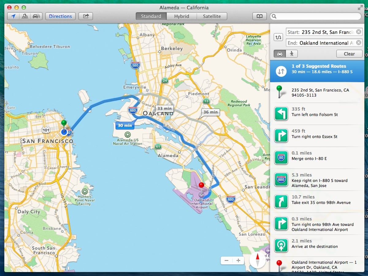
Directions
Walking and driving directions can be calculated between two destinations or from your current location by clicking the "Directions" button.
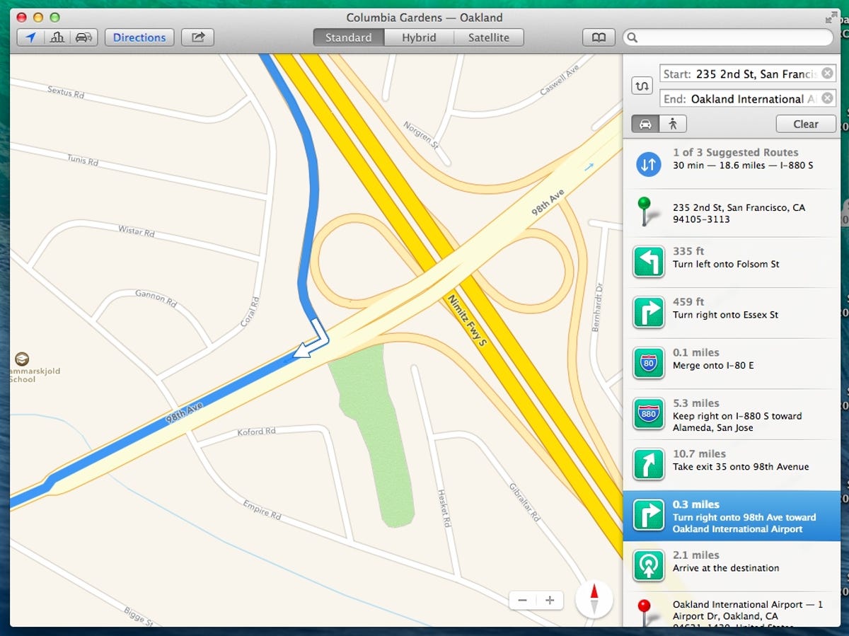
Detailed directions
Clicking any step in the list of directions in the right column zooms the map in on a detailed view.
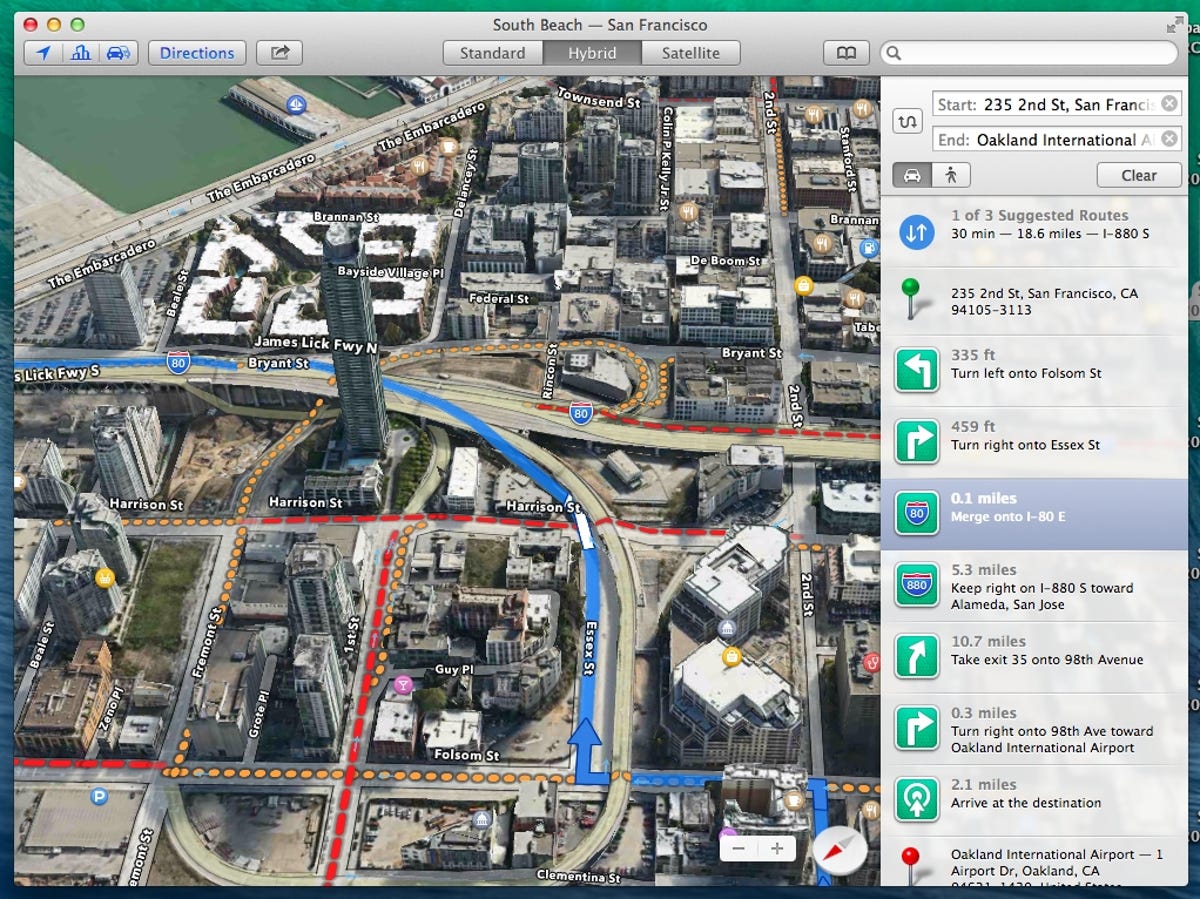
Multiple overlays
3D buildings, satellite data, and current traffic conditions are all viewable beneath the turn-by-turn directions calculated by the application.
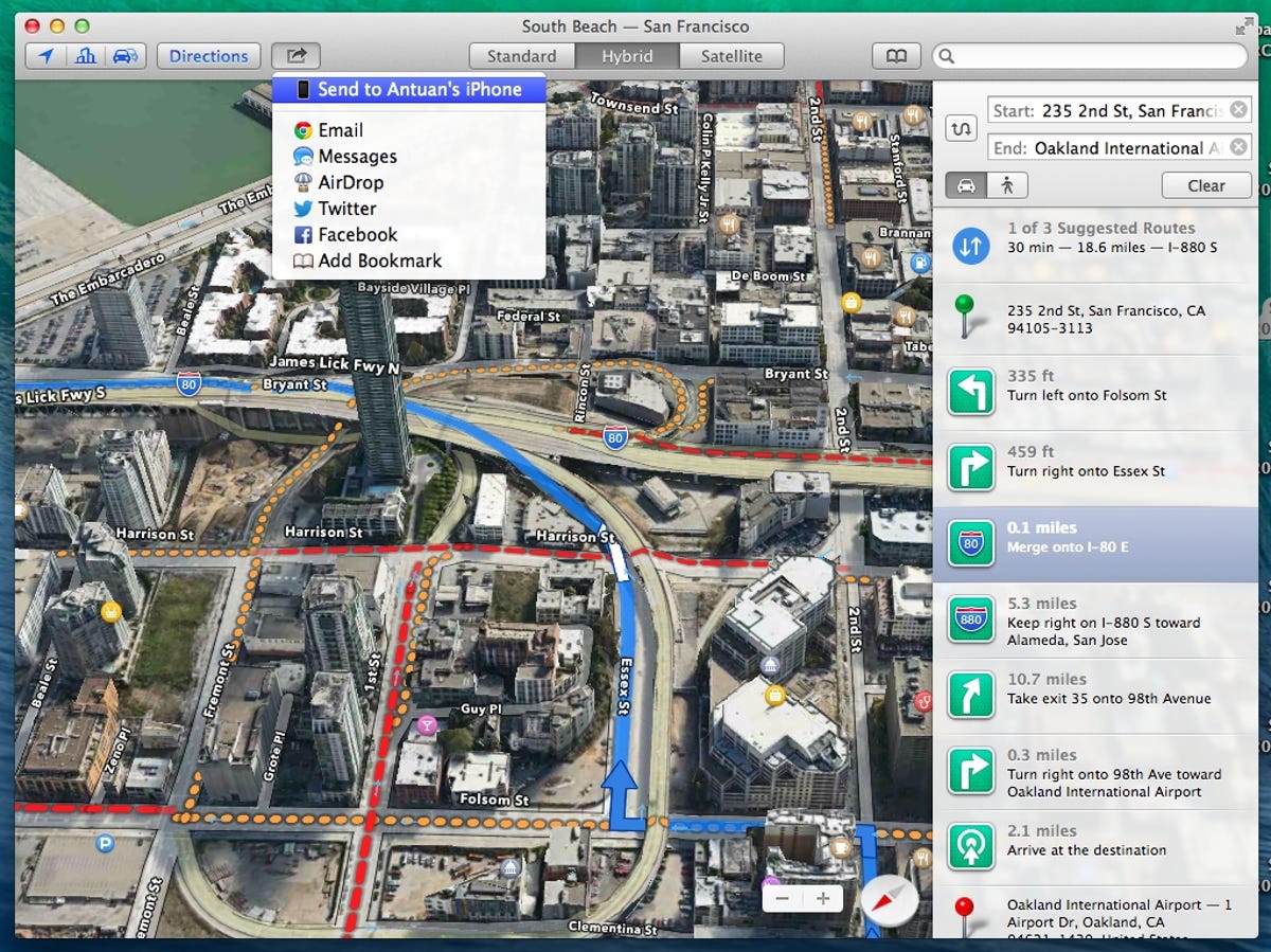
Sharing locations, trips
Users can share the currently displayed trip or location to social networks or via email or Messages. This dropdown menu also allows users to quickly send their trip to an iOS device associated with their Apple ID.
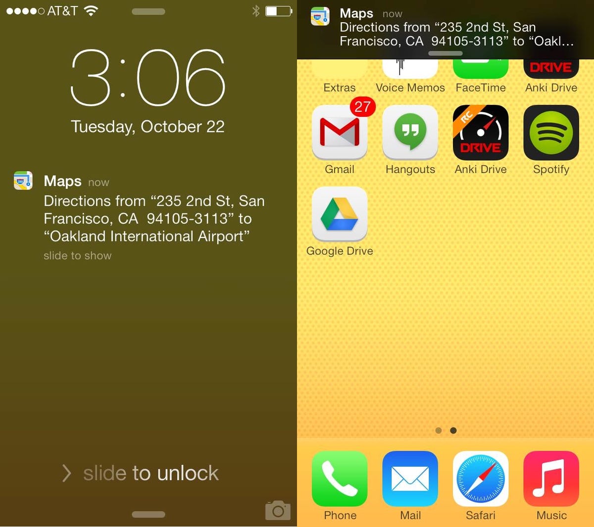
iOS 7 notifications
On the associated iPhone, the destination appears as a notification on the lockscreen or in the notification center.
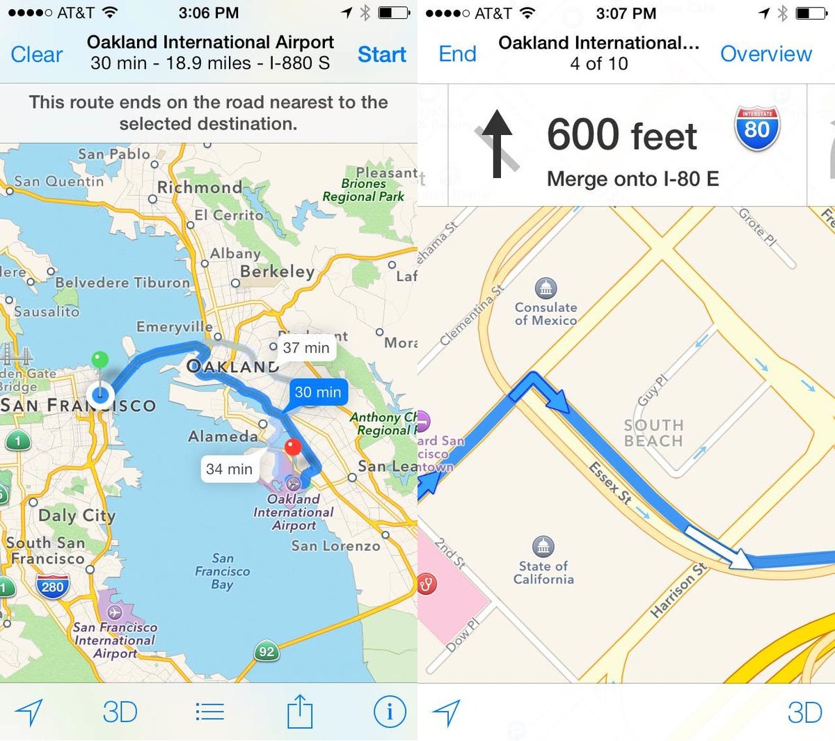
Apple Maps in iOS 7
Swiping or tapping the notification will open the trip in the iOS 7 Maps app where the user can receive turn-by-turn directions for navigation.
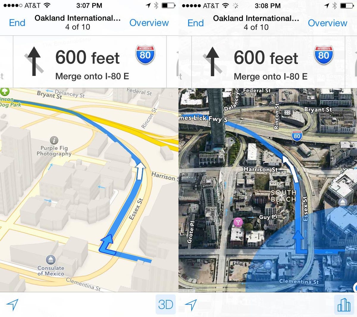
3D maps in iOS 7
Maps on the phone can, of course, be displayed with 3D building data and satellite data.
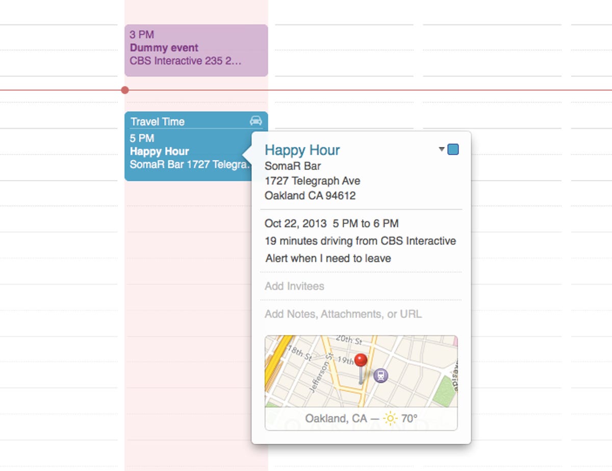
Calendar integration
Back on the desktop and in the new Calendar app, each event that has a location associated with it will feature a small map inlay in its information pop-up. Calendar is also able to take advantage of Maps' routing algorithms to calculate driving and walking times between events to automatically build travel time onto the front of each new entry.
More Galleries

My Favorite Shots From the Galaxy S24 Ultra's Camera
20 Photos
Honor's Magic V2 Foldable Is Lighter Than Samsung's Galaxy S24 Ultra
10 Photos
The Samsung Galaxy S24 and S24 Plus Looks Sweet in Aluminum
23 Photos
Samsung's Galaxy S24 Ultra Now Has a Titanium Design
23 Photos
I Took 600+ Photos With the iPhone 15 Pro and Pro Max. Look at My Favorites
34 Photos
