Geotagging photos the Google way (photos)
Sticking longitude and latitude information into the metadata of your digital photos and mapping them is a fun way to sort and organize. Google's free Picasa and Earth software make it a breeze to do, too.


Geotagging photos with Google Maps and Picasa
Picasa is an excellent image organizer in general, but its integration with Google Maps and Earth make it easy to add location information to the metadata of your photos. If you're not already using it, it's a free download as is Google Earth, which you'll need to install as well if you want to display photos on its satellite map.
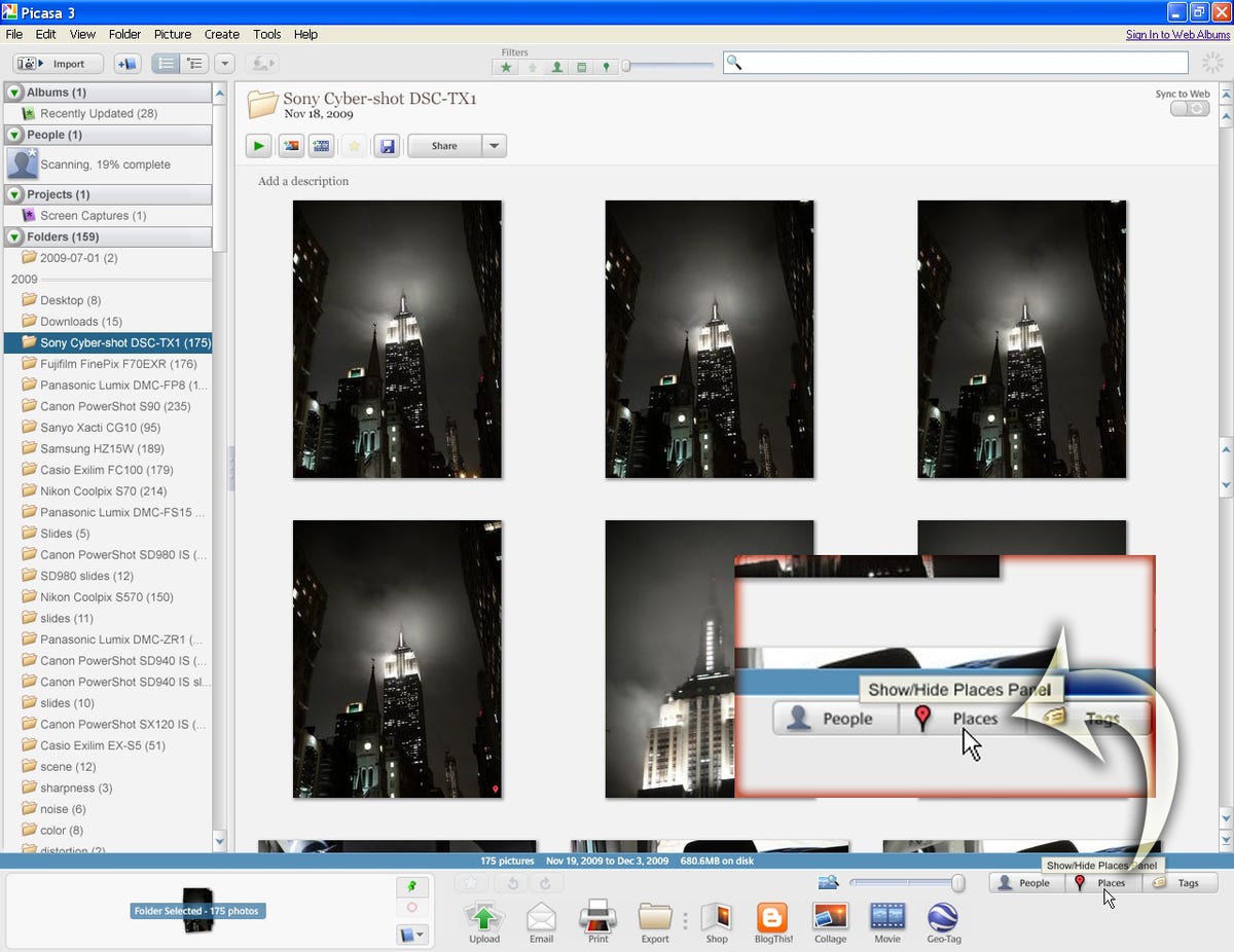
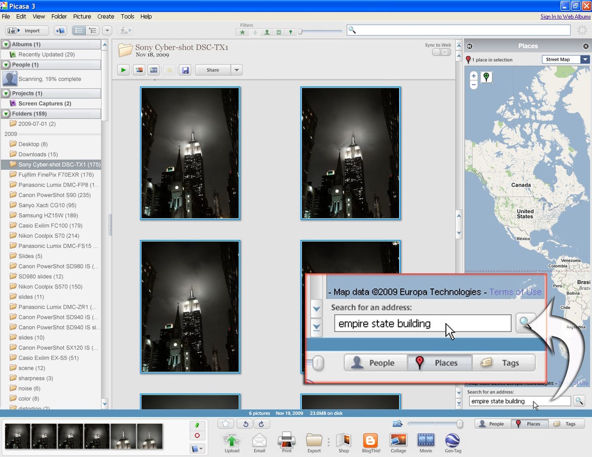
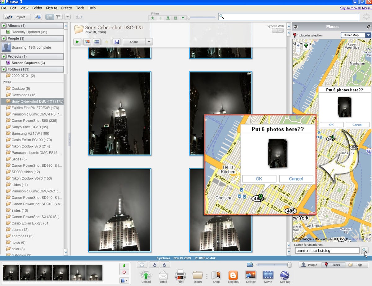
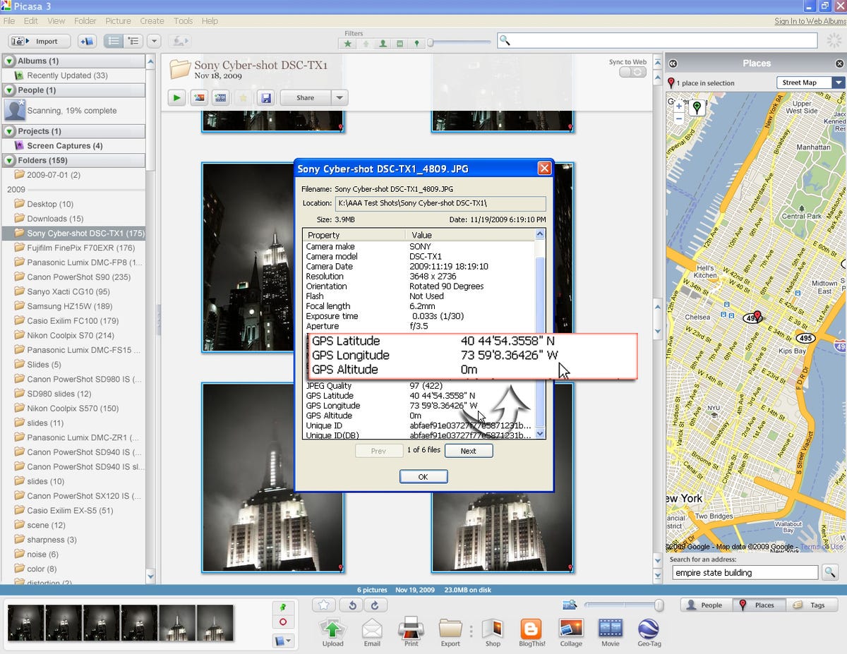
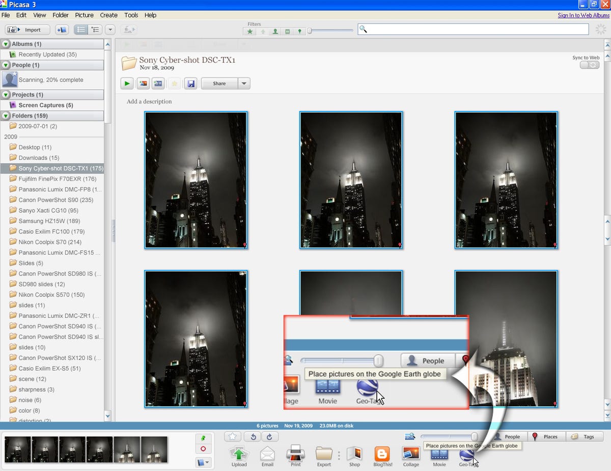
In this example, I'm using some pictures taken of the Empire State Building. Find and select the photos being tagged and in the lower right corner of the interface, click the Places button. Places uses Google Maps to get the coordinates for your photos.
Geotagging photos with Google Maps and Picasa
Geotagging photos with Google Maps and Picasa
Geotagging photos with Google Maps and Picasa
Geotagging photos with Google Earth and Picasa
Unfortunately, this isn't available for Mac users. There is a work-around, though. Once your images are geotagged--through Google Maps or another method--you can use a free iPhoto plug-in to create a KMZ file viewable in Google Earth.
Geotagging photos with Google Earth and Picasa
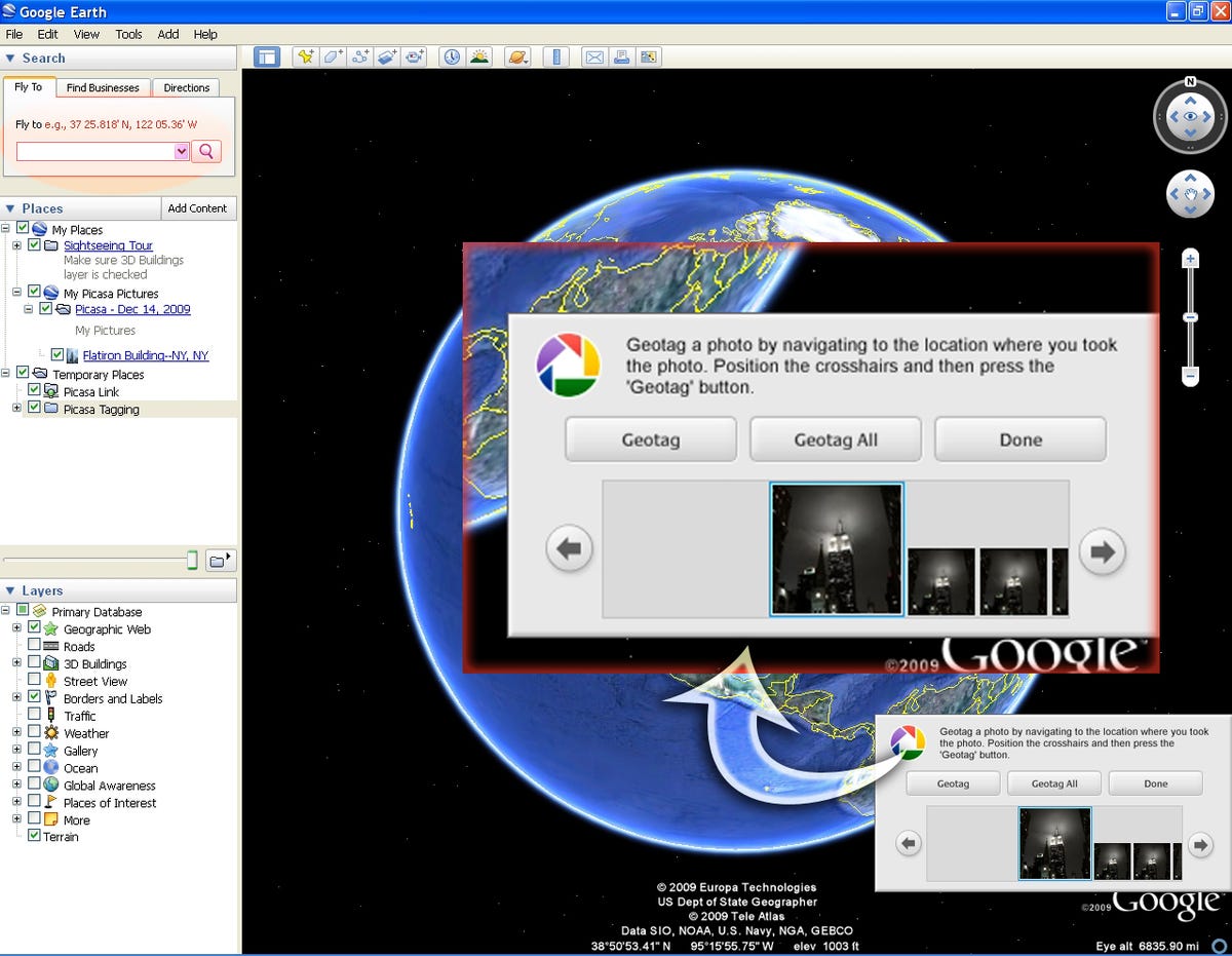
When you click the geotag button in Picasa (after you've selected the images you want to tag, of course), Google Earth will launch and ask you to navigate to the spot where you'd like to place your photos. You can do it manually using the crosshair (not shown)and directional controls in the upper right of the interface. Or, in the upper left, is a search bar.
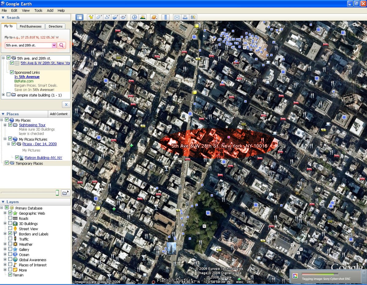
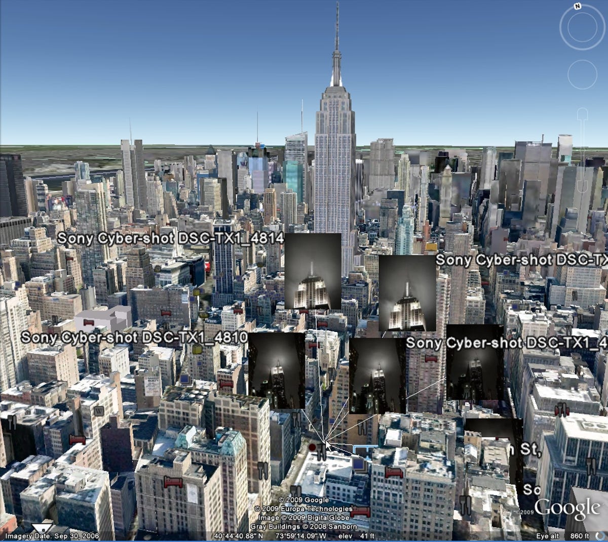
After you've navigated to the correct location, you simply click Geotag and Earth will add the metadata and place the photos on the Google Earth globe.
Geotagging photos with Google Earth and Picasa
Geotagging photos with Google Earth and Picasa
More Galleries

My Favorite Shots From the Galaxy S24 Ultra's Camera
20 Photos
Honor's Magic V2 Foldable Is Lighter Than Samsung's Galaxy S24 Ultra
10 Photos
The Samsung Galaxy S24 and S24 Plus Looks Sweet in Aluminum
23 Photos
Samsung's Galaxy S24 Ultra Now Has a Titanium Design
23 Photos
I Took 600+ Photos With the iPhone 15 Pro and Pro Max. Look at My Favorites
34 Photos
