X

Find your place at the Where 2.0 Conference (photos)

With location-based data becoming increasingly more important, the Where 2.0 Conference in San Jose, Calif., takes a look at some of the newest map-making APIs leaving their mark on the developer community.

CNET Reviews staff
where-2dot0-1.jpg
1 of 8 James Martin/CNET

Location, location, location

Companies pitching augmented reality, 3D mapping, check-ins, mobile location, and Web mapping APIs are center stage this weekend in San Jose, Calif., during the Where 2.0, Conference, where it's all about location, location, location. The sold-out event, which is now in its sixth year is bigger than ever on the heels of a geolocation space war that has developers competing in the space which is expected to grow in coming years.

A few years ago, Where 2.0 felt small and underattended. Most attendees were small companies specializing in a geo location service. Today, the conference is packed, and the majority of attendees seem to be developers or companies looking to provide location data services to existing companies eager to get more location specific through APIs and back end tools.

where-2dot0-2.jpg
2 of 8 James Martin/CNET

Dennis Crowley

Looking back on the first year of Foursquare, Dennis Crowley discusses his adventures in geoland and how he managed to turn real life into a game, and a business, with Foursquare check-ins during a session Wednesday.
where-2dot0-3.jpg
3 of 8 James Martin/CNET

Will Carter

Will Carter of Nodesnoop Labs talked about his location-based iPhone game Mobzombies, which uses the Foursquare API to generate zombies at real-world locations.
where-2dot0-4.jpg
4 of 8 James Martin/CNET

Geo on display

MapQuest, Google, DigitalGlobe, and Zoom Atlas are among the C3 are among the realistic map generators providing 3D imaging and mapping software.
where-2dot0-5.jpg
5 of 8 James Martin/CNET

Panels

Panel sessions during Where 2.0 touched largely on 3D imaging and augmented reality, in addition to social-networking integration and open-government data.
where-2dot0-6.jpg
6 of 8 James Martin/CNET

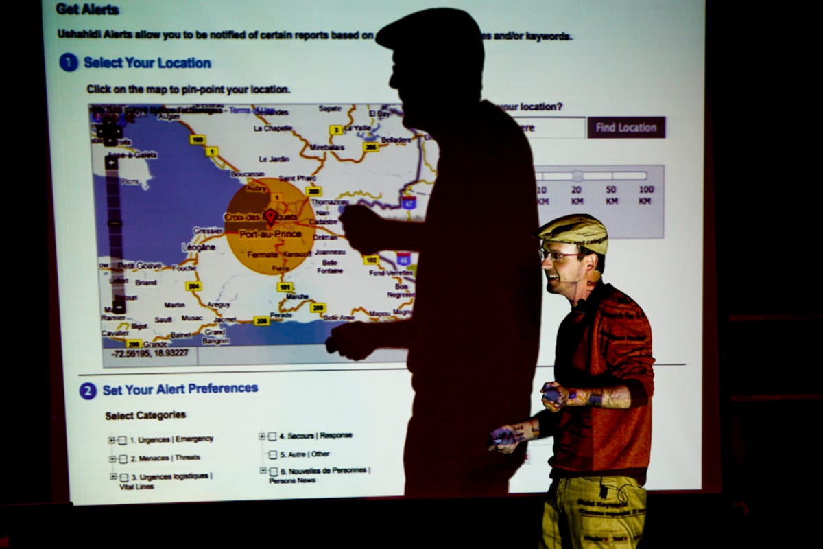
Patrick Meier, Director of Crisis Mapping

Patrick Meier, director of Crisis Mapping at Ushahidi, is using data gathered from mobile devices on the ground to better facilitate crisis response and disaster recovery.

Ushahidi's interactive Crisis Map of Haiti used simplae text messaging and crowdsourcing to allow for two-way communication between the community and governemnt to respond to disaster affected communities.

where-2dot0-7.jpg
7 of 8 James Martin/CNET

C3

Layers of data are collected by C3 which automatically generate rich, immersive 3D environments.
where-2dot0-8.jpg
8 of 8 James Martin/CNET

ZoomAtlas maps

ZoomAtlas is a geo-social-networking site that connects people and places with a wiki-like interface that ties together people and place markers over time and across communities.

More Galleries

Yamaha motorcycle and instrument designers trade jobs (pictures)
yamaha01.jpg

Yamaha motorcycle and instrument designers trade jobs (pictures)

16 Photos
CNET's 'Day of the Dead Devices' altar (pictures)
dia-de-los-muertos-3318-001.jpg

CNET's 'Day of the Dead Devices' altar (pictures)

9 Photos
2007 Los Angeles Auto Show: concept cars
conceptss01_440.jpg

2007 Los Angeles Auto Show: concept cars

14 Photos
Best sound bars under $300
polk-magnifi-mini-15.jpg

Best sound bars under $300

18 Photos
2018 Ford F-150 Power Stroke reports for diesel duty
2018 Ford F-150 diesel

2018 Ford F-150 Power Stroke reports for diesel duty

22 Photos
Music-friendly cell phone accessories

Music-friendly cell phone accessories

11 Photos
Cosplay at Comic-Con 2016: From Stormtroopers to Sansa Stark
dsc0515.jpg

Cosplay at Comic-Con 2016: From Stormtroopers to Sansa Stark

34 Photos