With i3 electric car, BMW wants you to consider public transit
Traditional navigation tells you how to drive to a destination, but the navigation in the BMW i3 will give options for mixing public transportation into your journey.


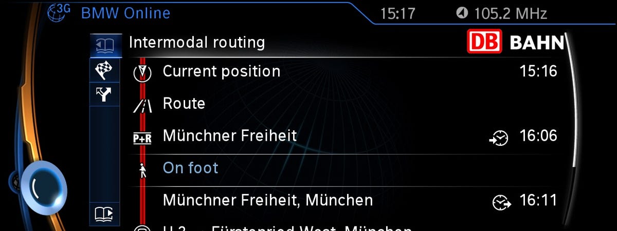
LAS VEGAS -- Trains, buses, and automobiles; you can use them all to get to a destination, and BMW shows you how with the intermodal navigation feature of its My Remote app for the i3 electric car.
At CES 2014, BMW explained how the system shows multiple transit options when plotting how to get to a destination. An i3 owner could enter a destination, and the app will figure out routes combining driving, walking, and public transit. For example, you could select a route that has you driving to a train station, taking a train to another city, then walking to the final destination.
The feature is especially relevant for the i3, an electric car with a range of 80 to 100 miles. For many destinations, the car might not be able to go far enough, making use of other transit necessary. The feature is also useful for avoiding bad traffic or difficult parking in cities.
Catch CNET's complete coverage of CES 2014
Traffic data aggregator Inrix gathers the transit data, along with scheduled departure times, so that the navigation system can include public transit options in its calculations. BMW's navigation system uses both onboard and offboard routing algorithm calculation.
Inrix also enables a range finder feature in the i3 that uses actual road distances to figure out how far you can go. Most current range finder apps in electric cars merely show a radius based on the current location, with distances "as the crow flies." The range finder in the i3 draws a polygon, with range shown realistically depending on actual road mileage.