Using your cell phone's GPS to map traffic
CNET's Kara Tsuboi takes a new mobile traffic mapping service around the San Francisco Bay Area.


When consulting online traffic maps to form your plan of attack for hitting the streets, how often do you suspect that the red, yellow, and green colors indicating the various speeds of traffic flow are inaccurate, show outdated data, or that they'll change by the time you get there?
The concept of online traffic maps makes a lot of sense, but until they're foolproof, users will always be skeptical. A new collaborative project between UC Berkeley and Nokia is trying to provide mapped traffic data with more accuracy than ever before. How? By tapping into the ubiquity of GPS-enabled cell phones and the willingness of drivers like you to share your location information.
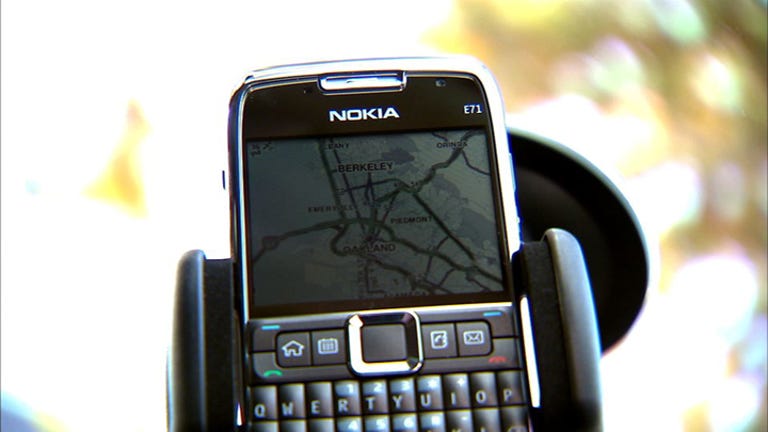
Here's how the pilot project, called Mobile Millennium, will work. Volunteers with phones running on T-Mobile or AT&T's services can register their phones and download the appropriate software through the pilot's Web site. Nokia does not need to be the manufacturer of the hardware, but the phone obviously needs GPS and has to be able to run Java applications, like Blackberries and iPhones. And yes, right now, you do need to live in the Bay Area.
Registration is free and takes less than five minutes. At this point, your work is essentially done. As you drive with your phone in the car, you'll cross the virtual trip lines placed every quarter mile on the NAVTEQ maps on the program. When you do, your phone knows to send its coordinates and traveling speed back to the engineers at UC Berkeley, who have created the algorithms to process the data.
This kind of program will only work where there's a large enough sample size to analyze, and that may not happen for a several months or even years. The advantage of this program, however, is that people with cell phones drive on roads that traffic cameras and actual trip lines simply cannot access to provide travel information. Imagine having access to traffic stats for city streets, rural roads, and vacation routes--and not just commuter thoroughfares.