Three iPad apps offer very different views of the world
Google Earth's familiar info-laden maps can't match the quality and resolution of National Geographic World Atlas HD nor the personalized geophotography of the free Stuck on Earth.


The iPad was made to move, but even if your iPad never leaves the house, these three apps deliver the world to your tablet.
Tilt your iPad to flatten your 3D satellite view
Do you remember the first time you used Google Earth to fly over your favorite world capitals -- or maybe just to get a bird's-eye view of your own back yard?
The novelty of panning and zooming may have worn off, but there's no denying the encyclopedic information Google Earth provides about all four corners of the globe.
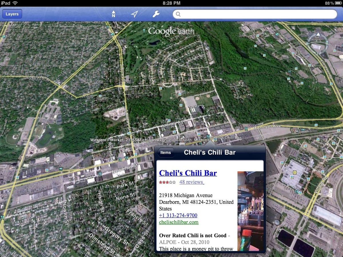
The Google Earth iPad app bears a striking resemblance to the desktop version, which is both the good news and the bad news. The program's satellite views load relatively smoothly as you zoom into specific sites from the opening outer-space view of the planet.
Street names and highway route numbers are overlain along with icons denoting the location of restaurants, shops, hotels, and various points of interest.
Tap an icon to open a window with information about the establishment, such as street address and phone number, Web address, star ratings, and reviews from hotels.com, citysearch.com, urbanspoon.com, and other sites.
To unclutter the satellite view, touch the Layers button in the top-left corner and uncheck such items as places, businesses, Wikipedia, borders and labels, and roads.
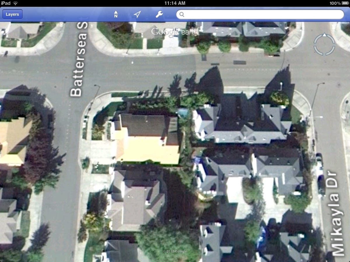
Touch the wrench icon in the menu bar at the top of the window to view the longitude and latitude, show or hide terrain, and activate the autotilt feature that gives you a 360-degree view of the area.
Autotilt moves the horizon down as you move the iPad closer to perpendicular. You start to think you can look in the front window of houses and businesses. I had fun revisiting one of my old haunts in search of kids playing Frisbee, but no dice.
National Geographic's high-quality maps come to the iPad
People love free stuff, so much so that they're willing to sacrifice quality for the chance to hold onto some of their hard-earned dough. But there's such a thing as a false economy: times when you can get a lot more by paying just a little bit.
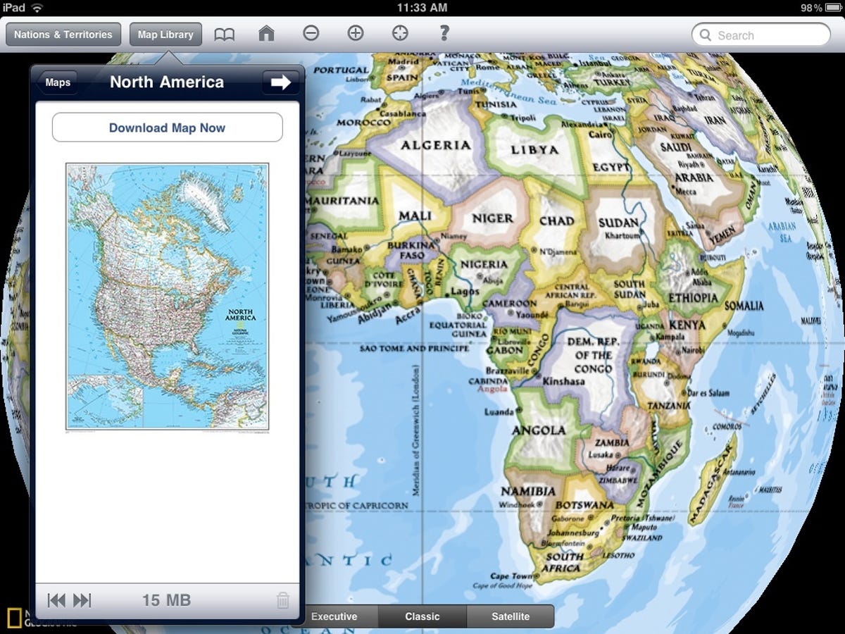
If you're a map aficionado, such a bogus "bargain" is opting for the free Google Earth over National Geographic's 99-cent World Atlas HD iPad app, which offers downloadable high-definition maps of six continents (if you're on your way to Antarctica, you're out of luck).
You can select one of four map views: Executive provides a subtle beige shading to oceans and national boundaries; Classic is the familiar NatGeo map look; Satellite shows Bing satellite images; and Road is the standard road-atlas view of streets and highways.
As you zoom in the map view the Executive and Classic view options disappear. Once you've downloaded a continent's map you can view it offline, but the satellite view requires an Internet connection.
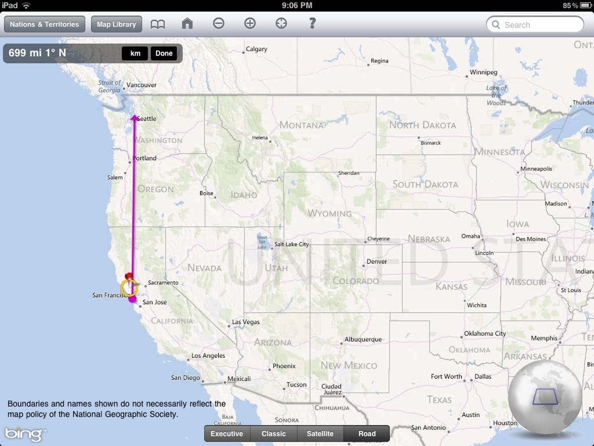
You can measure the distance between two points by tapping and holding the scale bar in the top-left corner of the window, which converts the bar to a movable direction line.
Drag each end of the line to the start and stop locations. The distance (in miles or kilometers) and bearing are displayed at the top of the window.
Even fans of Google Earth's satellite images may find it worth spending a buck for the higher-resolution top-down views delivered by Bing in NatGeo's atlas app. When I did a side-by-side comparison of the same view in both programs, the World Atlas image was the "clear" choice, as shown below.
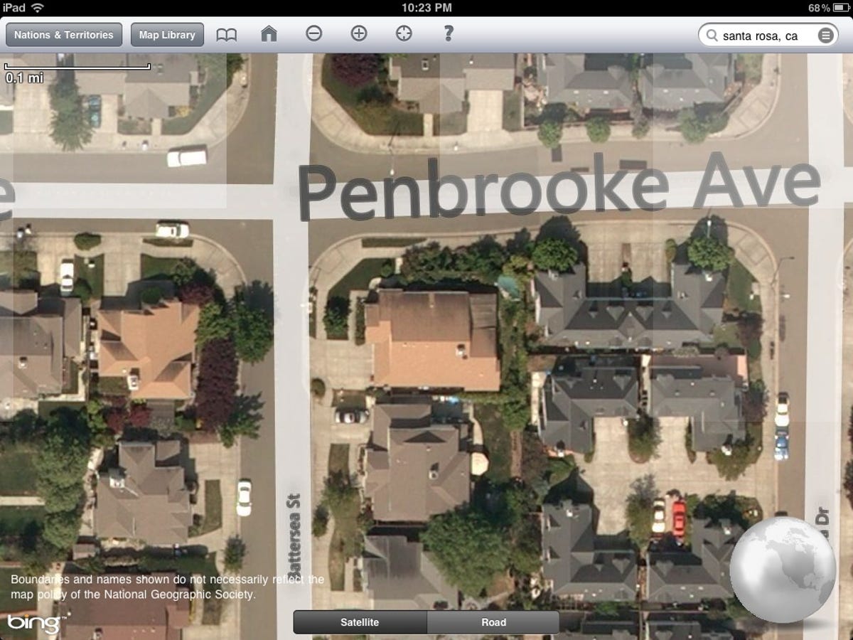
If you're looking for high-quality maps for your iPad and you can live with high-definition satellite views that don't show the location of eateries, accommodations, and other points of interest, you'll find the dollar you spend for NatGeo's world atlas one of the best investments you're likely to make all year.
Professional photographers deliver the world to your tablet
I confess, this review was supposed to be completed days ago. It's late because after I installed Trey Ratcliff's free Stuck on Earth, I couldn't put my iPad down.
Another confession: What I know about photography is not much. But as the saying goes, I know what I like, and the haunting, evocative, dreamy, showy, mystical, political, story-telling, location-based images in this app I like a lot.
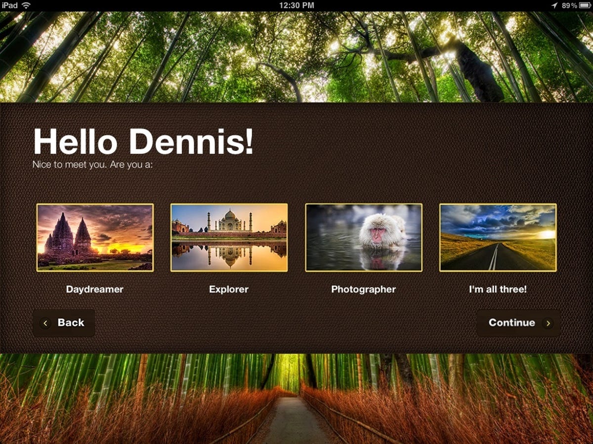
When you open the app for the first time the narrator welcomes you and you're asked to enter your name (turn off the narration via the settings button in the top-right corner of the app's home page). The app then invites you to designate yourself a daydreamer, an explorer, a photographer, or all three.
After you make your selection you're presented with a map of the world on which are pinned featured photo albums related to the location. You can choose one of three map views: standard, satellite, and hybrid.
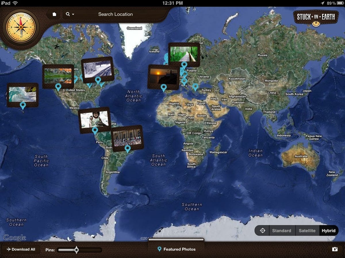
Drill down the map to a specific locale to view more photo-album pins. I started my virtual world tour by revisiting my old hometown of Detroit -- nothing much has changed there in recent years, right? You can save photographs in "trips" for easy revisiting, but the app really lends itself to free-form exploration.
When you select a photo album on the map the first image opens with the location associated with the photograph shown on a small map inset on the bottom left. The image name, the photographer, a description, and buttons for activating and controlling a slideshow, e-mailing the image, and adding it to a trip appear in the ribbon below the photo. Touch the small "enlarge" button in the bottom-right corner to view the full-screen image.
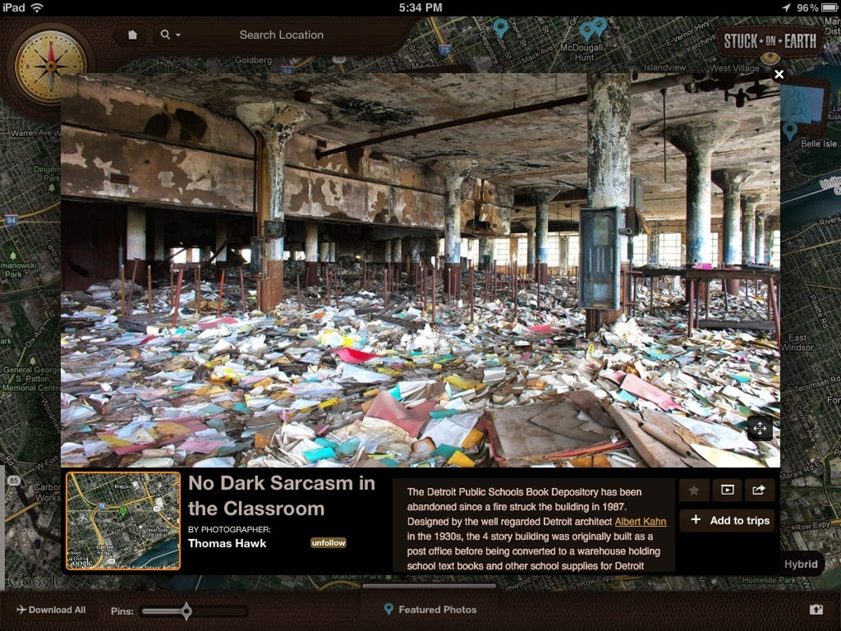
Slide the image to the left to preview the next photo in the collection. Another button invites you to follow the photographer. You can also download all the collections on the current map.
Press the small folder icon in the bottom-right corner of the main window to view instructions for connecting to your Flickr account to select geolocated photos you'd like to add to Stuck on Earth's collections. By joining the community forum you can submit a Top 50 list.
Apps like Stuck on Earth take the sting out of being Earthbound.