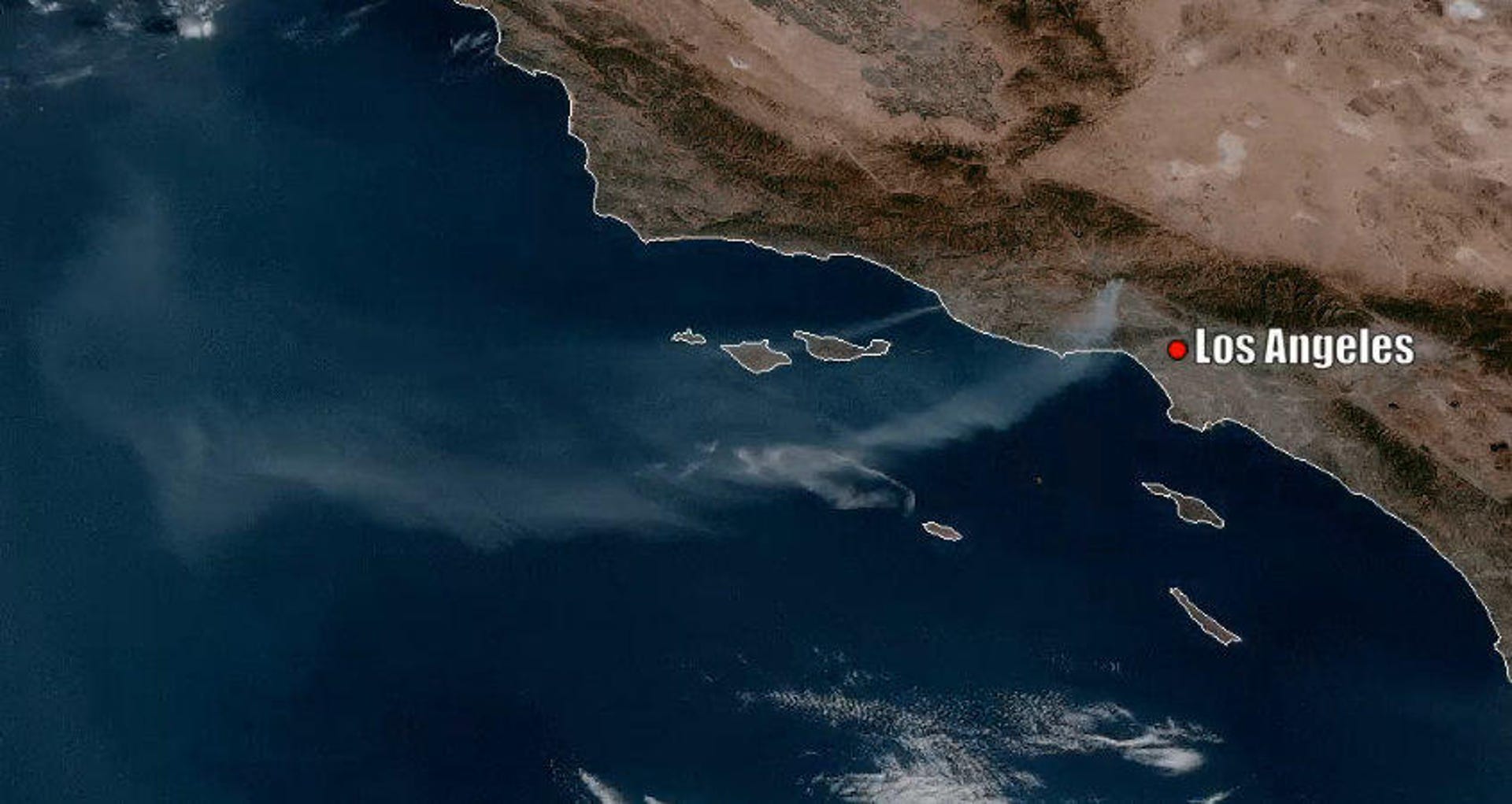
Saddleridge Fire smoke stretches forever in dramatic view from space
The plume from the Southern California wildfire covers hundreds of miles.


California is suffering. High winds are strafing the state and utilities companies have been shutting off power in an attempt to avoid wildfires caused by downed lines. It's not going well.
The Saddleridge Fire broke out near Los Angeles on Thursday night and the view from space is sobering.
The National Oceanic and Atmospheric Administration tweeted a GIF view from its GOES-17 satellite on Friday showing the Saddleridge Fire's smoke plume, which stretches for hundreds of miles across the Pacific Ocean.
SATELLITE SPOTLIGHT: The #smoke plume from the #SaddleridgeFire in #California can be seen stretching hundreds of miles away from the #fire on NOAA's #GOES17 🛰️this morning. Dozens of homes have been destroyed and thousands of people are under an #evacuation order. pic.twitter.com/tyUd1YsO8A
— NOAA Satellites - Public Affairs (@NOAASatellitePA) October 11, 2019
"Dozens of homes have been destroyed and thousands of people are under an evacuation order," the agency tweeted. The cause of the fire, which has consumed over 4,700 acres, is not yet known.
Multiple wildfires are now active around California, fed by dry landscapes and unrelenting winds. These latest fires come less than year after the Camp Fire, the deadliest wildfire in the state's history, devastated the entire community of Paradise.
Between power outages and wildfires, many California residents are on edge. If you're in an affected area, check out our guide to making it through the power shutdown while keeping your devices charged.