NASA's Mars Trek turns you into a Red Planet explorer
NASA has launched a new website that lets you explore Mars through interactive map made up of images and data from the space agency, including rover mission photos.


NASA astronauts won't be setting foot on Mars for at least another decade and a half, but that doesn't mean we have to be all forlorn and Mars-less in the meantime.
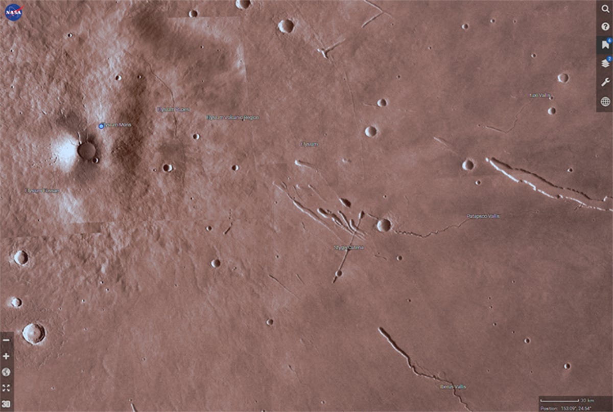
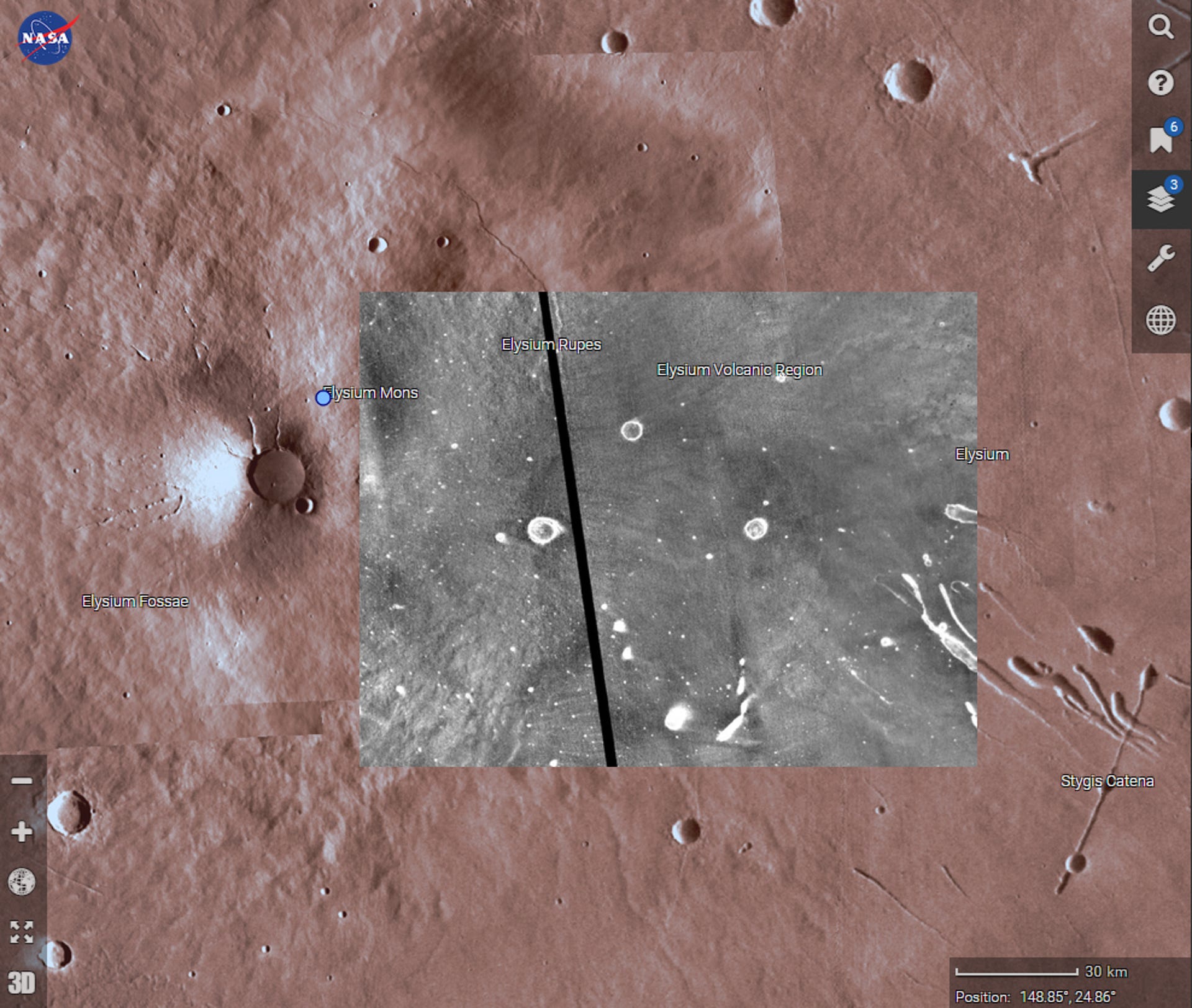
NASA has released a new interactive map of the red planet that lets you explore Mars' features. Called Mars Trek, it's like the global roaming image service Google Earth for Mars. You can view the planet in both 2D and 3D, zooming in to get a closer look at the topography.
The planet is mapped, so that you can select or even search for places of note to visit. The app includes bookmarks of important sites, including the landing sites for all four of NASA's Mars rovers (Sojourner, Spirit, Opportunity and Curiosity), as well as the Phoenix lander.
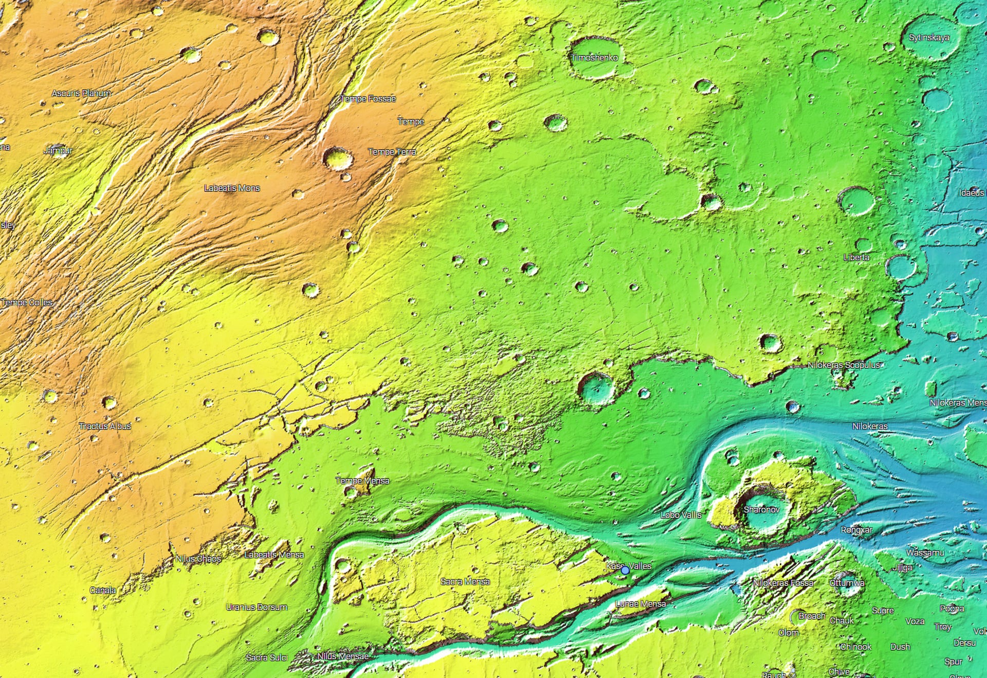
It also lets you zoom in and explore major features, such as Valles Marineris, a gash of canyons in the planet's crust over 4,000 kilometres (2,485 miles long), probably caused by tectonic movements or the Kasei Valles, a system of channels 1,800 kilometres (1,118 miles) probably caused by flowing water.
As you explore, you can overlay visual data supplied by various instruments aboard the Mars Global Surveyor spacecraft. Data from the Mars Orbiter Laser Altimeter allows you to view a colour map of elevation, data from the Thermal Emission Spectrometer shows landscape features in thermal infrared and visible near-infrared and data from the Mars Orbiter Camera shows the topography in black-and white.
Probably the most exciting part is the ability to 3D print sections of the terrain. Using a tool within the app, you can select an area -- or choose a preselected area -- and download a high-resolution STL file that you can feed into a 3D printer.
While these do have 3D topography, they're printed on a flat plane, so printing a spherical globe would take a little bit more work -- downloading the entire flat map and editing it into a ball. That said, educational and informational uses aside, you could probably use the flat map as tabletop gaming terrain if you were so minded...
Check out the Mars Trek browser app for yourself on the NASA website.