NASA to shoot lasers at Earth's forests from space
Using tech known as lidar, a device will map forests in 3D and increase understanding of their role in the carbon cycle.


Think NASA and you're likely to envision missions to Mars and probes sent to the farthest reaches of the solar system. But the space agency actually does a fair bit of work observing our own planet as well.
NASA announced Monday that it is developing the Global Ecosystem Dynamics Investigation (GEDI) lidar device to observe Earth from space.
Lidar is a method by which laser pulses are beamed at the planet's surface from space and then bounced back to the instrument that sent them. By measuring the time it takes for the laser pulse to return to the point of origin, scientists can determine the height of various planetary features like mountains or craters.
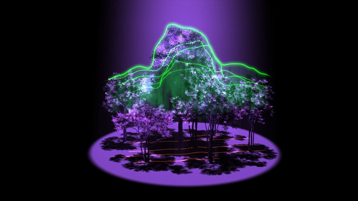
GEDI will use lidar (a combination of the words "light" and "radar") to map the Earth's forests in 3D, which in turn will allow scientists to study the amount of carbon the forests contain.
"Lidar has the unique ability to peer into the tree canopy to precisely measure the height and internal structure of the forest at the fine scale required to estimate their carbon content," said Bryan Blair, deputy principal investigator for GEDI at NASA's Goddard Space Flight Center.
GEDI will have three lasers on board. These lasers will be split into 14 different beams by sophisticated optics. These beams, which NASA says are safe to look at and don't harm vegetation, have the ability to penetrate tree canopies to paint an accurate picture of the world's forests both vertically and horizontally. The beams will be spaced at 1,640 feet apart and will cover a swath of about four miles at any one time. NASA said GEDI will send out about 16 billion laser pulses per year and will examine forests between 50 degrees north and 50 degrees south latitudes, "covering nearly all tropical and temperate forests."
When the laser pulses return to the orbiting instrument, they will have been modified by both the height of the vegetation in the forests and the type of material they hit. The result is that GEDI will be able to distinguish between tree branches, leaves and the ground.
As scientists get a better understanding of the exact layout of the world's forests, they can then determine how much carbon those forests are storing, which can in turn help them understand how deforestation or planting more trees can affect the environment.
"One of the most poorly quantified components of the carbon cycle is the net balance between forest disturbance and regrowth," said Ralph Dubayah, GEDI principal investigator at the University of Maryland. "GEDI will help scientists fill in this missing piece by revealing the vertical structure of the forest, which is information we really can't get with sufficient accuracy any other way."
NASA said GEDI is scheduled to be ready in 2018.
In related news, NASA announced earlier this month that it is developing two other Earth-observing pieces of equipment for the International Space Station (ISS): one, known as ISS-RapidScat, will monitor ocean winds and hurricanes and the other, called the Cloud-Aerosol Transport System (CATS), will measure clouds and the levels of smoke, pollution and other particles in the atmosphere.