NASA spots rare cloud formation that looks like a white rainbow
You know about jet streams. Now see what a jet streak can do.


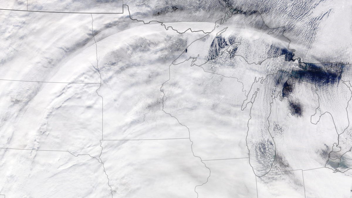
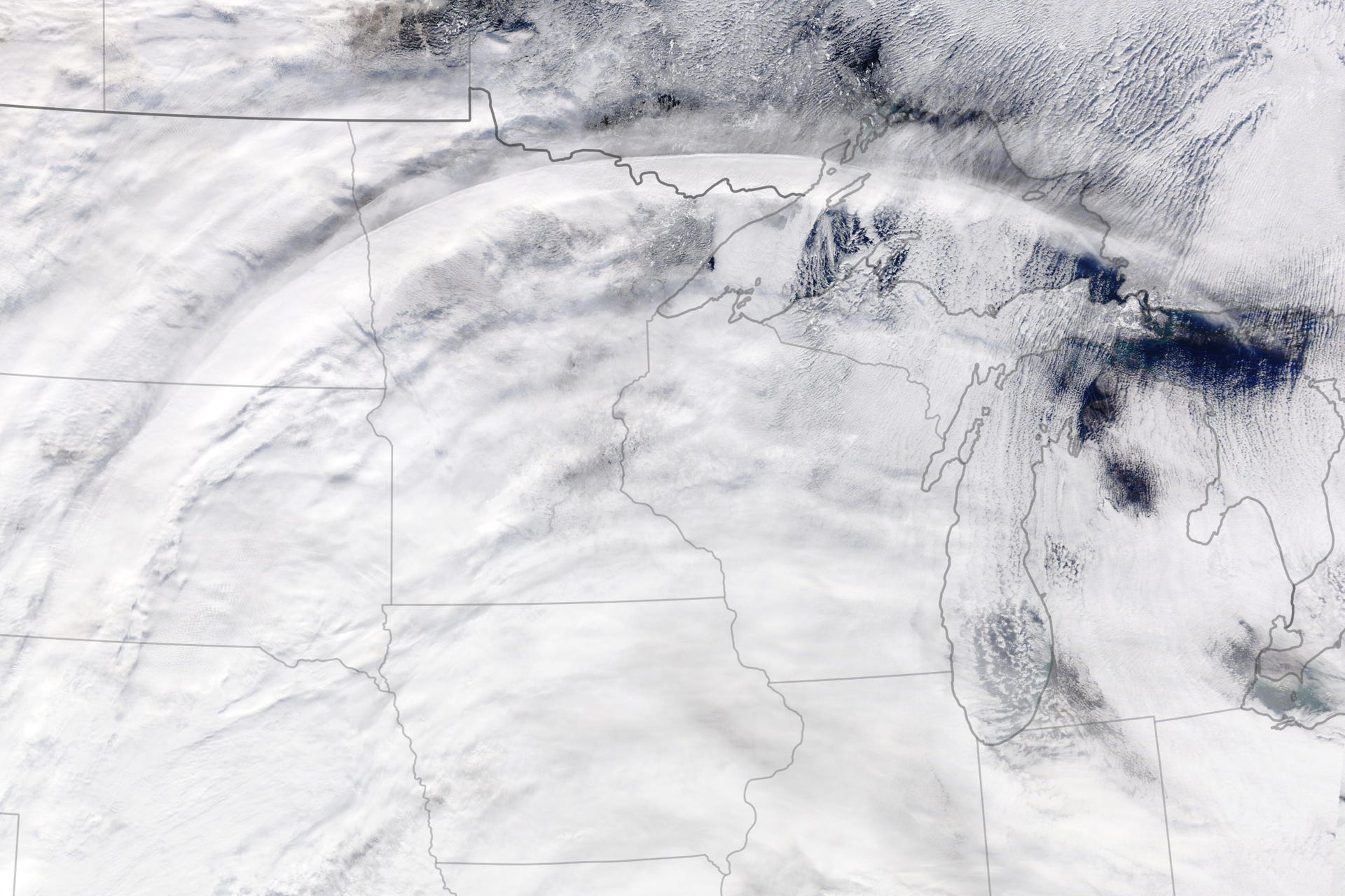
NASA has the best views. The space agency's weather-watching Terra satellite caught sight of a spectacular cloud formation on Nov. 28 when a winter storm was on the rise in the US.
The satellite view makes it look like someone bleached a giant rainbow and laid it across a wide swath of the US from Nebraska to the Great Lakes. NASA highlighted the lovely formation on Thursday as its Earth Observatory image of the day.
The elegant, curving line is formed from cirrus clouds shaped by a jet streak. A jet streak is an intense sub-stream of winds tucked into a jet stream, a fast-moving air current in the upper atmosphere. NASA said these streaks are "important to the formation of winter storms because they are associated with rising air, which can trigger clouds and precipitation."
Jet streaks can be hard to spot in satellite images, but the cirrus arc on display here is a giveaway. It's a rare view of a scenic formation that rivals some of NASA's best cloud views from space.