NASA spots Washington mudslide from space
Satellite shots from the Earth Observatory show the stunning scope of the mudslide that claimed lives and homes in the remote town of Oso, Wash.


- Finalist for the Nesta Tipping Point prize and a degree in broadcast journalism from the University of Missouri-Columbia.
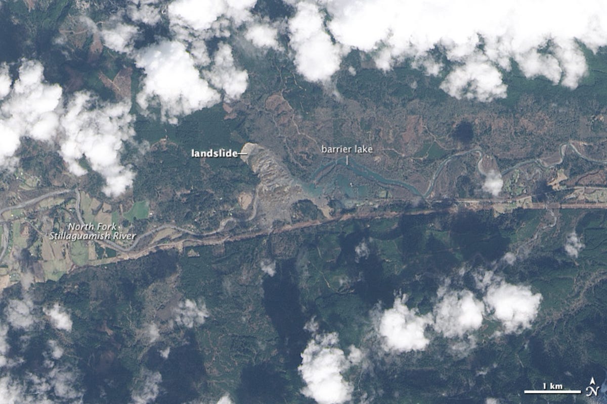
Rainfall is likely to have triggered the wall of muddy debris that was sent downhill and across the river on March 22, killing at least 14 people, with 176 still missing as of Tuesday. The slide also dammed the river, forming a barrier lake, which is shown in the above image from Landsat 8 taken a day later.
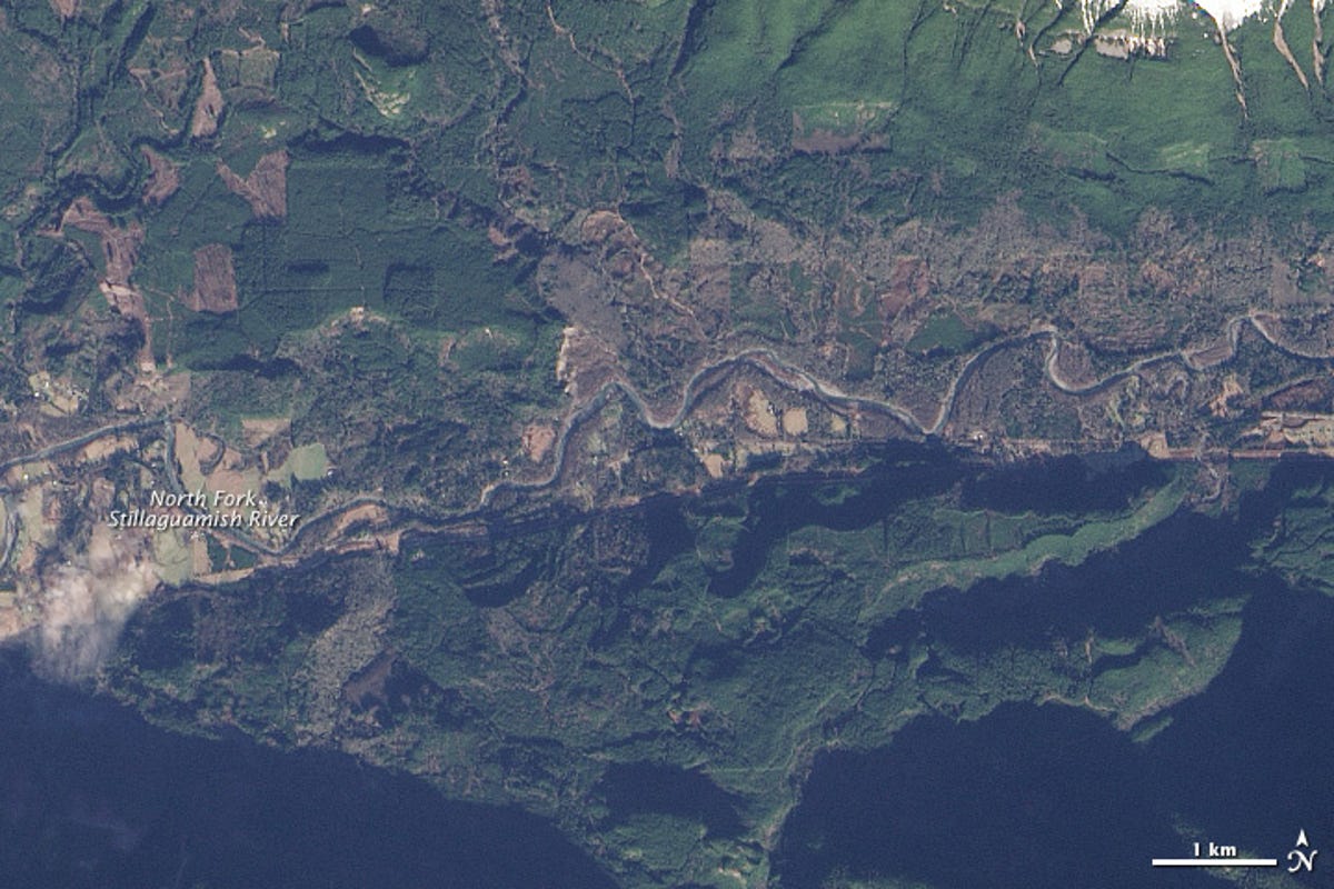
Have a look at another image of the same area taken on January 18 for comparison:
Concerns remain that water backing up from the earthen dam could lead to flash flooding. The landslide here isn't the first. Geologist Dave Petley of Durham University says it is actually a "reactivation" of an earlier landslide in 2006.