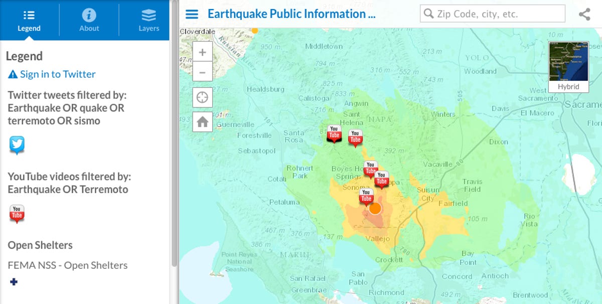
Napa earthquake as mapped by social media posts
Mapping software company Esri creates a real-time interactive map on the 6.0-magnitude quake filled with information from people's Twitter updates and YouTube videos.


The first way many people likely found out about the 6.0-magnitude quake that shook Napa, Calif., on Sunday was through social media. Some users updated their statuses with exclamations of fear or relief, while others gave a bit more information with locations, photos, and videos.
Mapping software company Esri tracked these social media posts on Twitter and YouTube and created an interactive map that lets users get more of a personal view of what happened on the ground.
The map has various layers where users can check out tweets or YouTube videos that have been filtered with the words "earthquake," "quake," "terremoto," and "sismo." The map also shows the site of the quake, aftershocks, and shelters.
In addition to the social media map, Esri also created another interactive map that shows demographic information about the people affected by the quake, along with seismic activity that was provided by the US Geological Survey.
Esri is known for creating public interest maps, especially is natural disasters. Earlier this summer, the company made a map that let users track Hurricane Arthur up the US Eastern seaboard and last August it created a map that showed the devastation of the Yosemite Rim Fire in California.