Map your sweetie's progress with a flight tracker
How to view real-time commercial flight info on Google Maps, Google Earth, and your mobile phone.


One of my favorite Google Earth apps is FBOWeb's commercial airline flight tracker (review). Enter in the details of a commercial flight and you can see exactly where it is. If you're a real geek, with Google Earth's new built-in flight simulator, you can also zoom into the flight and see what it'd be like to fly it youself.
The easiest way to access this feature is to just type in the flight code in Google. For example, search for "AA 34" (American Airlines flight 34), and click on the "fboweb.com" option. If it's in the air, the following results page will display your flight on a Google Map, and there will be a further option to show it in Google Earth.
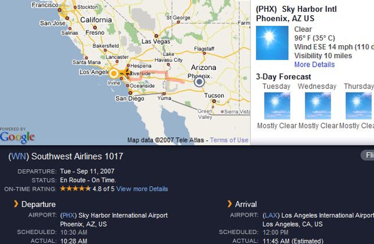
There are other flight trackers out there, including a new one from FlightStats, which mashes up the realtime flight info with Google Maps. Like other flight trackers, it shows scheduled departure and landing times, as well as actual take-off and projected landing. This tracker will also send you email or SMS alerts if the flight status changes, which is highly useful. FlightStats also has a very good mobile-friendly site. Bookmark this on your smartphone. It's the one you'll use when you're hanging around in the airport wondering just how far out the flight you're waiting for is.
Another service, FlightView Live, will also show you flight's position in real-time. Its cool trick is that it will overlay weather on the map.
Not enough? FlightAware, another flight tracking site, will also show you nerdy stuff like all the 737s in the air over the U.S., or all the SouthWest Airlines traffic.
But here's what I want: A service that incorporates air traffic data with highway data and tells me when I need to leave the house (or office) so I can arrive at the airport at just the right time to meet a flight: Not so early that I'm cooling my heels in the airport, and not late so that I'm leaving someone standing around waiting for me. There's a Webware T-Shirt in it (and a blog post) for the developer who builds this mash-up.