Google Maps ducks underwater with Street View panoramas
Google has taken refuge among the coral and seaweed and introduced the first underwater panorama to Street View.


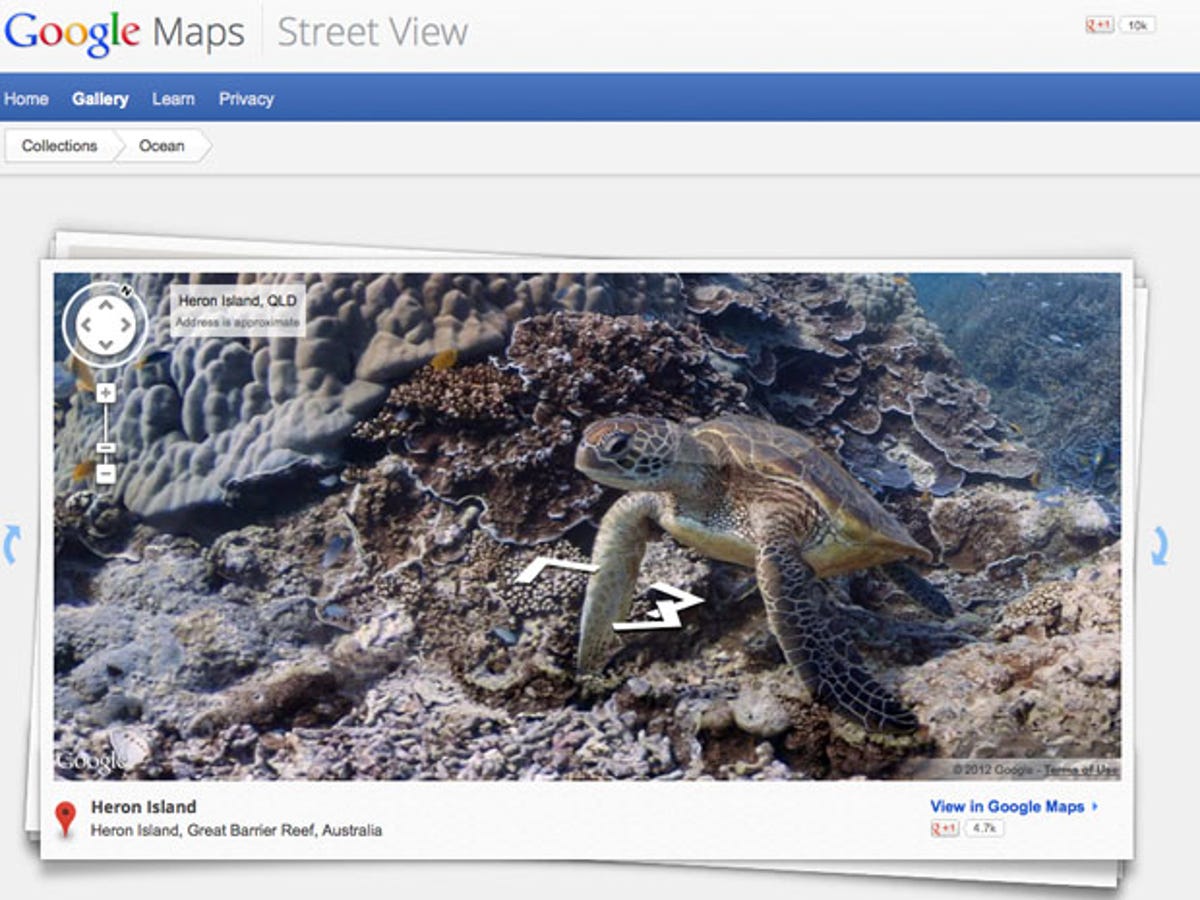
As a wise lobster once said: "Listen to me, the human world -- it's a mess, life under the sea is better than anything they've got up there." And it seems Eric Schmidt and co have taken advice from this clever crustacean, as Google has taken refuge among the coral and seaweed by introducing the first underwater panorama to Google Maps.
It's a timely reminder from Google that when it comes to cartography, it's got the magic touch. In a week of maps mayhem, in which Apple has attempted to fob off users of iOS 6 with its own inferior maps app, it's an inspired move by the Internet giant.
Duck down to the ocean floor where life is the bubbles and follow Crush the chilled-out turtle as he sculls about in the deep blue yonder. Keep an eye out for the harp-strumming carp and flute-tooting newt, as well as the bass-playing plaice and all the many other creatures that be devotin' full time to floatin'.
After you've been swimming around for a while, the idea of looking at normal Street View again will start to seem about as thrilling a prospect as reading Moby Dick. Hit play on the video below to get a clearer idea of Google's waterworld works.
Partnering with the Catlin Seaview Survey, Google used a specially designed underwater camera, the SVII, to capture the photos.
On its Behind the Scenes page, the company describes the addition of underwater panoramas to its Street View collection as "the next step in our quest to provide people with the most comprehensive, accurate and usable map of the world".
Six locations spread across the Great Barrier Reef, Hawaii and the Philippines have so far been mapped out for your perusal, and you can expect to find more ocean kingdoms, including Ariel's grotto, Jellyfish Fields and many an octopus's garden in the shade, available soon. It'll be the perfect tool for flat hunting in Atlantis, although we hope the Scuba divers mapping out the panoramas steer well clear of the Kraken's lair.
Diving on the Great Barrier Reef is something many around the world, particularly those stuck above sea level and heading full throttle into a dreary British winter, can only dream of doing, so I'm giving the Big G a big thumbs-up for providing us this insight into the life aquatic.
Don your mask and snorkel or swallow down your gillyweed and have an ogle at it yourself. Or for more fishy Google-related fun, head to elgoog underwater. Let us know what you think by submerging yourself in the comments section below or paddling over to our Facebook page, where you'll find shoals of other tech fans waiting to be your pals.