Google Maps boosts live transit in NYC, D.C., and Salt Lake City
The Web giant's mapping feature now boasts live departure times or service alerts in three new U.S. metropolitan areas.


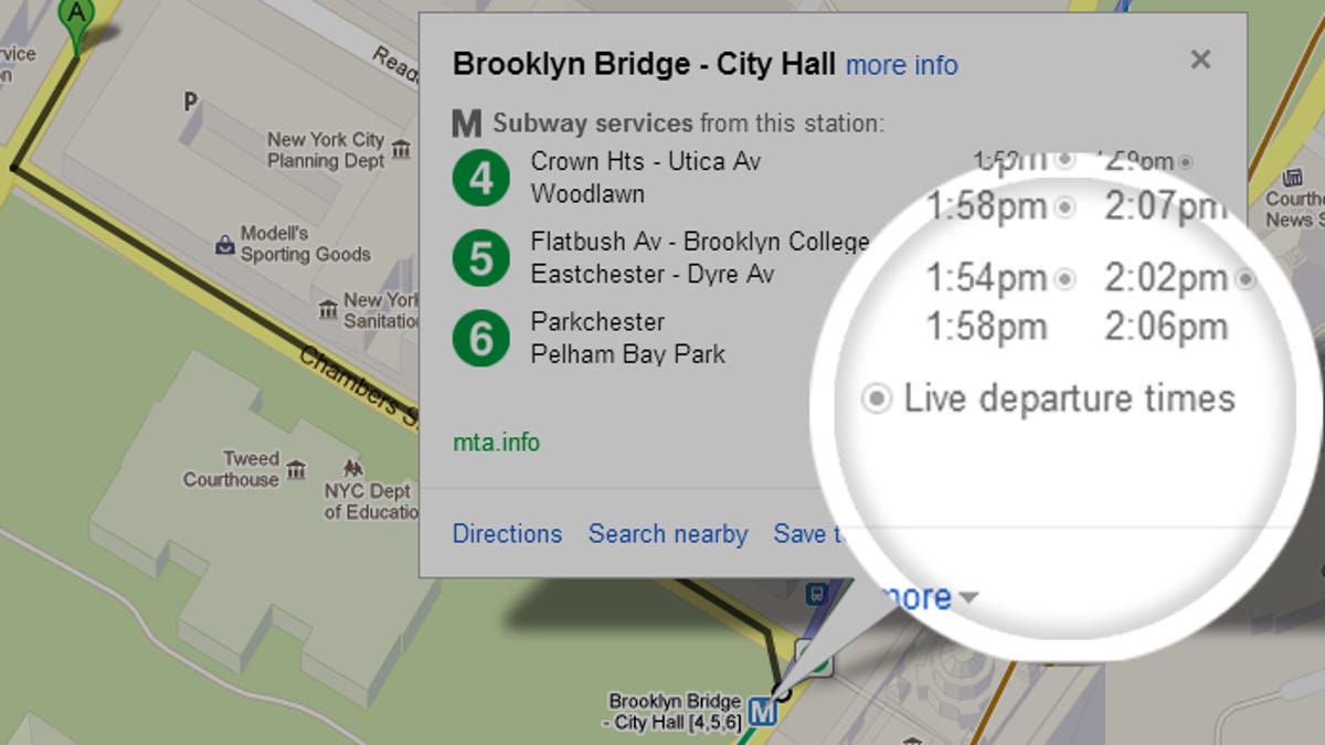
Working to keep an edge on the mapping front, Google announced today that it's boosting Google Maps' live transit feature. Now, users can see several subway and bus live departure times in New York and Salt Lake City and service alerts for Washington, D.C.'s Metrorail.
"We want to make sure you have access to the most comprehensive, accurate, and useful information when you're on the go -- and that includes public transportation," Soufi Esmaeilzadeh, Google Maps partnership development manager, said in a blog post today. "With these updates -- part of the millions of live transit schedule updates we process every day -- you get instant access to the latest information right on Google Maps, making trip planning a cinch."
Seven of New York's subway lines now have the live departure time feature, while various tram and bus lines in the greater Salt Lake City area have it. Washington doesn't yet have live departure information, but users can see live service alerts, delays, and scheduled track work.
Google Maps says that it now has transit information for 25 countries around the world. This includes pick-up locations, estimated travel time, and fare cost for 800 cities. This is up from last August when the Web giant reached a milestone of charting 1 million public transport schedules in 500 cities worldwide.
Google Maps has been working on mapping out the world's transit structures for several years now. In 2008, it included public transport in New York; in 2009 it included voice search with its transit planner; and last year it started providing live transit updates for a handful of cities in the U.S. and Europe.
Microsoft's Bing rolled out public transit directions to its Maps feature in 2010. Apple, however, has yet to add public transportation to its mapping app. The company banished the Google Maps native app with the debut of iOS 6 last September, but in December, Google released a standalone iOS app available for download.