Google Earth 7 brings tour guide feature, more 3D imagery
An updated version of the popular desktop app brings over features recently added to the mobile version.


Google Earth 7 for the desktop landed today with features familiar to anyone who has used the mobile version recently, including new 3D imagery and a virtual tour guide designed to highlight interesting places around the world.
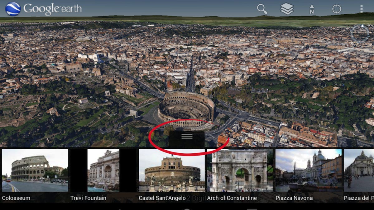
Google said its virtual tours are available for more than 11,000 sites around the world, including popular attractions like the Grand Canyon, Eiffel Tower, and St. Peter's Basilica. The tours, which show up as thumbnail images underneath the map view, suggest nearby places worth exploring and offer relevant information.
Meanwhile, the new version includes 3D imagery for a bunch of places that until now have been available only on Android and iOS: Boulder, Colo.; Boston; Charlotte, N.C.; Denver; Lawrence, Kan.; Long Beach, Calif.; Los Angeles; Portland, Ore.; San Antonio, Texas; San Diego; Santa Cruz, Calif.; Seattle, Tampa, Fla.; Tucson, Ariz.; Rome, and the San Francisco Bay Area (including the Peninsula and East Bay). As of today, you can now also see 3D imagery for Avignon, France; Austin, Texas; Munich; Phoenix, Ariz.; and Mannheim, Germany.
"The experience of flying through these areas and seeing the buildings, terrain, and even the trees rendered in 3D is now consistent across both mobile and desktop devices -- making all of your virtual travels more realistic than ever," Google's Peter Birch said in a blog post.
You can download the new version for Mac, PC, or Linux here.