Google brings Street View to the Grand Canyon
The company has deployed its Trekker team to Arizona for its latest far-flung project.


Soon enough, visitors to the Grand Canyon will be able to get an early look at what awaits them, courtesy of Google Maps.
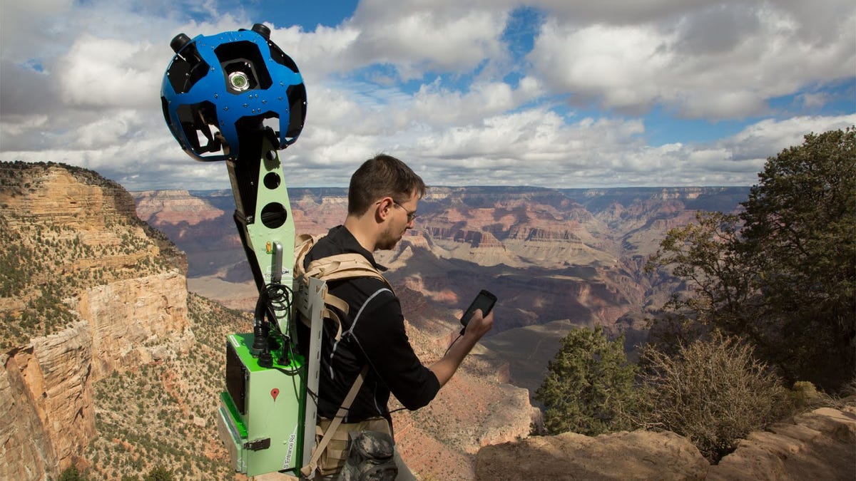
Google published a blog post today highlighting the maps team's current trip to Arizona, which marks the first time the company is using its "Trekker" camera system.
The Trekker, unveiled at a press event in June, is a wearable backpack with a camera system poking out of it. The camera enables the team to capture 360-degree images of its surroundings, thanks to more than a dozen 5-megapixel lenses and a battery that lasts all day. It is controlled by an Android smartphone.
"The narrow ridges and steep, exposed trails of the Grand Canyon provide the perfect terrain for our newest camera system," the company said.
Google is spending the week at the South Rim of Grand Canyon National Park, including the Bright Angel and South Kaibab trails, among others. Eventually the panoramas will be available on Google Maps for all to see.