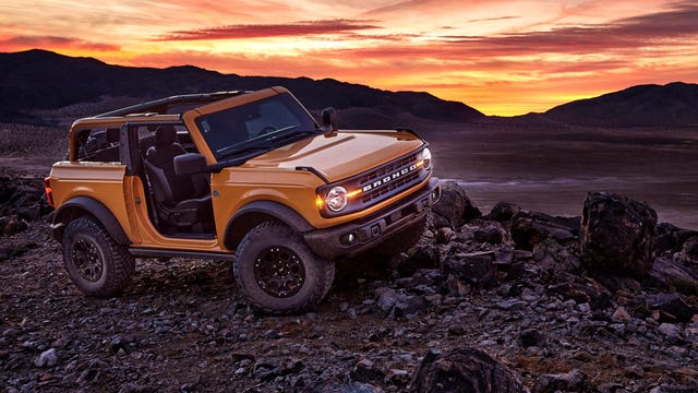
Navigating off-road in the Ford Bronco looks to be a cinch
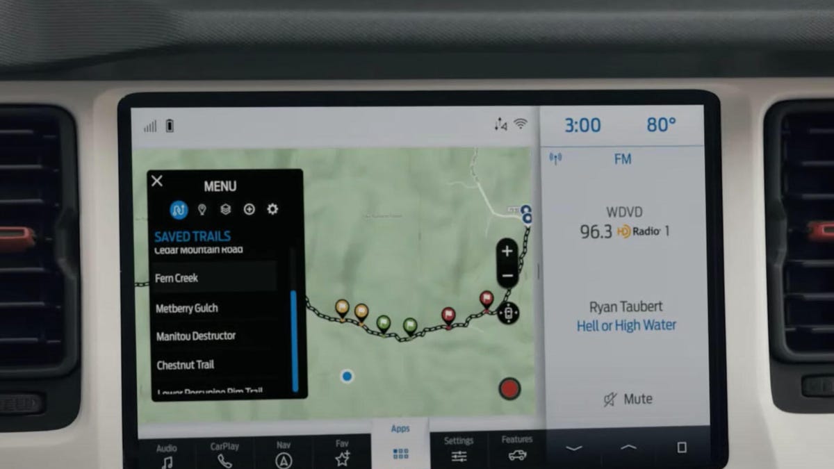
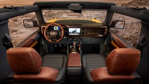
Curated trail maps are sharable and work online or offline through Sync 4.


It's safe to say I'm a bit of a map geek. Blame my experience with the Rebelle Rally for my love of topographic maps, but seeing how mountains and valleys translate into elevation lines is just so cool. If my mind's eye is really good, I can see the two-dimensional map rise up and become 3D, and suddenly I know exactly what route I should attempt in my rig.
The new 2021 Ford Bronco wants to give drivers that same experience with its navigation system and the new Trail Maps app. Now, I haven't actually tried it, so I can't speak to the actual execution of the technology, but at first glance, it seems to be a very cool feature.
Available on both the standard 8-inch and optional 12-inch Sync 4 infotainment screens, the system lets Bronco drivers select curated off-road maps from the likes of NeoTreks' AccuTerra Maps, Trails Offroad or FunTreks. I like the idea of a curated map here, provided by "the top trail guides in the country," according to Ford. Oftentimes when I look at trail guides, it's tough to discern the level of difficulty. One person's intermediate is another person's advanced. A curated trail combined with showing the topographic features should give drivers enough information to choose a route that's appropriate for their skill level.
The sharing of trails should be pretty dope, too. It can be difficult to describe a trail to your pals (famous ones like the Rubicon Trail notwithstanding), and just being able to digitally shoot the trail via the FordPass Performance app to your wheeling buddy will be an easy way to share your experience. And if your pals don't have the app -- which is free, by the way -- you can export your trail as a GPX file and share it that way. Even better, you can import GPX files as well, so if someone has found a cool, secret trail you can still get the info. You can then add that trail to your library so it's always at the ready.

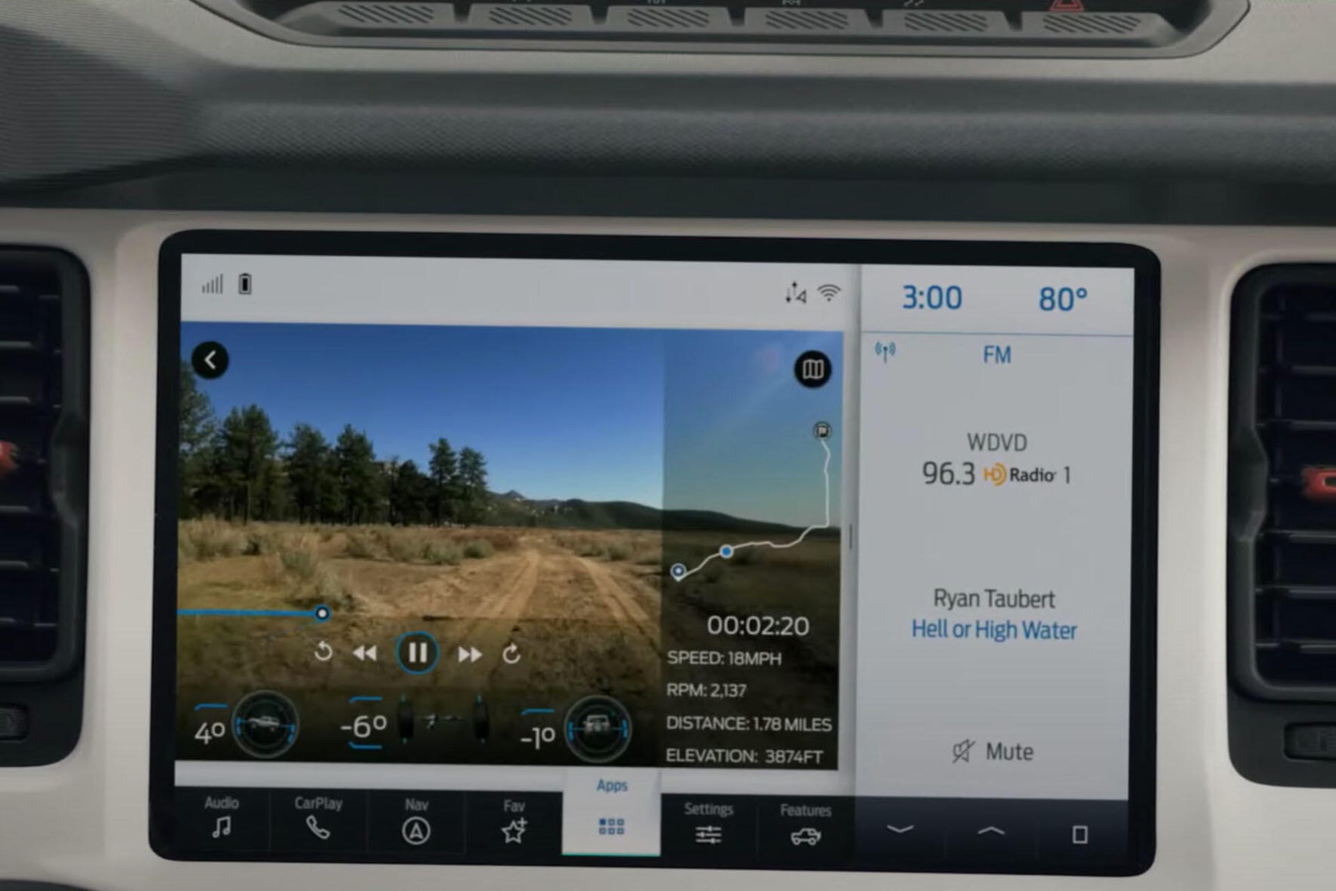
Data overlays FTW!
All this sharing capability means that Trail Maps may help when trying to meet up with pals in remote locations. Assuming you can grab a few seconds of connectivity, sharing a trail can provide latecomers with the exact route the rest of the group is taking. This way, you won't find yourself one ridge over from the outdoor party because you took the left fork instead of the right. Further, you know that if your buddy's all-wheel-drive Subaru Crosstrek made it to the site, your two-door Bronco Badlands will have no problem.
Ford says that Trail Maps can collect your vehicle data like speed and engine revs and overlay that data on video recorded from your phone. You can also mark trail conditions -- hey, big rock here -- and share all that information with your friends. This kind of reporting can be key in off-roading. My lifted Miata can get a lot of places but if I know ahead of time that there's a fallen tree across the road, I'll choose another route.
One thing that gives me pause here is the use of relief maps in the press materials. I asked Ford if there was a true topographical view with contour lines, but haven't heard back just yet. Topographic lines are key when navigating an unknown trail. For example, if you see on the map that a trail goes straight over a feature that has a lot of topo lines placed close together, you know that's a steep trail. However, if the lines are placed farther apart, the climb is gentler. If you're not a fan of steep climbs, you can opt for the easier route and keep yourself out of a pickle.
The topo lines can also tell you the final elevation, which is helpful when gathering supplies. Nobody likes to start at 5,000 feet elevation and then unknowingly end up at 10,000 feet when you didn't think to bring a jacket. You can get some of this information from a relief map, but you'll learn more from topo lines and be better prepared.
Now, should you rely completely on these navigational systems? Absolutely not. Sure, these electronic maps will work even without connectivity, but I still love paper maps for a few reasons. You can write notes on them and it's generally easier to see the big picture of where you are. Plus, you get the added benefit of those crucial topo lines. Add in a compass, and you can always find your way in a jam, even if it is old-school. The best and safest mapping setup is likely a blending of old and new tech -- Trail Maps app with a paper map backup.