Cool Easter egg: Google Earth's flight simulator
The ultimate hidden feature: A flight simulation inside Google Earth.


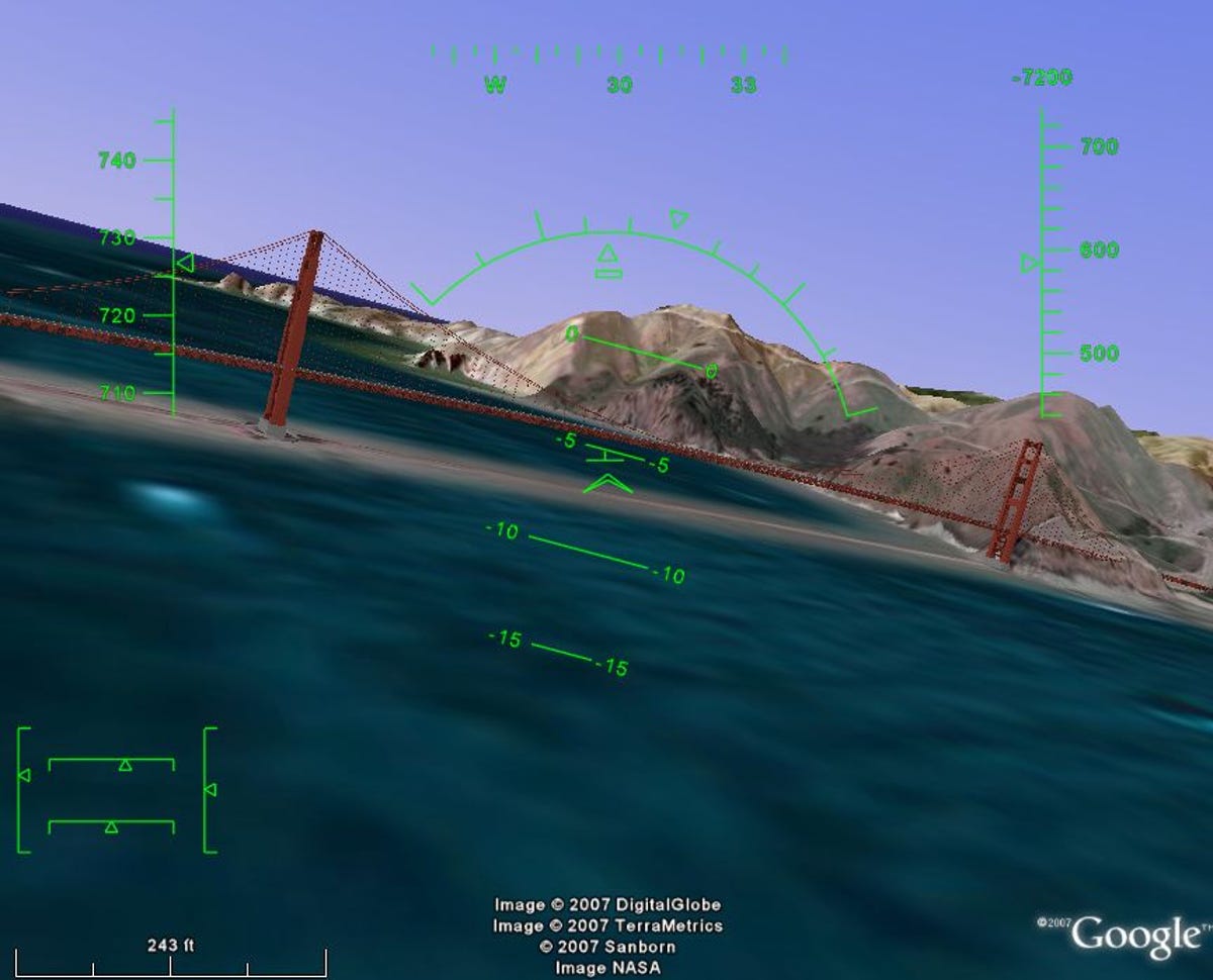
It's no Microsoft Flight Simulator in terms of controls, flyability, or features (no sound, no weather, no autopilot, only two aircraft choices... I could go on), but since the Google flight simulator has access to Google Earth's streaming database, the visuals are awesome. In most areas, it looks fantastic when your plane is more than about 2,000 feet above ground level. Get down low and it becomes a lot less believable, except in cities with good 3D building coverage.
I used to be a flight simulator junkie, and I still have a flight controller (err, joystick), plugged into my PC. Google's flight simulator has a "use joystick" option, but I caution readers that getting the application to actually read the joystick seems to be voodoo science--sometimes it works, sometimes it doesn't. Also, on my controller, some controls were swapped, which made the joystick unusable. On my ThinkPad, though, using the TrackPoint under mouse-control mode works well, and definitely better than trying to fly with either the keyboard or a standard mouse.
While a big step up from the "flight controls" option in Google Earth (Ctrl-G on a PC), and a really fun way to explore the scenery, Google Earth's flight simulator Easter egg is no competitor for a real flight simulator--even if it does have the best scenery in the world.
Via TechCrunch and Marco's blog.
See also: Google looks to the heavens.