Camera robot gives virtual tourism a leg up
Carnegie Mellon announces a robot that helps take gargantuan panoramic photos and a Web site where people can explore the results. The aim? Cross-cultural understanding.


- Shankland covered the tech industry for more than 25 years and was a science writer for five years before that. He has deep expertise in microprocessors, digital photography, computer hardware and software, internet standards, web technology, and more.

Carnegie Mellon University on Wednesday announced a $300 robot designed to easily enable people to create super-high-resolution panoramic pictures--and a Web site to let anyone in the world dive into them.
The GigaPan robot, built by Charmed Labs, can accommodate most compact cameras and is designed to be relatively inexpensive, said Illah Nourbakhsh, a Carnegie Mellon associate professor of robotics. Images then are uploaded to the new GigaPan Web site. They also can be viewed through the Google Earth software.
The researchers' project aspirations extend well beyond just flipping through snapshots of foreign lands. "What if you could do imagery that is so high-resolution that the act of looking at the image is an act of exploration?" asked Nourbakhsh in an interview.
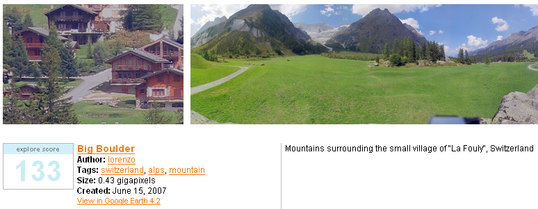
The GigaPan project enables people to pan across and zoom into the high-resolution images, such as this one of the Harmandir Sahib, or Golden Temple, in India. You can use either of the interface buttons in the image. (Text continues below the image.)
The GigaPan work is part of Carnegie Mellon's Global Connection Project, which is designed to connect and inform citizens across the world. Sponsors include Unesco and Intel.
About 300 GigaPan robots will be built initially, with recipients carefully selected to provide good images of the globe, Nourbakhsh said.

Photography has been around for many decades, but a new era of almost obsessive-compulsive recording is arriving. I noticed it first with the Sloan Digital Sky Survey, an astronomy project to capture detailed images of almost a quarter of the night sky, but now more terrestrial projects are under way. One notable participant is Google, which is photographing as well as mapping roads and which acquired an aerial photography company called ImageAmerica.
At the same time, others have been trying to capture detail--for example, Microsoft's work to create 10-gigapixel images or the Gigapixl Project to capture (using digitally scanned film of all things) images between 1 and 4 gigapixels.
The GigaPan project aims for both breadth and depth: lots of photos and lots of detail.
To encourage broad adoption, Carnegie Mellon aimed to make the robot relatively cheap and designed it to work with inexpensive cameras. "We're trying to democratize it," Nourbakhsh said of the GigaPan project. Some comparable projects today require expensive equipment and time-consuming methods, he said.

The robot takes a series of images--ideally about 300 for each location. An actuator pushes the camera's shutter release button, then the robot repositions for the next shot. The user sets up the robot in advance to figure out what field of view the camera can handle, and later where the upper left and lower right portions of the ultimate image should be. The camera then figures out where it needs to point.
The sub-images are stitched together with supplied software into a single view that's then uploaded to the GigaPan site. Nourbakhsh said images have to be at least 50 megapixels in size.
To explore the image, the Web site uses a modified version of the Flash-based image viewer from the Flash Earth site. Users can zoom in and out with a mouse scroll wheel and can click and drag to pan.
So far, there are 468 images on the GigaPan site, and the researchers hope for fast growth. "We have a lot of disk space waiting for these panoramas," Nourbakhsh said--between 5 and 10 terabytes, plus bandwidth to serve the images up over the Internet.