Ford's Argo AI will release its HD maps for free to autonomy researchers
Argo AI claims this is the first release of high-definition maps to the research community.


A self-driving car is only as good as its maps. Automakers around the world have made efforts to create high-definition maps of as many roads as possible as they ramp up AV development, so that their cars can have the best idea possible of the surrounding world. But while most groups don't seem too keen on the idea of giving those maps away, Ford's Argo AI is taking a different approach.
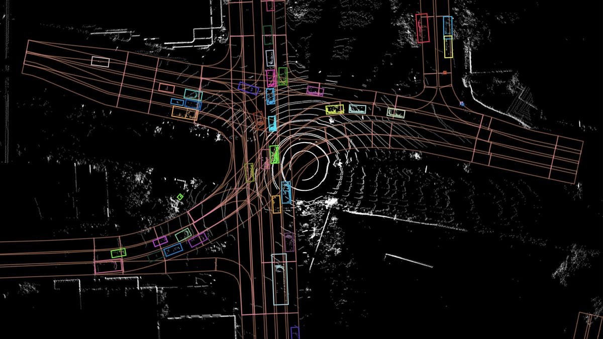
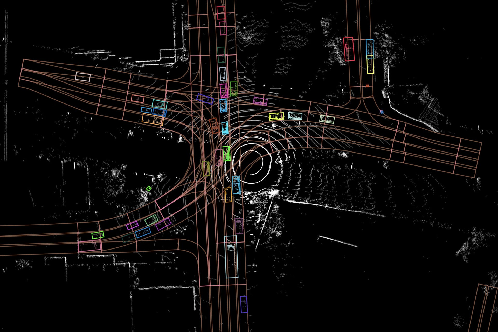
Argo AI announced on Wednesday that it has created a public repository for its self-driving-car development data, including high-definition maps. Argoverse, as it's called, contains datasets and maps collected as part of Argo AI's own research into autonomy, and it's being released for free under a non-commercial Creative Commons license. The hope is that researchers will be able to use these HD maps to further advance AV technology.
"For our team at Argo, releasing this data collection is about giving academic communities access to the materials they need," Argo AI said in a statement. "We're excited to not only support cutting-edge developments in computer vision and machine learning but also to support the next generation of engineers and roboticists who are preparing for jobs at self-driving technology companies, Argo AI included."
It's not all of Argo AI's data, of course. What's available covers about 127 linear miles of road in Miami and another 53 miles' worth in Pittsburgh. The data came from the Ford Fusion development vehicles Argo AI uses, which are loaded with lidar and cameras. The maps have three layers: One looks at individual lane geometry, another looks at actual drivable area and the third covers ground height. Argo AI also created an API to better sift through its data.
There's more than just maps in here, too. Argoverse also contains datasets to train 3D tracking models that detect and follow objects like vehicles and anything else within a road's potential drivable area. There are 113 segments available, varying in length between 15 and 30 seconds, containing some 11,000 tracked objects. There's more than that, too, and you can check it all out on the Argoverse site.