Get elevation info for bike routes in Google Maps
Google Maps finally answers a common bike route question: How hilly is it?


Not all bike routes are created equal. A short ride over hill and dale can be much more grueling than a longer, flatter ride.
Google Maps added bike routes a few years ago to let you avoid cars and find trails and bike lanes, which I'm sure is a useful tool for urban cyclists. I happen to live in New Hampshire, however, where mountains and hills are of more concern than cars, trucks, and buses. I could use the Google Maps' Terrain overlay to get a sense of the topography and elevation of an area, but there was no way of knowing how many feet I'd have to climb for any given route.
Now, Google Maps show bicyclists the exact number of feet they'll climb for a route, and how many feet they'll blissfully decline.
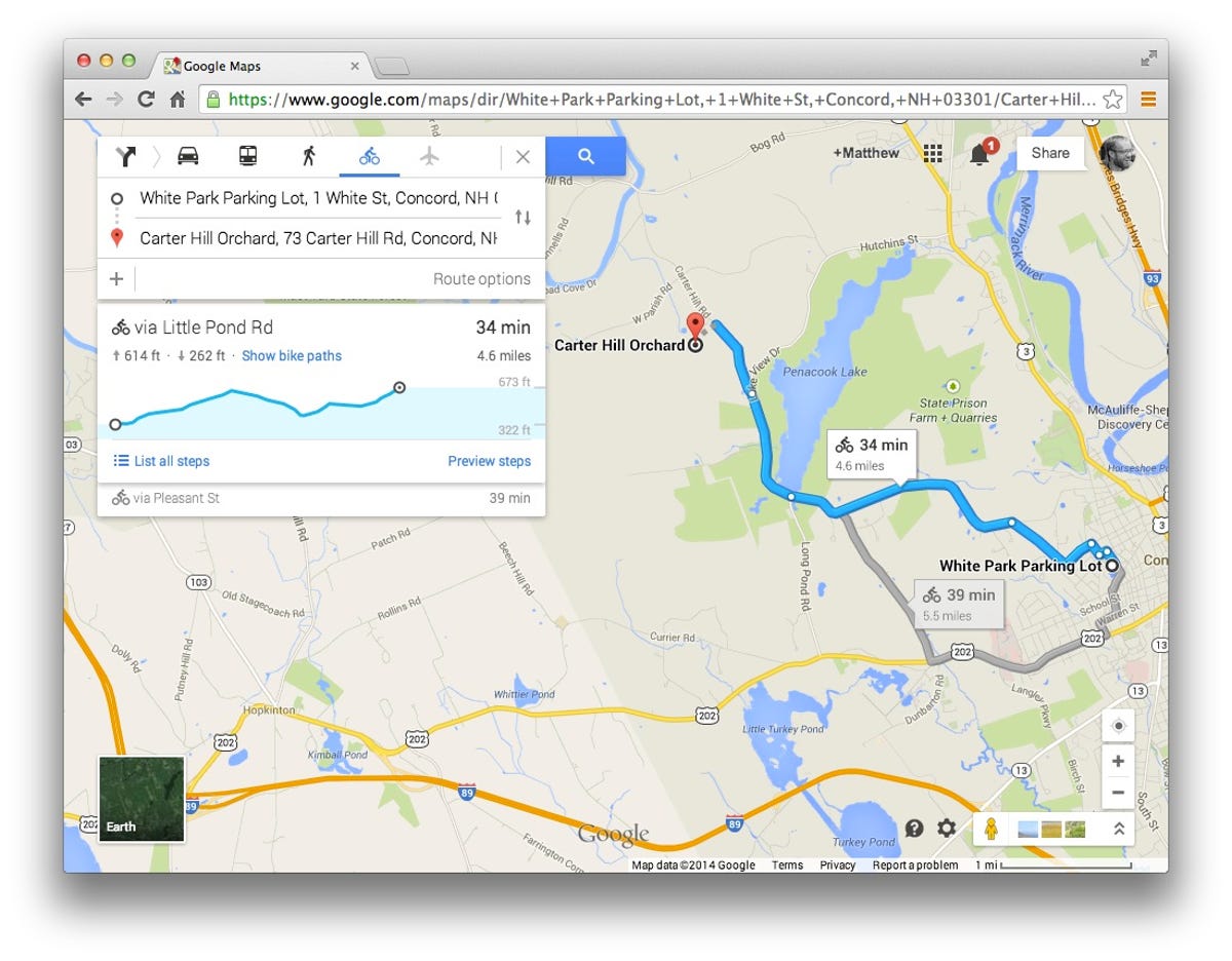
To get this information, click on the directions icon, choose a starting point and a destination, and then choose biking directions by clicking on the bike icon. A panel will slide down with an overview of the route, but in addition to the usual information -- total time and distance -- you'll see a chart that shows you the elevation profile for the route. Above the chart, the total feet you'll climb and the total feet you'll decline are listed. You can move your cursor over the chart or the route on the map itself to see how the changes in elevation correspond to the selected route.
This new elevation information for bike routes is available on the Web-based Google Maps but not on its mobile apps, so be sure to locate those hills before you set out.