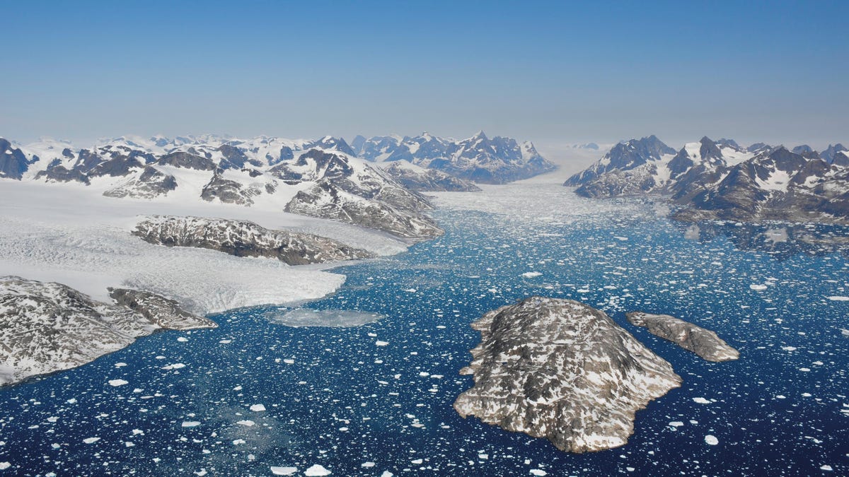
Greenland has lost 3.8 trillion metric tons of ice since 1992
Not cool.


Greenland is losing ice faster than expected.
A new assessment of the Greenland ice sheet tells a grim story: The sheet has lost almost 4 trillion metric tons of ice, raising global sea levels by 10.6 millimeters, since 1992. The rate of loss has accelerated since the 1990s and, if it continues this way, we're on track to hit the high-end global warming scenario predicted by the UN's Intergovernmental Panel on Climate Change in 2013.
The Greenland ice sheet is second only to Antarctica in size, holding enough water to raise sea levels by over 24 feet (7.4 meters). NASA and European Space Agency satellites monitor the region, providing researchers with bounties of data to understand how the ice sheet changes -- and how much of an impact climate change is having on its mass.
In a new report, published in the journal Nature on Tuesday, a collaboration of 96 polar scientists use the data provided by those space agencies to measure the volume, flow and gravity to perform a health check on Greenland's mammoth ice sheet. In total, 11 different satellite missions provided data and 26 individual measurements were used to understand how climate change is affecting one of the world's largest reservoirs of ice.
"Satellite observations of polar ice are essential for monitoring and predicting how climate change could affect ice losses and sea level rise," said Erik Ivins, a senior research scientist at NASA's Jet Propulsion Laboratory, in a statement. "While computer simulation allows us to make projections from climate change scenarios, the satellite measurements provide prima facie, rather irrefutable, evidence."
The researchers, including Ivins, are part of the Ice Sheet Mass Balance Inter-comparison Exercise, a partnership of scientific institutions that attempts to estimate how much water is locked away in ice sheets around the world. Last year, the IMBIE team showed a similar phenomenon in the Antarctic ice sheet, finding it had lost around 3 trillion tons of ice between 1992 and 2017.
Greenland's gone a little bigger, numbers-wise, which means it has actually fared worse. In total, 3.8 trillion metric tons of ice were lost since 1992. The chief causes of the loss were increased melt water runoff -- literally, ice melting away -- and glacier discharge, as huge chunks of ice drop into the ocean.
Worryingly, the rate of loss has dramatically increased since the early 1990s, when the ice sheet only lost approximately 18 billion tons a year. Even though cooler oceans slowed the loss between 2012 and 2017, the ice sheet still lost 238 billion tons on average.
The acceleration is particularly worrying because it puts us on track to hit the kind of climate change target we'd rather miss.
The landmark 2013 IPCC report provided three scenarios for the amount of sea level rise we can expect by 2100, based on how much ice we're losing. The satellite data from Tuesday's report lines up with the high-end warming scenario -- which could mean water levels rise by 7 centimeters, putting 40 million people in coastal towns and cities in flood zones. In fact, it could be much worse.
"As a rule of thumb, for every centimeter rise in global sea level another 6 million people are exposed to coastal flooding around the planet," said Andrew Shepherd, a polar scientist from the University of Leeds who led the research. "On current trends, Greenland ice melting will cause 100 million people to be flooded each year by the end of the century, so 400 million in total due to all sea level rise."
The IMBIE team noted that it's difficult to get accurate records of how the mass of the ice sheet changed before 1992 because we just didn't have the tools for the job. There are also some discrepancies in the various models studying how much the ice is changing in Northern Greenland.
With new satellites, like NASA's Grace-FO and IceSat-2, the authors note some of the measurement problems might be resolved, as better data becomes available.