Software layers BP oil spill over your home
Web site uses Google Maps to let users place BP oil spill image over any region to fathom its scope.


Using freely available government data, a new Web site helps people quantify the BP oil spill in local terms.
IfItWasMyHome.com uses a combo of Google Maps and National Oceanic and Atmospheric Administration satellite tracking data to place the parameters of the BP oil spill--the result of the April 20 explosion of an oil rig--over any area in the world.
The spill can be moved to center on any location of one's choosing by simply entering location data (such as a city or postal code) as one would usually do for Google Maps.
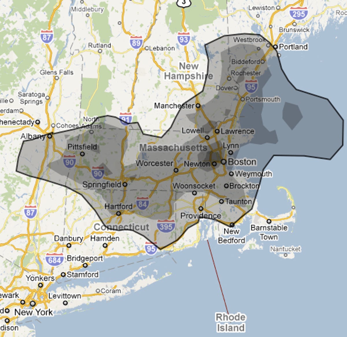
Playing with the tool is devastating.
Many in the media initially compared the spill to the size of Rhode Island or Delaware, America's smallest states. But playing with this tool that follows NOAA data daily, one sees that if centered on Boston, the spill now would cover almost all of Rhode Island and Massachusetts, more than half of Connecticut, and parts of New Hampshire and Maine combined. That's more than half of New England.
The tool is the work of Andy Lintner, a software developer from Royal Oak, Mich. who wanted to better demonstrate to his wife the scope of the spill. He initially Photoshopped the spill over a map of Michigan, but then got the idea to use Google Maps to let anyone put the spill over their home area.
Lintner told The New York Times that he created the Web site last week and posted its address to his Facebook page. Since then, Lintner has seen at least a quarter of a million visitors, a number that will no doubt grow quickly after this morning's exposure from the NYT article and other media outlets.
The site seems to be updated daily