Hurricane Dorian lightning show mesmerizes before landfall
The hurricane's might was on full display.


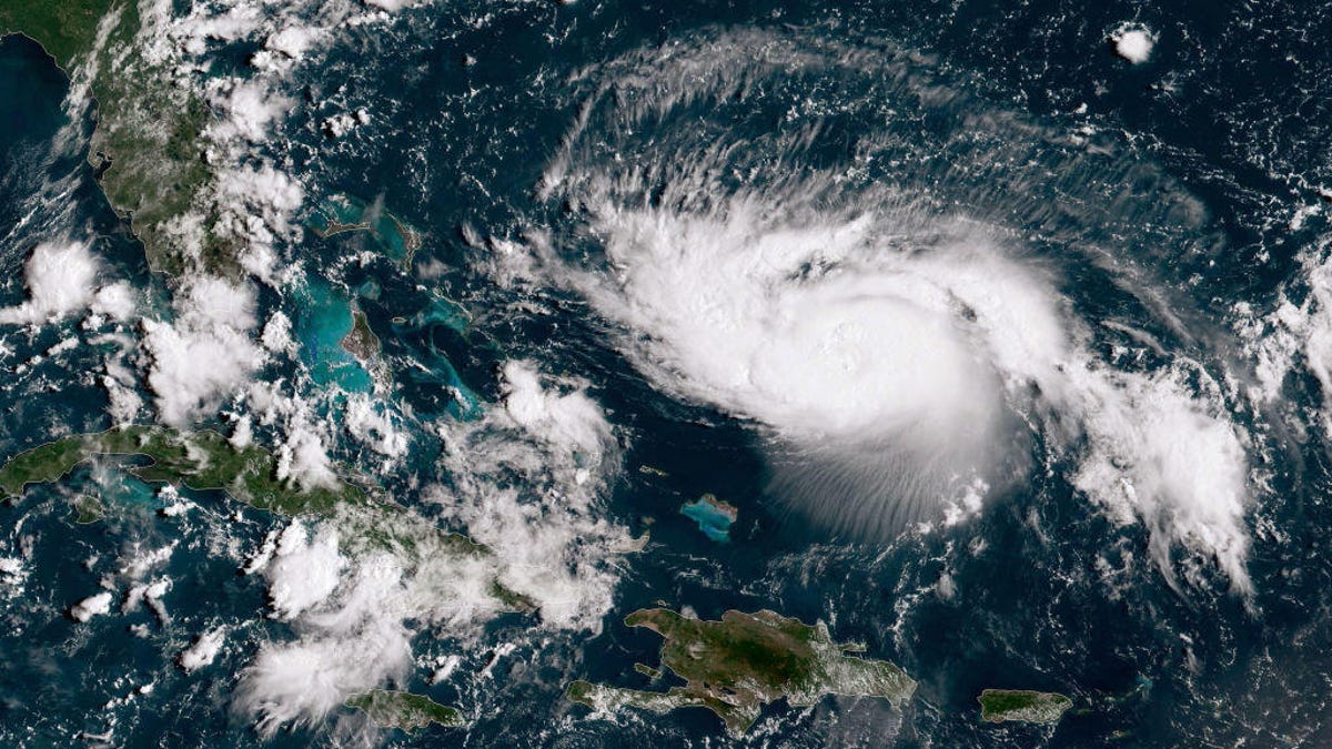
In this NOAA GOES-East satellite image, Hurricane Dorian, now a Cat. 2 storm with maximum sustained winds of 110 mph, gains strength as it tracks towards the Florida coast on August 30, 2019 in the Atlantic Ocean.
Hurricane Dorian is due to hit land over the coming days, with the increasingly powerful storm rising to become a Category 2 hurricane Thursday night. The power of the storm, which could become a Category 4 hurricane with winds up to 140 mph when it hits Florida early next week, was on full display as captured by meteorologist Dakota Smith.
In a tweet Friday morning, Smith shared an image of the many lightning shows taking place inside the massive storm. "Hurricane Dorian putting on a lightning show tonight. Spectacular imagery," he tweeted.
Hurricane Dorian putting on a lightning show tonight.
— Dakota Smith (@weatherdak) August 30, 2019
Spectacular imagery. pic.twitter.com/cdrs22PZqe
A subsequent tweet showcased the scale of Dorian, which is set to hit Florida as soon as Monday evening and as late as Tuesday morning, according to CBS News weather producer David Parkinson. The images Smith created come from the National Oceanic and Atmospheric Administration's GOES-East satellite, which the NOAA shared from its own Twitter account later.
Sunrise Hurricane Dorian.
— Dakota Smith (@weatherdak) August 30, 2019
Dorian intensified overnight & will soon become a powerful major hurricane. pic.twitter.com/epX9W3r3Ie
While lightning in a storm like this isn't unique, Smith tells CNET that "lightning in the eye wall is less common but still happens with tropical systems. A few flashes in that gif are from the eye wall."
The National Weather Service is warning people in the path of the storm of its power, saying it has the potential to "bring a triple-threat of dangers to the Florida east coast" with "life-threatening storm surge, devastating hurricane-force winds, (and) heavy rains." NWS is urging those who might be in its path to begin preparing now.
There's an increasing chance for #Dorian to bring a triple-threat of dangers to the Florida east coast...
— National Weather Service (@NWS) August 29, 2019
🌊life-threatening storm surge
🌬️devastating hurricane-force winds
🌧️heavy rains
The onset of tropical storm force winds could be as soon as Saturday evening.
Prepare NOW. pic.twitter.com/Moes49tcyu