Google Maps cruises the rapids of the Colorado River
The Street View trekker sets sail down the country's most endangered river, taking in views of the Grand Canyon, Nankoweap Granaries, the Redwall Cavern, and much more.


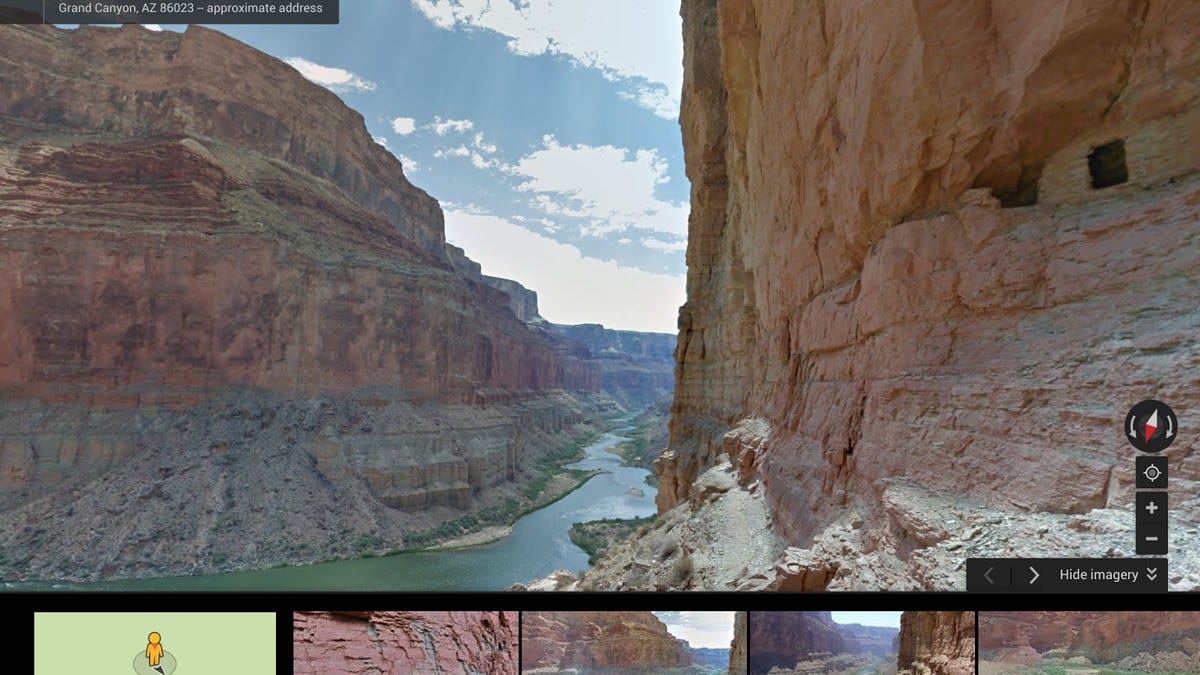
Rafting down the rapids of the Colorado River and gazing up at the walls of the Grand Canyon is not something many people get to do. But now Google Maps is sharing the experience with the masses.
On Thursday, the Web giant released its newest Street View Trek, which navigates "America's most endangered river." Partnering with American Rivers conservation group, Google has mapped out the course of the Colorado River, highlighting attractions along the way, like North Canyon, Nankoweap Granaries, and the Redwall Cavern.
"Now with Google Street View, you can ride the whitewater rapids, cruise the sleepy river bends, and discover the side canyons that make the Colorado River a treasured resource," American Rivers Senior Vice President of Conservation Chris Williams wrote in a blog post.
The Colorado River has been around for more than 6 million years, carving 1,450 miles down the Rocky Mountains, through the deserts of Utah, Arizona, and Nevada, and emptying into the Gulf of California in Mexico. The Grand Canyon is so massive that it can be seen from outer space. Yet, because of being excessively dammed, diverted, and plumbed, the river is "at risk," Williams wrote.


"By the time it reaches the Gulf of California in Mexico, the river is barely a trickle -- a ghost of its once magnificent self," Williams wrote. "You can see evidence of the river's decline in Street View, like the high water mark (showing 1950s driftwood on top of the rock), or sedimentation along the river's edge down by Lake Mead."
Google and American Rivers hope that by letting armchair explorers take a float down the Colorado River, they can raise awareness about the need to "protect and restore" it.
Google Maps has increasingly brought digital travelers to some of the most difficult places to reach on Earth. Just in the past month, the Web giant created a way for Internet users to visit the frozen home of polar bears in a remote area of the Canadian tundra and also to see 30 of India's national treasures, including the Taj Mahal. And, over the past year, the Street View trekker has brought viewers to remote beaches in Hawaii, Japan's Fukushima nuclear no-go zone, and Ecuador's pristine Galapagos Islands.