See Inside the Eye of Hurricane Ian in Dramatic Aircraft Video
Pilots fly choppy rides into the center of the dangerous hurricane.


Hurricane Ian reached the western coast of Florida on Wednesday with a head full of steam. The powerful storm is bringing high winds, rain and the threat of a dangerous storm surge and flooding. In the name of research, pilots flew right into the center of the hurricane on Tuesday, capturing sobering videos and images along the way.
The National Oceanic and Atmospheric Administration's Hurricane Hunters are people who will head into storms in order to study them and better understand their growth, strength and movement.
The NOAA Aircraft Operations Center tweeted a video Tuesday of a specially equipped aircraft named Kermit flying into the eye of Ian. The video shows the inside of the plane as the crew weathers a bumpy ride through swirling clouds before emerging into the calm of the hurricane's center.
OVER THE CARIBBEAN- @NOAA WP-3D Orion “Kermit” #NOAA42 flies into the eye of Hurricane #Ian 09.27.22. Credit: Nick Underwood, NOAA. Visit https://t.co/Wv5xRkqsl1 for info on the storm. #FlyNOAA #Science #aviation pic.twitter.com/lUP9JMNfFD
— NOAA Aircraft Operations Center (@NOAA_HurrHunter) September 27, 2022
A first-hand report added some chilling details. NOAA Hurricane Hunter Nick Underwood tweeted, "This flight to Hurricane Ian on Kermit was the worst I've ever been on. I've never seen so much lightning in an eye." Underwood shared an image of the eye taken at night where it was lit up by lightning.
I have flown storms for the last six years. This flight to Hurricane #Ian on Kermit (#NOAA42) was the worst I’ve ever been on. I’ve never seen so much lightning in an eye.
— Tropical Nick Underwood (@TheAstroNick) September 28, 2022
This was the eye. You can see the curvature. Understand this is at NIGHT. The light is from LIGHTNING. pic.twitter.com/cfZ9ls6YD3
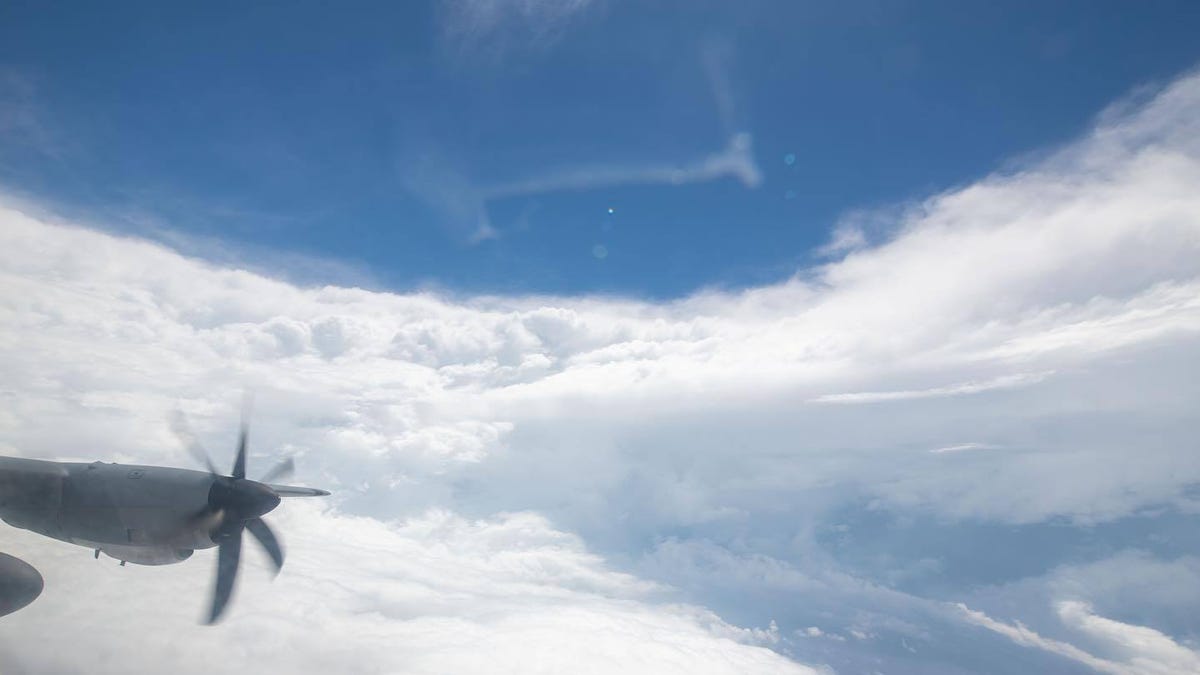
The Air Force Reserve 53rd Weather Reconnaissance Squadron Hurricane Hunters also took to Twitter to share their views of Ian on Tuesday.
Scenes from today’s flight into #HurricaneIan as it makes its way toward Florida ✈️ 🌀
— Hurricane Hunters (@53rdWRS) September 27, 2022
Make sure you’re paying attention to the forecast (@NHC_Atlantic) as well as heeding local advisories.#ReserveReady pic.twitter.com/BY9JA1elKI
Authorities have been urging residents to heed evacuation orders. On Wednesday morning, the National Hurricane Center reported Ian's eyewall was moving onshore. "Catastrophic storm surge along with destructive waves are expected along the southwest Florida coast from Englewood to Bonita Beach, including Charlotte Harbor," the NHC warned in a tweet.
9/28 11am EDT: Eyewall of #Ian moving onshore! Catastrophic storm surge along with destructive waves are expected along the southwest Florida coast from Englewood to Bonita Beach, including Charlotte Harbor. Residents should urgently follow evacuation orders in effect. pic.twitter.com/a82s6OGus6
— NHC Storm Surge (@NHC_Surge) September 28, 2022
Ian registered as a Category 4 on the Saffir-Simpson Hurricane Wind Scale with sustained 155 mph (250 km/h) winds, just shy of the most extreme Category 5. The scale is a way of assessing potential property damage from a storm's winds.
The NOAA and Air Force Reserve Hurricane Hunters play a vital role in understanding hurricanes and helping to provide more accurate storm forecasts. The aircraft act as flying meteorological stations that collect wind speed, wind direction, temperature, humidity and pressure data right from the source.
Check out NOAA's one-stop resource guide for forecasts, maps, images and safety information for Hurricane Ian. The view from the air can be compared to what satellites see from orbit. It's a much different perspective when coming from the belly of the beast.