Garmin readies Android-powered Monterra outdoor GPS
The handheld Monterra's rugged and waterproof exterior protects an app-friendly, Android-powered interior.


- North American Car, Truck and SUV of the Year (NACTOY) Awards Juror
Today, Garmin pulled the wraps off of its new Monterra -- a handheld, outdoor GPS device that can survive in conditions and environments where few smartphones dare to tread.
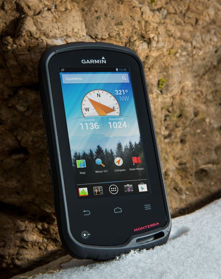
At first glance, the newest model in Garmin's line of outdoor GPS devices looks remarkably similar to the existing Montana models -- which is good for reasons that we'll revisit later. The Monterra differs from the current Garmin product line in running on the Android mobile operating system. The advantage here is that users will be able to download outdoor-related apps to augment the device's functionality, such as Summit Finder, professional apps like construction estimators and ArcGIS, or one of the plethora of Android geocaching apps.
You'll also be able to download apps that aren't outdoor-specific -- perhaps a podcatcher app to keep you entertained on a hike -- via the Google Play Store. Garmin's announcement also seems to imply that users will be able to sideload APK app files that aren't in the Play Store.
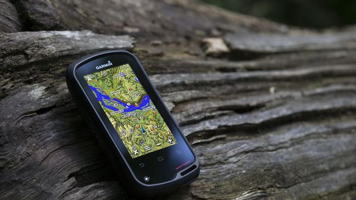
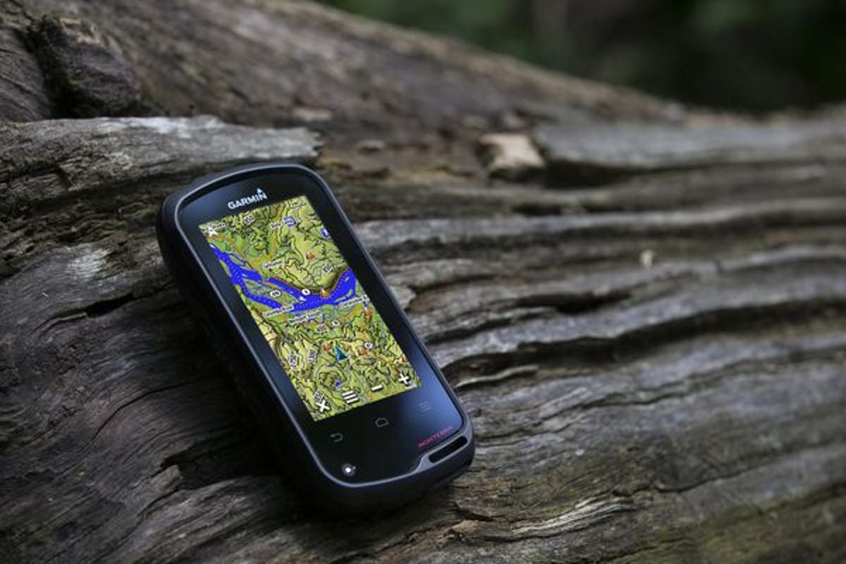
Like any good device designed for use outdoors, the new Monterra boasts a rugged construction; its chassis is shock-resistant and IPX7 waterproof (tested to a 1m depth for up to 30 minutes). Garmin claims that the 4-inch, multitouch mineral glass display is also durable enough to take a few bumps and scrapes, but an integrated loop for a strap and what looks like a grippy, rubberized coating may make dropping the Monterra a nonissue.
By moving to the Android operating system, Garmin's handheld GPS device draws comparisons with the omnipurpose smartphones that have been a constant threat to the standalone GPS market, so the Monterra has to bring more advantages than a bit of water resistance.
Fortunately, this device is packed to the gills with sensors for every occasion. In addition to its dual-band GPS and Glonass receiver, which Garmin claims is accurate "even in heavy cover and deep canyons," the Monterra boasts a built-in three-axis compass with an accelerometer and gyro, a barometric altimeter that is also useful for weather monitoring, a UV sensor, Wi-Fi, ANT+, Bluetooth 3.0 and NFC capabilities, built-in FM radio, and a NOAA weather radio with SAME alerts. There's also an 8MP digital camera with LED flash that also captures 1080p HD video saved to the 8GB of internal memory (expandable via microSD) and sharable via the Garmin Adventures software.
Of course, one of a GPS device's strongest feature should be its maps. The Monterra is compatible with Garmin's BaseCamp software that lets users view and organize maps, waypoints, routes, and tracks. Once on the device, a new feature called 3D MapMerge allows the user to combine two maps, such as TOPO, base map, or BirdsEye Satellite Imagery, into a unique 3D dimensional amalgam. Garmin lists the combination examples of a BirdsEye view with TOPO US 24K maps or a GIS-based water table map with a shaded relief base map. And if you don't know what any of that means, well, that's okay, too.
The new Garmin Monterra will be available later this year (Q3 2013) with two different map data preloads at two different price points. The $649.99 model features worldwide base maps out of the box. For $699.99, you also get an increase in detail for the United States with the addition of TOPO U.S. 100K and Navteq roads data. In addition to access to the Google Play Store via Wi-Fi, the Monterra will also be compatible with pre-existing Garmin Montana mounts and accessories, so it will reach the market with an ecosystem of apps and accessories.