The high-tech hunt for WWII MIAs (pictures)
Thanks to some very high-tech tools being used in the hunt for American military planes shot down by the Japanese in near the island nation of Palau in 1944, some families will finally be learning the fate of their lost loved ones. CNET traveled to Palau to document the hunt.


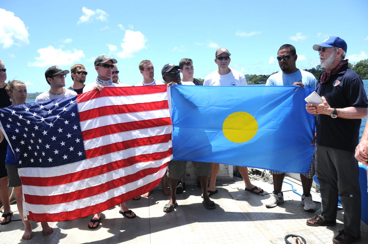
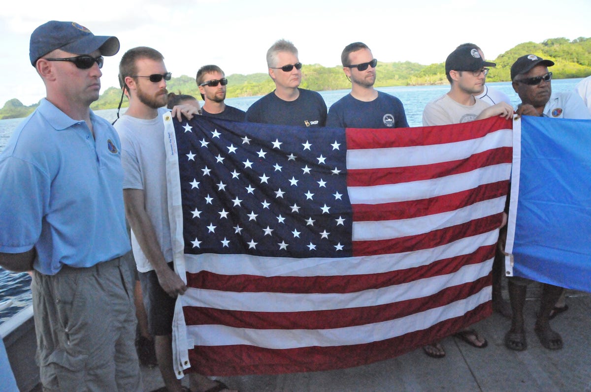
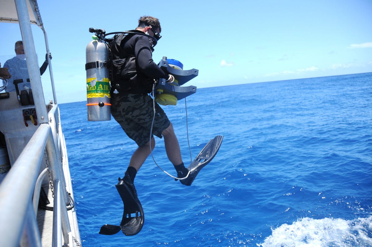
Hellcat flag ceremony
AIMELIIK STATE, PALAU--For 70 years, dozens of American airmen have been listed as missing in action after being shot down over this South Pacific nation during World War II by the Japanese.
But for the families of some, the long wait to learn their fate has come to an end thanks to the efforts of the BentProp Project, a group of volunteers that for years has been traveling each year to Palau to hunt for the lost planes and the missing men who went down with them.
Late last month, the BentProp project held a flag ceremony to mark the discovery of two planes shot down in 1944, a TBM Avenger and an F6F Hellcat.
During the ceremony for the Hellcat, BentProp founder Pat Scannon (right) remembered the sacrifice made by the plane's pilot, and the years the airman's family has been waiting to learn his fate.
In 2014, BentProp's annual expedition was joined by scientists from the Scripps Institution of Oceanography and the University of Delaware's School of Marine Science and Policy, who brought with them high-tech tools to help in the hunt for the MIAs.
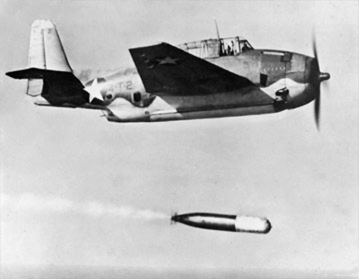
TBM Avenger
The TBM Avenger was the U.S. military's main torpedo bomber during from 1942 to 1945. It carried a crew of three and could launch from either land or an aircraft carrier.
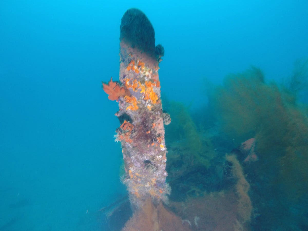
Avenger propeller
This is the front propeller of the TBM Avenger, which was found in the waters off Aimeliik State in Palau on March 24, 2014 thanks to the joint effort of the BentProp Project and scientists from the Scripps Institution of Oceanobgraphy and the University of Delaware's School of Marine Science and Policy.
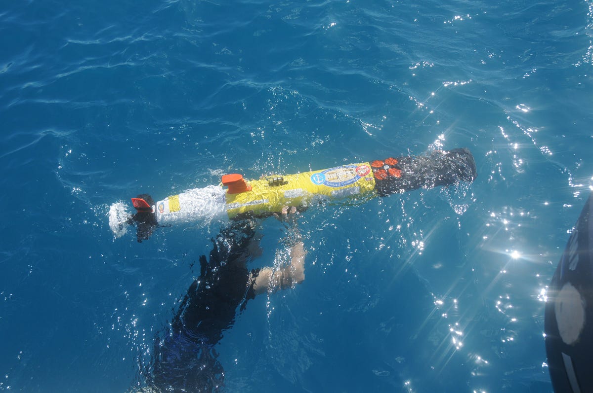
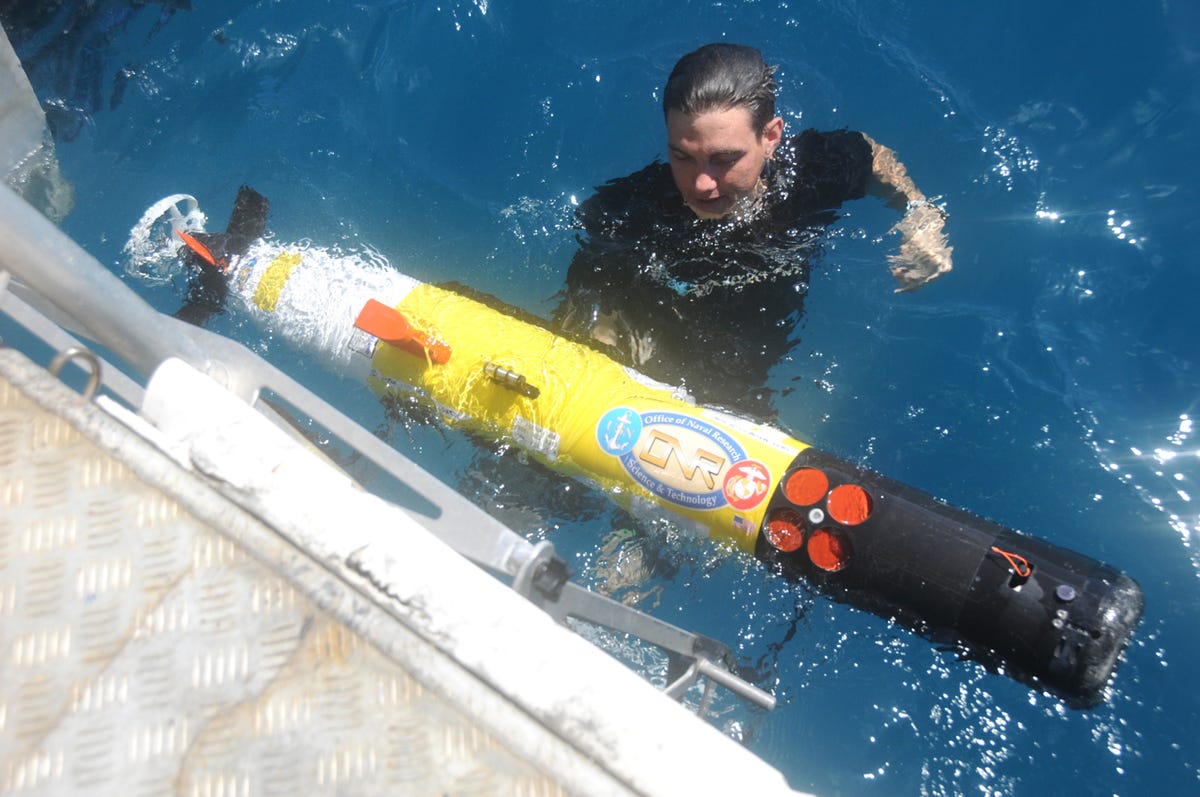
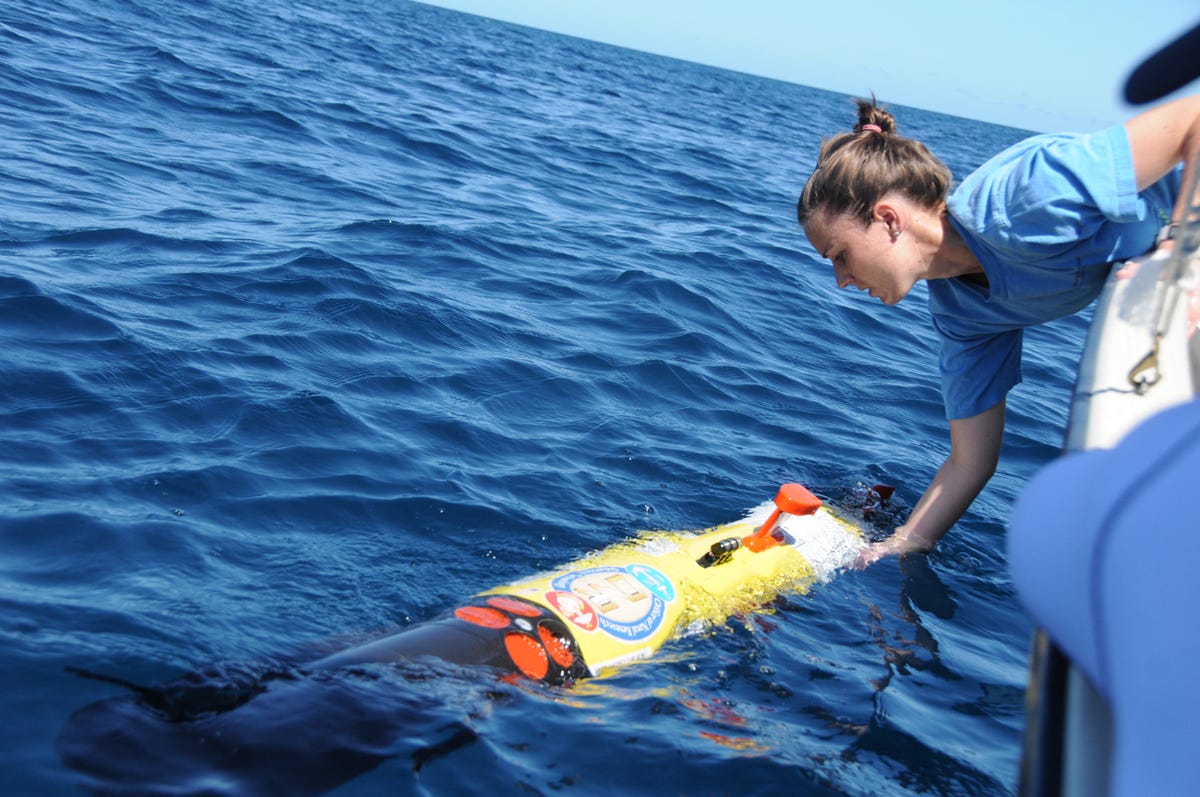
Remus ready for launch
The key scientific tool the combined teams used during the 2014 mission to find the downed planes was the Remus autonomous underwater vehicle. The $300,000 device is loaded with sensors and scanners and can be programmed to autonomously survey large grids of open water. Among other things, it utilizes side scan sonar, which can generate imagery of the sea bottom regardless of visibility.

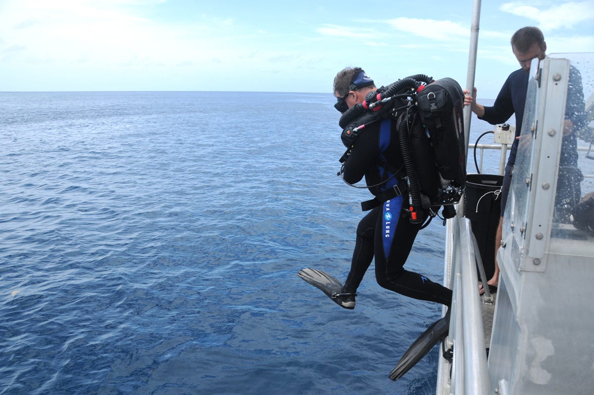
Diving the Corsair
In this photograph from 2012, a member of the BentProp project dives near an F4U Corsair the team had previously located.
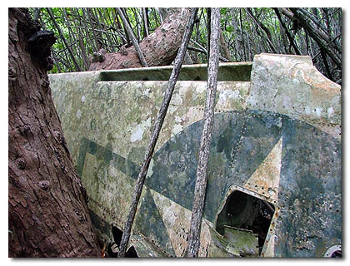
Avenger wing
Though the combined BentProp/Scripps/Delaware teams found the Avenger on March 24, 2014, BentProp had been looking for it since 2005, when members of the volunteer organization had first found one of its wings in the mangrove jungle at the edge of Aimeliik. This photo was taken in 2005 when the wing was first discovered.
Holding three flags
Members of the Scripps and Delaware teams hold three American flags during the ceremony for the airmen lost on the Avenger.
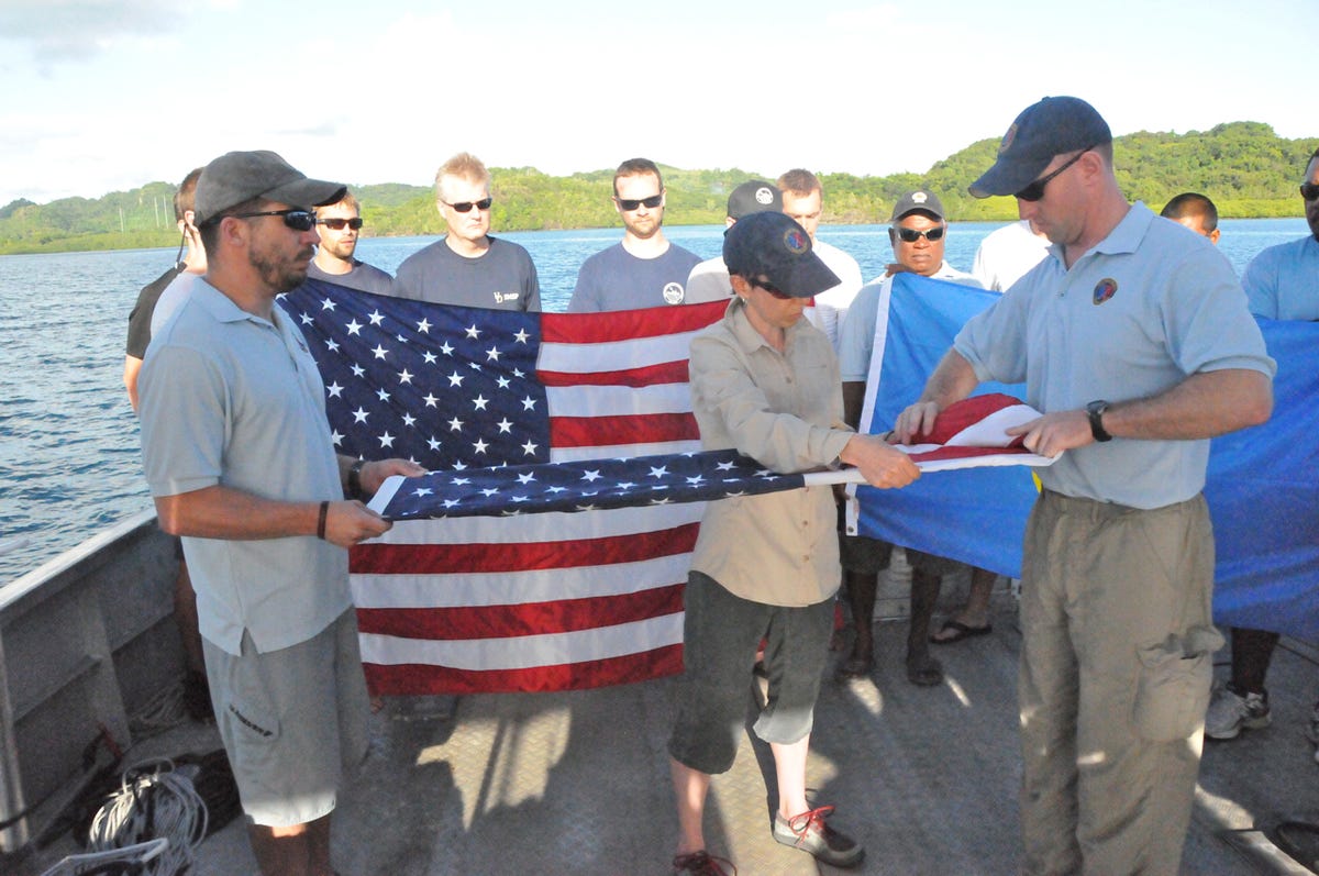
Folding the flag
BentProp members Derek Abbey (left), Nell Scannon (middle), and Casey Doyle (right) fold one of the American flags during the Avenger flag ceremony on March 31, 2014.
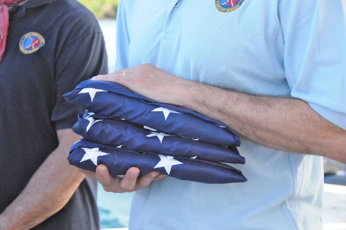
Three folded flags
The three American flags were collected by BentProp member and former Navy Lt. Commander Flip Colmer, whose job it is to ensure they eventually make their way back to the airmen's families.
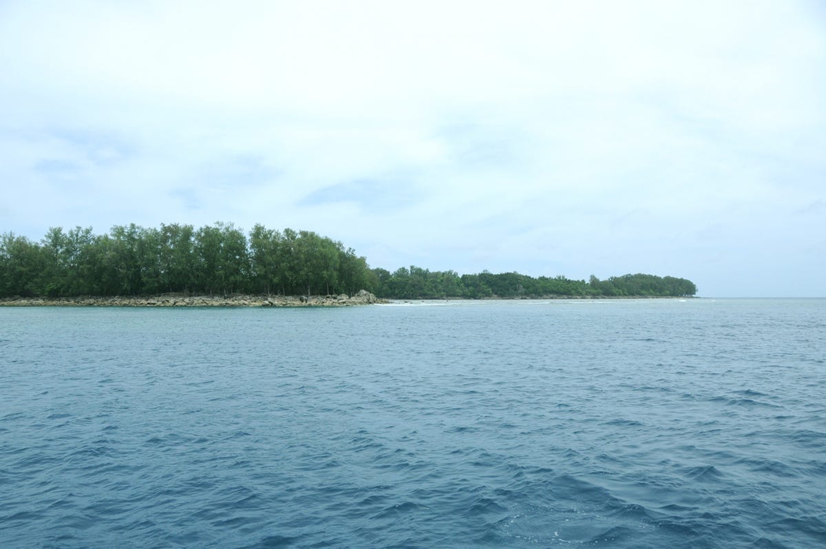
Peleliu
The southern edge of Peleliu, where, for seven weeks starting Sept. 15, 1944, the Americans and Japanese fought one of the bloodiest battles of World War II.
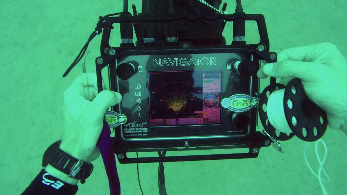
Navigator
Scripps' Eric Terrill uses a device called a Navigator, which gathers 3D imagery of the seabed, as he dives the Hellcat site, which was discovered March 28, 2014.
Murky Avenger
One of the reason many of the lost airplanes have gone unfound for 70 years is that they are located in murky water. In a country known for some of the best scuba diving in the world thanks to the clarity of its waters, that means that few, if any, people have visited the sites where the planes came to rest, and as a result, they remained missing since 1944.
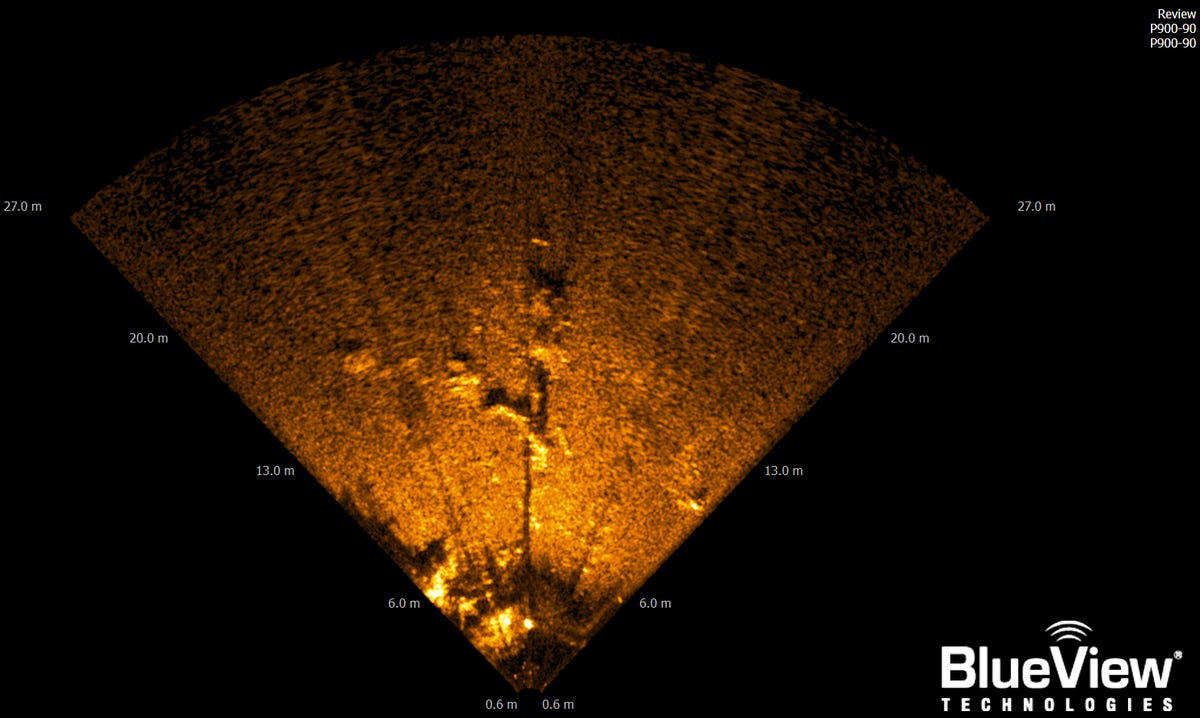
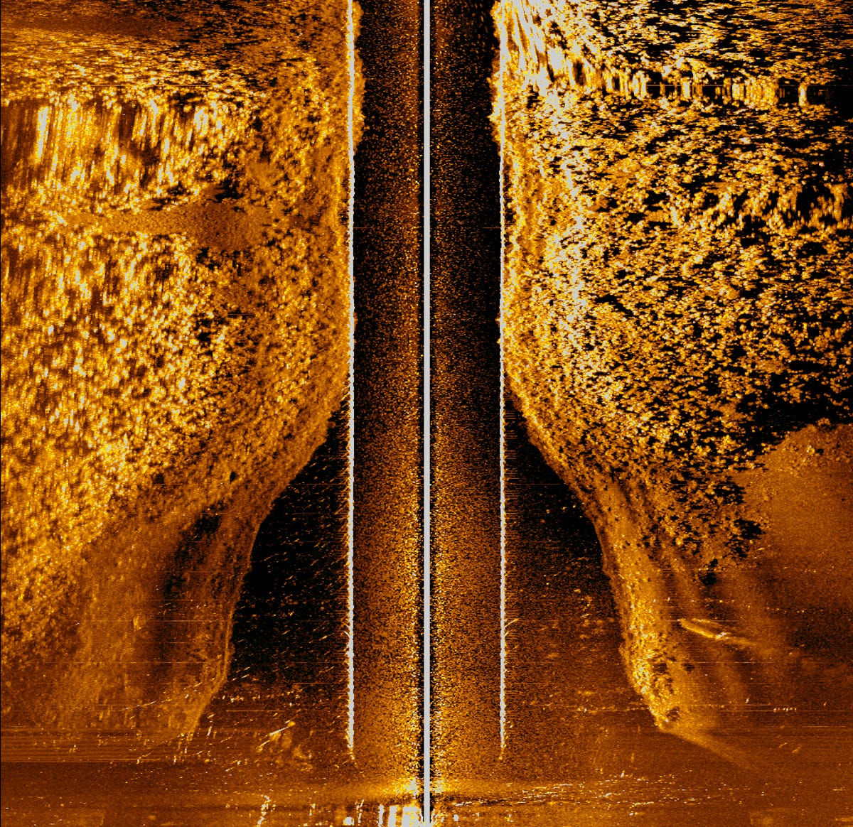
Side scan sonar imagery of Avenger
Although the average person might never recognize anything out of the ordinary in this imagery generated by side scan sonar, experts like Scripps' Terrill can see that it contains something man-made. In this case, it shows the landing gear of the TBM Avenger.
This image that identified the Avenger
BentProp members had been hunting for the Avenger since they first found one of its wings in the Palauan jungles in 2005. In 2014, thanks to new information about where the plane might have ended up, the science teams on the expedition sent one of the Remus AUVs to survey areas off Aimeliik. This is the image that finally showed the airplane and led the teams to scuba dive the site and find the Avenger.
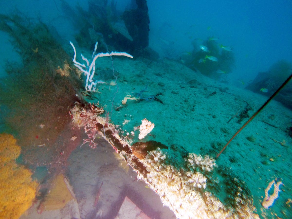
Avenger wing under water
This is the Avenger's other wing, which has been sitting in 100 feet of water in Palau since 1944.
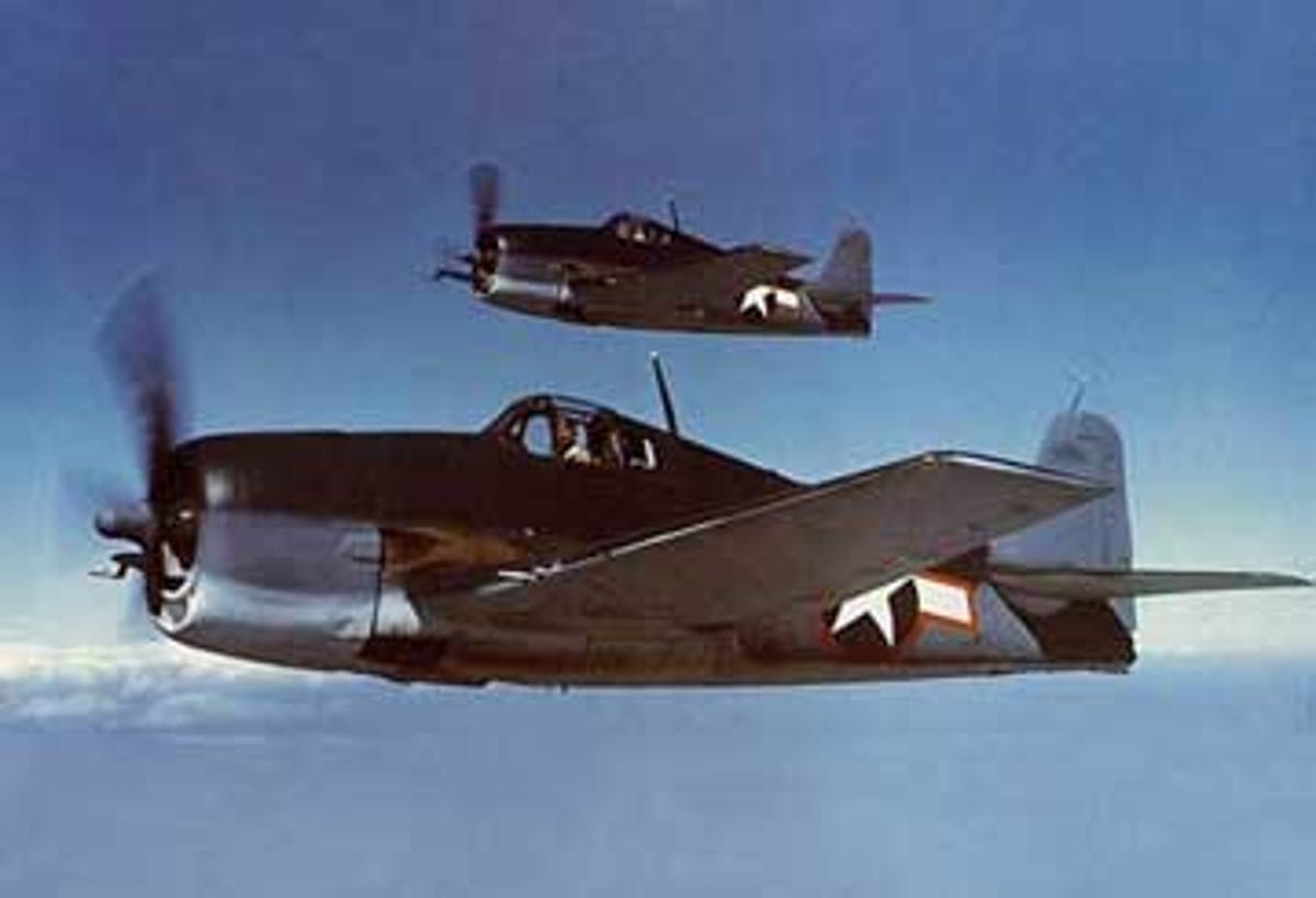
Hellcats
In this U.S. Navy photograph, we see two F6F Hellcats in the air.
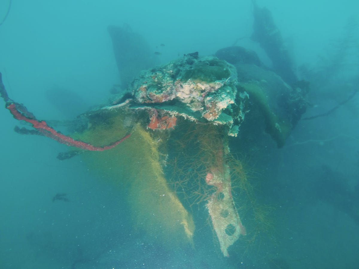
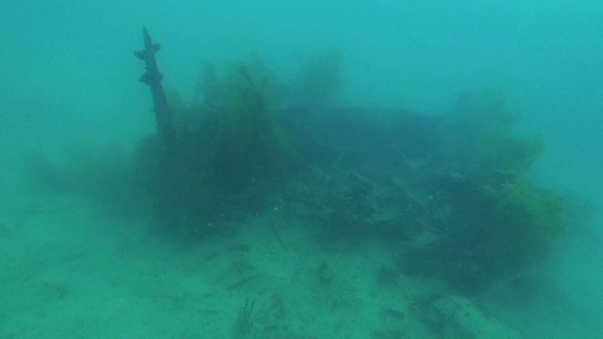
Hellcat wreckage
When divers finally found the Hellcat, which they'd been looking for since 2004, under 100 feet of water just off the coast of Palau, this is what they saw.
Side scan imagery of Hellcat wing
The teams searching for the Hellcat had gotten nowhere for years. Until, that is, they saw this side scan sonar image. In the lower right hand area of the image, you can see a shape that the scientists eventually identified as the plane's wing.
Remus in the water
Scripps development engineer Myles Syverud helps bring the Remus in from a survey mission.
Belcher jumping to dive LVT
Bill Belcher, a BentProp member and a forensic anthropologist from the Joint POW/MIA Accounting Command (JPAC) dives a site near Peleliu in order to take a closer look at an LVT, an amphibious warfare vehicle that the U.S. Marines used to storm the island in September, 1944. The LVT was sunk, and has been sitting there for 70 years.
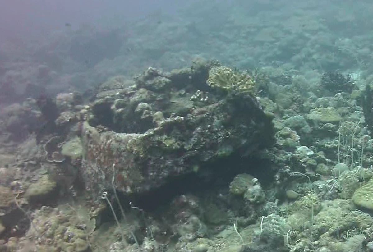
LVT today
The turret of the LVT, as seen earlier this month, 75 feet under water off the coast of Peleliu. It is now covered in coral, and to the average person, would almost certainly not be identifiable for what it is.
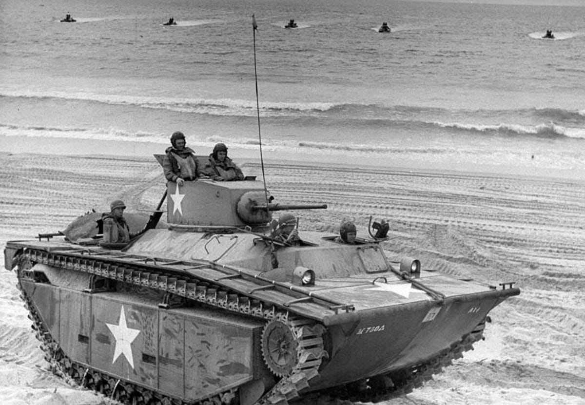
LVT original
An LVT as it would have looked during World War II.
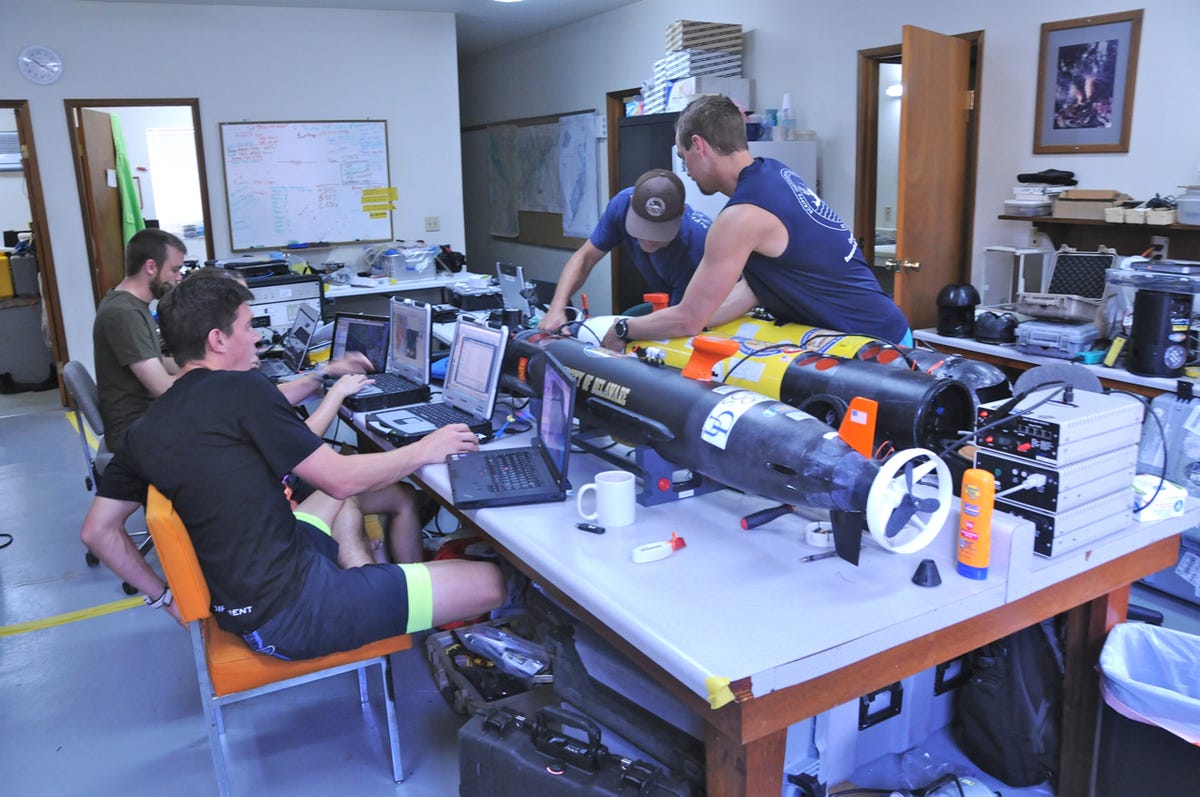
Three Remuses
During the 2014 expedition, the Scripps and Delaware teams brought a total of three Remus AUVs. Here, the three underwater vehicles are seen in the lab at the Coral Reef Research Foundation in Koror, Palau, where the science teams worked throughout the expedition.
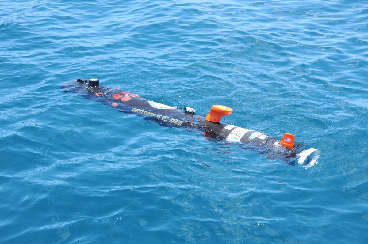
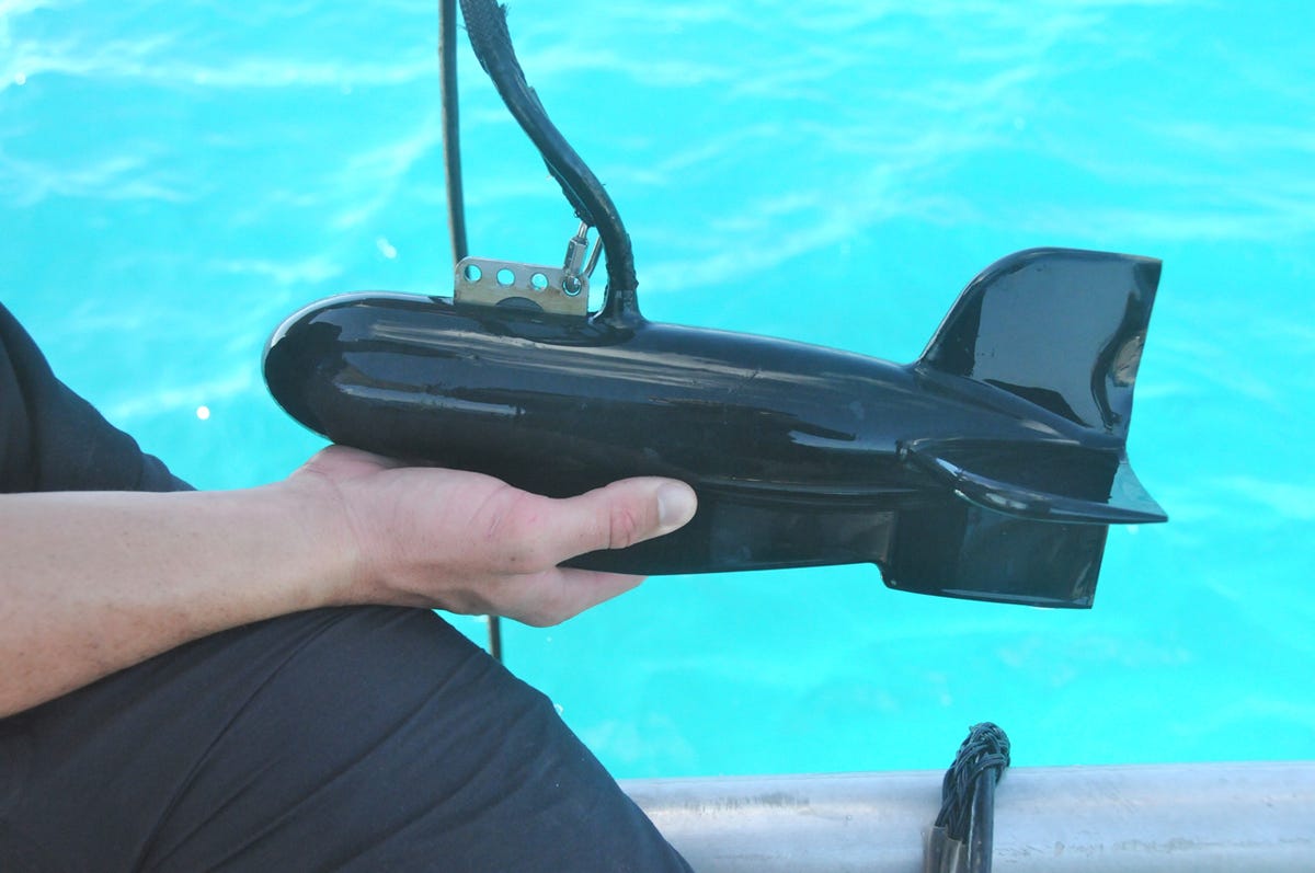
Delaware Remus
The Remus operated by the University of Delaware is black, unlike the bright yellow of the Scripps Remus.
ACDP
This is an acoustic Doppler current profiler, a device used by oceanographers to measure how currents are shifting in the Palauan islands. That's important, Scripps' Terrill said, because ocean behavior in the Western and South Pacific are is a "canary in a coalmine" for ocean behavior elsewhere. Sea level rise has been three times higher in the area than in the West Coast of the United States.
Diving the ADCP
In order to get meaningful data on changes in currents, the ADCP must be placed in the ocean and left there for some time. As a result, Scripps anchored this one on a sea mount near Peleliu. Here, Terrill holds on to the device as he dives into the ocean.
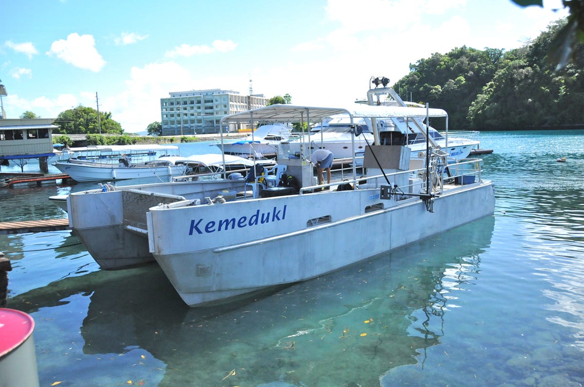
Kemedukl
The Kemedukl is a 40-foot catamaran used by the science teams from Scripps and Delaware and the BentProp Project to seaarch for missing airplanes and the aviators who went down with them. The boat is owned by Dr. Pat Colin of the Coral Reef Research Foundation.
The flag ceremonies held for the Hellcat and Avenger were performed on the boat.
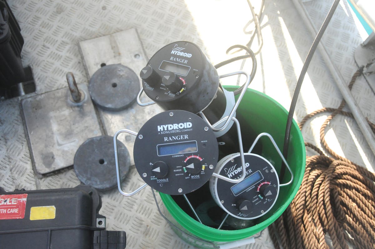
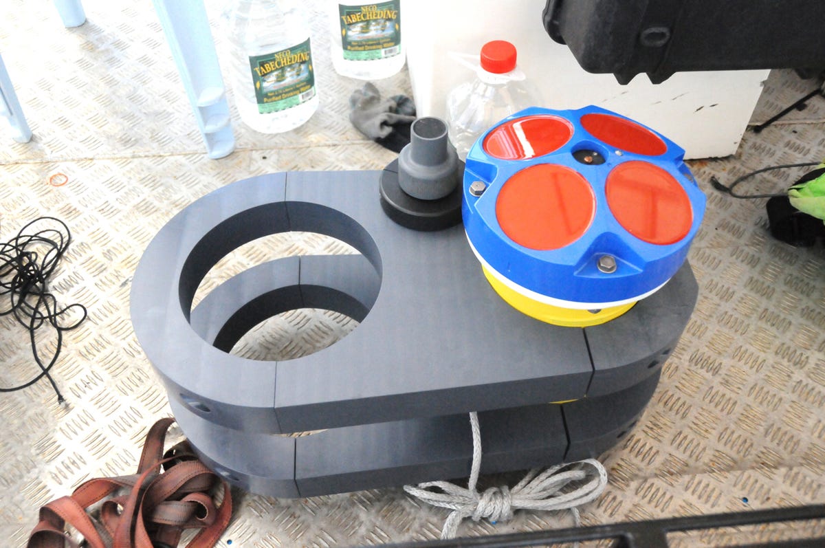
Rangers
These three devices, known as Rangers, give the scientists a way keep track of Remus while they are out at sea. The devices show how far away the vehicles are, as well as other data.
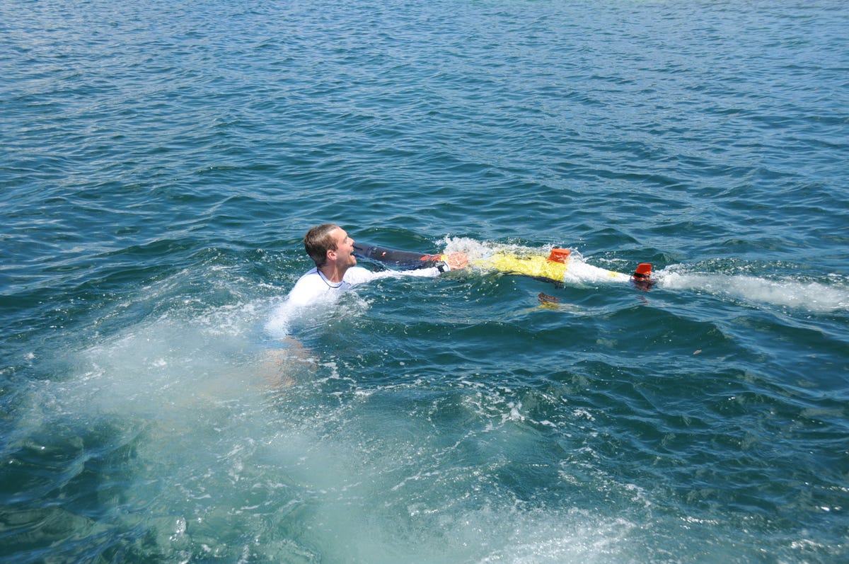
Andy pushing the Remus down
Sometimes the Remus needs a bit of cajoling to do what they're supposed to. During one mission, the vehicle was having trouble submerging. As a result, Scripps development engineer Andy Nager jumped into the water and physically pushed it underwater.
Megan gives Remus a push
At another point, Megan Cimino, a University of Delaware Ph.D. student, checked out the Remus as it floated alongside.
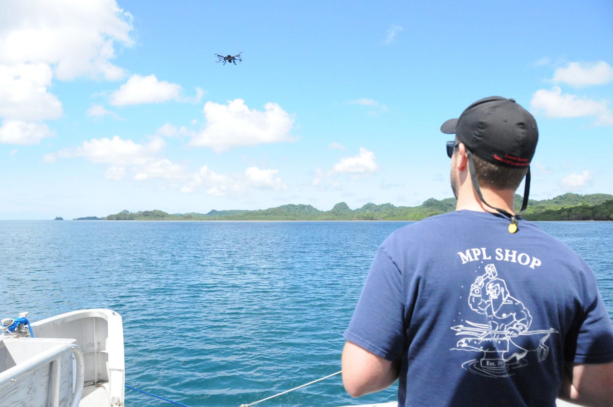
Evan flying a drone
Scripps development engineer Evan Walsh pilots a 3D Robotics aerial drone off the back of the Kemedukl. He was flying the device over the Aimeliik jungles in order to try to get aerial imagery of the area where the Avenger's wing was originally found in 2005.
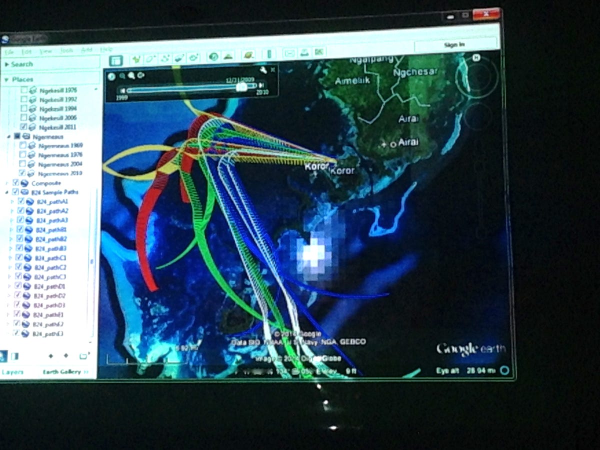
Probable flight paths
In order to try to determine where a B-24 bomber may have crashed, Scripps scientists came up with probability models based on a number of factors including wind direction, that show where the plane may have gone down. Each colored path represents a different scenario.
Towfish
This device, known a a Towfish, is placed in the water and connected by cable to computer used by the scientists on board the boats. The towfish communicates wirelessly with transponders placed in the water that in turn communicate with the Remus in order to triangulate its location.
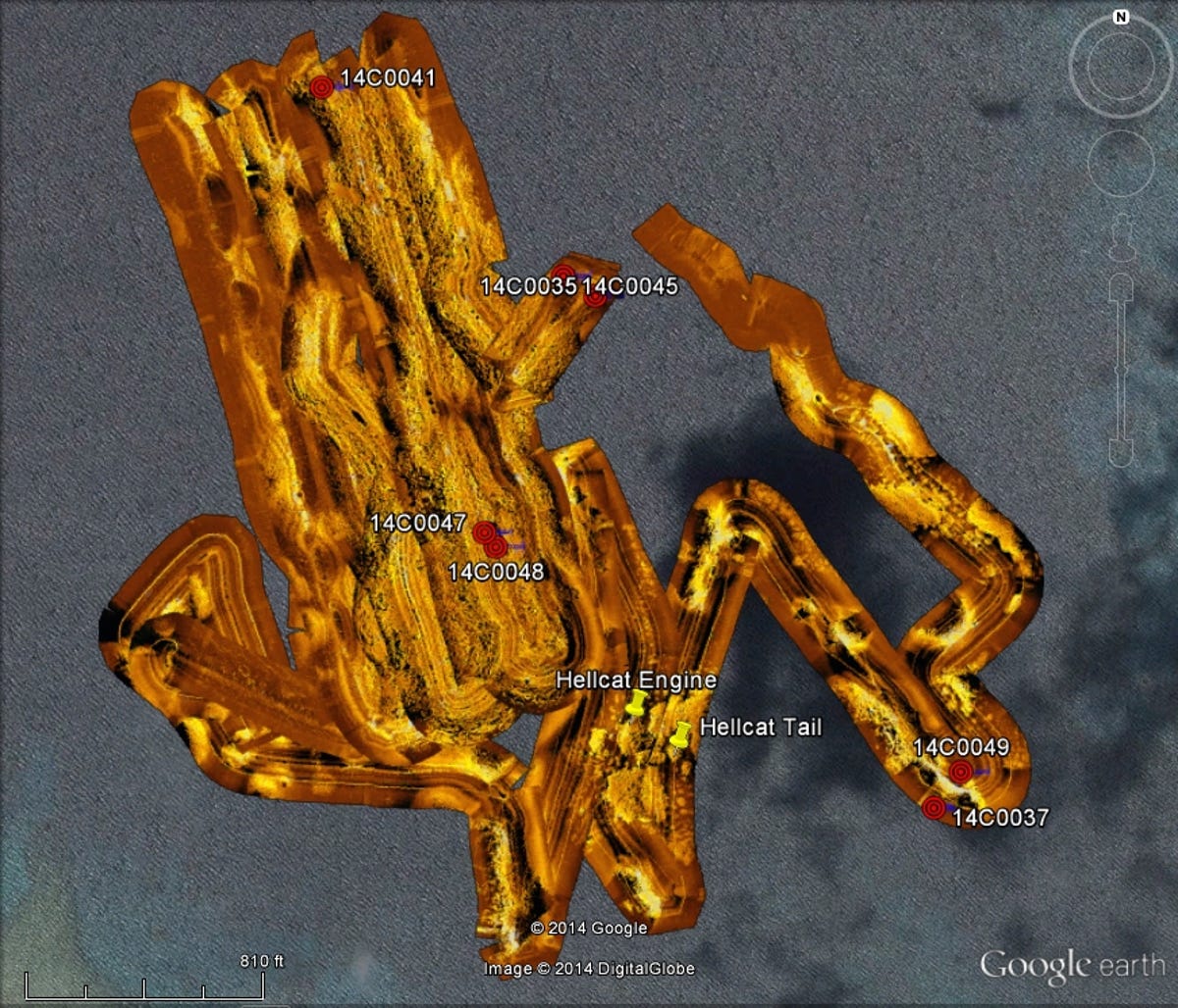
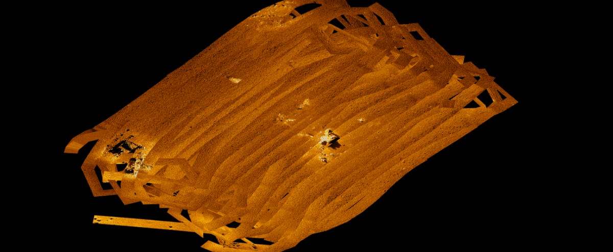
Side scan survey area
This odd-shaped image shows the area surveyed by a Remus.
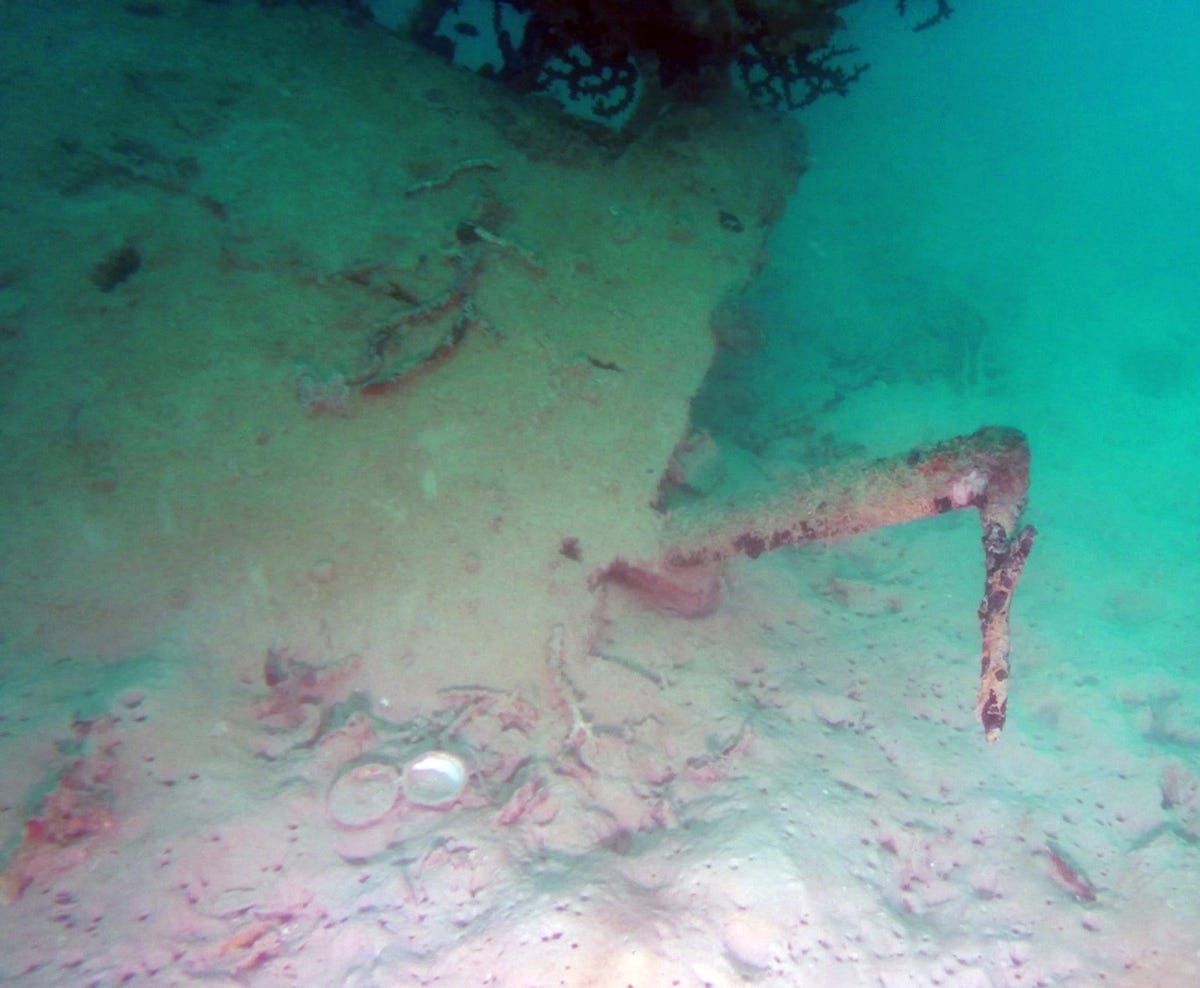
Avenger pitot tube
The Avenger's pitot tube, which is used to measure air speed, is located on the plane's wing. This particular pitot tube is unique and helped divers identify the plane as an Avenger.
More Galleries

My Favorite Shots From the Galaxy S24 Ultra's Camera
20 Photos
Honor's Magic V2 Foldable Is Lighter Than Samsung's Galaxy S24 Ultra
10 Photos
The Samsung Galaxy S24 and S24 Plus Looks Sweet in Aluminum
23 Photos
Samsung's Galaxy S24 Ultra Now Has a Titanium Design
23 Photos
I Took 600+ Photos With the iPhone 15 Pro and Pro Max. Look at My Favorites
34 Photos
