Earth's recent changes, from space (pictures)
Satellite Landsat 8 has been surveying Earth for over a year now, providing an interesting take on our planet's shifts.


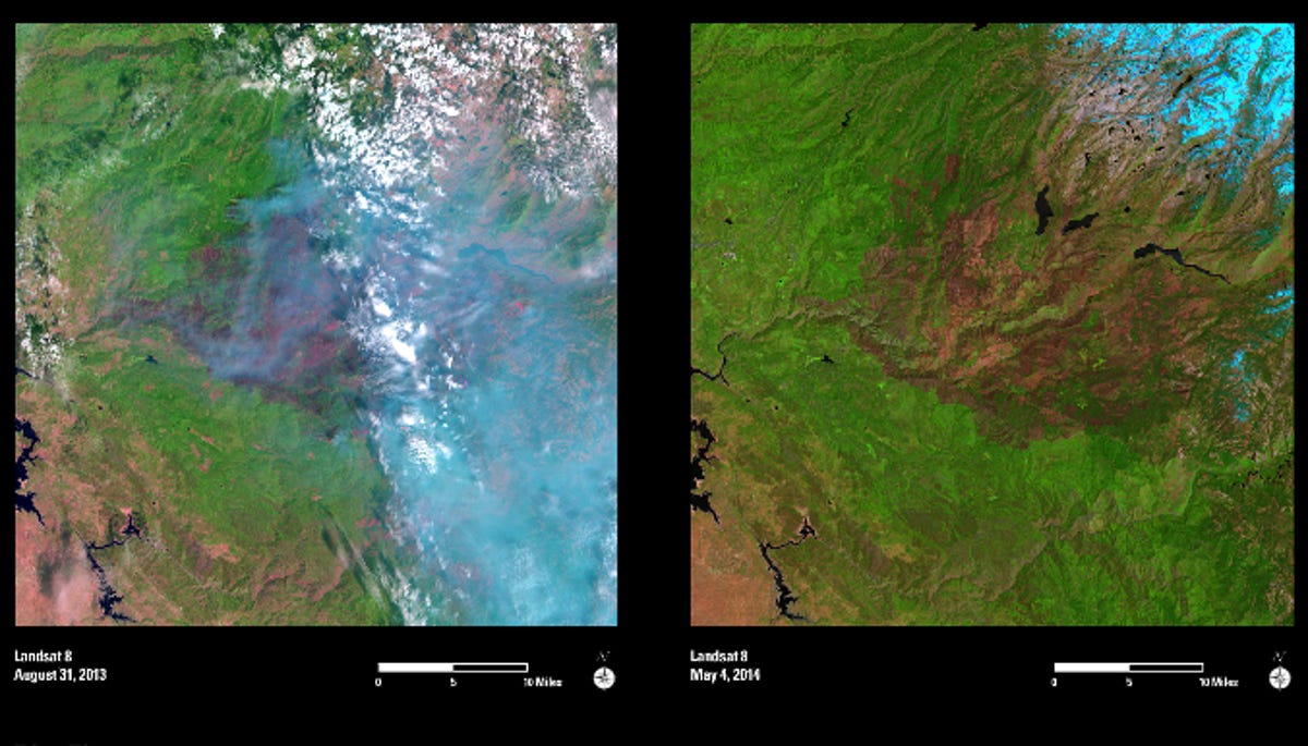
Yosemite fire
Landsat 8 has been in orbit for a little over a year, sending back pictures of Earth from myriad perspectives. The satellite is the latest and most advanced bird in the storied flock of Landsat observers going back four decades.
Above on the left is an image of the August 2013 wildfire that burned over 200,000 acres near Yosemite National Park, as seen from Landsat 8. On the right, a photo from May 2014 shows the forest already beginning to recover.
See related article: Check out this Earth yearbook, as seen from space
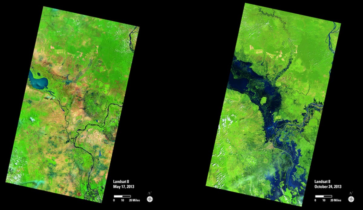
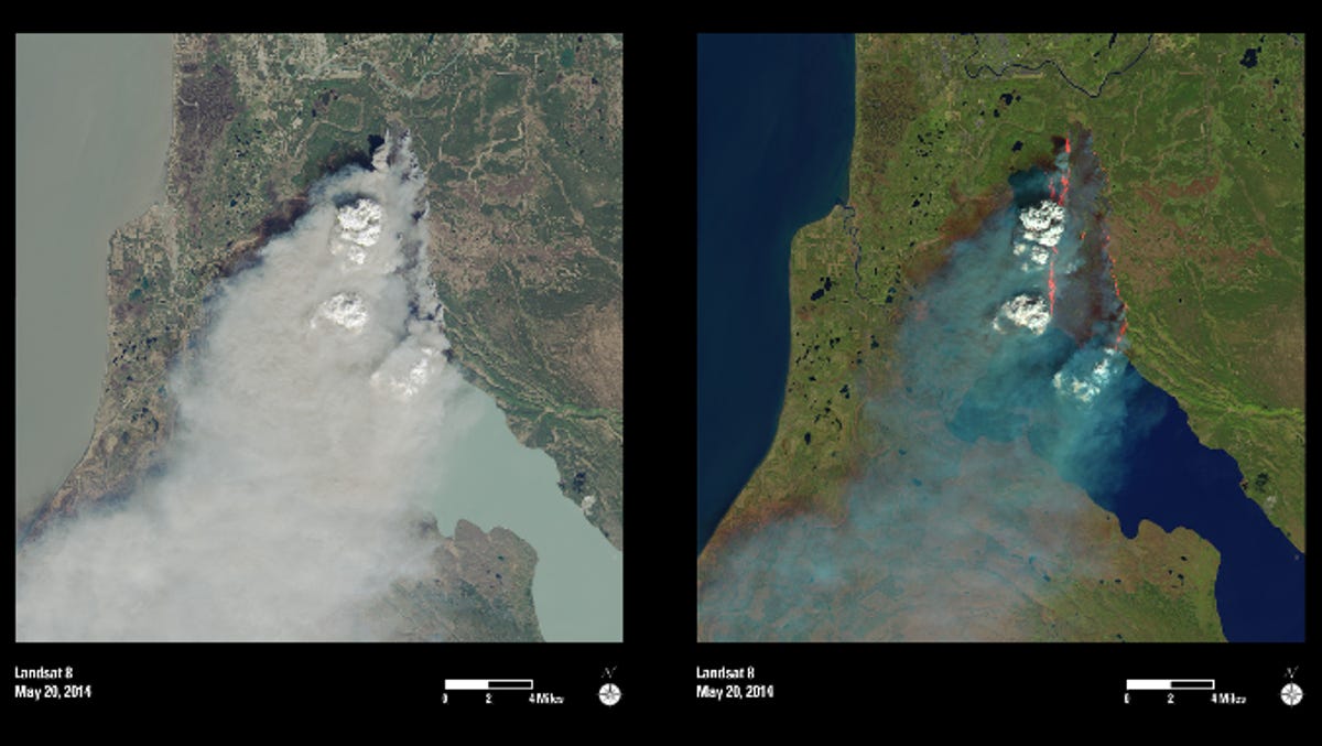
Cambodia flooding
The Landsat "after" image on the right shows the severely swollen Mekong and Tonle Sap rivers in Cambodia following heavy rains and a typhoon in October 2013. The capital city Phnom Penh can be seen just below the center of the images.
See related article: Check out this Earth yearbook, as seen from space
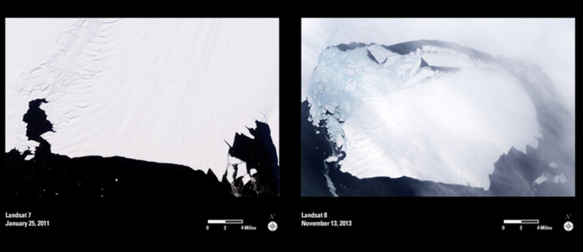
Antarctica's Pine Island Glacier
You may have heard the news that much of Antarctica's glacial mass is slowly slipping into the ocean. Here's what that looks like. Pine Island Glacier is shown here separating from the rest of the continental ice shelf.
See related article: Check out this Earth yearbook, as seen from space
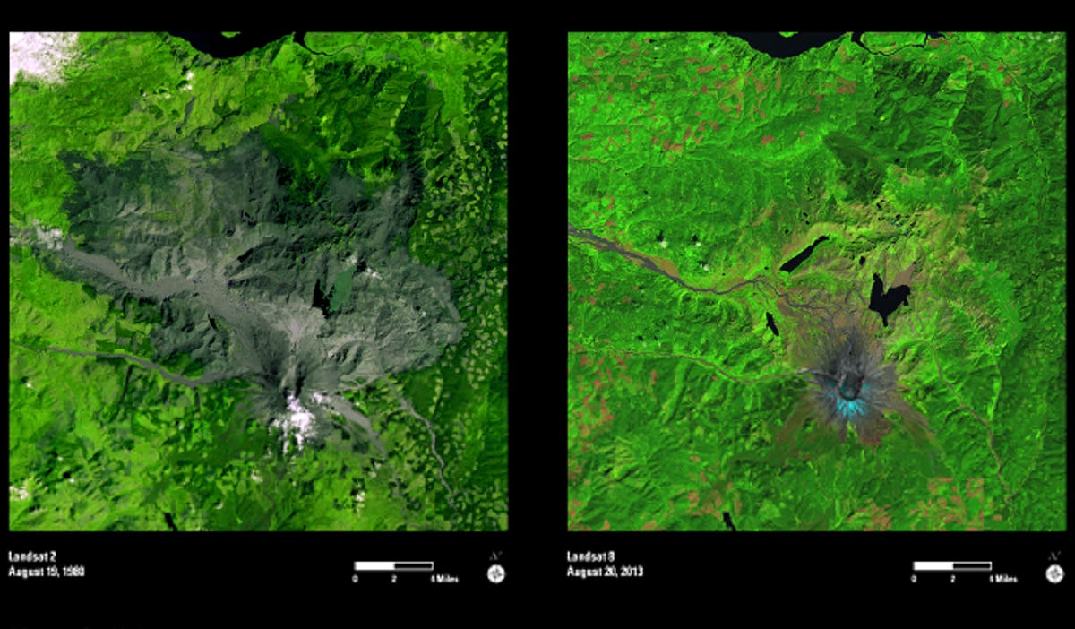
Mount St. Helens
It's been a long road back for the area around Mount St. Helens since it erupted over three decades ago, but as the recent Landsat image on the right shows, life has returned in force to the volcano's neighborhood.
See related article: Check out this Earth yearbook, as seen from space
Funny River fire, Alaska
Showing off the latest tech, Landsat 8 is able to see through the smoke of wildfires, like this one in south central Alaska, using infrared sensors. The image on the left shows natural color similar to a photograph. The same image on the right has gone through infrared processing.
See related article: Check out this Earth yearbook, as seen from space
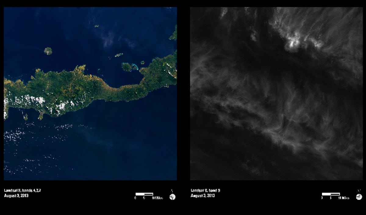
Cloudless sky
Among Landsat's latest tools is a specialized kind of X-ray vision. Using a new sensor that includes a cirrus band, high altitude clouds are removed from the image. These images were taken of the same area of Indonesia, but the clouds in the image on the right were removed to produce the clearer view on the left.
See related article: Check out this Earth yearbook, as seen from space
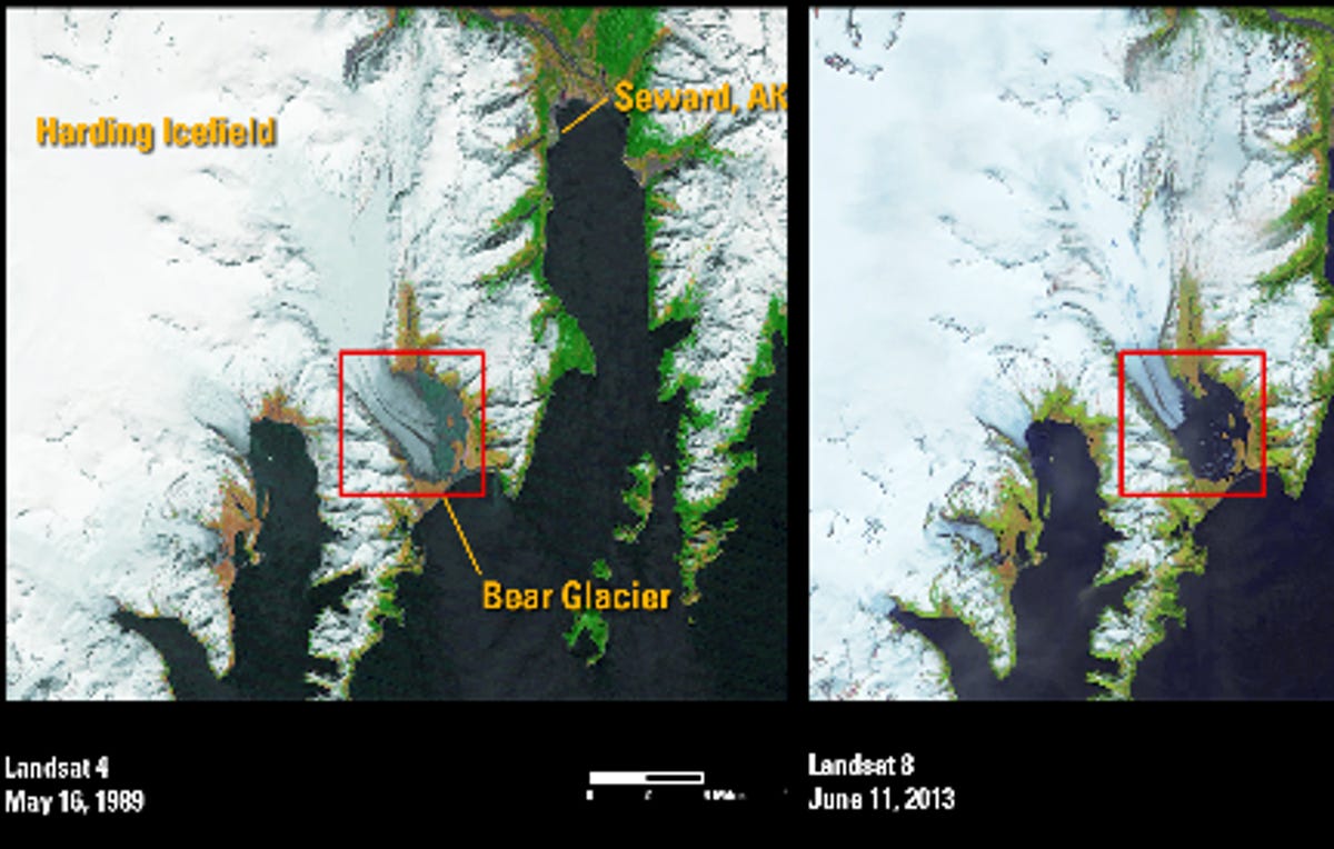
Bear Glacier
Alaska's Bear Glacier is shown receding dramatically over the past few decades in this series of Landsat photos. For a little perspective, the Harding Ice Field that covers much of the left half of each photo spans over 700 square miles.
See related article: Check out this Earth yearbook, as seen from space
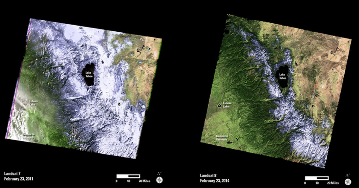
Snowless Sierras
Snowpack in the Sierra Nevada mountains of California is at historic lows this year, as the photo on the right -- taken three years to the day after the one on the left -- demonstrates. Landsat keeps a close eye on all kind of environmental factors to help us see what might be coming. In the case of the western United States this summer, these photos show it could be a tough wildfire season, among other impacts.
See related article: Check out this Earth yearbook, as seen from space
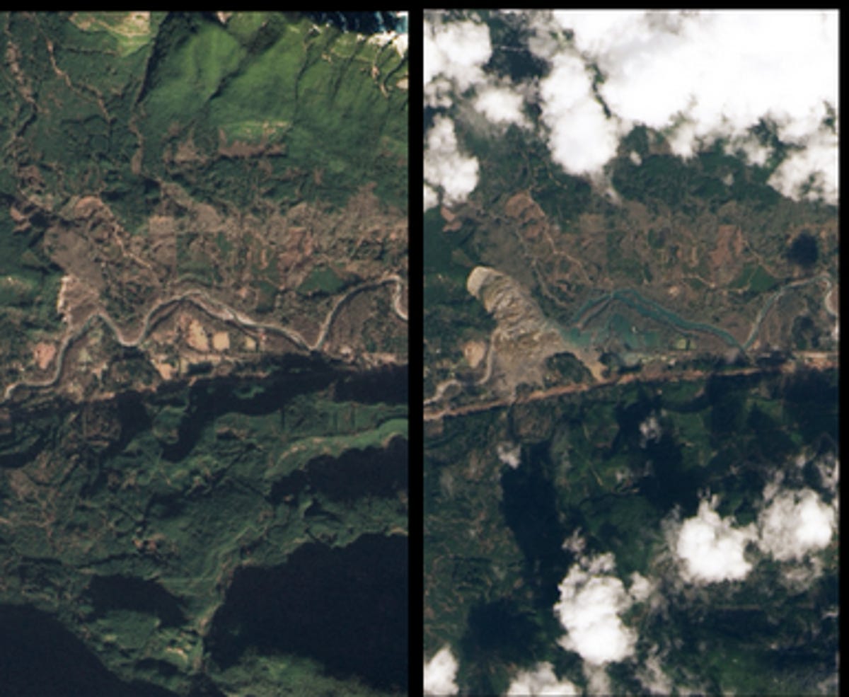
Washington landslide
Landsat 8 snapped these photos of Oso, Wash., in January (on the left) and in late March (on the right), following a landslide that formed an earthen dam blocking the Stillaguamish River and creating a barrier lake.
See related article: Check out this Earth yearbook, as seen from space
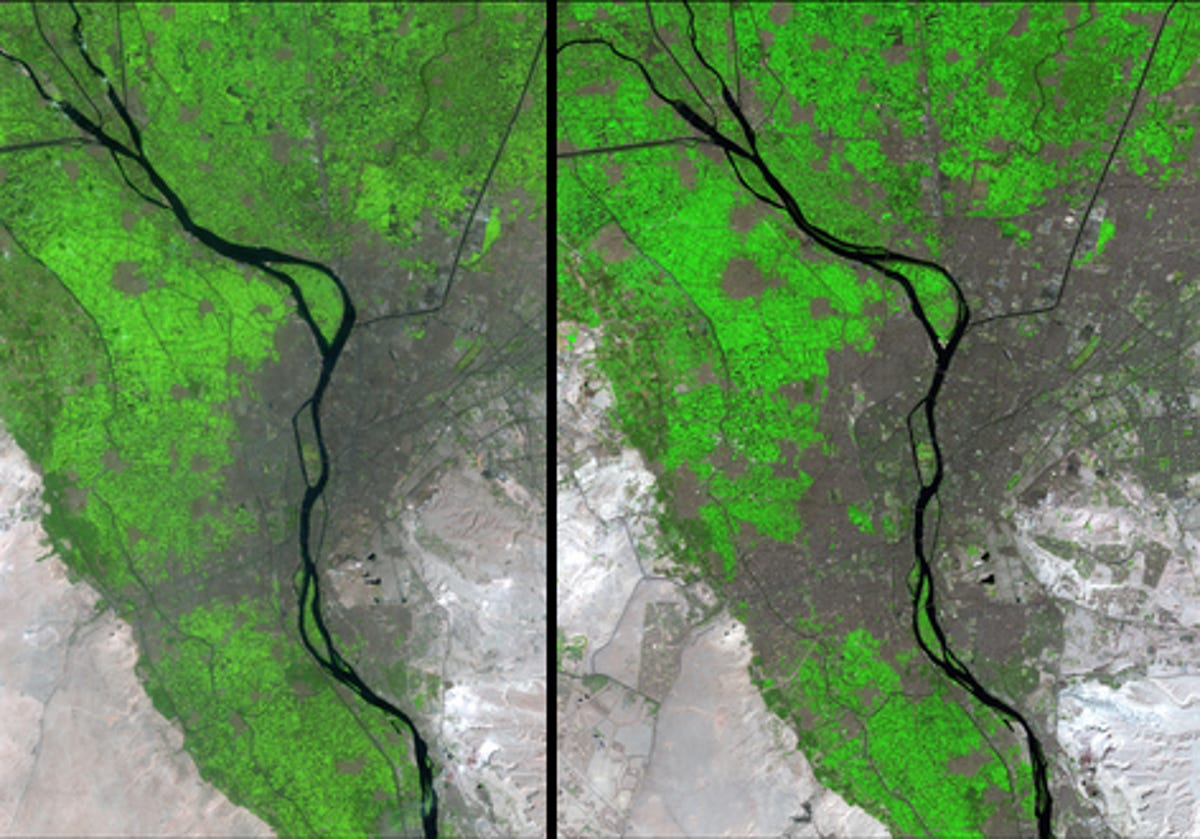
Cairo
Check out the other Arab Spring -- the dramatic growth of Cairo's metropolis over the past three decades. This before-and-after shot shows the diversion of water from the Nile to irrigate areas on the edges of the city.
See related article: Check out this Earth yearbook, as seen from space
More Galleries

My Favorite Shots From the Galaxy S24 Ultra's Camera
20 Photos
Honor's Magic V2 Foldable Is Lighter Than Samsung's Galaxy S24 Ultra
10 Photos
The Samsung Galaxy S24 and S24 Plus Looks Sweet in Aluminum
23 Photos
Samsung's Galaxy S24 Ultra Now Has a Titanium Design
23 Photos
I Took 600+ Photos With the iPhone 15 Pro and Pro Max. Look at My Favorites
34 Photos
