Riding along with Nokia Maps and the True mapping car (pictures)
We go hands on with the newest version of Nokia Maps on the Lumia 822 and get a look at where the map data that powers it comes from.
Antuan Goodwin
Antuan Goodwin gained his automotive knowledge the old fashioned way, by turning wrenches in a driveway and picking up speeding tickets. From drivetrain tech and electrification to car audio installs and cabin tech, if it's on wheels, Antuan is knowledgeable.
We got an opportunity to play with the newest version of Nokia Maps (version 3.0) on the upcoming Nokia Lumia 822 on Verizon's network.
2 of 19 Antuan Goodwin/CNET
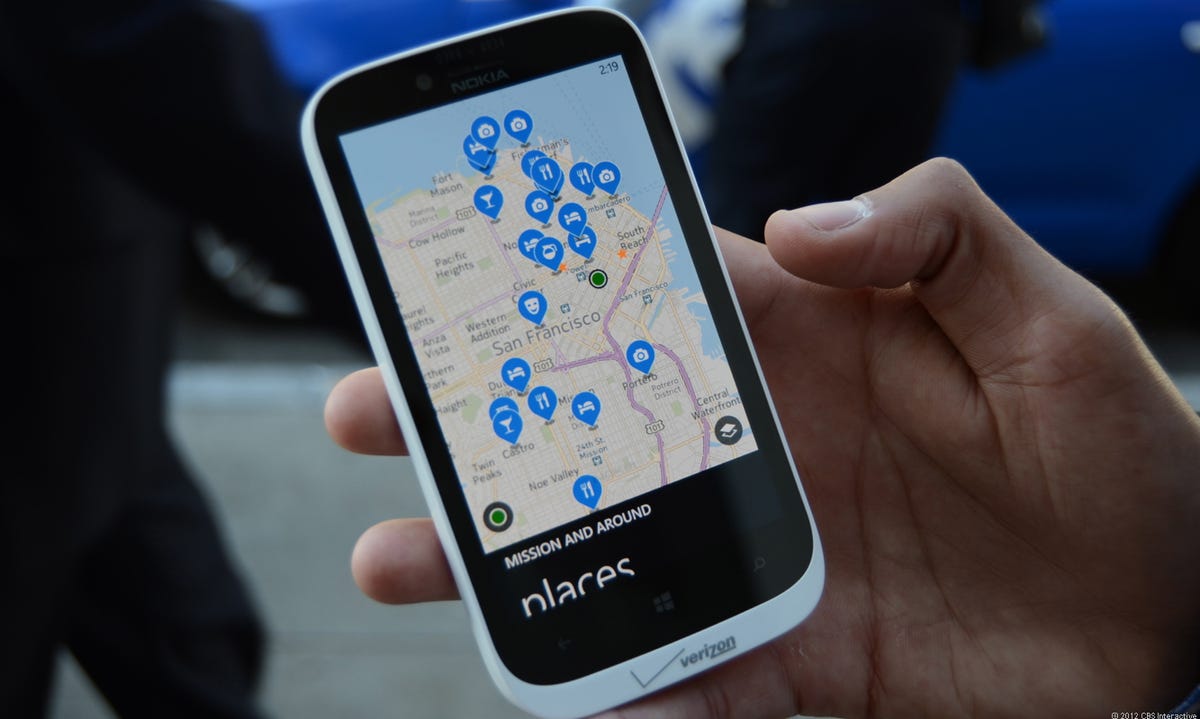
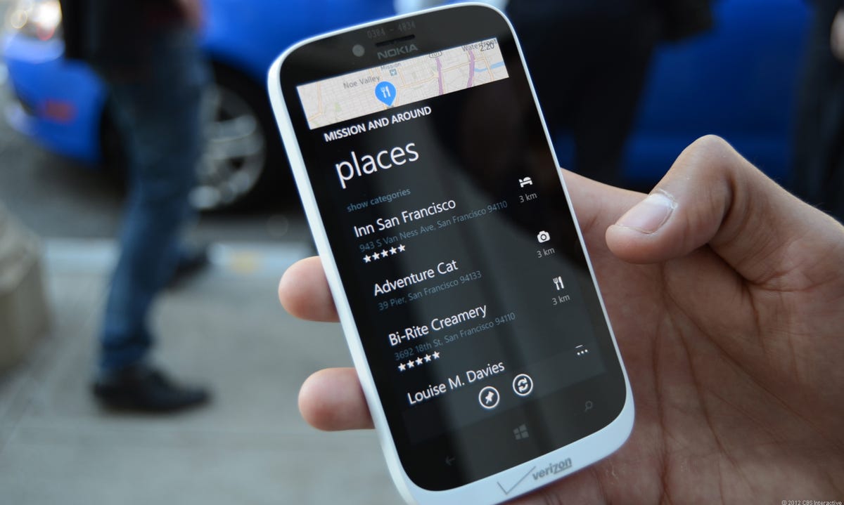
Popular destinations
With the touch of a button, we were able to search for popular locations in any of San Francisco's neighborhoods. This being a Windows Phone 8 app, any of these destinations or searches could be pinned to the home screen as a Live Tile.
3 of 19 Antuan Goodwin/CNET
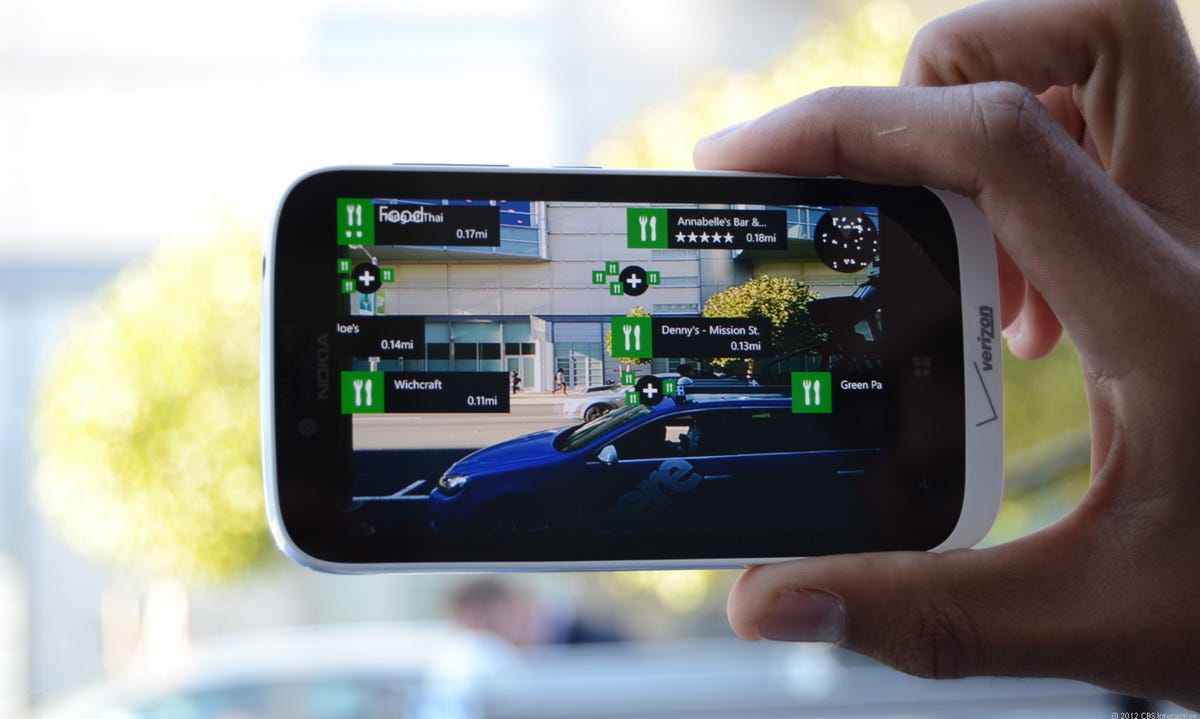
Live Sight
A feature called Live Sight transforms the phone into an augmented-reality viewport, displaying nearby points of interest as floating icons with distances on the camera's display.
4 of 19 Antuan Goodwin/CNET
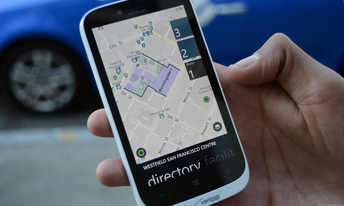
Indoor maps
The newest version of Nokia Maps also features indoor maps for places like this mall in downtown San Francisco. You can even view multiple floors after zooming in.
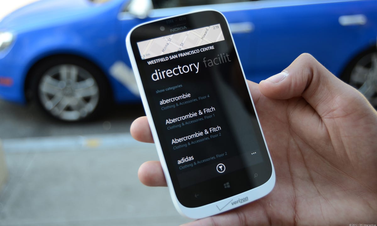
5 of 19 Antuan Goodwin/CNET
Indoor maps
By pulling up a menu from below the indoor map, we were able to view a directory of shops in the mall.
6 of 19 Antuan Goodwin/CNET
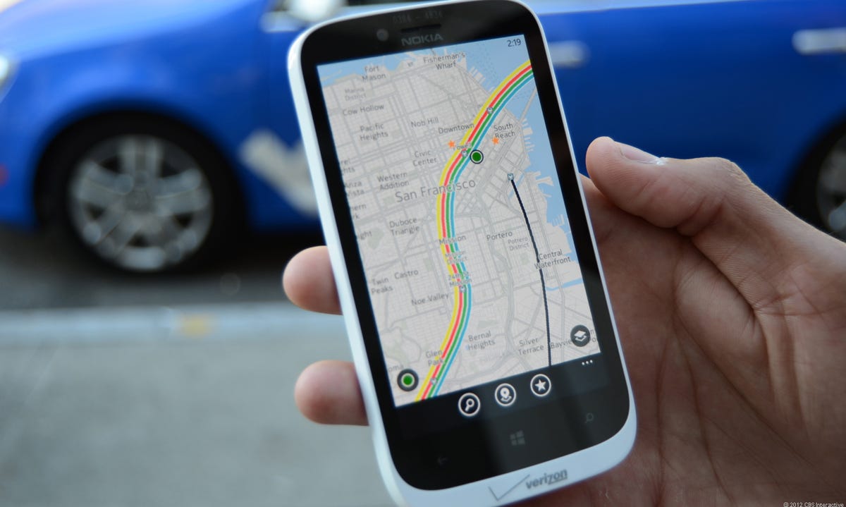
Public transportation
For those city dwellers who prefer to use their feet to get where they're going, Nokia Maps also features a public transportation overlay and walking directions.
7 of 19 Antuan Goodwin/CNET
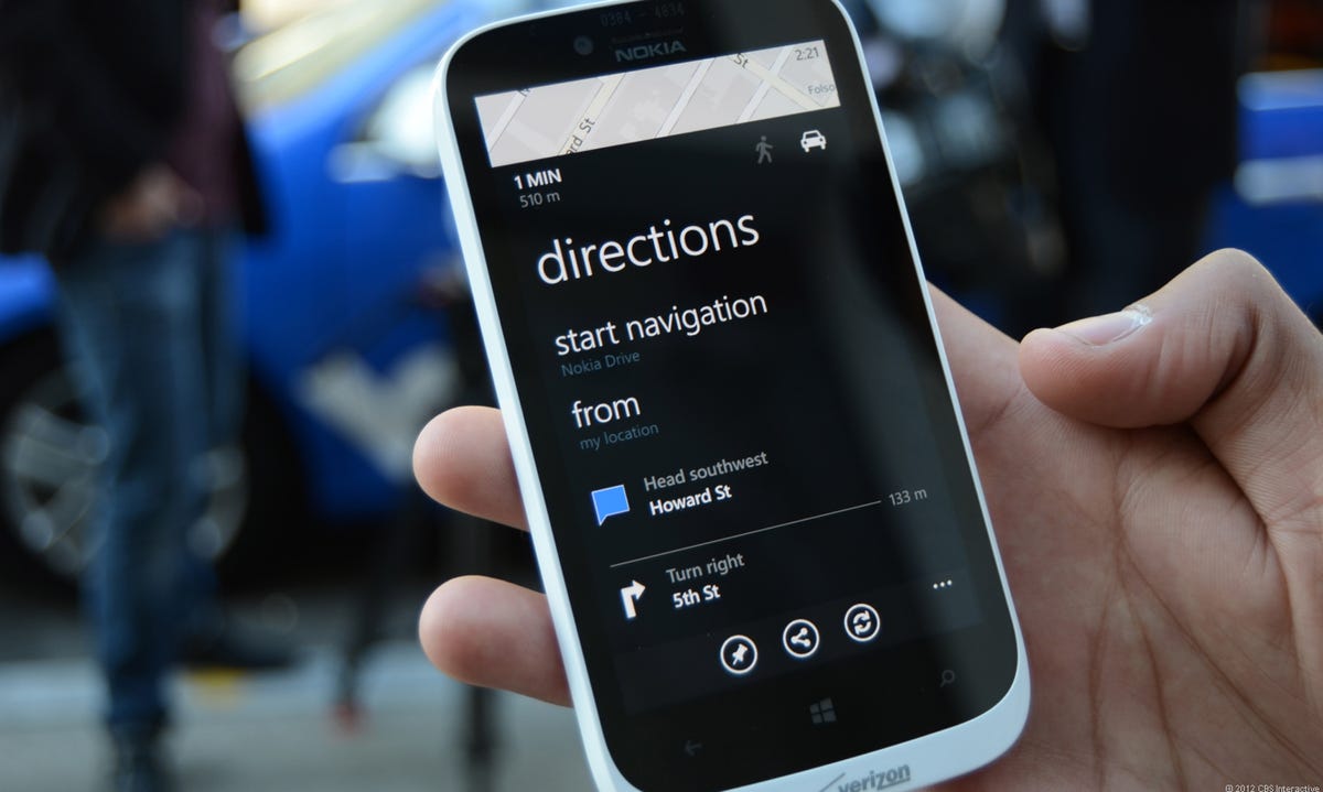
Navigation
Of course, Nokia Maps would be useless without turn-by-turn directions. This software can plan routes and give directions for driving or walking.
8 of 19 Antuan Goodwin/CNET
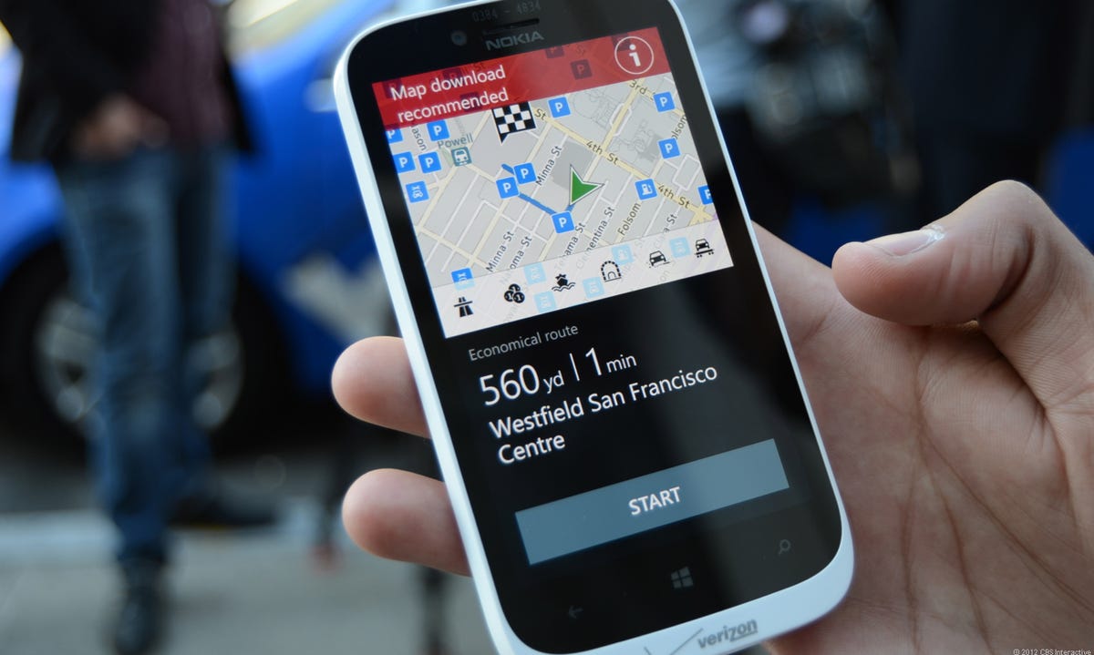
Offline maps
Before starting your trip, Nokia Maps gives a summary of the distance and estimated time of your trip. Look at the top of the screen and you'll see a red bar in this photo that is suggesting to us that we download the map data before embarking. That's right, Nokia offers offline map data.
9 of 19 Antuan Goodwin/CNET
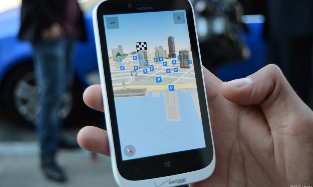
You can activate floating POI icons on the map for quick navigation -- we have parking lots and garages activated here. Major buildings and landmarks are also represented in Nokia Maps by these 3D models.
10 of 19 Antuan Goodwin/CNET
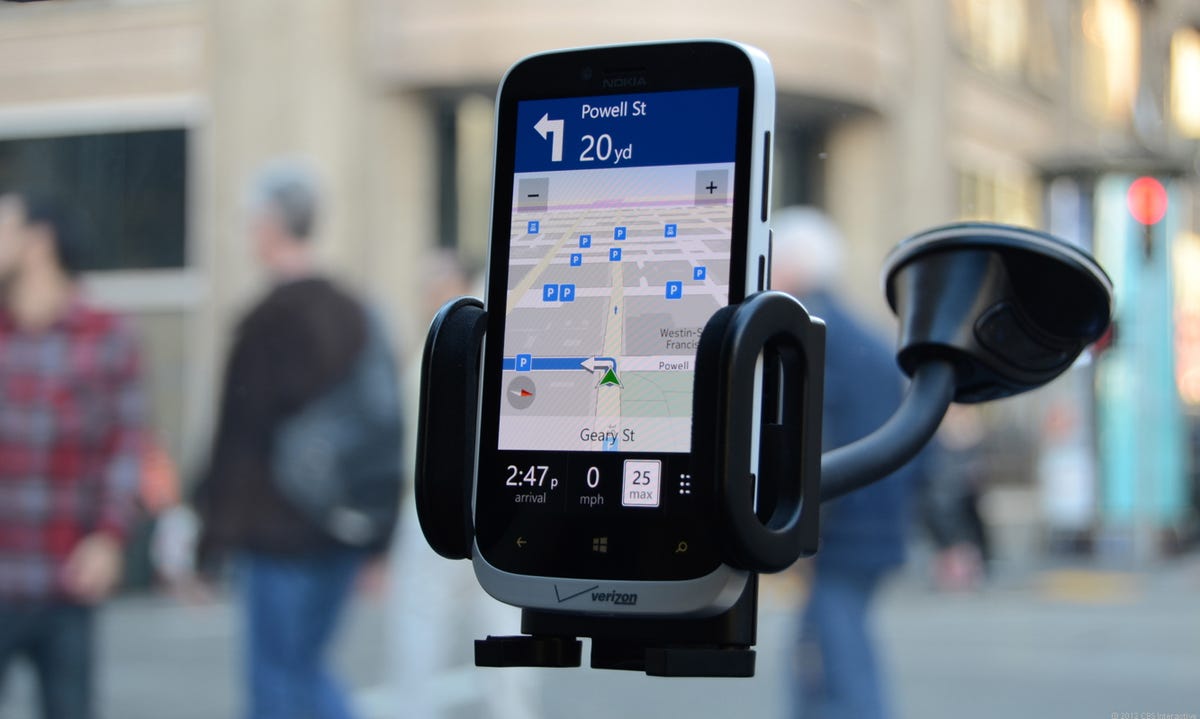
Nokia Lumia 822
Toss the Lumia 822 in a cradle on your vehicle's windshield or dashboard and follow its directions to your chosen destination. I was impressed by the 822's bright and crisp screen, which could be viewed clearly even in direct sunlight.
11 of 19 Antuan Goodwin/CNET
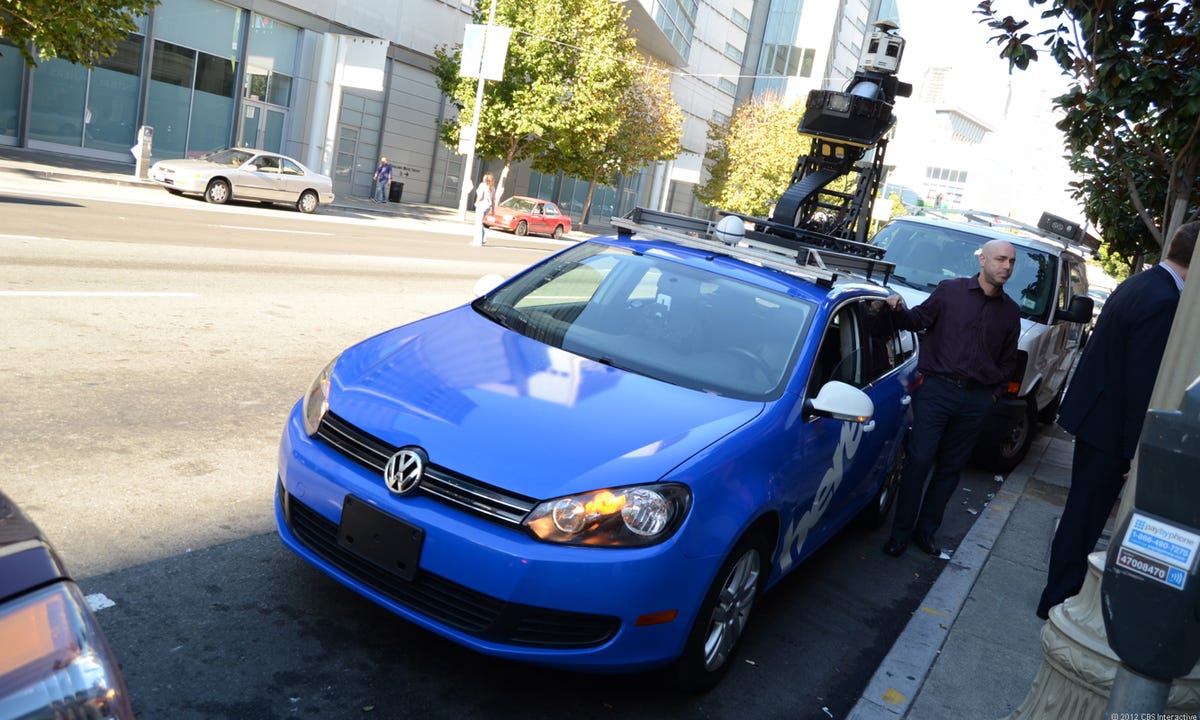
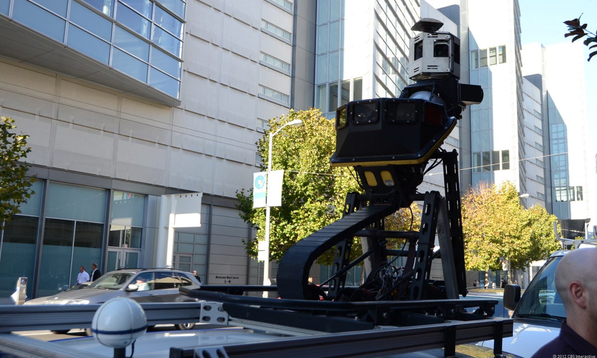
Nokia/Navteq True car
The second part of my tour of Nokia Maps involved a spin in this, the True car. This Volkswagen Jetta has been fitted with a camera and Lidar (Light Detection and Ranging) array that allows it to capture map data as it rolls down the road.
12 of 19 Antuan Goodwin/CNET
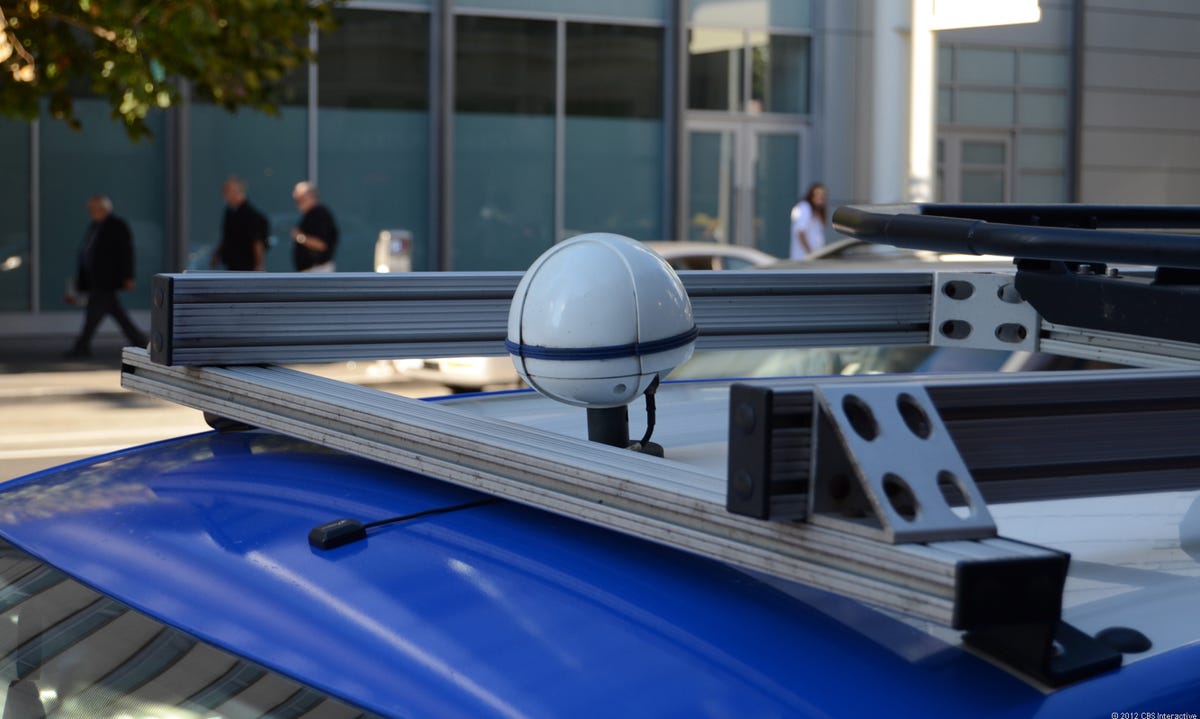
Differential GPS receiver
The first bit of the puzzle is this differential GPS receiver, which tracks the vehicle's location with much better precision than, say, your average Garmin Nuvi or smartphone A-GPS receiver.
13 of 19 Antuan Goodwin/CNET
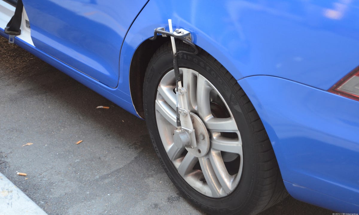
Wheel sensors
The differential GPS data is complemented with wheel sensors on either side of the vehicle. By measuring the wheel rotation speed and the 3D position of the vehicle using accelerometers, these sensors can tell how fast the car is going, assess the grade and bank of the road, and provide error correction for the GPS data.
14 of 19 Antuan Goodwin/CNET
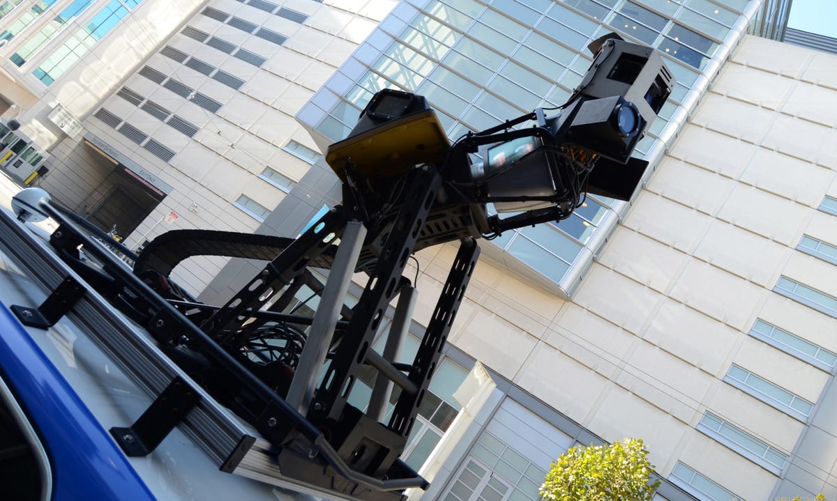
Camera and Lidar array
Mounted on a roof rack is the most obvious bit of data acquisition equipment, the camera and Lidar array. It's a complex bit of equipment, but it can be simplified to three major elements at work. At the bottom is an array of forward-facing high-resolution cameras that capture the data on street signs (for information such as turn restrictions and street names) and business signs. At the very top is the 360-degree camera array that captures data in the round for panoramic street view.
15 of 19 Antuan Goodwin/CNET
Lidar scanner
In between the two banks of cameras is the spinning Lidar array. Sixty-four lasers spin rapidly, scanning the buildings nearby, trees, the road, and even the road markings. More than 1.3 million data points are captured every minute as the True car rolls down the road. Unlike older street scanners, this car can capture at the posted speed limit. Nokia tells us that the company has been able to scan highways at up to 70 mph.
16 of 19 Antuan Goodwin/CNET
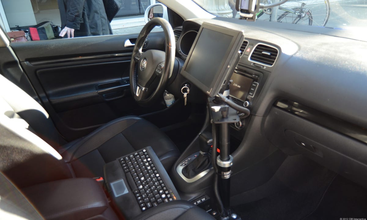
Driver's seat
Nokia and Navteq use a network of local drivers who scan every road in their city's territory and add their local knowledge of what roads are changing and need rescanning to the acquisition plan. A single driver can run each vehicle, following a drive plan displayed on the dashboard monitor.
17 of 19 Antuan Goodwin/CNET
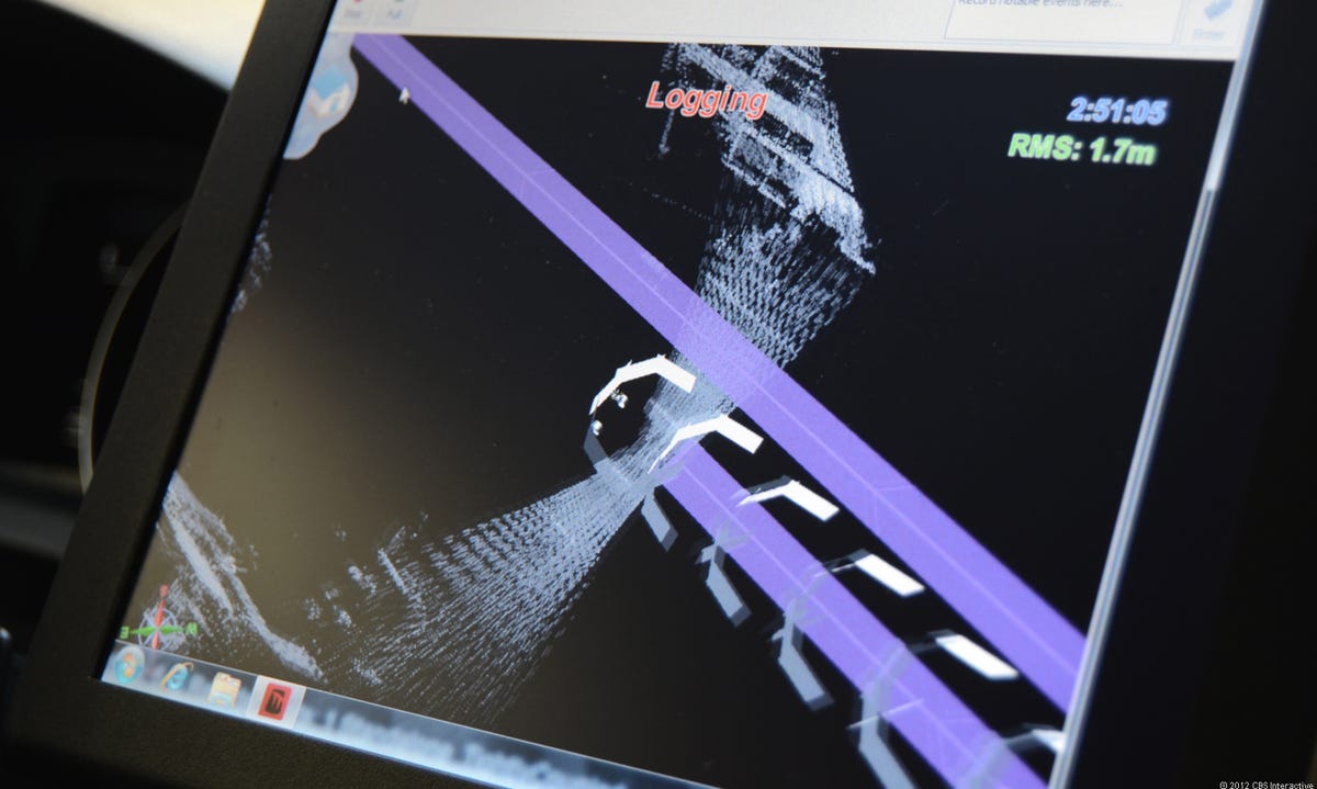
Scanning
For demonstration purposes, the standard routing screen of the True car was replaced with this visualization of what the Lidar array was scanning in real time. I was able to see the the road, the curb, nearby buildings and signs, and even the markings on the road separating the lanes and marking bike and fire lanes pass under the Lidar's eye.
18 of 19 Antuan Goodwin/CNET
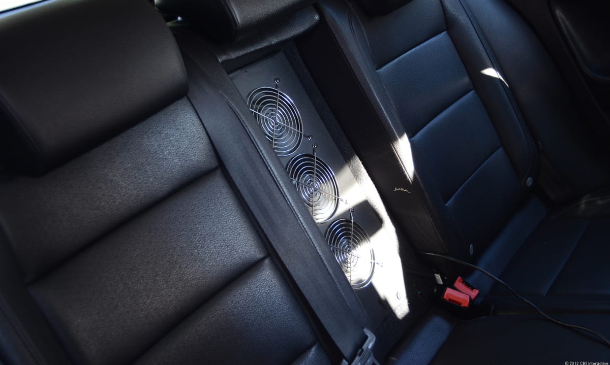
Cooling
When asked why a Volkswagen Jetta was chosen as the scanning platform, Nokia's representatives explained that the Jetta wagon's interior volume, accessory power system, and fuel economy make it an ideal True car.
19 of 19 Antuan Goodwin/CNET
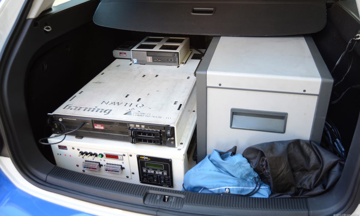
Processing and computing
Pop the wagon's hatch and you'll find the computers that process the millions of data points being captured every minute and over 10TB of onboard storage. This much machinery generates a lot of heat and requires space to breathe.