NASA releases incredible views of the Earth at night (pictures)
In stunning new images of Earth taken at night, the Suomi NPP satellite shows how the lights from our cities illuminate the "black marble."
James Martin
James Martin is the Managing Editor of Photography at CNET.
His photos capture technology's impact on society - from the widening wealth gap in San Francisco, to the European refugee crisis and Rwanda's efforts to improve health care.
From the technology pioneers of Google and Facebook, photographing Apple's Steve Jobs and Tim Cook, Facebook's Mark Zuckerberg and Google's Sundar Pichai, to the most groundbreaking launches at Apple and NASA, his is a dream job for any documentary photography and journalist with a love for technology.
Exhibited widely, syndicated and reprinted thousands of times over the years, James follows the people and places behind the technology changing our world, bringing their stories and ideas to life.
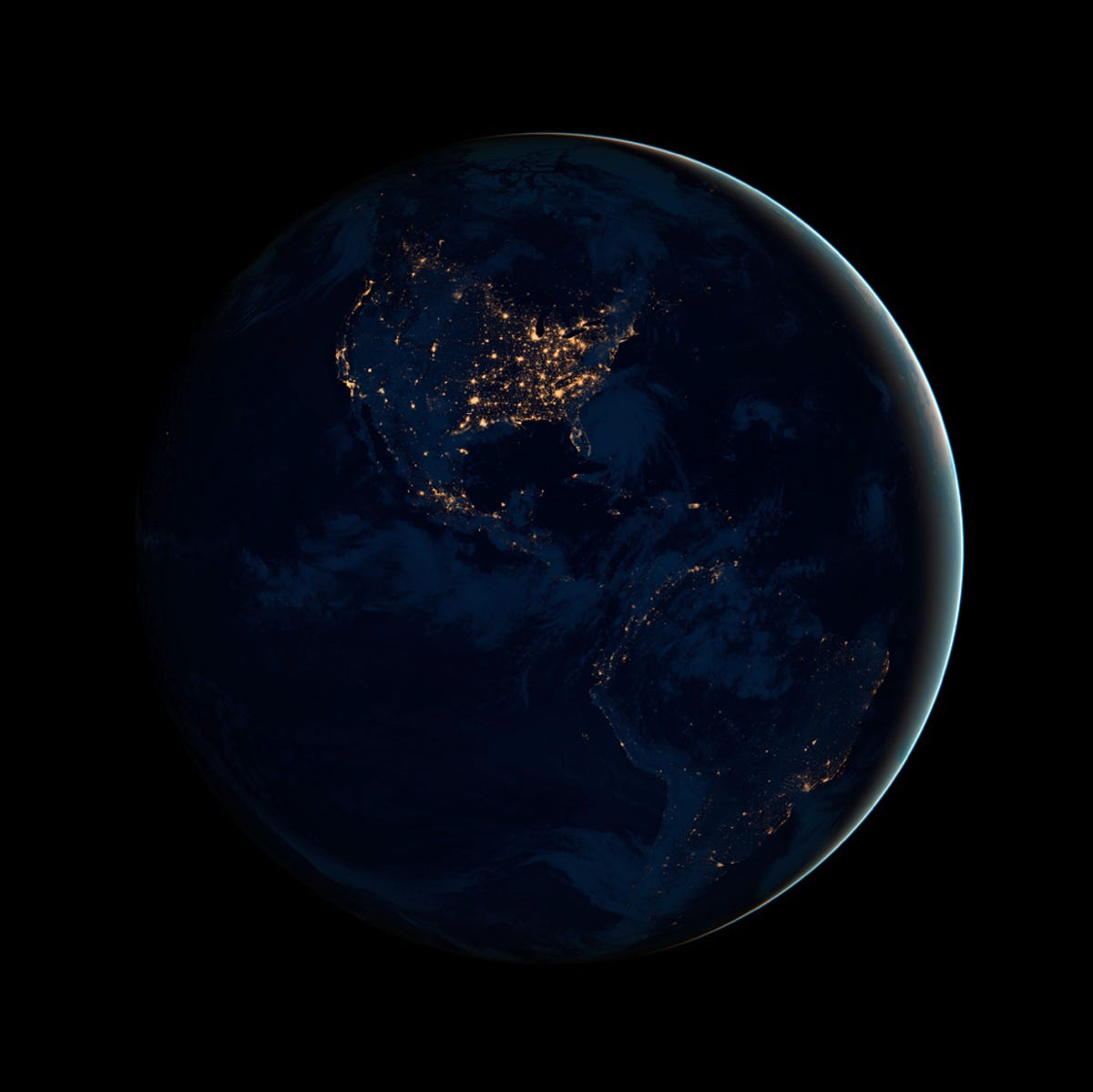
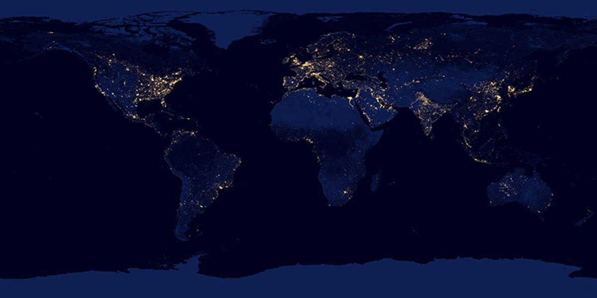
In stunning new images of Earth taken at night, the Suomi NPP satellite shows how the lights from our cities illuminate the black marble globe. The composite image, taken in April and October, was mapped over existing Blue Marble imagery of Earth to provide a realistic view of the planet.
The nighttime view was made possible by the new satellite's "day-night band" of the Visible Infrared Imaging Radiometer Suite. VIIRS detects light in a range of wavelengths from green to near-infrared and uses filtering techniques to observe dim signals such as city lights, gas flares, auroras, wildfires, and reflected moonlight.
2 of 9 NASA Earth Observatory
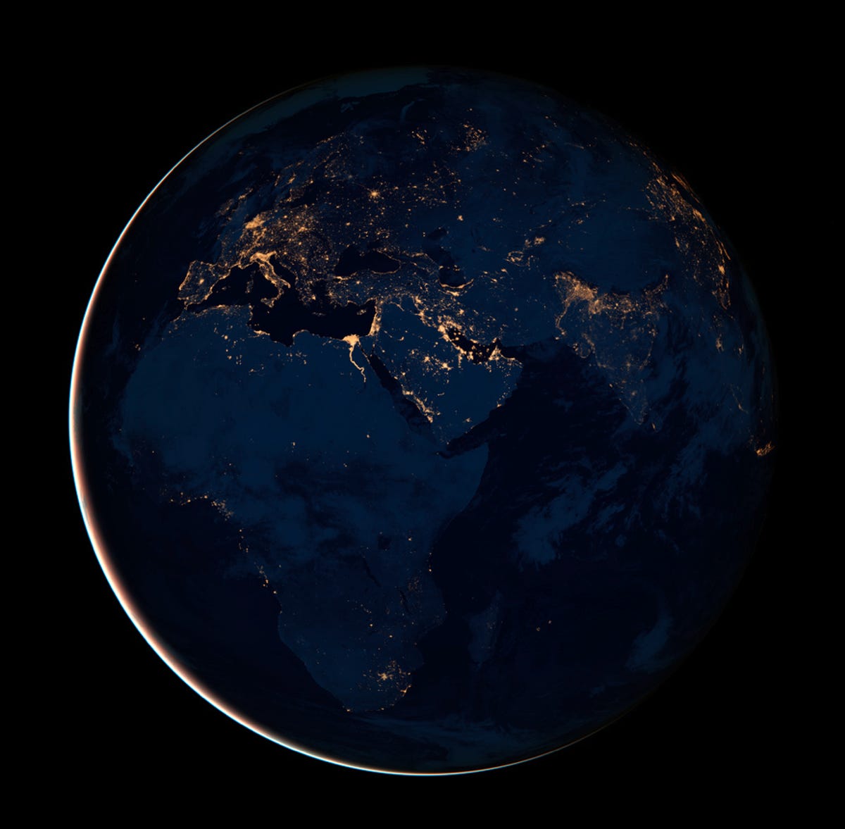
Africa, Europe, and the Middle East
Africa, Europe, and the Middle East are seen in this nighttime view of Earth which NASA is calling the "Black Marble."
3 of 9 NASA Earth Observatory
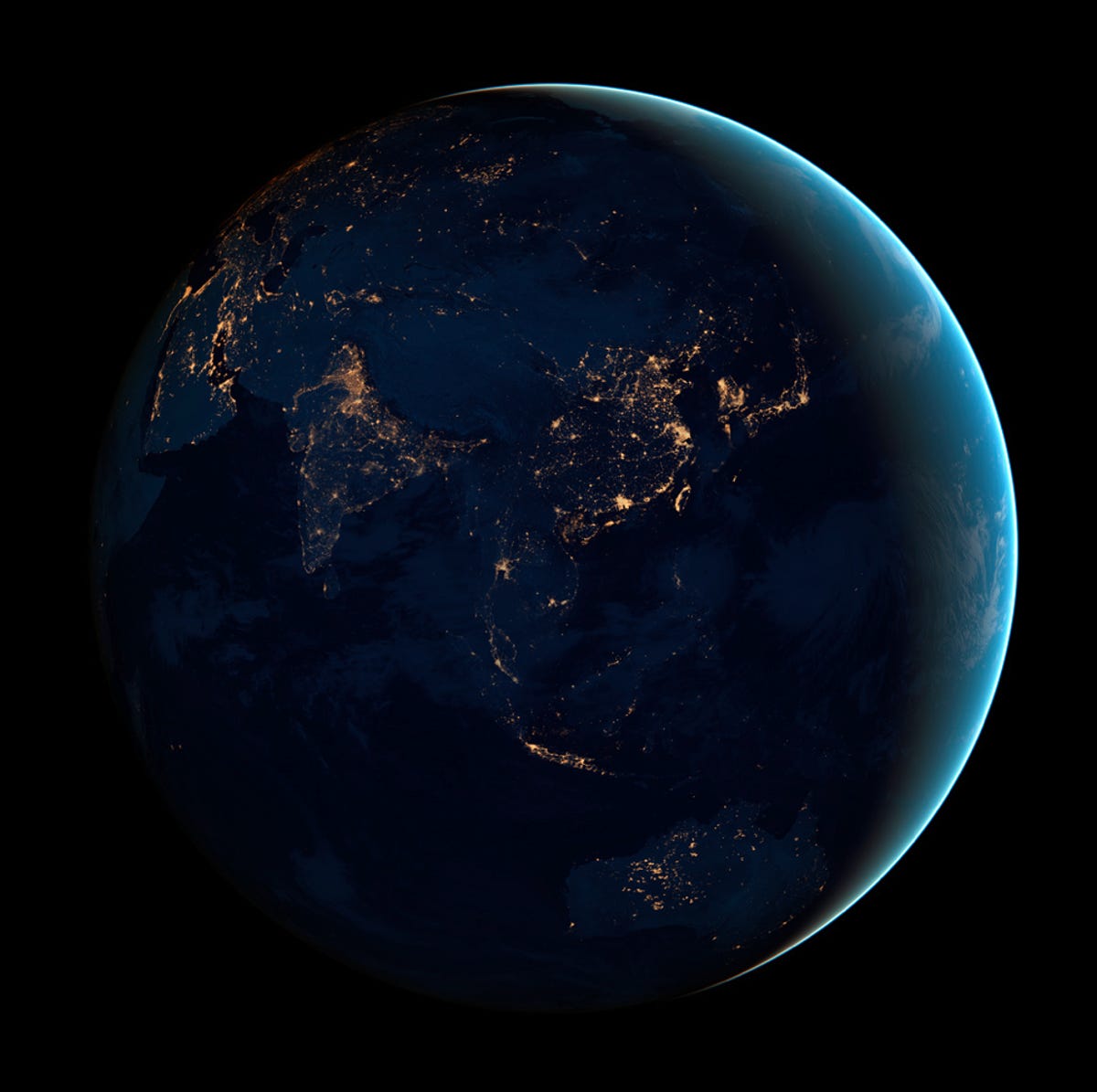
Asia and Australia
Asia and Australia are seen in this nighttime view of Earth which NASA is calling the "Black Marble."
4 of 9 NASA Earth Observatory
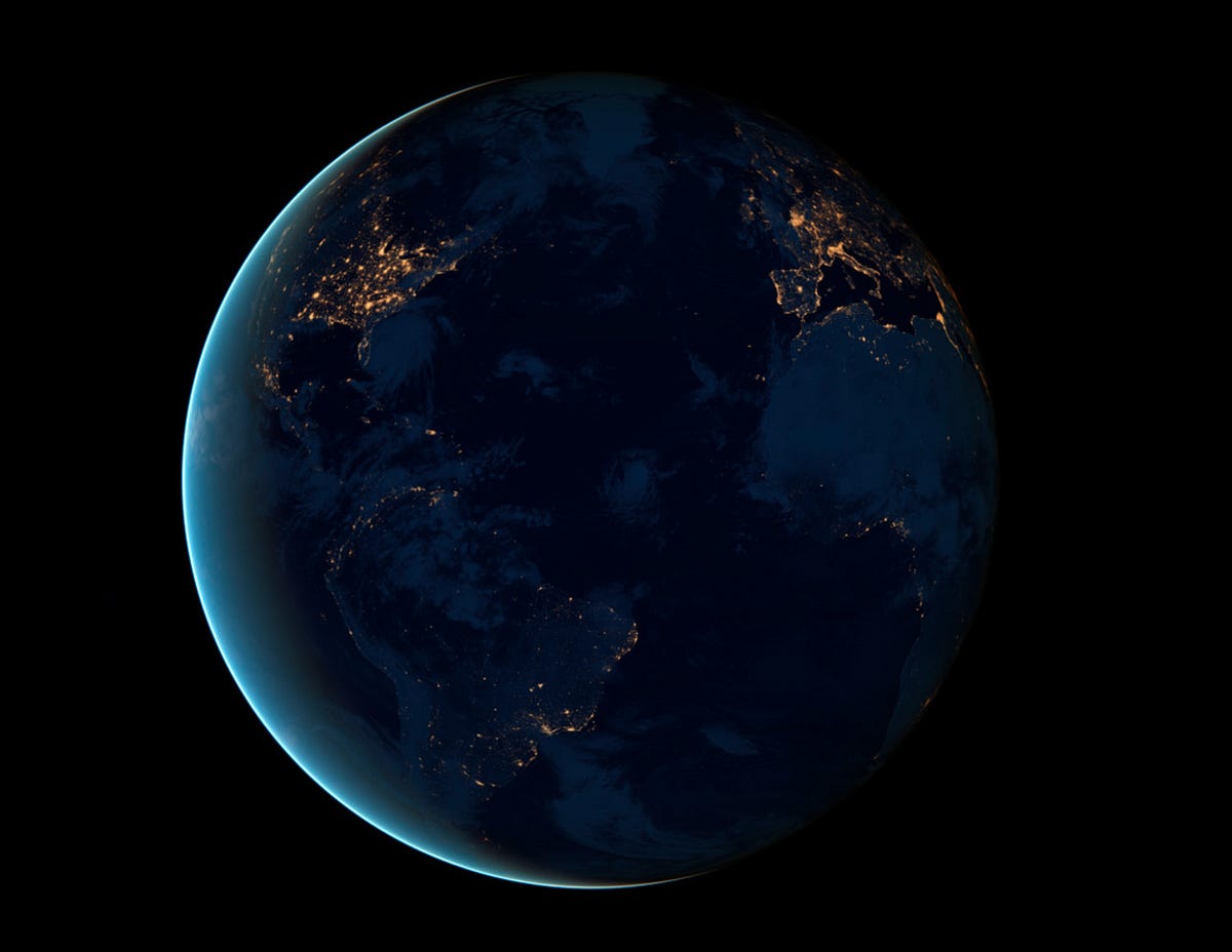
City lights
The night side of Earth twinkles with the light, and the first thing to stand out is the cities. "Nothing tells us more about the spread of humans across the Earth than city lights," asserts Chris Elvidge, an NOAA scientist who has studied them for 20 years.
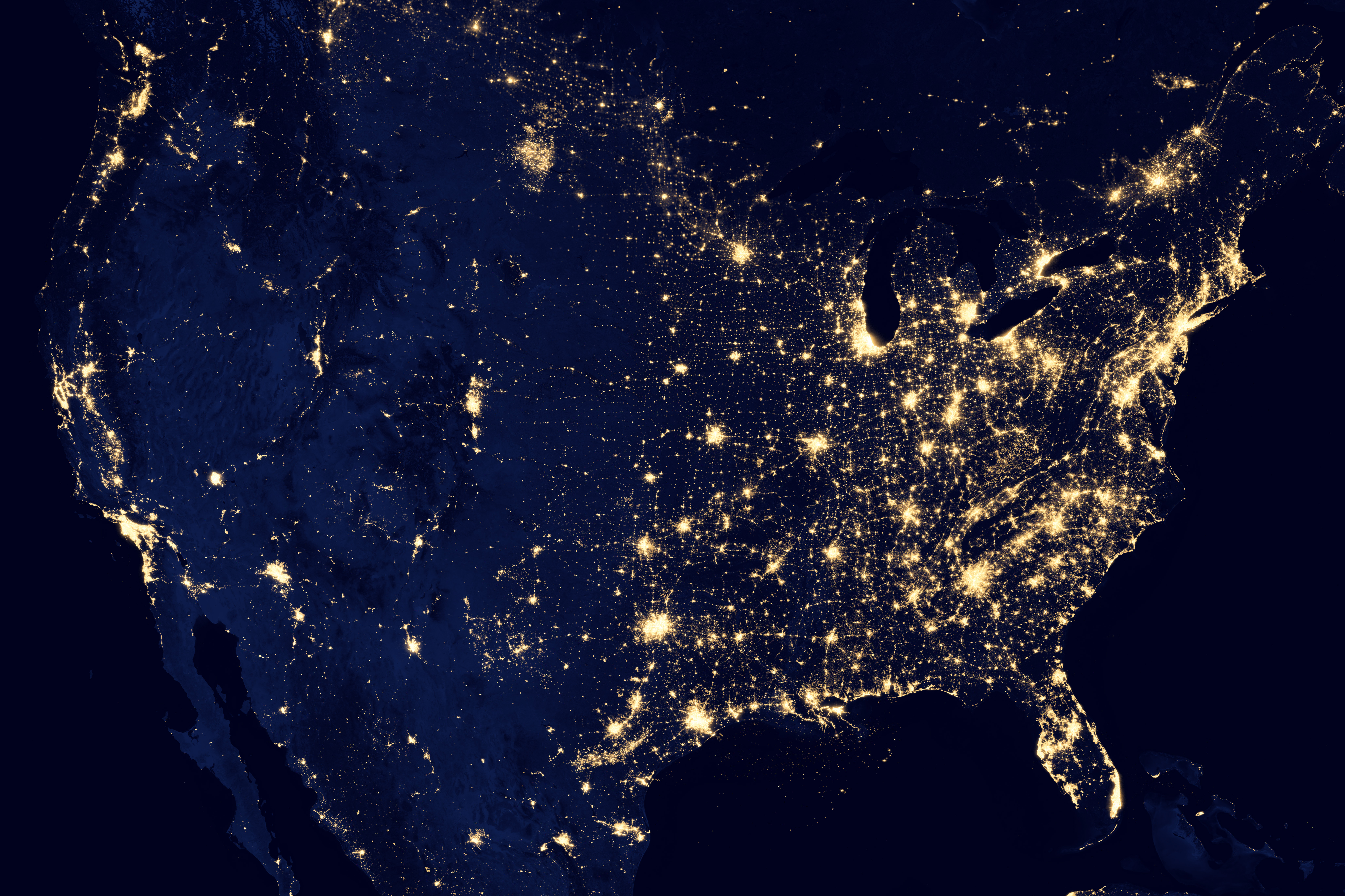
5 of 9 NASA Earth Observatory
City lights of the U.S. in 2012
This image of the United States at night is a composite assembled from data acquired by the Suomi NPP satellite in April and October. The image was made possible by the new satellite's "day-night band" of the Visible Infrared Imaging Radiometer Suite (VIIRS), which detects light in a range of wavelengths from green to near-infrared and uses filtering techniques to observe dim signals such as city lights, gas flares, auroras, wildfires, and reflected moonlight.
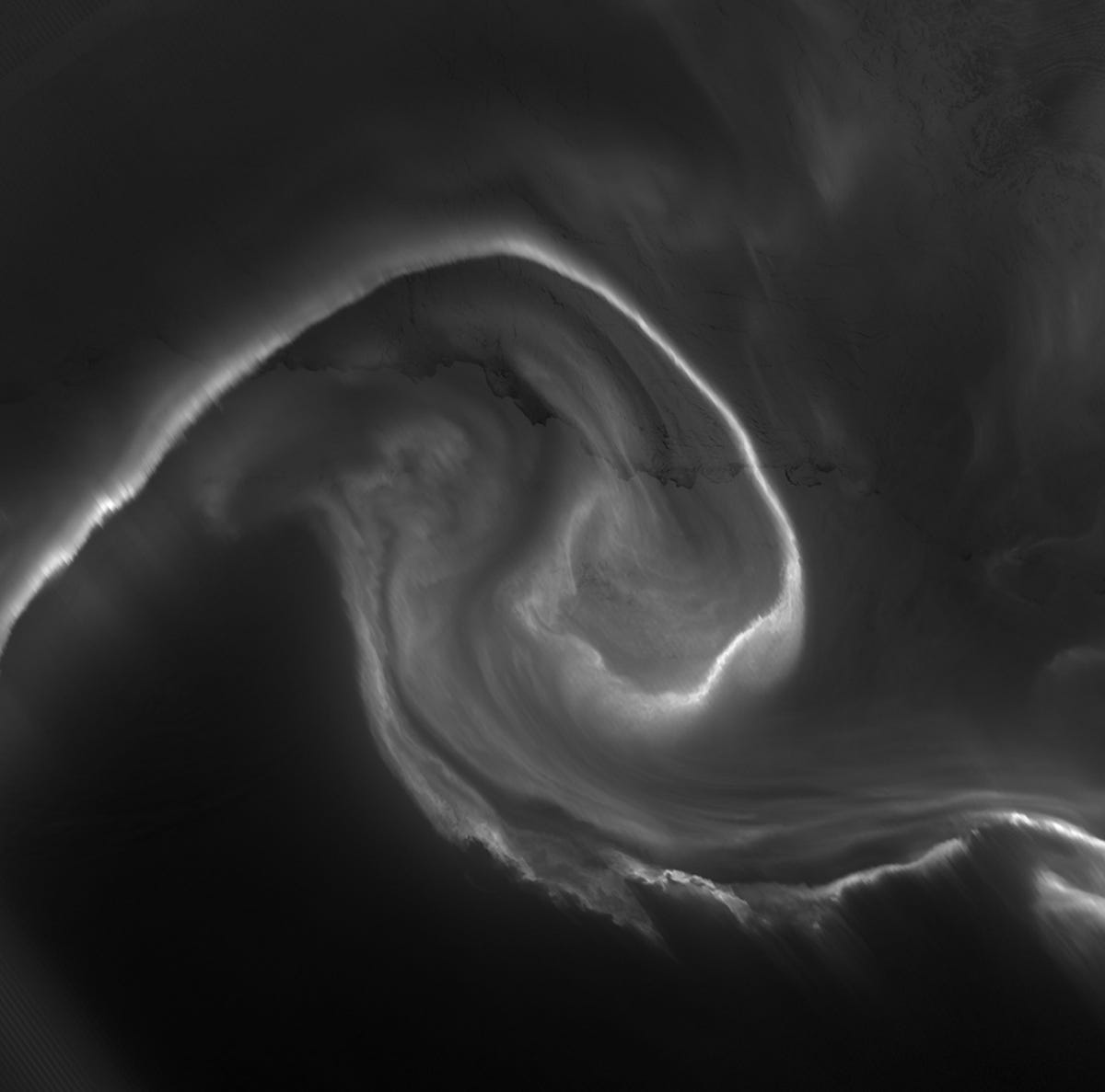
On July 15, 2012, the Visible Infrared Imaging Radiometer Suite (VIIRS) on the Suomi NPP satellite captured this nighttime view of the aurora australis, or "southern lights," over Antartica's Queen Maud Land and the Princess Ragnhild Coast.
8 of 9 NASA Earth Observatory
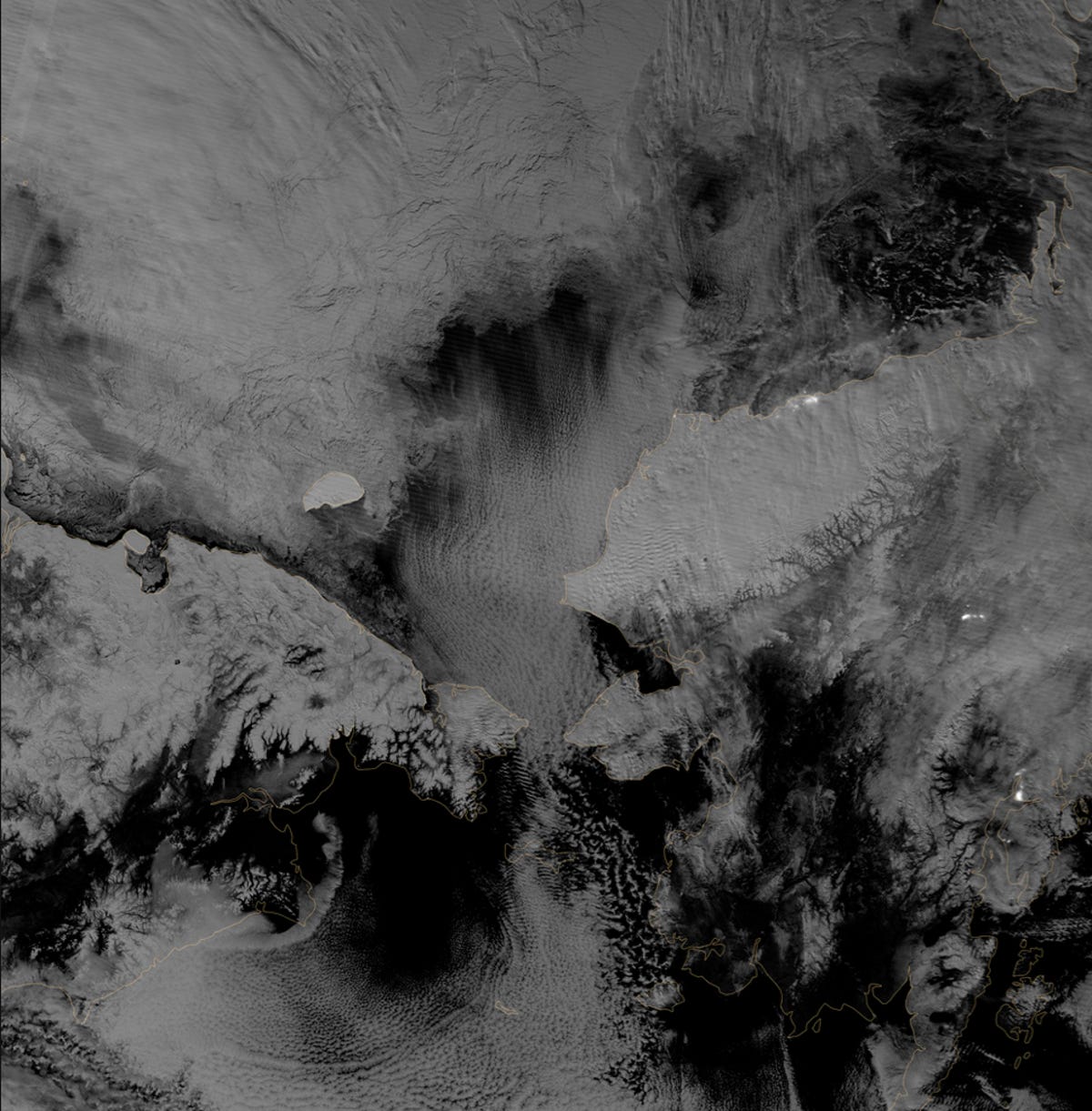
Polar darkness
Scientists monitored the Arctic with particular interest in the summer of 2012, when Arctic sea ice set a new record low, in this image captured October 30, 2012.
9 of 9 NASA Earth Observatory
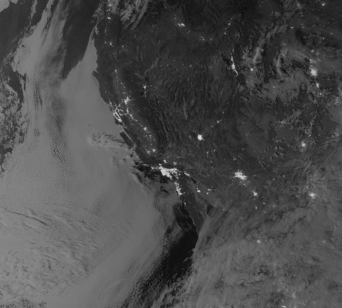
Marine layer clouds off the California Coast
On September 27, 2012, the Visible Infrared Imaging Radiometer Suite (VIIRS) on the Suomi NPP satellite captured this nighttime view of low-lying marine layer clouds along the coast of California.


